|
Kiyoo Mogi
was a prominent seismologist. He was regarded as Japan's foremost authority on earthquake predictionNuclear crisis in Japan as scientists reveal quake threat to power plants The Times, published 2007-07-19, accessed 2011-03-18 and was a chair of the Japanese (CCEP).Quake shuts world's largest nuclear plant Nature, vol 448, 392-393, , pu ... [...More Info...] [...Related Items...] OR: [Wikipedia] [Google] [Baidu] |
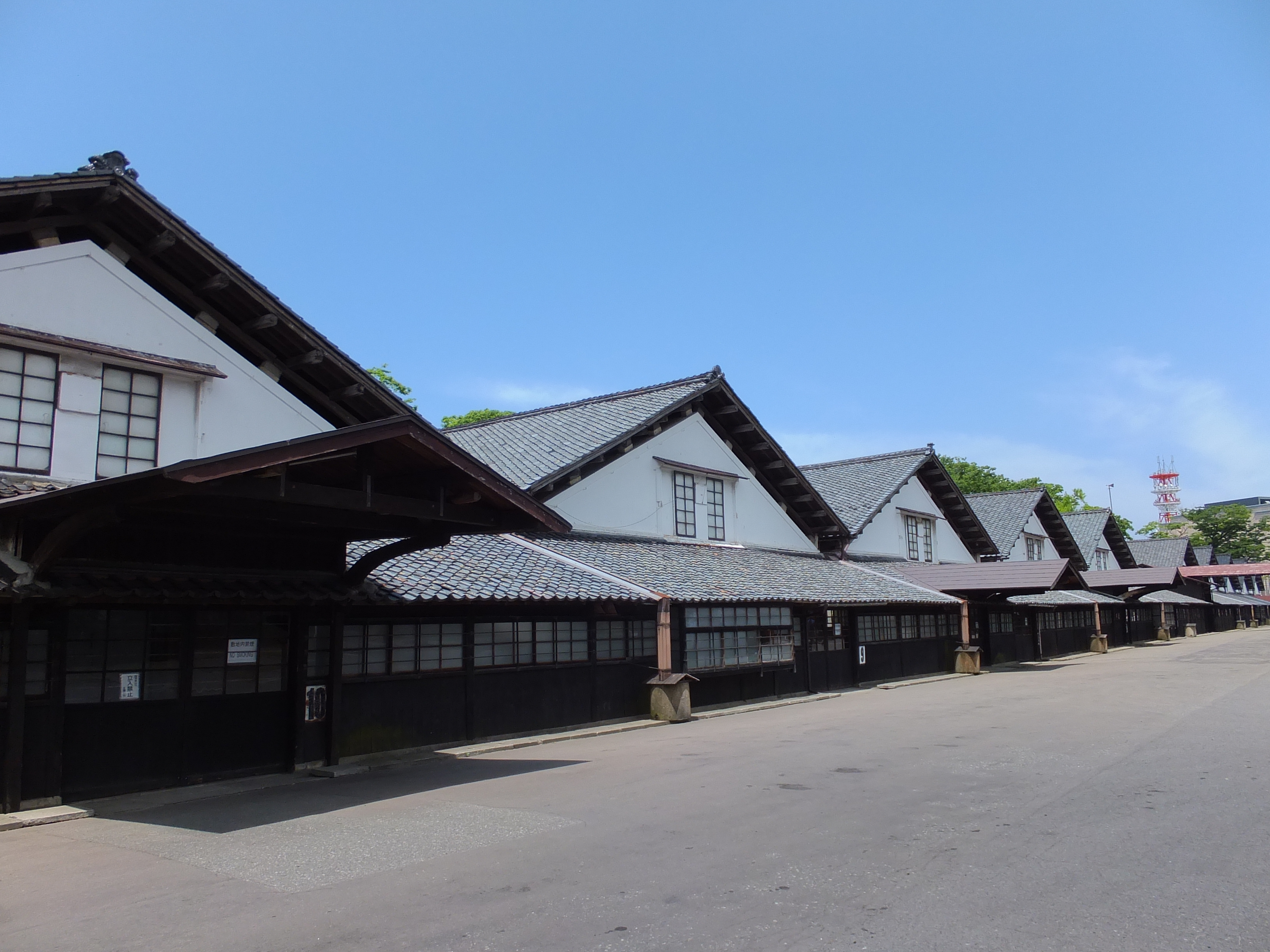
Yamagata Prefecture
is a prefecture of Japan located in the Tōhoku region of Honshu. Yamagata Prefecture has a population of 1,079,950 (1 June 2019) and has a geographic area of 9,325 km² (3,600 sq mi). Yamagata Prefecture borders Akita Prefecture to the north, Miyagi Prefecture to the east, Fukushima Prefecture to the south, and Niigata Prefecture to the southwest. Yamagata is the capital and largest city of Yamagata Prefecture, with other major cities including Tsuruoka, Sakata, and Yonezawa. Yamagata Prefecture is located on Japan's western Sea of Japan coast and its borders with neighboring prefectures are formed by various mountain ranges, with 17% of its total land area being designated as Natural Parks. Yamagata Prefecture formed the southern half of the historic Dewa Province with Akita Prefecture and is home to the Three Mountains of Dewa, which includes the Haguro Five-story Pagoda, a recognised National Treasure of Japan. History The aboriginal people once inhabited the area ... [...More Info...] [...Related Items...] OR: [Wikipedia] [Google] [Baidu] |
2007 Chūetsu Offshore Earthquake
The ) was a powerful magnitude 6.6 earthquake that occurred 10:13 local time (01:13 UTC) on July 16, 2007, in the northwest Niigata region of Japan. The earthquake, which occurred at a previously unknown offshore fault shook Niigata and neighbouring prefectures. The city of Kashiwazaki and the villages of Iizuna and Kariwa registered the highest seismic intensity of a strong 6 on Japan's ''shindo'' scale, and the quake was felt as far away as Tokyo. Eleven deaths and at least 1,000 injuries were reported, and 342 buildings were completely destroyed, mostly older wooden structures. Prime Minister Shinzō Abe broke off from his election campaign to visit Kashiwazaki and promised to "make every effort towards rescue and also to restore services such as gas and electricity". Tectonic summary This magnitude 6.6 earthquake occurred approximately off the west coast of Honshū, Japan, in a zone of compressional deformation that is associated with the boundary between the Amur P ... [...More Info...] [...Related Items...] OR: [Wikipedia] [Google] [Baidu] |
Pacific Ring Of Fire
The Ring of Fire (also known as the Pacific Ring of Fire, the Rim of Fire, the Girdle of Fire or the Circum-Pacific belt) is a region around much of the rim of the Pacific Ocean where many Types of volcanic eruptions, volcanic eruptions and earthquakes occur. The Ring of Fire is a Horseshoe, horseshoe-shaped belt about long and up to about wide. The Ring of Fire includes the Pacific coasts of South America, North America and Kamchatka, and some islands in the western Pacific Ocean. Although there is consensus among geologists about almost all areas which are included in the Ring of Fire, they disagree about the inclusion or exclusion of a few areas, for example, the Antarctic Peninsula and western Indonesia. The Ring of Fire is a direct result of plate tectonics: specifically the movement, collision and destruction of lithosphere, lithospheric plates (e.g. the Pacific Plate) under and around the Pacific Ocean. The collisions have created a nearly continuous series of subdu ... [...More Info...] [...Related Items...] OR: [Wikipedia] [Google] [Baidu] |
Geology Of Japan
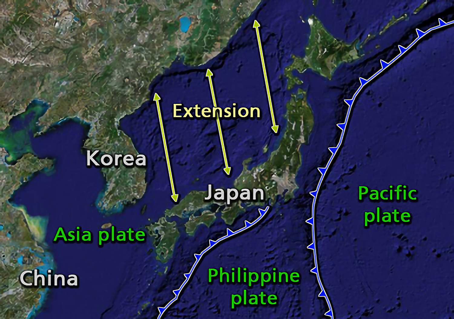
The islands of Japan are primarily the result of several large ocean movements occurring over hundreds of millions of years from the mid- Silurian to the Pleistocene, as a result of the subduction of the Philippine Sea Plate beneath the continental Amurian Plate and Okinawa Plate to the south, and subduction of the Pacific Plate under the Okhotsk Plate to the north. Japan was originally attached to the eastern coast of the Eurasian continent. The subducting plates, being deeper than the Eurasian plate, pulled Japan eastward, opening the Sea of Japan around 15 million years ago. The Strait of Tartary and the Korea Strait opened much later. Japan is situated in a volcanic zone on the Pacific Ring of Fire. Frequent low intensity earth tremors and occasional volcanic activity are felt throughout the islands. Destructive earthquakes, often resulting in tsunamis, occur several times per century. The most recent major quakes include the 2011 Tōhoku earthquake and tsunami, the 2004 ... [...More Info...] [...Related Items...] OR: [Wikipedia] [Google] [Baidu] |
Nuclear Power In Japan
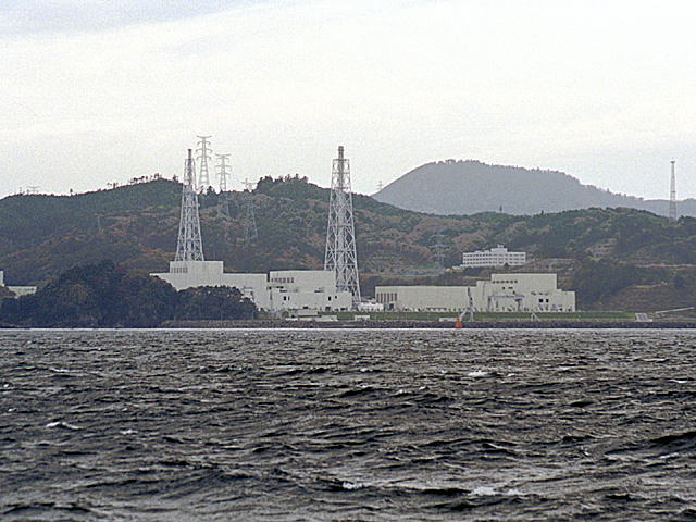
Prior to the 2011 Tōhoku earthquake and tsunami, Japan had generated 30% of its electrical power from nuclear reactors and planned to increase that share to 40%. Nuclear power energy was a national strategic priority in Japan. , of the 54 nuclear reactors in Japan, there were 42 operable reactors but only 9 reactors in 5 power plants were actually operating. A total of 24 reactors are scheduled for decommissioning or are in the process of being decommissioned. Others are in the process of being reactivated, or are undergoing modifications aimed to improve resiliency against natural disasters; Japan's 2030 energy goals posit that at least 33 will be reactivated by a later date. Though all of Japan's nuclear reactors successfully withstood shaking from the Tohoku earthquake, flooding from the ensuing tsunami caused the failure of cooling systems at the Fukushima I Nuclear Power Plant on 11 March 2011. Japan's first-ever nuclear emergency was declared, and 140,000 residents w ... [...More Info...] [...Related Items...] OR: [Wikipedia] [Google] [Baidu] |
Katsuhiko Ishibashi
is a professor in the ''Research Center for Urban Safety and Security'' in the ''Graduate School of Science'' at Kobe University, Japan and a seismologist who has written extensively in the areas of seismicity and seismotectonics in and around the Japanese Islands. He also coined the term '' genpatsu-shinsai'' (原発震災), from the Japanese words for "nuclear power" and "quake disaster". Katsuhiko Ishibashi has said that Japan's history of nuclear accidents stems from an overconfidence in plant engineering. He was a member of a 2006 Japanese government subcommittee charged with revising the national guidelines on the earthquake-resistance of nuclear power plants, published in 2007."Quake shuts world's largest nuclear plant" ''Nature'', vol 448, 392-393, , (July 25, 2007) Retrieved March 18, 2011 [...More Info...] [...Related Items...] OR: [Wikipedia] [Google] [Baidu] |
Fukushima I Nuclear Accidents
The was a nuclear accident in 2011 at the Fukushima Daiichi Nuclear Power Plant in Ōkuma, Fukushima, Japan. The proximate cause of the disaster was the 2011 Tōhoku earthquake and tsunami, which occurred on the afternoon of 11 March 2011 and remains the most powerful earthquake ever recorded in Japan. The earthquake triggered a powerful tsunami, with 13–14-meter-high waves damaging the nuclear power plant's emergency diesel generators, leading to a loss of electric power. The result was the most severe nuclear accident since the Chernobyl disaster in 1986, classified as level seven on the International Nuclear Event Scale (INES) after initially being classified as level five, and thus joining Chernobyl as the only other accident to receive such classification. While the 1957 explosion at the Mayak facility was the second worst by radioactivity released, the INES ranks incidents by impact on population, so Chernobyl (335,000 people evacuated) and Fukushima (154,000 evacuate ... [...More Info...] [...Related Items...] OR: [Wikipedia] [Google] [Baidu] |
Volcanology
Volcanology (also spelled vulcanology) is the study of volcanoes, lava, magma and related geological, geophysical and geochemical phenomena (volcanism). The term ''volcanology'' is derived from the Latin word ''vulcan''. Vulcan was the ancient Roman god of fire. A volcanologist is a geologist who studies the eruptive activity and formation of volcanoes and their current and historic eruptions. Volcanologists frequently visit volcanoes, especially active ones, to observe volcanic eruptions, collect eruptive products including tephra (such as ash or pumice), rock and lava samples. One major focus of enquiry is the prediction of eruptions; there is currently no accurate way to do this, but predicting eruptions, like predicting earthquakes, could save many lives. Modern volcanology image:Icelandic tephra.JPG, Volcanologist examining tephra horizons in south-central Iceland. In 1841, the first volcanological observatory, the Vesuvius Observatory, was founded in the Kingdom o ... [...More Info...] [...Related Items...] OR: [Wikipedia] [Google] [Baidu] |
University Of Iceland
The University of Iceland ( is, Háskóli Íslands ) is a public research university in Reykjavík, Iceland and the country's oldest and largest institution of higher education. Founded in 1911, it has grown steadily from a small civil servants' school to a modern comprehensive university, providing instruction for about 14,000 students in twenty-five faculties. Teaching and research is conducted in social sciences, humanities, law, medicine, natural sciences, engineering and teacher education. It has a campus concentrated around ''Suðurgata'' street in central Reykjavík, with additional facilities located in nearby areas as well as in the countryside. History The University of Iceland was founded by the Alþingi on 17 June 1911, uniting three former post-secondary institutions: ''Prestaskólinn'', ''Læknaskólinn'' and ''Lagaskólinn'', which taught theology, medicine and law, respectively. The university originally had only faculties for these three fields, in addition to a fa ... [...More Info...] [...Related Items...] OR: [Wikipedia] [Google] [Baidu] |
Magma Chamber
A magma chamber is a large pool of liquid rock beneath the surface of the Earth. The molten rock, or magma, in such a chamber is less dense than the surrounding country rock, which produces buoyant forces on the magma that tend to drive it upwards. If the magma finds a path to the surface, then the result will be a volcanic eruption; consequently, many volcanoes are situated over magma chambers. These chambers are hard to detect deep within the Earth, and therefore most of those known are close to the surface, commonly between 1 km and 10 km down. Dynamics of magma chambers Magma rises through cracks from beneath and across the crust because it is less dense than the surrounding rock. When the magma cannot find a path upwards it pools into a magma chamber. These chambers are commonly built up over time, by successive horizontal or vertical magma injections. Influx of new magma causes reaction of pre-existing crystals and the pressure in the chamber to increase. Th ... [...More Info...] [...Related Items...] OR: [Wikipedia] [Google] [Baidu] |
Volcano
A volcano is a rupture in the crust of a planetary-mass object, such as Earth, that allows hot lava, volcanic ash, and gases to escape from a magma chamber below the surface. On Earth, volcanoes are most often found where tectonic plates are diverging or converging, and most are found underwater. For example, a mid-ocean ridge, such as the Mid-Atlantic Ridge, has volcanoes caused by divergent tectonic plates whereas the Pacific Ring of Fire has volcanoes caused by convergent tectonic plates. Volcanoes can also form where there is stretching and thinning of the crust's plates, such as in the East African Rift and the Wells Gray-Clearwater volcanic field and Rio Grande rift in North America. Volcanism away from plate boundaries has been postulated to arise from upwelling diapirs from the core–mantle boundary, deep in the Earth. This results in hotspot volcanism, of which the Hawaiian hotspot is an example. Volcanoes are usually not created where two tectonic plates slide ... [...More Info...] [...Related Items...] OR: [Wikipedia] [Google] [Baidu] |
Vulcanian Eruption-numbers
A Vulcanian eruption is a type of volcanic eruption characterized by a dense cloud of ash-laden gas exploding from the crater and rising high above the peak. They usually commence with phreatomagmatic eruptions which can be extremely noisy due to the rising magma heating water in the ground. This is usually followed by the explosive clearing of the vent and the eruption column is dirty grey to black as old weathered rocks are blasted out of the vent. As the vent clears, further ash clouds become grey-white and creamy in colour, with convolutions of the ash similar to those of Plinian eruptions. The term ''Vulcanian'' was first used by Giuseppe Mercalli, witnessing the 1888–1890 eruptions on the island of Vulcano. His description of the eruption style is now used all over the world. Mercalli described Vulcanian eruptions as "...Explosions like cannon fire at irregular intervals..." Their explosive nature is due to increased silica content of the magma. Almost all types of magma ... [...More Info...] [...Related Items...] OR: [Wikipedia] [Google] [Baidu] |


.jpg)
