|
Kings Park West, Virginia
Kings Park West is a census-designated place in the eastern USA, in Fairfax County, Virginia, southwest of Washington, D.C. The population as of the 2010 census was 13,390. Geography The CDP is located in central Fairfax County, south of the city of Fairfax. It is bordered to the north by the George Mason CDP, to the northeast by Long Branch, to the southeast by Burke, and to the south by Fairfax Station. The CDP border follows Braddock Road on the north, Guinea Road on the southeast, Zion Drive on the southwest, and State Route 123 (Ox Road) on the west. Downtown Fairfax is to the north, and downtown Washington, D.C. is to the northeast. According to the U.S Census Bureau, the Kings Park West CDP has a total area of , of which is land and , or 2.11%, is water. History Following the success of its Kings Park development earlier in the decade, Richmarr Construction Corporation started on Kings Park West. Construction began in mid-1967 and the first homes were available in ... [...More Info...] [...Related Items...] OR: [Wikipedia] [Google] [Baidu] |
Census-designated Place
A census-designated place (CDP) is a concentration of population defined by the United States Census Bureau for statistical purposes only. CDPs have been used in each decennial census since 1980 as the counterparts of incorporated places, such as self-governing cities, towns, and villages, for the purposes of gathering and correlating statistical data. CDPs are populated areas that generally include one officially designated but currently unincorporated community, for which the CDP is named, plus surrounding inhabited countryside of varying dimensions and, occasionally, other, smaller unincorporated communities as well. CDPs include small rural communities, edge cities, colonias located along the Mexico–United States border, and unincorporated resort and retirement communities and their environs. The boundaries of any CDP may change from decade to decade, and the Census Bureau may de-establish a CDP after a period of study, then re-establish it some decades later. Most unin ... [...More Info...] [...Related Items...] OR: [Wikipedia] [Google] [Baidu] |
Long Branch, Fairfax County, Virginia
Long Branch is a census-designated place in Fairfax County, Virginia, bordering the city of Fairfax. The population as of the 2010 census was 7,593. Geography The CDP lies mainly in the watershed of Long Branch, an Accotink Creek tributary. The CDP is bounded by Guinea Road to the east, Braddock Road to the south, Little River Turnpike (Virginia State Route 236) to the north, the Fairfax city limits to the northwest, and Burke Station Road to the west. Neighboring census-designated places are Mantua to the north, Wakefield to the east, Burke to the south, Kings Park West to the southwest, and George Mason to the west. According to the U.S. Census Bureau, the Long Branch CDP has a total area of , of which , or 0.50%, is water. A larger version of the CDP was delineated in 1970 when the CDP had a population of 21,634 and a land area of . [...More Info...] [...Related Items...] OR: [Wikipedia] [Google] [Baidu] |
Blevinstown, Virginia
Blevinstown is an unincorporated community on Braddock Road in Fairfax County, Virginia Virginia, officially the Commonwealth of Virginia, is a state in the Mid-Atlantic and Southeastern regions of the United States, between the Atlantic Coast and the Appalachian Mountains. The geography and climate of the Commonwealth ar ..., United States. References Unincorporated communities in Fairfax County, Virginia Washington metropolitan area Unincorporated communities in Virginia {{FairfaxCountyVA-geo-stub ... [...More Info...] [...Related Items...] OR: [Wikipedia] [Google] [Baidu] |
Burke Centre, Virginia
Burke Centre is a planned residential community located west of Burke in Fairfax County, Virginia, United States. Burke Centre is a planned community managed by the Burke Centre Conservancy homeowners' association (HOA). Burke Centre is also the name of a census-designated place (CDP). The CDP boundaries extend beyond the planned community limits. As of the 2010 census, the Burke Centre CDP had a total population of 17,326. Burke Centre is located south of the center of Fairfax County. It is bordered to the east and partially to the north by the Burke CDP, and to the west and north by the Fairfax Station CDP. The Burke Centre CDP border follows Ox Road to the west, the VRE Manassas Line to the north, Burke Lake Road to the southeast, and Fairfax County Parkway to the southwest. Neighborhoods Burke Centre is divided into five neighborhoods: The Woods, The Oaks, the Commons, the Ponds, and the Landings. Each neighborhood's name appears frequently in streets within its bounda ... [...More Info...] [...Related Items...] OR: [Wikipedia] [Google] [Baidu] |
Wakefield, Fairfax County, Virginia
Wakefield is a census-designated place in Fairfax County, Virginia, United States. The population as of the 2010 census was 11,275. The current Wakefield area was built in the 1950-60's. Geography Bounded by the Capital Beltway, Little River Turnpike, Guinea Road and Braddock Road, the CDP draws much of its identity from Wakefield Chapel, an 1899-built Methodist church that is now owned by the county Park Authority and still available as a chapel. Wakefield Chapel Road bisects the CDP, and Wakefield Park Recreation Center and several subdivisions bear the Wakefield name. Northern Virginia Community College's Annandale Campus is also here, as is the historic Oak Hill Mansion. Neighboring communities are Mantua to the northwest, Woodburn to the north, Annandale to the east, North Springfield to the southeast, Ravensworth and Kings Park to the south, Burke to the southwest, and Long Branch to the west. The city of Fairfax is to the west, and downtown Washington, D.C. is to t ... [...More Info...] [...Related Items...] OR: [Wikipedia] [Google] [Baidu] |
Robinson Secondary School
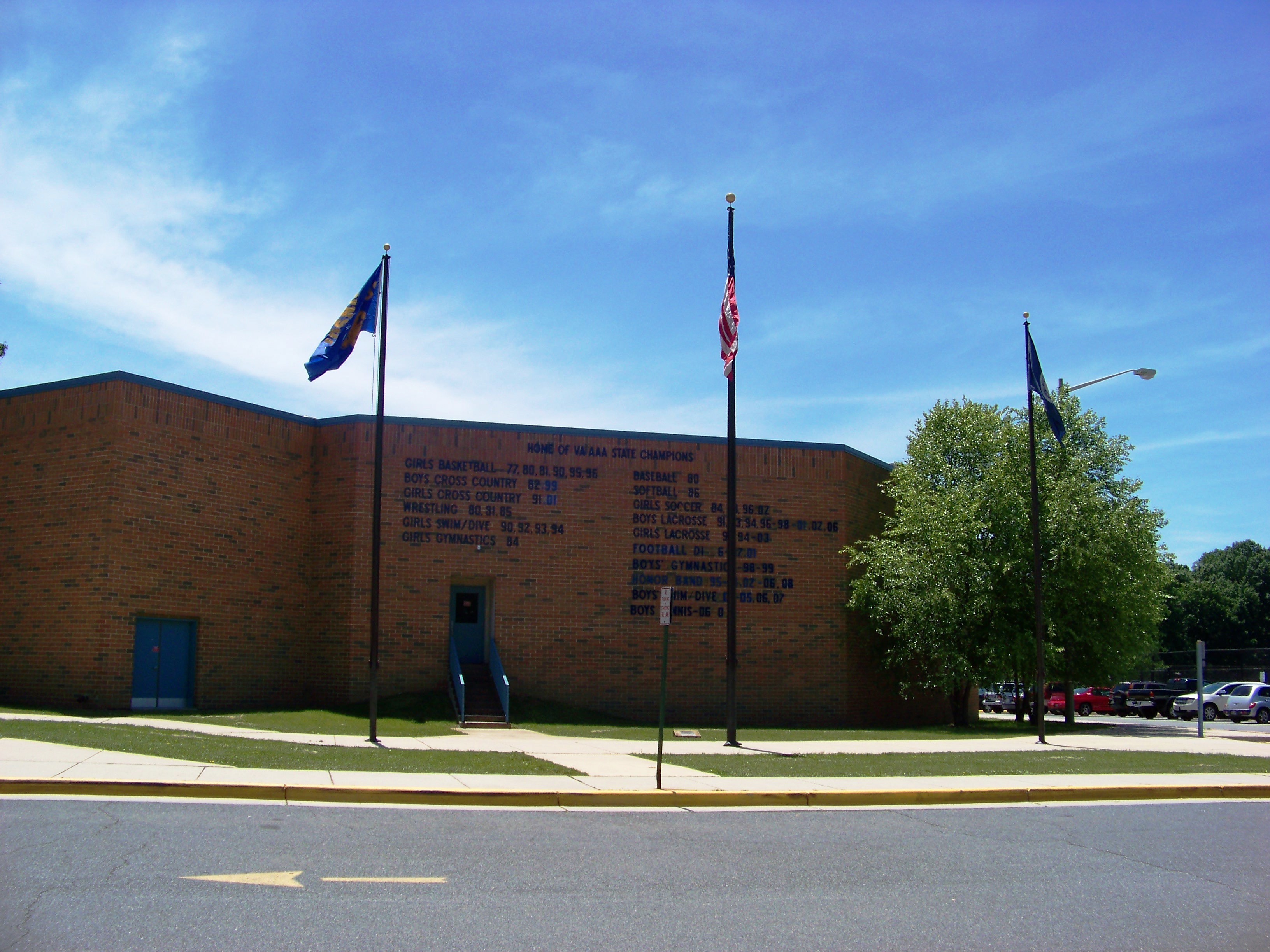
James W. Robinson, Jr. Secondary School is a six-year public school in the Commonwealth of Virginia, in the United States. Known as Robinson Secondary School, it is located in Fairfax County, a suburb southwest of Washington, D.C. Opened in 1971, Robinson is located south of Braddock Road near George Mason University, and is administered by the Fairfax County Public Schools. It offers the International Baccalaureate program, and has approximately 3,900 students in grades 7–12. Robinson's school colors are royal blue and gold, and the school mascot is a ram. History Robinson was named after Medal of Honor recipient James W. Robinson, Jr., the first resident of Virginia to be awarded the medal during the Vietnam War. Sergeant Robinson, age 25, was fatally wounded under heroic circumstances in South Vietnam in April 1966, while serving in the infantry in the U.S. Army. The school opened its doors in September 1971, taking its students from Fairfax, W.T. Woodson, Oakto ... [...More Info...] [...Related Items...] OR: [Wikipedia] [Google] [Baidu] |
Fairfax County Public Schools
The Fairfax County Public Schools system (FCPS) is a school division in the U.S. commonwealth of Virginia. It is a branch of the Fairfax County government which administers public schools in Fairfax County and the City of Fairfax. FCPS's headquarters is located in the Gatehouse Administration Center in Merrifield, an unincorporated section of the county near the city of Falls Church; the headquarters has a Falls Church address but is not within the city limits. With over 185,000 students enrolled, FCPS is the largest public school system in Virginia and one of the largest in the country. The school division has been led by Division Superintendent Michelle Reid since July 2022. History The public school system in Fairfax County was created after the Civil War with the adoption by Virginia of the Reconstruction-era state constitution in 1870, which provided for the first time that a free public education was a constitutional right. The first superintendent of Schools for ... [...More Info...] [...Related Items...] OR: [Wikipedia] [Google] [Baidu] |
Kings Park, Virginia
Kings Park is a census-designated place (CDP) in the eastern United States in Fairfax County, Virginia, southwest of Washington D.C. The population as of the 2010 census was 4,333. A suburban community begun in early 1960, Kings Park is located a few miles west of the Capital Beltway and Annandale, near the junction of Braddock, Burke Lake, and Rolling roads in the Springfield area ( ZIP code 22151). Richmarr Construction designed Kings Park as a planned community, with a park at its center, an elementary school, and an adjacent namesake shopping center. History Ownership of the properties can be traced to Lord Culpeper who transferred the lands which now include Kings Park and Ravensworth Farm to William Fitzhugh in 1690. The land passed through Martha Custis, the wife of George Washington, to her son George Custis, then to his daughter, Mary Randolph Custis, who married Robert E. Lee at Arlington when he was a young officer in the U.S Army. After the outbreak of the Civ ... [...More Info...] [...Related Items...] OR: [Wikipedia] [Google] [Baidu] |
Virginia State Route 123
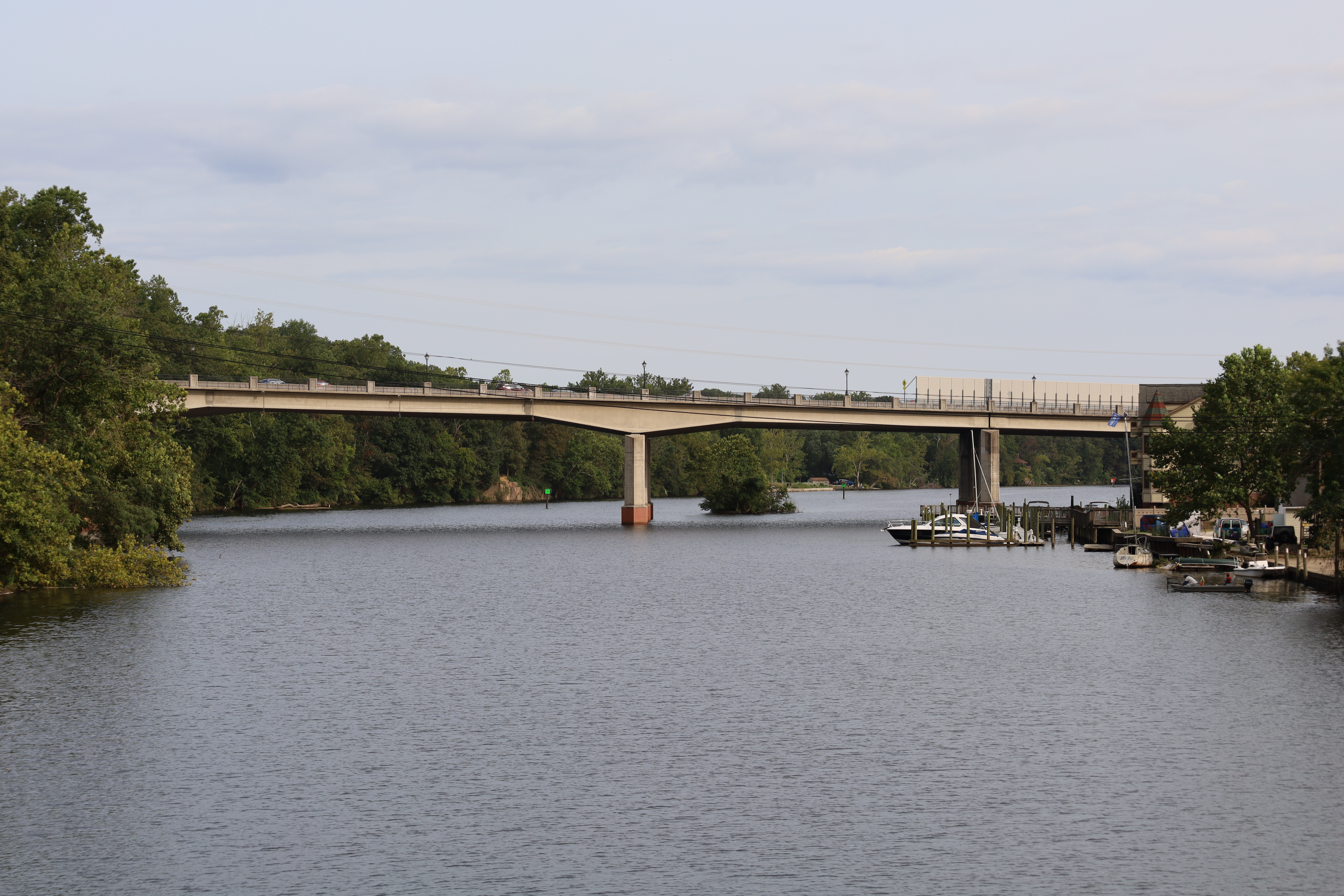
State Route 123 (SR 123) is a primary state highway in the U.S. state of Virginia. The state highway runs from U.S. Route 1 in Virginia, U.S. Route 1 (US 1) in Woodbridge, Virginia, Woodbridge north to the Chain Bridge (Potomac River), Chain Bridge across the Potomac River into Washington, D.C., Washington from Arlington, Virginia, Arlington. It goes by four local names. From its southern terminus to the Occoquan River Bridge, it is known as Gordon Boulevard. From the Occoquan River Bridge to the city of Fairfax, Virginia, Fairfax it is known as Ox Road. From Fairfax until it enters the Town of Vienna, it is known as Chain Bridge Road. Then, as it passes through the Town of Vienna, it is known as Maple Avenue. After leaving the Town of Vienna, the name reverts to Chain Bridge Road, and continues this way until the intersection with Interstate 495 (Capital Beltway), I-495 in Tysons, Virginia, Tysons. Between Tysons and the George Washington Memorial Parkway, it is known as Do ... [...More Info...] [...Related Items...] OR: [Wikipedia] [Google] [Baidu] |
Virginia State Route 620 (Fairfax And Loudoun Counties)
State Route 620 in Fairfax and Loudoun Counties, Virginia is a secondary state highway. The entire length of SR 620 is also known as Braddock Road (except for a small section in Centreville called Spindle Court). SR 620 also has a short concurrency with SR 659 / Union Mill Road in Centreville. In Centreville and Eastern Loudoun County, SR 620 is a major commuter route, as it empties onto SR 28 (Sully Rd.), which in turn has a nearby interchange with Interstate 66. SR 620 also has major junctions with SR 123, Fairfax County Parkway, and Interstate 495 (Capital Beltway). It has a very large number of residential neighborhoods lining the road, so most of the remainder is also a major commuter artery. The length and positioning of the highway attract motorists that are traveling from one part of Fairfax County to another. Route description East and Central Fairfax County SR 620 begins in Fairfax County at Columbia Pike ( SR 244) near Lake Barcroft and runs southward, cro ... [...More Info...] [...Related Items...] OR: [Wikipedia] [Google] [Baidu] |
Fairfax Station, Virginia
Fairfax Station is a census-designated place (CDP) in Fairfax County, Virginia, United States. The population was 12,030 at the 2010 census. Located in Northern Virginia, its center is located southwest of Washington, D.C. Geography Fairfax Station is located in western Fairfax County, between Clifton to the west, Burke to the east, and the city of Fairfax to the north. The original community of Fairfax Station is located in the eastern part of the CDP, where State Route 123 (Ox Road) crosses the Norfolk Southern Railway line. State Route 286, the Fairfax County Parkway, curves through the center of the CDP, leading northwest to Fair Lakes and southeast to Newington. Population densities range from 200 to 500 per square mile (77 to 193 per square kilometer) in the northern, southern, and western portions of the CDP, to between 1,600 and 2,200 per square mile (584 to 849 per square kilometer) in the center and eastern portions. According to the U.S. Census Bureau, the Fair ... [...More Info...] [...Related Items...] OR: [Wikipedia] [Google] [Baidu] |


.jpg)