|
Kimmeridge Bay
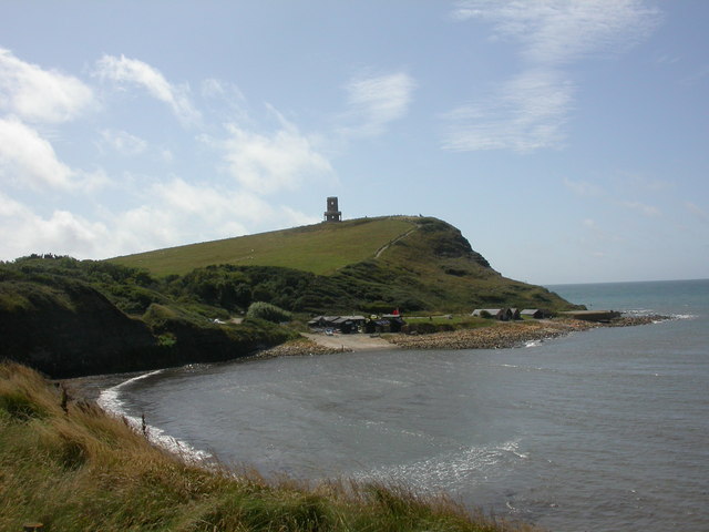
Kimmeridge Bay () is a bay on the Isle of Purbeck, a peninsula on the English Channel coast in Dorset, England, close to and southeast of the village of Kimmeridge, on the Smedmore Estate. The area is renowned for its fossils, with The Etches Collection in the village of Kimmeridge displaying fossils found by Steve Etches in the area over a 30-year period. It is a popular place to access the coast for tourists. To the east are the Kimmeridge Ledges, where fossils can be found in the flat clay beds. Overview Kimmeridge Bay forms part of the Jurassic Coast, a World Heritage Site. The coast is also part of a Site of Special Scientific Interest, and the whole area is part of the Dorset Area of Outstanding Natural Beauty. Kimmeridge is the type locality for Kimmeridge clay, the geological formation that covers most of the area. Within the clay are bands of bituminous shale. An oil well has operated on the shore of Kimmeridge Bay since 1959. The bay is roughly semi-circular, facing ... [...More Info...] [...Related Items...] OR: [Wikipedia] [Google] [Baidu] |
Dorset
Dorset ( ; archaically: Dorsetshire , ) is a county in South West England on the English Channel coast. The ceremonial county comprises the unitary authority areas of Bournemouth, Christchurch and Poole and Dorset. Covering an area of , Dorset borders Devon to the west, Somerset to the north-west, Wiltshire to the north-east, and Hampshire to the east. The county town is Dorchester, in the south. After the reorganisation of local government in 1974, the county border was extended eastward to incorporate the Hampshire towns of Bournemouth and Christchurch. Around half of the population lives in the South East Dorset conurbation, while the rest of the county is largely rural with a low population density. The county has a long history of human settlement stretching back to the Neolithic era. The Romans conquered Dorset's indigenous Celtic tribe, and during the Early Middle Ages, the Saxons settled the area and made Dorset a shire in the 7th century. The first re ... [...More Info...] [...Related Items...] OR: [Wikipedia] [Google] [Baidu] |
Site Of Special Scientific Interest
A Site of Special Scientific Interest (SSSI) in Great Britain or an Area of Special Scientific Interest (ASSI) in the Isle of Man and Northern Ireland is a conservation designation denoting a protected area in the United Kingdom and Isle of Man. SSSI/ASSIs are the basic building block of site-based nature conservation legislation and most other legal nature/geological conservation designations in the United Kingdom are based upon them, including national nature reserves, Ramsar sites, Special Protection Areas, and Special Areas of Conservation. The acronym "SSSI" is often pronounced "triple-S I". Selection and conservation Sites notified for their biological interest are known as Biological SSSIs (or ASSIs), and those notified for geological or physiographic interest are Geological SSSIs (or ASSIs). Sites may be divided into management units, with some areas including units that are noted for both biological and geological interest. Biological Biological SSSI/A ... [...More Info...] [...Related Items...] OR: [Wikipedia] [Google] [Baidu] |
Head (geology)
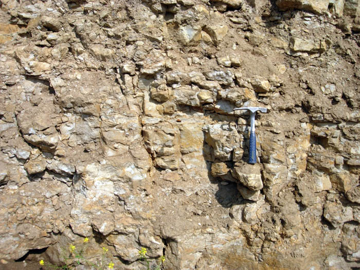
Head describes deposits consisting of fragmented material which, following weathering, have moved downslope through a process of solifluction. The term has been used by British geologists since the middle of the 19th century to describe such material in a range of different settings from flat hilltops to the bottoms of valleys. Areas identified as head include deposits of aeolian origin such as blown sand and loess Loess (, ; from german: Löss ) is a clastic, predominantly silt-sized sediment that is formed by the accumulation of wind-blown dust. Ten percent of Earth's land area is covered by loess or similar deposits. Loess is a periglacial or aeolian ..., slope deposits such as gelifluctates and solifluctates, and recently eroded soil material, called colluvium. With geologists becoming more interested in studying the near-surface environment and its related processes, the term head is becoming obsolete. A related term is 'combe (or coombe) rock', descriptive of a b ... [...More Info...] [...Related Items...] OR: [Wikipedia] [Google] [Baidu] |
Quaternary
The Quaternary ( ) is the current and most recent of the three period (geology), periods of the Cenozoic era (geology), Era in the geologic time scale of the International Commission on Stratigraphy (ICS). It follows the Neogene Period and spans from 2.58 million years ago to the present. The Quaternary Period is divided into two epochs: the Pleistocene (2.58 million years ago to 11.7 thousand years ago) and the Holocene (11.7 thousand years ago to today, although a third epoch, the Anthropocene, has been proposed but is not yet officially recognised by the ICS). The Quaternary Period is typically defined by the cyclic growth and decay of continental ice sheets related to the Milankovitch cycles and the associated climate and environmental changes that they caused. Research history In 1759 Giovanni Arduino (geologist), Giovanni Arduino proposed that the geological strata of northern Italy could be divided into four successive formations or "orders" ( it, quattro ord ... [...More Info...] [...Related Items...] OR: [Wikipedia] [Google] [Baidu] |
Late Jurassic
The Late Jurassic is the third epoch of the Jurassic Period, and it spans the geologic time from 163.5 ± 1.0 to 145.0 ± 0.8 million years ago (Ma), which is preserved in Upper Jurassic strata.Owen 1987. In European lithostratigraphy, the name "Malm" indicates rocks of Late Jurassic age. In the past, ''Malm'' was also used to indicate the unit of geological time, but this usage is now discouraged to make a clear distinction between lithostratigraphic and geochronologic/chronostratigraphic units. Subdivisions The Late Jurassic is divided into three ages, which correspond with the three (faunal) stages of Upper Jurassic rock: Paleogeography During the Late Jurassic Epoch, Pangaea broke up into two supercontinents, Laurasia to the north, and Gondwana to the south. The result of this break-up was the spawning of the Atlantic Ocean. However, at this time, the Atlantic Ocean was relatively narrow. Life forms of the epoch This epoch is well known for many famous types of din ... [...More Info...] [...Related Items...] OR: [Wikipedia] [Google] [Baidu] |
Bedrock
In geology, bedrock is solid rock that lies under loose material ( regolith) within the crust of Earth or another terrestrial planet. Definition Bedrock is the solid rock that underlies looser surface material. An exposed portion of bedrock is often called an outcrop. The various kinds of broken and weathered rock material, such as soil and subsoil, that may overlie the bedrock are known as regolith. Engineering geology The surface of the bedrock beneath the soil cover (regolith) is also known as ''rockhead'' in engineering geology, and its identification by digging, drilling or geophysical methods is an important task in most civil engineering projects. Superficial deposits can be very thick, such that the bedrock lies hundreds of meters below the surface. Weathering of bedrock Exposed bedrock experiences weathering, which may be physical or chemical, and which alters the structure of the rock to leave it susceptible to erosion. Bedrock may also experience ... [...More Info...] [...Related Items...] OR: [Wikipedia] [Google] [Baidu] |
University Of Southampton
, mottoeng = The Heights Yield to Endeavour , type = Public research university , established = 1862 – Hartley Institution1902 – Hartley University College1913 – Southampton University College1952 – gained university status by royal charter , chancellor = Ruby Wax , vice_chancellor = Mark E. Smith , head_label = Visitor , head = Penny Mordaunt , location = Southampton, Hampshire, England , campus = City Campus , academic_staff = 2,715 (2020) , administrative_staff = 5,001 , students = () , undergrad = () , postgrad = () , colours = Navy blue, light sea green and dark red , endowment = £14.9 million , budget = £578.4 million , affiliations = ACU EUA Port-City University League Russell Group SES SETsquared AACS ... [...More Info...] [...Related Items...] OR: [Wikipedia] [Google] [Baidu] |
Dorset Wildlife Trust
Dorset Wildlife Trust (DWT) is a wildlife trust covering the county of Dorset, United Kingdom. The trust was founded in 1961 as Dorset Naturalists' Trust, to protect and conserve the wildlife and natural habitats of the county. DWT is one of 46 local independent Wildlife Trusts that make up The Wildlife Trusts. DWT is headquartered at Brooklands Farm, just north of Dorchester. DWT is led by a Council of Trustees, has 27,000 members, 65 staff and over 850 active volunteers. The current chair of DWT is Jo Davies MBE. Ms. Davies has been a trustee of DWT for over 20 years and was elected as chair in March 2018. She took over from Prof. Nigel Webb, one of the UK's leading experts on heathlands and author of Collins New Naturalist No. 72 Heathlands. Former DWT President and past chairman, Tony Bates, was awarded an MBE in the Queen's Birthday Honours 2015 for his outstanding contribution to nature conservation in Dorset. The Chief Executive of Dorset Wildlife Trust is Brian B ... [...More Info...] [...Related Items...] OR: [Wikipedia] [Google] [Baidu] |
Surfing
Surfing is a surface water sport in which an individual, a surfer (or two in tandem surfing), uses a board to ride on the forward section, or face, of a moving wave of water, which usually carries the surfer towards the shore. Waves suitable for surfing are primarily found on ocean shores, but can also be found in standing waves in the open ocean, in lakes, in rivers in the form of a tidal bore, or in wave pools. The term ''surfing'' refers to a person riding a wave using a board, regardless of the stance. There are several types of boards. The Moche of Peru would often surf on reed craft, while the native peoples of the Pacific surfed waves on alaia, paipo, and other such water craft. Ancient cultures often surfed on their belly and knees, while the modern-day definition of surfing most often refers to a surfer riding a wave standing on a surfboard; this is also referred to as stand-up surfing. Another prominent form of surfing is body boarding, where a surfer rides t ... [...More Info...] [...Related Items...] OR: [Wikipedia] [Google] [Baidu] |
Rocky Shore
A rocky shore is an intertidal area of seacoasts where solid rock predominates. Rocky shores are biologically rich environments, and are a useful "natural laboratory" for studying intertidal ecology and other biological processes. Due to their high accessibility, they have been well studied for a long time and their species are well known. Marine life Many factors favour the survival of life on rocky shores. Temperate coastal waters are mixed by waves and convection, maintaining adequate availability of nutrients. Also, the sea brings plankton and broken organic matter in with each tide. The high availability of light (due to low depths) and nutrient levels means that primary productivity of seaweeds and algae can be very high. Human actions can also benefit rocky shores due to nutrient runoff. Despite these favourable factors, there are also a number of challenges to marine organisms associated with the rocky shore ecosystem. Generally, the distribution of benthic specie ... [...More Info...] [...Related Items...] OR: [Wikipedia] [Google] [Baidu] |
Wave-cut Platform
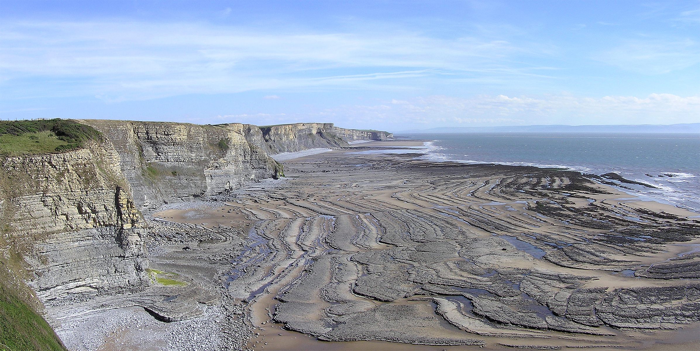
A wave-cut platform, shore platform, coastal bench, or wave-cut cliff is the narrow flat area often found at the base of a sea cliff or along the shoreline of a lake, bay, or sea that was created by erosion. Wave-cut platforms are often most obvious at low tide when they become visible as huge areas of flat rock. Sometimes the landward side of the platform is covered by sand, forming the beach, and then the platform can only be identified at low tides or when storms move the sand. __TOC__ Formation Wave-cut platforms form when destructive waves hit against the cliff face, causing an undercut between the high and low water marks, mainly as a result of abrasion, corrosion and hydraulic action, creating a wave-cut notch. This notch then enlarges into a cave. The waves undermine this portion until the roof of the cave cannot hold due to the pressure and freeze-thaw or biological weathering acting on it, and collapses, resulting in the cliff retreating landward. The base of the ca ... [...More Info...] [...Related Items...] OR: [Wikipedia] [Google] [Baidu] |
Bituminous Shale
Oil shale is an organic-rich fine-grained sedimentary rock containing kerogen (a solid mixture of organic chemical compounds) from which liquid hydrocarbons can be produced. In addition to kerogen, general composition of oil shales constitutes inorganic substance and bitumens. Based on their deposition environment, oil shales are classified as marine, lacustrine and terrestrial oil shales. Oil shales differ from oil-''bearing'' shales, shale deposits that contain petroleum (tight oil) that is sometimes produced from drilled wells. Examples of oil-''bearing'' shales are the Bakken Formation, Pierre Shale, Niobrara Formation, and Eagle Ford Formation. Accordingly, shale oil produced from oil shale should not be confused with tight oil, which is also frequently called shale oil. Deposits of oil shale occur around the world, including major deposits in the United States. A 2016 estimate of global deposits set the total world resources of oil shale equivalent of of oil in pla ... [...More Info...] [...Related Items...] OR: [Wikipedia] [Google] [Baidu] |


