|
Killycluggin
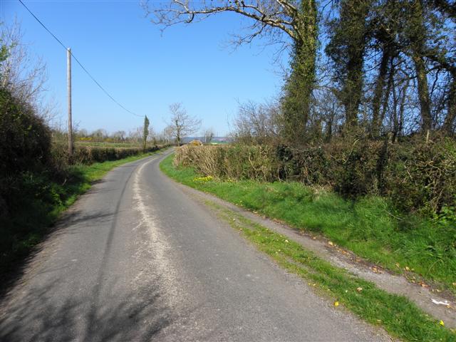
Killycluggin () is a townland in the civil parish of Templeport, County Cavan, Ireland. It lies in the Roman Catholic parish area of Templeport and the barony of Tullyhaw. Geography Killycluggin is bounded on the north by Tonyhallagh townland, on the west by Lissanover townland, on the east by Tonyrevan townland and on the south by Bellaheady townland in Kildallan parish and by Kilnavert and Corran, County Cavan townlands. Killycluggin's chief geographical features are a stream, a stone quarry and a gravel pit. Killycluggin is traversed by the R205 road (Ireland), minor roads, rural lanes and the disused Cavan and Leitrim Railway. The townland covers 76 statute acres. History In medieval times the McGovern tuath of Tullyhaw was divided into economic taxation areas called ballibetoes, from the Irish ''Baile Biataigh'' (Anglicized as 'Ballybetagh'), meaning 'A Provisioner's Town or Settlement'. The original purpose was to enable the farmer, who controlled the baile, to provide ... [...More Info...] [...Related Items...] OR: [Wikipedia] [Google] [Baidu] |
Killycluggin Stone
The Killycluggin Stone is a decorated stone, found near the town of Killycluggin, County Cavan, in Ireland. Roughly cone-shaped and covered in Iron Age La Tène designs, it was discovered broken in several pieces, partly buried close to a Bronze Age stone circle, inside which it probably once stood. The stone is now housed in the Cavan County Museum, while an imperfect replica stands near the road about 300 metres from the original site. Although now much damaged, the stone can be reconstructed from the different surviving pieces. It was at least 6 feet high. At the base of the stone there were four rectangular adjoining panels measuring 90 cm each in width giving a circumference of 3 m 60 cm when it was first carved. The height of each panel was about 75 cm. Find site and associations The stone was found in 1921 at Killycluggin, County Cavan. The site has several associations with St. Patrick. Nearby is ''Tobar Padraig'' (St. Patrick's We ... [...More Info...] [...Related Items...] OR: [Wikipedia] [Google] [Baidu] |
Tonyhallagh
Tonyhallagh () is a townland in the civil parish of Templeport, County Cavan, Ireland. It lies in the Roman Catholic parish of Templeport and barony of Tullyhaw. Geography Tonyhallagh is bounded on the north by Cavanaquill townland, on the west by Lissanover townland, on the east by Crossmakelagher townland and on the south by Killycluggin townland. Tonyhallagh's chief geographical feature is pastureland. The regional R205 road (Ireland) running between Killycluggin and Ballyconnell passes Tonyhallagh at its eastern boundary. There are only minor roads and rural lanes within the townland. The townland covers 38 statute acres. History In medieval times the McGovern tuath of Tullyhaw was divided into economic taxation areas called ballibetoes, from the Irish ''Baile Biataigh'' (anglicized as ''ballybetagh''), meaning 'A Provisioner's Town or Settlement'. The original purpose was to enable the farmer, who controlled the baile, to provide hospitality for those who needed it, such ... [...More Info...] [...Related Items...] OR: [Wikipedia] [Google] [Baidu] |
Crom Cruach
Crom Cruach ( sga, Cromm Crúaich ) was a pagan god of pre-Christian Ireland. According to Christian writers, he was propitiated with human sacrifice and his worship was ended by Saint Patrick. He is also referred to as ''Crom Cróich'', ''Cenn Cruach''/''Cróich'' () and ''Cenncroithi'' (). He is related to the later mythological and folkloric figure Crom Dubh. The references in a ''dinsenchas'' ("place-lore") poem in the 12th century to sacrifice in exchange for milk and grain suggest that Crom had a function as fertility god. The description of his image as a gold figure surrounded by twelve stone or bronze figures has been interpreted by some as representing the sun surrounded by the signs of the zodiac, suggesting a function as solar deity. Name Crom Cruach's name takes several forms. ''Crom'' (or ''cromm'') means "bent, crooked, stooped" or according to O'Reilly is perhaps related to ''cruim'' meaning "thunder". ''Cenn'' means "head", and by extension "head, chief". ... [...More Info...] [...Related Items...] OR: [Wikipedia] [Google] [Baidu] |
Tonyrevan
Tonyrevan () is a townland in the civil parish of Templeport, County Cavan, Ireland. It lies in the Roman Catholic parish of Templeport and barony of Tullyhaw. Geography Tonyrevan is bounded on the west by Tonyhallagh and Killycluggin townlands, on the east by Crossmakelagher townland and on the south by Bellaheady townland in Kildallan parish. Tonyrevan's chief geographical features are a wood, a spring well, a dug well and a stone quarry. Tonyrevan is traversed by the national secondary R205 road (Ireland), rural lanes and the disused Cavan and Leitrim Railway. The townland covers 55 statute acres. History In medieval times the McGovern tuath of Tullyhaw was divided into economic taxation areas called ballibetoes, from the Irish Baile Biataigh (Anglicized as 'Ballybetagh'), meaning 'A Provisioner's Town or Settlement'. The original purpose was to enable the farmer, who controlled the baile, to provide hospitality for those who needed it, such as poor people and travellers. T ... [...More Info...] [...Related Items...] OR: [Wikipedia] [Google] [Baidu] |
Cavan County Museum
Cavan County Museum ( ga, Músaem Chontae an Chabháin) is a museum dedicated to the history of County Cavan. The museum is housed in the former Convent of St Clare in Ballyjamesduff. History The museum was established in 1996, and is housed in a 19th-century former convent of the Poor Clare nuns. The museum was established to collect, conserve and display the material heritage and culture of County Cavan, over its 6000-year history, for the benefit of the people. Contents The former convent building comprises the exhibition spaces and gardens. The collections range from prehistoric to modern objects, including the Killycluggin Stone, the Lavey Sheela na gig, costumes in the Pighouse Collection, and GAA paraphernalia. Other exhibitions cover the Great Famine in the county, as well as renowned local singer, Percy French. In relation to the convent building the museum occupies, there is also an exhibition dedicated to the Poor Clares. A more recent object to be put on display ... [...More Info...] [...Related Items...] OR: [Wikipedia] [Google] [Baidu] |
Corran, County Cavan
Corran () is a townland in the civil parish of Templeport, County Cavan, Ireland. It lies in the Roman Catholic parish of Templeport and the barony of Tullyhaw. Geography Corran is bound on the north by Killycluggin townland, on the west by Kilnavert and Derrycassan townlands, on the south by Toberlyan and Toberlyan Duffin townlands, and the east by Bellaheady townland in Kildallan Parish. Corran can be entered using the regional R205 road, several minor roads, rural and disused lanes, and the Cavan and Leitrim Railway. The townland covers 146 statute acres. History In medieval times the McGovern tuath of Tullyhaw was divided into economic taxation areas called ballibetoes, from the Irish ''Baile Biataigh'' (Anglicized as 'Ballybetagh'), meaning 'A Provisioner's Town or Settlement'. The original purpose was to enable the farmer, who controlled the baile, to provide hospitality for those who needed it, such as poor people and travellers. The ballybetagh was further divided ... [...More Info...] [...Related Items...] OR: [Wikipedia] [Google] [Baidu] |
Bellaheady
Bellaheady (Irish derived place name, either Béal Átha Héide meaning 'The Entrance to the Ford of Éadach' or Béal Átha an Fheadha meaning 'The Entrance to the Ford of the Wood'. Also called Rossbressal = Ros Breasail = Breasal’s Wood ) is a townland in the civil parish of Templeport, barony of Tullyhunco, County Cavan, Ireland. Geography Bellaheady is bounded on the west by Corran, County Cavan and Killycluggin townlands, on the east by Killarah townland, on the south by Toberlyan Duffin townland and on the north by Crossmakelagher and Tonyrevan townlands. Its chief geographical features are the Shannon-Erne Waterway, small streams, forestry plantations, quarries, dug wells and spring wells. Bellaheady is traversed by the R205 road (Ireland), minor public roads, rural lanes and the disused Cavan and Leitrim Railway. The townland covers 220 acres, including 10 acres of water. History Until the 1650s, Bellaheady was paired with the townland of Killarah, the lands being ... [...More Info...] [...Related Items...] OR: [Wikipedia] [Google] [Baidu] |
Kilnavert
Kilnavert () is a townland in the civil parish of Templeport, County Cavan, Ireland. It lies in the Roman Catholic parish of Templeport and barony of Tullyhaw. The present local pronunciation is ''Killnavart'' but up to the 1870s the local pronunciation was ''Kilfertin''. Geography Kilnavert is bounded on the north by Lissanover and Killycluggin townlands, on the west by Gortnaleck and Camagh townlands, on the south by Derrycassan townland and on the east by Corran, County Cavan townland. Its chief geographical features are Camagh Lough, a gravel pit, a wood, streams, a spring well and dug wells. Kilnavert is traversed by the national secondary R205 road (Ireland), minor roads, rural lanes and the disused Cavan and Leitrim Railway. The townland covers 188 statute acres. Etymology The reason for the Irish name Cill na bhFeart meaning ''The Church of the Tumuli'', is that there is a Roman Catholic church and eight prehistoric monuments in the townland, including 3 barrows (Tumulu ... [...More Info...] [...Related Items...] OR: [Wikipedia] [Google] [Baidu] |
Templeport
Templeport () is a civil parish in the barony of Tullyhaw, County Cavan, Ireland. The chief towns in the parish are Bawnboy and Ballymagauran. The large Roman Catholic parish of Templeport containing 42,172 statute acres was split up in the 18th & 19th centuries into three new parishes, Templeport, Corlough and Glangevlin. Etymology The name of Templeport parish derives from the old townland of Templeport (which is now shortened to Port) which is the anglicisation of the Gaelic 'Teampall An Phoirt' ("The Church of the Port or Bank or Landing-Place"). The church referred to is the old church on St. Mogue's Island in the middle of Port Lake. This church fell into disuse in medieval times and a new church was built on the opposite shore of the lake. It was forfeited to Queen Elizabeth in 1590 and started use as a Protestant church in about 1610. It is very unlikely that the island church ever served as the parish church because there was only one boat available and it would have ... [...More Info...] [...Related Items...] OR: [Wikipedia] [Google] [Baidu] |
Lissanover
Lissanover () is a townland in the civil parishes in Ireland, civil parish of Templeport, County Cavan, Republic of Ireland, Ireland. It lies in the Roman Catholic parish of Templeport and barony of Tullyhaw. Geography Lissanover is bounded on the north by Keenagh, Templeport and Munlough South townlands, on the west by Cor, Templeport, Cloneary and Gortnaleck townlands, on the south by Kilnavert townland and on the east by Killycluggin, Tonyhallagh and Cavanaquill townlands. Its chief geographical features are streams, quarries, gravel pits and a spring well. Lissanover is traversed by a public road, several rural lanes and the disused Cavan and Leitrim Railway. The townland covers 299 statute acres. Etymology The supposed derivation of the townland name ''The Fort of the Pride'' is given in a book published in 1875 ''The Origin and History of Irish Names of Places'' by Patrick Weston Joyce as follows- ''Lissanover is the name of a place near the village of Bawnboy, in Cava ... [...More Info...] [...Related Items...] OR: [Wikipedia] [Google] [Baidu] |
Tullyhaw
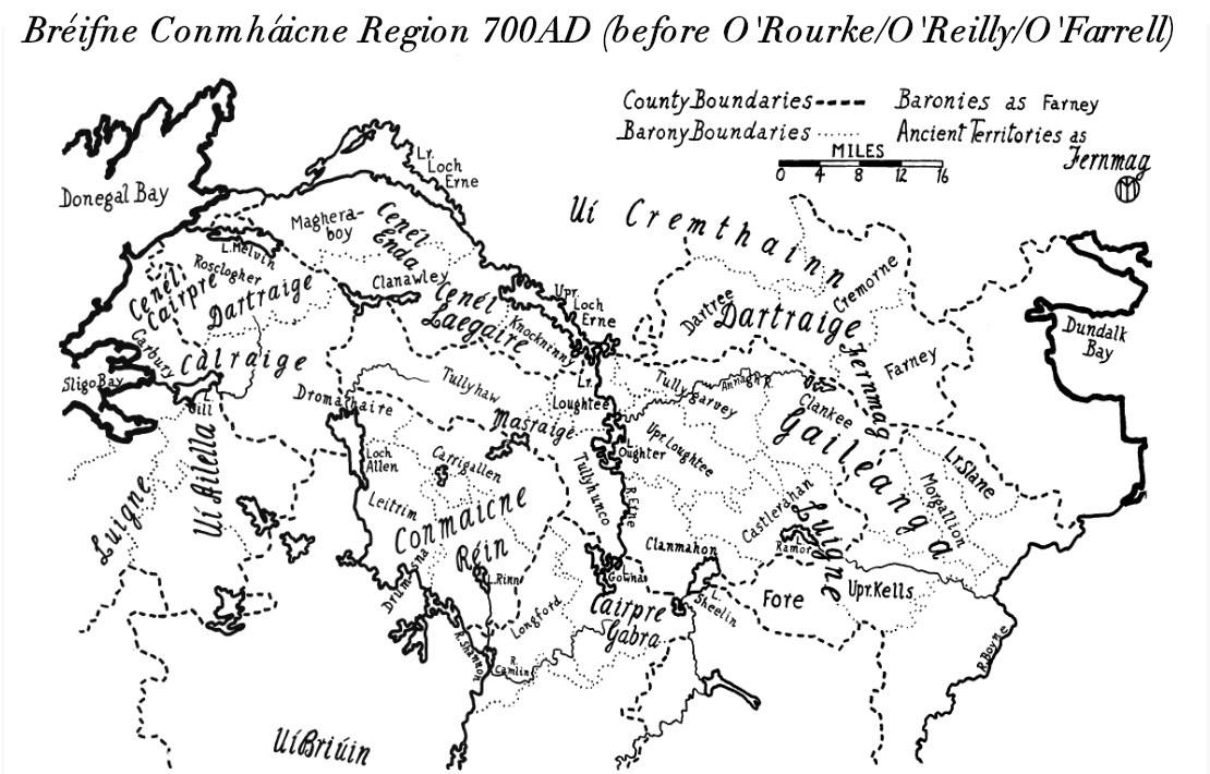
Tullyhaw ( ga, Teallach Eathach) (which means 'The Territory of Eochaidh', an ancestor of the McGoverns, who lived ) is a Barony in County Cavan in the Republic of Ireland. The area has been in constant occupation since pre-4000 BC. Located in the northwest of the county, it has been referred to as Cavan's panhandle. In 1579, East Breifne, then part of Connacht, was made a shire. The shire was named County Cavan ( ga, An Cabhán) after Cavan, the area's main town. The administration remained in the control of the local Irish dynasty and subject to the Brehon and Canon Law. In 1584, Sir John Perrot formed the shire into a county in Ulster. It was subdivided into seven baronies: *two of which were assigned to Sir John O'Reilly and *three to other members of the family; *two remaining, possessed by the septs of ** McKiernan Clan and **McGovern (a.k.a. ''Magauran'') The last one, Tullyhaw, encompassed the mountains bordering on O'Rourke's country, and was left subject t ... [...More Info...] [...Related Items...] OR: [Wikipedia] [Google] [Baidu] |
Republic Of Ireland
Ireland ( ga, Éire ), also known as the Republic of Ireland (), is a country in north-western Europe consisting of 26 of the 32 counties of the island of Ireland. The capital and largest city is Dublin, on the eastern side of the island. Around 2.1 million of the country's population of 5.13 million people resides in the Greater Dublin Area. The sovereign state shares its only land border with Northern Ireland, which is part of the United Kingdom. It is otherwise surrounded by the Atlantic Ocean, with the Celtic Sea to the south, St George's Channel to the south-east, and the Irish Sea to the east. It is a unitary, parliamentary republic. The legislature, the , consists of a lower house, ; an upper house, ; and an elected President () who serves as the largely ceremonial head of state, but with some important powers and duties. The head of government is the (Prime Minister, literally 'Chief', a title not used in English), who is elected by the Dáil and appointed by ... [...More Info...] [...Related Items...] OR: [Wikipedia] [Google] [Baidu] |


.jpg)


