|
Kilcalmonell
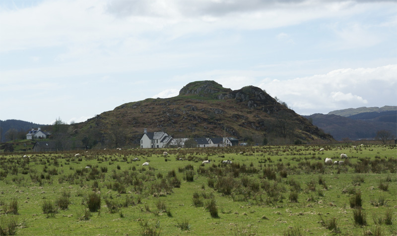
The parish of Kilcalmonell is situated in Argyll and Bute, Scotland. It extends from Clachan, Kintyre, Clachan, in Kintyre to Kilberry, in Knapdale. References *W. & A.K. Johnston; ''The Gazetteer of Scotland'' 1882. Civil parishes of Scotland {{Argyll-geo-stub ... [...More Info...] [...Related Items...] OR: [Wikipedia] [Google] [Baidu] |
Argyll And Bute
Argyll and Bute ( sco, Argyll an Buit; gd, Earra-Ghà idheal agus Bòd, ) is one of 32 unitary authority council areas in Scotland and a lieutenancy area. The current lord-lieutenant for Argyll and Bute is Jane Margaret MacLeod (14 July 2020). The administrative centre for the council area is in Lochgilphead at Kilmory Castle, a 19th-century Gothic Revival building and estate. The current council leader is Robin Currie, a councillor for Kintyre and the Islands. Description Argyll and Bute covers the second-largest administrative area of any Scottish council. The council area adjoins those of Highland, Perth and Kinross, Stirling and West Dunbartonshire. Its border runs through Loch Lomond. The present council area was created in 1996, when it was carved out of the Strathclyde region, which was a two-tier local government region of 19 districts, created in 1975. Argyll and Bute merged the existing Argyll and Bute district and one ward of the Dumbarton district. The Dumbart ... [...More Info...] [...Related Items...] OR: [Wikipedia] [Google] [Baidu] |
Clachan, Kintyre
Clachan is a small village in North Kintyre, Argyll & Bute, Scotland. Clachan is the site of an old church, which was the principal church for the North Kintyre area. The church is surrounded by carved stone statues of the Chiefs of the Clan Alasdair. Another group of standing stones (the tallest of which is 3.4 metres), and a burial cist, are found to the south of Clachan, near Ballochroy Farm. In 1971 it had a population of 108. The last major battle to be fought in Kintyre took place on the steep slopes of Loup Hill in May 1689, when the local forces of MacDonald of Largie, McAlester of Loup and McNeill of Gallichoille, all strong supporters of King James VII, were defeated by a Government force. Clachan is also the site of Balinakill House. Once the home of Coll McAlester, who led the first large settlement of highlanders in North Carolina at Cross Creek in the Cape Fear River valley in 1739, and later the home of Sir William MacKinnon Sir William Mackinnon, 1st Baronet ... [...More Info...] [...Related Items...] OR: [Wikipedia] [Google] [Baidu] |
Kintyre
Kintyre ( gd, Cinn Tìre, ) is a peninsula in western Scotland, in the southwest of Argyll and Bute. The peninsula stretches about , from the Mull of Kintyre in the south to East and West Loch Tarbert in the north. The region immediately north of Kintyre is known as Knapdale. Kintyre is long and narrow, at no point more than from west coast to east coast, and is less than wide where it connects to Knapdale. The east side of the Kintyre Peninsula is bounded by Kilbrannan Sound, with a number of coastal peaks such as Torr Mor. The central spine of the peninsula is mostly hilly moorland, the highest point being Beinn an Tuirc at .Ordnance Survey. Landranger 1:50,000 Map Sheet 68 (South Kintyre & Cambeltown) The coastal areas and hinterland, however, are rich and fertile. Kintyre has long been a prized area for settlers, including the early Scots who migrated from Ulster to western Scotland and the Vikings or Norsemen who conquered and settled the area just before the start of t ... [...More Info...] [...Related Items...] OR: [Wikipedia] [Google] [Baidu] |
Kilberry
Kilberry ( gd, Cill Bheiridh) is a village in Argyll and Bute, Scotland. It is close to the western coast of the district of Knapdale. Kilberry Castle, just to the west of the village, was built in 1497 as a L-plan castle by a cadet branch of Clan Campbell. The castle was destroyed by an English pirate in 1513. The ruins were incorporated into the present mansion, built in 1844 by John Campbell and enlarged in 1871. A group of sculptured stones, in the care of Historic Environment Scotland, are on display in a purpose-built shelter in the grounds of the castle. The stones, which include cross-slabs and medieval grave markers, originally came from the medieval parish church, which was destroyed in the 17th century. People from Kilberry * Marion Campbell Francis Marion Campbell (May 25, 1929 – July 13, 2016) was an American football defensive lineman and coach. He played college football for the Georgia Bulldogs from 1949 until 1951, where he was appropriately nicknamed " S ... [...More Info...] [...Related Items...] OR: [Wikipedia] [Google] [Baidu] |
Knapdale
Knapdale ( gd, Cnapadal, IPA: ˆkraÊ°pÉ™t̪əɫ̪ forms a rural district of Argyll and Bute in the Scottish Highlands, adjoining Kintyre to the south, and divided from the rest of Argyll to the north by the Crinan Canal. It includes two parishes, North Knapdale and South Knapdale. The area is bounded by sea to the east and west (Loch Fyne and the Sound of Jura respectively), whilst the sea loch of West Loch Tarbert almost completely cuts off the area from Kintyre to the south.Ordnance Survey. Landranger 1:50000 Map Sheet 55 (Lochgilphead & Loch Awe)Ordnance Survey. Landranger 1:50000 Map Sheet 62 (North Kintyre & Tarbert) The name is derived from two Gaelic elements: ''Cnap'' meaning hill and ''Dall'' meaning field. Knapdale gives its name to the Knapdale National Scenic Area, one of the forty national scenic areas in Scotland, which are defined so as to identify areas of exceptional scenery and to ensure their protection from inappropriate development. The designated area covers ... [...More Info...] [...Related Items...] OR: [Wikipedia] [Google] [Baidu] |


