|
Khargone District
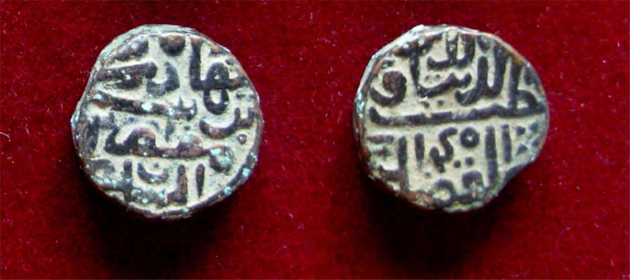
Khargone district, formerly known as West Nimar district, is a district of Madhya Pradesh state in central India. The district lies in the Nimar region, and is part of the Indore Division. Khargone city is the headquarters of this district which lies south to Indore metropolis and headquarters of Indore District. History In ancient times, the Haihayas of Mahishmati (present-day Maheshwar) ruled the region. In the early medieval ages, the area was under the Paramaras of Malwa and the Ahirs of Asirgarh. In the late medieval ages, the area was under the Malwa Sultanate of Mandu. In 1531, Gujarat sultan Bahadur Shah brought this area under his control. In 1562, Akbar annexed this territory along with the whole Malwa to Mughal empire. In 1740 Marathas under the Peshwa brought the area under their control. In 1778, Peshwa distributed this territory to the Maratha rulers, Holkars of Indore, Sindhias of Gwalior and Ponwars of Dhar. After the independence and merger of the Princely ... [...More Info...] [...Related Items...] OR: [Wikipedia] [Google] [Baidu] |
List Of Districts Of Madhya Pradesh
The Indian state of Madhya Pradesh came into existence on 1 November 1956. Madhya Pradesh has various geographic regions which have no official administrative governmental status; some correspond to historic countries, states or provinces. Currently, the number of districts in the state is 52. These districts are grouped into ten administrative divisions. Districts are subdivided into tehsils, of which there are 428 in Madhya Pradesh. List of districts There are 52 districts in Madhya Pradesh categorized into ten divisions. All districts share their name with their capital city. Proposed districts A bill giving in-principle approval to the creation of three districts was passed on 19 March 2020. The following districts would be created: * Nagda district * Maihar district * Chachaura district Notes References {{Districts of India Districts A district is a type of administrative division that, in some countries, is managed by the local government. Across the wor ... [...More Info...] [...Related Items...] OR: [Wikipedia] [Google] [Baidu] |
Bahadur Shah Of Gujarat
Qutb-ud-Din Bahadur Shah, born Bahadur Khan was a sultan of the Muzaffarid dynasty who reigned over the Gujarat Sultanate, a late medieval kingdom in India from 1526 to 1535 and again from 1536 to 1537. He ascended to throne after competing with his brothers. He expanded his kingdom and made expeditions to help neighbouring kingdoms. In 1532, Gujarat came under attack of the Mughal Emperor Humayun and fell. Bahadur Shah regained the kingdom in 1536 but he was killed by the Portuguese on board a ship when making a deal with them. The army of Bahadur Shah included the Koli tribe and Abyssinians. The Kolis of Gujarat attacked the Humayun in the help of Bahadur Shah at the Gulf of Khambhat. Early years Bahadur Shah's father was Shams-ud-Din Muzaffar Shah II, who had ascended to the throne of the Gujarat Sultanate in 1511. Muzaffar Shah II nominated Sikandar Shah (Bahadur Shah's elder brother) as the heir apparent to the throne. Bahadur Khan's relationship with his brother and father ... [...More Info...] [...Related Items...] OR: [Wikipedia] [Google] [Baidu] |
Malwa Sultanate
The Malwa Sultanate ( fa, ) (Pashto: ; ''lit: Mālwā Salṭanat'') was a late medieval Islamic sultanate in the Malwa, Malwa region, covering the present day Indian states of Madhya Pradesh and south-eastern Rajasthan from 1392 to 1562. It was founded by Dilawar Khan, an Afghan (ethnonym), Afghan governor of the Delhi Sultanate. Dilawar Khan had ceased to pay tribute to Delhi after 1392. Following Timur's invasion and the disintegration of the Delhi Sultanate, in 1401/2, Dilawar Khan made Malwa an independent realm. History The sultanate of Malwa was founded by Dilawar Khan, Dilawar Khan Ghuri, the governor of Malwa for the Delhi Sultanate, who asserted his independence in 1392, but did not actually assume the ensigns of royalty till 1401. Initially Dhar was the capital of the new kingdom, but soon it was shifted to Mandu, Madhya Pradesh, Mandu, which was renamed Shadiabad (the city of joy). After his death, he was succeeded by his son Hoshang Shah of Malwa, Alp Khan, who ... [...More Info...] [...Related Items...] OR: [Wikipedia] [Google] [Baidu] |
Ahir
Ahir or Aheer are a community of traditionally non-elite pastoralists in India, most members of which identify as being of the Indian Yadav community because they consider the two terms to be synonymous. The Ahirs are variously described as a caste, a clan, a community, a race and a tribe. The traditional occupations of Ahirs are cattle-herding and agriculture. Since late 19th century to early 20th century, Ahirs have adopted ''Yadav'' word for their community and have claimed descent from the mythological king Yadu as a part of a movement of social and political resurgence Quote: "The movement, which had a wide interregional spread, attempted to submerge regional names such as Goala, Ahir, Ahar, Gopa, etc., in favour of the generic term Yadava (Rao 1979). Hence a number of pastoralist castes were subsumed under Yadava, in accordance with decisions taken by the regional and national level caste sabhas. The Yadavas became the first among the shudras to gain the right to wear ... [...More Info...] [...Related Items...] OR: [Wikipedia] [Google] [Baidu] |
Paramara Dynasty
The Paramara dynasty ( IAST: Paramāra) was an Indian dynasty that ruled Malwa and surrounding areas in west-central India between 9th and 14th centuries. They belonged to the Parmara clan of the Rajputs. The dynasty was established in either the 9th or 10th century, and its early rulers most probably ruled as vassals of the Rashtrakutas of Manyakheta. The earliest extant Paramara inscriptions, issued by the 10th-century ruler Siyaka, have been found in Gujarat. Around 972 CE, Siyaka sacked the Rashtrakuta capital Manyakheta, and established the Paramaras as a sovereign power. By the time of his successor Munja, the Malwa region in present-day Madhya Pradesh had become the core Paramara territory, with Dhara (now Dhar) as their capital. The dynasty reached its zenith under Munja's nephew Bhoja, whose kingdom extended from Chittor in the north to Konkan in the south, and from the Sabarmati River in the west to Vidisha in the east. The Paramara power rose and declined several t ... [...More Info...] [...Related Items...] OR: [Wikipedia] [Google] [Baidu] |
Maheshwar
Maheshwar is a town, near Khargone city in Khargone district of Madhya Pradesh state, in central India. It is located on State Highway-38 ( Khargone city-Barwaha- Bandheri Highway),13.5 km east of National Highway 3 (Agra-Mumbai highway) and 91 km from Indore, the commercial capital of the state. The Town lies on the north bank of the Narmada River. It was the kingdom of Chaktavartin Samrat Sahastraarjun, Kartavirya Arjuna a Heheya king. Lately, after many years, it was the capital of the Malwa during the Maratha Holkar reign till 6 January 1818, when the capital was shifted to Indore by Malhar Rao Holkar III. Etymology The word Maheshwar in Hindi means ''Great God, ''an epithet of Lord Shiva. History Writers such as HD Sankalia, PN Bose and Francis Wilford, among others, identify Maheshwar as the ancient town of Mahishmati. Also known as Minnagara to Greeko-Romans. Maheshwar is believed to be built on the site of the ancient city of Somvanshya Shastrarjun ... [...More Info...] [...Related Items...] OR: [Wikipedia] [Google] [Baidu] |
Mahishmati
Mahishmati (IAST: Māhiṣmatī) was an ancient city in present-day central India. It was located in present-day Madhya Pradesh, on the banks of Narmada River, although its exact location is uncertain. It is mentioned in several ancient texts, and is said to have been ruled by the legendary Haihaya ruler Kartavirya Arjuna. Mahishmati was the most important city in the southern part of the Avanti kingdom, and later served as the capital of the Anupa Kingdom. The city may have flourished as late as until 13th century, as indicated by a Paramara inscription. Identification The following things are known about Mahishmati's location: * It was located on the banks of the Narmada river. * It was located to the south of Ujjayini, and north of Pratishthana, on the route connecting the two cities (according to ''Sutta Nipata''). Patanjali mentions that a traveler starting out from Ujjayini saw the sunrise at Mahishmati. * It was located in the Avanti kingdom, and at times was a ... [...More Info...] [...Related Items...] OR: [Wikipedia] [Google] [Baidu] |
Haihayas
The Heheya Kingdom (also known as Haihaya, Haiheya, Heiheya _sa.html" ;"title="nowiki/> sa">हैहय was a kingdom ruled by the Yadava people, who claimed to be descended from Yadu, a legendary king of Chandravamsha lineage. One of the most well known Haihaya rulers was Kartavirya Arjuna. It is believed that the Kingdom was involved with a number of conflicts with neighboring kingdoms, and it is believed that it was ultimately defeated by the Bhargava leader Parashurama. The capital of the Heheya Kingdom was Mahishmati, located on the banks of the Narmada River in present-day Madhya Pradesh. Haihaya clans The Haihayas were an ancient confederacy of five ''gana''s (clans), who claimed their common ancestry from Yadu. According to the ''Harivamsha Purana'' (34.1898), Haihaya was the great-grandson of Yadu and grandson of Sahasrajit.Pargiter, F.E. (1972) 922 ''Ancient Indian Historical Tradition'', Delhi: Motilal Banarsidass, p.87. In the ''Vishnu Purana'' (IV.11), all t ... [...More Info...] [...Related Items...] OR: [Wikipedia] [Google] [Baidu] |
Indore Division
Indore division is an administrative geographical unit of Madhya Pradesh state of India. Indore is the administrative headquarters of the division. The division consists of districts of Indore, Barwani, Burhanpur, Dhar, Jhabua, Khandwa, Khargone Khargone is a city and administrative headquarters of an Khargone district in the Indian state of Madhya Pradesh. The city is located on the bank of the Kunda river and is known for its cotton and chilly (chili pepper) production. It is also ... and Alirajpur. References {{Reflist Divisions of Madhya Pradesh ... [...More Info...] [...Related Items...] OR: [Wikipedia] [Google] [Baidu] |
Nimar
Nimar is the southwestern region of Madhya Pradesh state in west-central India. This region has sub-regions which include Nimad, Khandya and Bhuwana. The region lies south of the Vindhya Range, and consists of two portions of the Narmada and Tapti river valleys, separated by a section of the Satpura Range, about 15 miles (24 km) in breadth. On the highest peak, about 800 ft (244 m) above the plain and 1800 ft (549 m) above sea-level, stands the fortress of Asirgarh, commanding a pass which has for centuries been the chief highway between Upper India and the Deccan. The Nimar region is home to the Nimadi language. History Nimar was formed as a district of British India, in the Nerbudda Division of the Central Provinces. The administrative headquarters were at Khandwa; but the capital in Muslim times was Burhanpur. Area, 4273 mi² (11,067 km²), population (1901) 329,615. The staple crops were cotton and millet; ganja or Indian hemp was also allowed to be grown under governm ... [...More Info...] [...Related Items...] OR: [Wikipedia] [Google] [Baidu] |


