|
Kerry North–West Limerick (Dáil Constituency)
Kerry North–West Limerick was a parliamentary constituency represented in Dáil Éireann, the lower house of the Irish parliament or Oireachtas, for a single Dáil term, from 2011 to 2016. The constituency elected 3 deputies ( Teachtaí Dála, commonly known as TDs). The method of election was proportional representation by means of the single transferable vote (PR-STV). History and boundaries The Constituency Commission proposed in 2007 that at the next general election a new constituency called Kerry North–West Limerick be created. It was established by the Electoral (Amendment) Act 2009 when it partially replaced the former constituencies of Kerry North and Limerick West. It was only used at the 2011 general election. The constituency comprised the northern half of County Kerry, located between the River Shannon estuary and the Slieve Mish Mountains; taking in Tralee, Listowel, Tarbert, Ballybunion and Castleisland; and the western part of County Limerick taking i ... [...More Info...] [...Related Items...] OR: [Wikipedia] [Google] [Baidu] |
Dáil Constituencies
There are 39 multi-member electoral districts, known as Dáil constituencies, that elect 160 TDs (members of parliament), to Dáil Éireann, Ireland's lower house of the Oireachtas, or parliament, by means of the single transferable vote, to a maximum term of five years. Electoral law Article 16.2 of the Constitution of Ireland outlines the requirements for constituencies. The total number of TDs is to be no more than one TD representing twenty thousand and no less than one TD representing thirty thousand of the population, and the ratio should be the same in each constituency, as far as practicable, avoiding malapportionment. Under the Constitution, constituencies are to be revised at least once in every twelve years in accordance with the census reports, which are compiled by the Central Statistics Office every five years. Under the Electoral Act 1997, as amended, a Constituency Commission is to be established after each census. The commission is independent and is resp ... [...More Info...] [...Related Items...] OR: [Wikipedia] [Google] [Baidu] |
Electoral (Amendment) Act 2009
The Electoral (Amendment) Act 2009 (No. 4) is a law of Ireland which amended electoral law, including revisions to Dáil constituencies and European Parliament constituencies in light of the 2006 census. The new European Parliament constituencies were used at the election in June 2009. The revision to Dáil constituencies took effect on the dissolution of the 30th Dáil on 1 February 2011 and a general election for the 31st Dáil on the revised constituencies took place on 25 February 2011. Revision to constituencies In April 2007, the Minister for the Environment, Heritage and Local Government established an independent Constituency Commission under the terms of the Electoral Act 1997. Its report proposed several changes to Dáil constituencies. The commission was chaired by Iarfhlaith O'Neill, judge of the High Court, and delivered its report later in 2007. The Act implemented the recommendations of this report and repealed the Electoral (Amendment) (No. 2) Act 1998, whic ... [...More Info...] [...Related Items...] OR: [Wikipedia] [Google] [Baidu] |
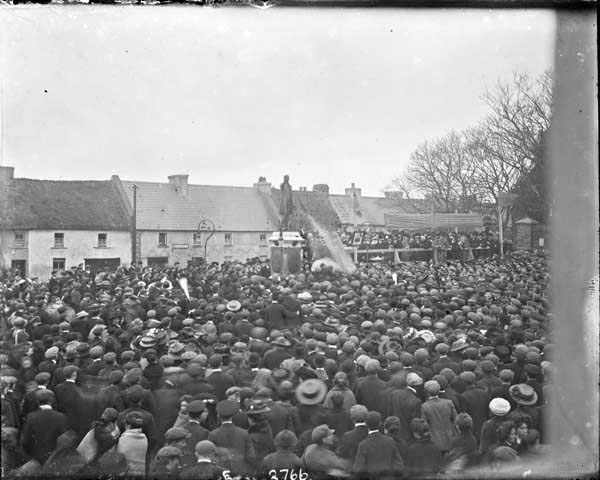
Tournafulla
Tournafulla, or Toornafulla (), is a village in the southwest of County Limerick, Republic of Ireland, Ireland. Tournafulla is a long single-street village. It has a Catholic church, a primary school, three pubs, a community hall and a GAA pitch. As of the 2016 census, the village had a population of 144 people. Geography Tournafulla is located 11 km from Abbeyfeale, 13 km from Newcastle West and 56 km from Limerick City. It is one half of the parish of Tournafulla/Mountcollins which was formed in 1838. Surrounding parishes include Killeedy to the east, Monagea to the northeast, Templeglantine to the north, Abbeyfeale to the west, Meelin/Rockchapel, County Cork to the south and Brosna, County Kerry to the southwest. It is surrounded by hills to the north and the Mullaghareirk Mountains to the south. Woods covered most of Tournafulla until the 17th century and Irish language, Irish was still the main language up until the 1910s. The three counties of County Limeri ... [...More Info...] [...Related Items...] OR: [Wikipedia] [Google] [Baidu] |
Templeglantine
Templeglantine (pronounced "Temple-glan-tin"), officially Templeglentan (), is a village in west County Limerick, Ireland between Newcastle West and Abbeyfeale on the N21 national primary route – the main road from Limerick to Tralee. The village is approximately 55 kilometres southwest Limerick City and roughly 45 kilometres east of Tralee. Templeglantine is often simply referred to as 'Glantine' by natives and other west Limerick locals. History The Irish for Templeglantine is "Teampall an Ghleanntáin", which means "the church of the little glen". Templeglantine is historically known locally as 'Inse Bán' or "Inchabaun", which, when translated, means 'the White River meadow'. Templeglantine is a chapel village, having grown up around the church, which was built in 1829. A community centre was officially opened in 1977 by Bishop Jeremiah Newman. In the same year, the village received the Glór na nGael trophy from the then President of Ireland, Patrick Hillery. This is an ... [...More Info...] [...Related Items...] OR: [Wikipedia] [Google] [Baidu] |
Mountcollins
Mountcollins () is a village in the extreme south west of County Limerick, Ireland, barely 100 metres from the border with County Kerry and just a mile from County Cork. The River Feale runs parallel to the village and is fed by the Caher River that divides the village. Mountcollins is in the parish of Mountcollins-Tournafulla. The local post office closed a few years ago. The last grocery shop closed in 2008. The village skyline is dominated by a large Roman Catholic church with an 80 foot steeple which can be plainly seen from both bordering County Cork and County Kerry When entering the village from either end there are very narrow bridges which only one car can cross over at a time. History Tournafulla-Mountcollins parish was formed in 1838 from part of the parish of Killeedy. Until 1586, Mountcollins had been part of the parish of Monagea. The present day population of the parish is about 1,500 people. Mountcollins was formerly called Knockroedermot. The area used t ... [...More Info...] [...Related Items...] OR: [Wikipedia] [Google] [Baidu] |
Glin, County Limerick
Glin () is a village in the northwest of County Limerick, Republic of Ireland, Ireland. It is on the south shore of the River Shannon's estuary, on the N69 road (Ireland), N69 road between Foynes and Tarbert, Kerry, Tarbert. The population of the village at the 2016 census of Ireland, 2016 census was 576. History The lands around Glin were the Manorialism, manor of the Knight of Glin after the Norman invasion of Ireland, Norman invasion. Glin was not included in the Down Survey of the 1650s. The village, as it was then, was called Ballygullyhannane. Glin ''An Gleann'' was previously ''Gleann Corbraighe'', "Valley of the Corbry", from the stream flowing through the village into the Shannon. Glin is in the Barony (Ireland), barony of Shanid, formerly a division of the barony of Lower Connello.Glin ''A Topographical Dictionary of Ireland'' (1837), Samue ... [...More Info...] [...Related Items...] OR: [Wikipedia] [Google] [Baidu] |
Athea
Athea ( or ''Áth Té'') is a village in west County Limerick, Ireland. Athea has a Roman Catholic church, and is the centre for the parish of Athea, which encompasses several nearby townlands. History The community was dependent on agriculture and a creamery was built near the river which acted as the centrepoint for local trade. A primary school was built near the creamery to cope with the rising younger population. Over time, cottages and workshops lined the main road to create the village of Athea. New local roads were built to neighbouring Moyvane and off the main Listowel-Limerick and Glin-Abbeyfeale roads. The river was the primary water source as well as its use for drainage. The Catholic population were forbidden to practise their faith under Penal Laws, and the first church wasn't built in Athea until the early 19th century. Prior to this locals congregated each Sunday at a Mass rock to the east of the village. Geography Topography Athea is situated on the river Ga ... [...More Info...] [...Related Items...] OR: [Wikipedia] [Google] [Baidu] |
Abbeyfeale
Abbeyfeale (; ) is a historic market town in County Limerick, Ireland, near the border with County Kerry. The town is on the N21 road (Ireland), N21 road from Limerick to Tralee, some south-west of Newcastle West and south-east of Listowel and north-east of Tralee. Geography The town is situated on the banks of the River Feale in the foothills of the Mullaghareirk Mountains. History In 1418 in Ireland, 1418, Thomas FitzGerald, 5th Earl of Desmond was dispossessed of his lands and deprived of his earldom by his paternal uncle, James FitzGerald, 6th Earl of Desmond, after Thomas had concluded a marriage far below his station to Catherine MacCormac of Abbeyfeale;Alfred Webb, Webb, Alfred. A Compendium of Irish Biography'. Dublin: 1878. Catherine was the daughter one of Thomas's dependants, William MacCormac, known as "the Monk of River Feale, Feale."George Cokayne, Cokayne, George Edward, Complete Peerage of England, Scotland, Ireland, Great Britain and the United Kingdom, Ex ... [...More Info...] [...Related Items...] OR: [Wikipedia] [Google] [Baidu] |
Castleisland
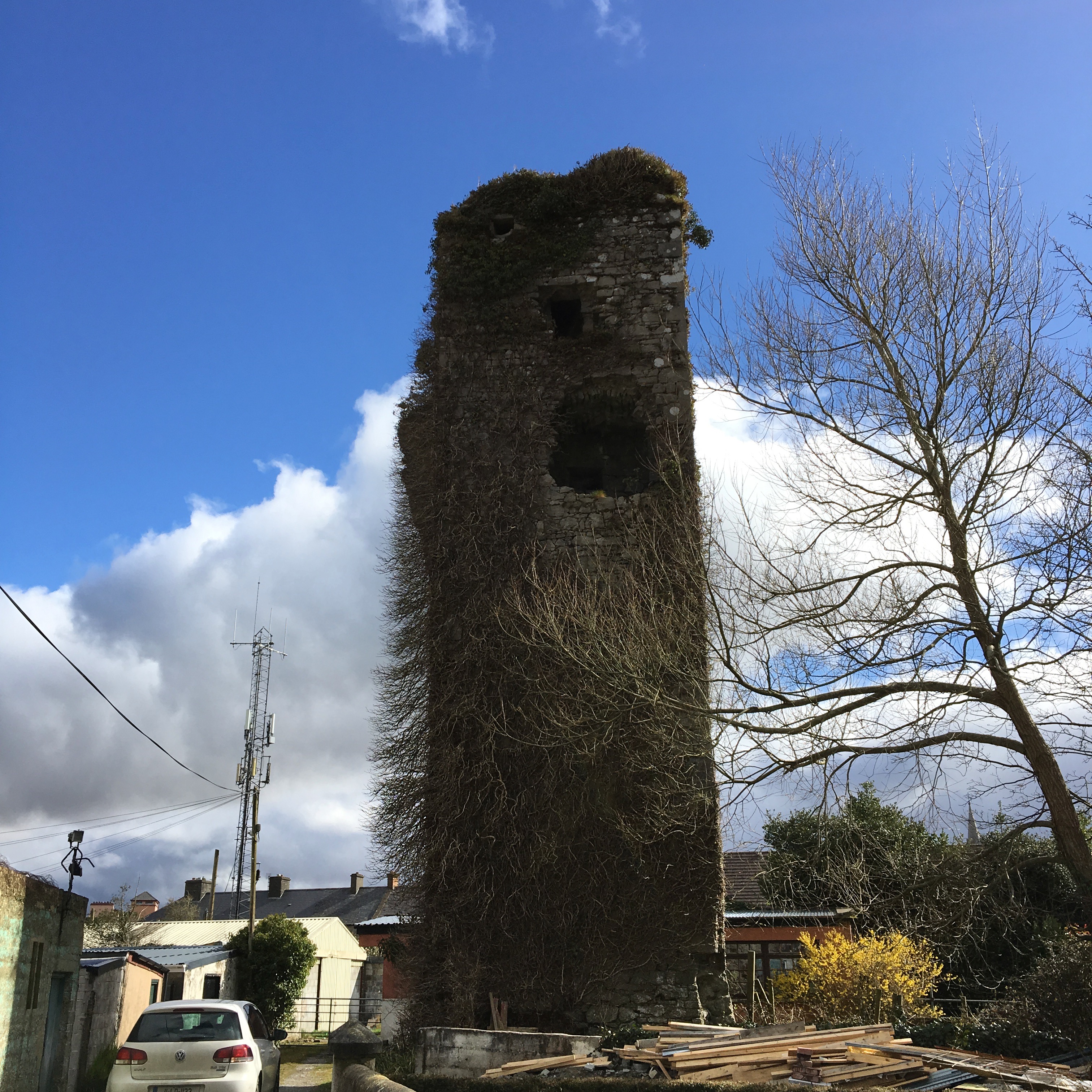
Castleisland () is a town and commercial centre in County Kerry in south west Ireland. The town is known for the width of its main street. As of the 2016 Census, Castleisland had a population of 2,486. Castleisland was described by one of its citizens, journalist Con Houlihan, as "not so much a town as a street between two fields". History Castleisland was the centre of Desmond power in Kerry. The village got its name, 'Castle of the Island of Kerry', from a castle built in 1226 by Geoffrey Maurice (or de Marisco). Maurice had been the Lord Justice of Ireland during the reign of King Henry III. The island was created by turning the waters of the River Maine into a moat around the castle. Sometime in the 120 years after its construction, the castle was taken by the forces of the Earl of Desmond. It is known that in 1345 the castle was being held for the Earl of Desmond by Sir Eustace de la Poer and other knights when it was captured by Sir Ralph Ufford, Lord Justice of Ir ... [...More Info...] [...Related Items...] OR: [Wikipedia] [Google] [Baidu] |
Ballybunion
Ballybunion or Ballybunnion () is a coastal town and seaside resort in County Kerry, Ireland, on the Wild Atlantic Way, from the town of Listowel. Tourism Ballybunion has two main beaches, divided by the Castle Green. The Ladies Beach is to the right and the Men's Beach to the left – names arising from the fact that both sexes swam on separate beaches on the orders of the local parish priest, who patrolled daily ensuring the rule wasn't broken. Further to the left of the Men's Beach lies the Long Strand, a 3.2 km stretch of sand, overlooked by the sand dunes of Ballybunion Golf Club. In the summer, Ballybunion attracts tourists, and the beaches near Ballybunion are a common surfing site, with a dedicated surf school on the Men's Beach. Other traditions include seaweed baths, featuring sea water with serrated wrack. The town itself has a number of restaurants, pubs and cafes, and schools. There is also a statue commemorating the golfing visit of Bill Clinton. This was ... [...More Info...] [...Related Items...] OR: [Wikipedia] [Google] [Baidu] |
Tarbert, County Kerry
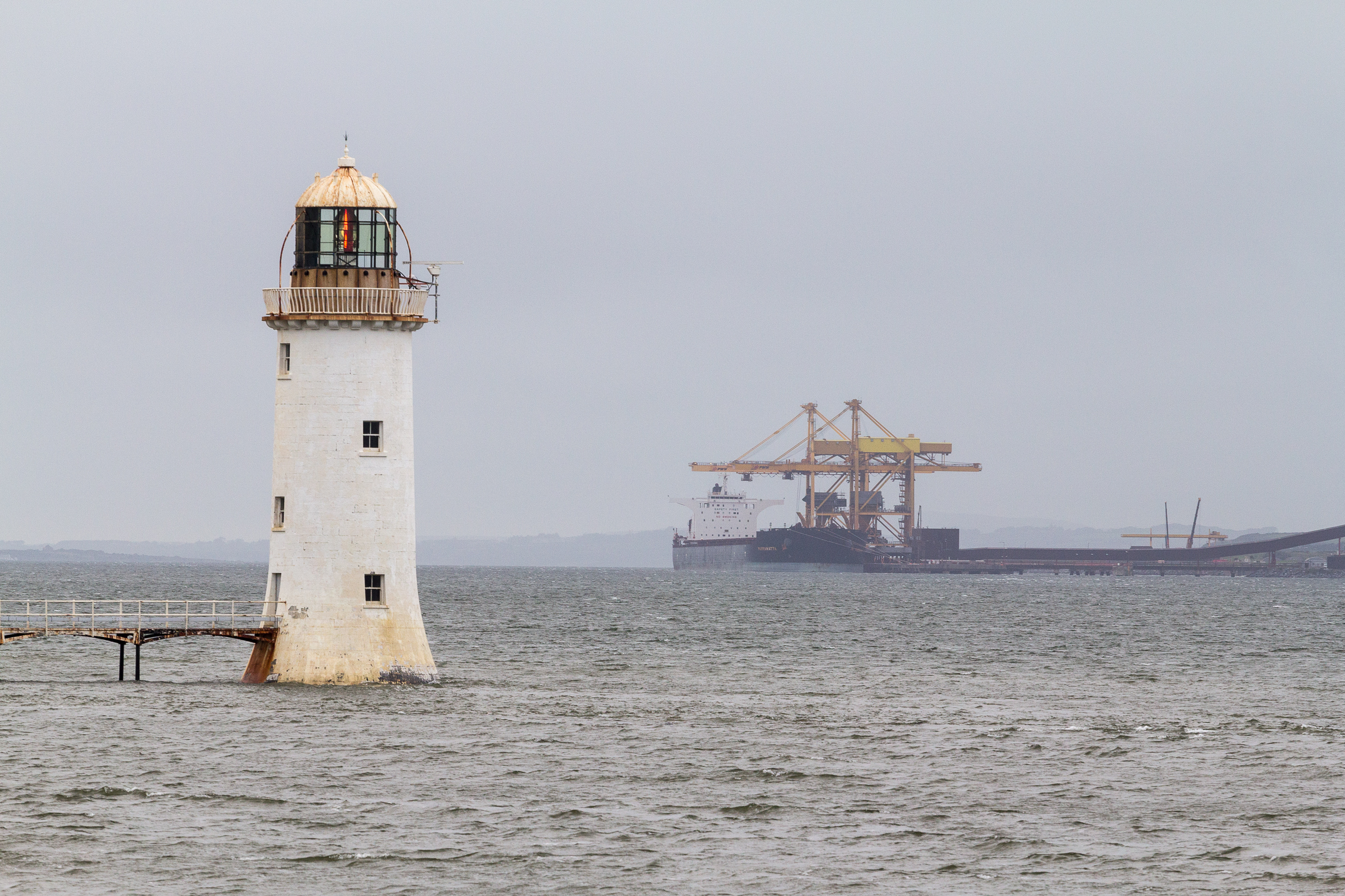
Tarbert (, from an Old Irish term meaning "draw-boat", i.e. portage) is a town in the north of County Kerry, with woodland to the south and the Shannon estuary to the north. It lies on the N69 coast road that runs along the estuary from Limerick before turning inland at Tarbert towards Listowel, and has two schools Tarbert Primary and Tarbert Comprehensive. Tarbert Island The nearby island is linked to the mainland by a short isthmus – the site of the boat portage that gave its name to both the island and the town. There is a car ferry service from the island to the town of Killimer, near Kilrush in Clare. This service, operated by Shannon Ferries, provides a link between the N69 in Kerry and the N67 in Clare. Also on the island is a small lighthouse and an electricity plant with four oil-fired turbines and a capacity of 640MW. This plant, opened in 1969, was the site of an explosion in 2003 that killed two workers and seriously injured another. The plant was due to ... [...More Info...] [...Related Items...] OR: [Wikipedia] [Google] [Baidu] |
Listowel
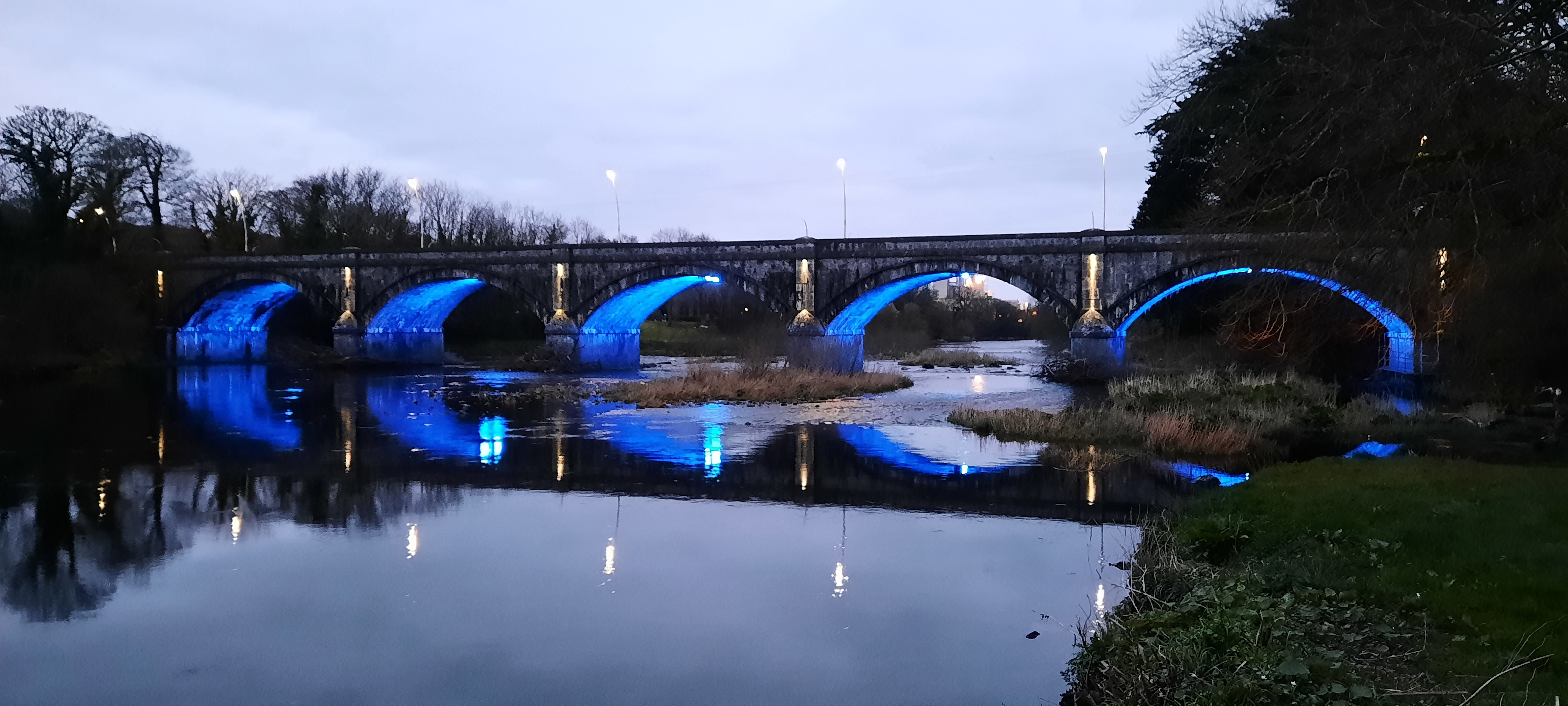
Listowel ( ; , IPA:[ˈlʲɪsˠˈt̪ˠuəhəlʲ]) is a heritage market town in County Kerry, Ireland. It is on the River Feale, from the county town, Tralee. The town of Listowel had a population of 4,820 according to the Central Statistics Office of Ireland, CSO Census 2016. Described by the organisers of Listowel's writers festival as the "Literary Capital of Ireland", a number of internationally known playwrights and authors have lived there, including Bryan MacMahon (writer), Bryan MacMahon and John B. Keane. Location Listowel is on the N69 road (Ireland), N69 Limerick – Foynes – Tralee Roads in Ireland, road. Bus Éireann provides daily services to Tralee, Cork (city), Cork, and Limerick. The nearest railway station is Tralee. Listowel used to have its own railway station on a broad gauge line between Tralee and Limerick city; however, this was closed to passengers in 1963, to freight in 1978, and finally abandoned and lifted in 1988. The station building has been ... [...More Info...] [...Related Items...] OR: [Wikipedia] [Google] [Baidu] |

.jpg)


