|
Kensington, Dunedin
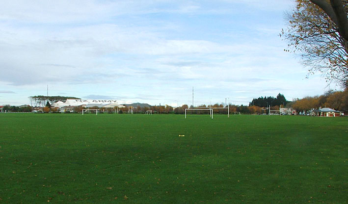
Kensington is a small suburb of the New Zealand city of Dunedin, nestled to the south of a hilly spur between the central city and the major suburb of South Dunedin, some to the south of the city centre. The suburb was named for the leafy London suburb, possibly by John Hyde Harris, who subdivided the area in the 1860s. Kensington is located on and around King Edward Street, close to the point at which it becomes Princes Street. This is one of Dunedin's main arterial routes, with King Edward Street stretching south to become the main road through South Dunedin, and Princes Street heading north to Dunedin's city centre. The suburb lies at the foot of a spur off Maryhill officially referred to as Montecillo Ridge, and close to the inner city sports ground, the Oval. This ground, originally called the Southern Recreation Ground, is now referred to as the Kensington Oval, so as to distinguish it from the University Oval in the north of the city. This ground is actually triangula ... [...More Info...] [...Related Items...] OR: [Wikipedia] [Google] [Baidu] |
Belleknowes
City Rise is an inner suburb of the New Zealand city of Dunedin. One of the city's older suburbs, it is, as its name suggests, centred on the slopes which lie close to the city centre, particularly those closest to the city's original heart of The Exchange (for this reason, places are said to be ''on the City Rise'' rather than ''in City Rise''). Extensive views across the central city can be gained from much of City Rise. The name City Rise is generally applied to the area immediately to the west of Princes Street, especially to the approximately triangular area of one square kilometre bounded by Princes Street and the city's Town Belt, with Maitland Street and Stuart Street lying at the edge of the area. Some parts of the lower slopes at one time carried the name Fernhill, a term still occasionally encountered to refer to this area, arising from the name of the residence of an early settler, Captain Bellairs. Other notable streets on the City Rise include High Street, Rat ... [...More Info...] [...Related Items...] OR: [Wikipedia] [Google] [Baidu] |
Drill Hall
A drill hall is a place such as a building or a hangar where soldiers practise and perform military drills. Description In the United Kingdom and Commonwealth, the term was used for the whole headquarters building of a military reserve unit, which usually incorporated such a hall. Many of these drill halls were built through public subscriptions in order to support the local Volunteer Force which was raised in the late 1850s. In the United Kingdom, these were later renamed Territorial Army (TA) Centres and later Army Reserve Centres (ARC)s. As well as a drill hall itself, they now usually feature other facilities such as a gymnasium, motor transport department, lecture rooms, stores, an armoury, administrative offices and the Officer's, Warrant Officers and Senior NCOs, and Junior Ranks Messes. Some Officer Training Corps, Army Cadet Force and Air Training Corps units are also co-located on the site of modern Army Reserve Centres, for example Blackheath drill hall. Over ... [...More Info...] [...Related Items...] OR: [Wikipedia] [Google] [Baidu] |
Slip Road
In the field of road transport, an interchange (American English) or a grade-separated junction (British English) is a road junction that uses grade separations to allow for the movement of traffic between two or more roadways or highways, using a system of interconnecting roadways to permit traffic on at least one of the routes to pass through the junction without interruption from crossing traffic streams. It differs from a standard intersection, where roads cross at grade. Interchanges are almost always used when at least one road is a controlled-access highway (freeway or motorway) or a limited-access divided highway (expressway), though they are sometimes used at junctions between surface streets. Terminology ''Note:'' The descriptions of interchanges apply to countries where vehicles drive on the right side of the road. For left-side driving, the layout of junctions is mirrored. Both North American (NA) and British (UK) terminology is included. ; Freeway junction, ... [...More Info...] [...Related Items...] OR: [Wikipedia] [Google] [Baidu] |
New Zealand State Highway 1
State Highway 1 (SH 1) is the longest and most significant road in the New Zealand road network, running the length of both main islands. It appears on road maps as SH 1 and on road signs as a white number 1 on a red shield, but it has the official designations SH 1N in the North Island, SH 1S in the South Island. SH 1 is long, in the North Island and in the South Island. Since 2010 new roads have reduced the length from . For the majority of its length it is a two-lane single carriageway, with at-grade intersections and property accesses, in both rural and urban areas. These sections have some passing lanes. Around of SH 1 is of motorway or expressway standard : in the North Island and in the South Island. Route North Island (SH 1N) SH 1 starts at Cape Reinga, at the northwestern tip of the Aupouri Peninsula, and since April 2010 has been sealed (mainly with either chipseal or asphalt) for its entire length. From Waitiki Landing south of Cape Reinga, SH 1 trav ... [...More Info...] [...Related Items...] OR: [Wikipedia] [Google] [Baidu] |
Overpass
An overpass (called an overbridge or flyover in the United Kingdom and some other Commonwealth countries) is a bridge, road, railway or similar structure that crosses over another road or railway. An ''overpass'' and ''underpass'' together form a grade separation. Stack interchanges are made up of several overpasses. History The world's first railroad flyover was constructed in 1843 by the London and Croydon Railway at Norwood Junction railway station to carry its atmospheric railway vehicles over the Brighton Main Line. Highway and road In North American usage, a ''flyover'' is a high-level overpass, built above main overpass lanes, or a bridge built over what had been an at-grade intersection. Traffic engineers usually refer to the latter as a ''grade separation''. A flyover may also be an extra ramp added to an existing interchange, either replacing an existing cloverleaf loop (or being built in place of one) with a higher, faster ramp that eventually bears left, but may b ... [...More Info...] [...Related Items...] OR: [Wikipedia] [Google] [Baidu] |
South Island Main Trunk
The Main North Line between Picton and Christchurch and the Main South Line between Lyttelton and Invercargill, running down the east coast of the South Island of New Zealand, are sometimes together referred to collectively as the South Island Main Trunk Railway (SIMT). Construction of a line running the length of the east coast began in the 1860s and was completed all the way from Picton to Invercargill in 1945; the last sections being on the Main North Line south of Picton. The designation "South Island Main Trunk" originally referred to only that line between Christchurch and Invercargill. Construction Main South Line Construction of the Main South Line (originally known as the "Great Southern Railway") began in 1865 when the Canterbury Provincial Railways began work on a broad gauge line south from Christchurch. It reached Rolleston on 13 October 1866 and Selwyn a year later. A number of routes south were considered, and the one chosen was a compromise betwe ... [...More Info...] [...Related Items...] OR: [Wikipedia] [Google] [Baidu] |
William Cargill (New Zealand Politician)
William Walter Cargill (27 August 1784 – 6 August 1860) was the founder of the Otago settlement in New Zealand, after serving as an officer in the British Army. He was a member of parliament and Otago's first Superintendent. Early life Cargill was born in Edinburgh, Scotland, in 1784. His parents were James Cargill and Marrion Jamieson. His father died of alcoholism when he was 15. He joined the British Army in 1802 and served with distinction in India, Spain, and France. In 1813, he married Mary Ann Yates; they had seventeen children. Of these, two of his five sons became notable in public life: John, who followed in his father's footsteps and became a politician, and Edward, a prominent businessman and politician. Family circumstances forced him to sell his commission in 1820, though he was later referred to as "Captain Cargill". After leaving the army, he became a wine merchant in Scotland. On 24 November 1847, Cargill sailed for New Zealand on the ship '' John Wickliffe ... [...More Info...] [...Related Items...] OR: [Wikipedia] [Google] [Baidu] |
Dunedin North
Dunedin North, also known as North Dunedin, is a major inner suburb ''Inner suburb'' is a term used for a variety of suburban communities that are generally located very close to the centre of a large city (the inner city and central business district). Their urban density is usually lower than the inner city ... of the New Zealand city of Dunedin, located northeast of the city centre. It contains many of the city's major institutions, including the city's university, polytechnic, main hospital, and largest museum. Dunedin North's 2001 population was 7,047, including the university area. Geography Dunedin North is located immediately to the north and northeast of the city's Central business district, CBD. The suburb of Woodhaugh lies immediately to the northwest, and Dalmore, New Zealand, Dalmore and the Gardens Corner lie to the north. It is centred on a widening of the inner city plain around the lower reaches of the Water of Leith, New Zealand, Water of Leith, and o ... [...More Info...] [...Related Items...] OR: [Wikipedia] [Google] [Baidu] |
Maori Hill
Māori Hill is a residential suburb of the New Zealand city of Dunedin. It is located at the northern end of the ridge which runs in a crescent around the central city's western edge, to the northwest of the city centre, immediately above and within the Town Belt. It is connected to Dunedin North, which lies to the east, via Drivers Road, the suburbs of Roslyn and Kaikorai to the southwest via Highgate, and the suburb of Wakari to the northwest via Balmacewen Road. In the northeast of the suburb lies the recreational ground of Prospect Park, and this part of Māori Hill is also often known by this name. From Prospect Park, views across the lower Leith Valley can be obtained, as the park sits close to the edge of cliffs which rise above the broad canyon at Woodhaugh. A steep walking track, the Bullock Track, links the two suburbs. Māori Hill is regarded as one of the city's wealthier and more exclusive suburbs, and contains many fine houses, especially in the maze of windin ... [...More Info...] [...Related Items...] OR: [Wikipedia] [Google] [Baidu] |
Roslyn, Otago
Roslyn is a major residential and retail suburb of the New Zealand city of Dunedin. It is located above the city centre on the ridge which runs in a crescent around the central city's western edge. It is to the northwest of the city centre, immediately above the Town Belt. Roslyn is connected to the city's CBD via Stuart Street and City Road. The former of these runs below Roslyn under the Roslyn Overbridge, and is linked to the suburb via a complex interchange To the west of Roslyn, Stuart Street passes the suburbs of Kaikorai and Wakari before becoming Taieri Road, which eventually traverses Three Mile Hill to reach the Taieri Plains. City Road travels through Belleknowes before linking with Rattray Street and descending the City Rise, reaching the central city at The Exchange. Roslyn is also connected to the suburbs of Mornington to the southwest and Maori Hill to the northeast by way of Highgate, Roslyn's main road. Roslyn is predominantly residential, though it does ... [...More Info...] [...Related Items...] OR: [Wikipedia] [Google] [Baidu] |


.jpg)