|
Kemano Generating Station
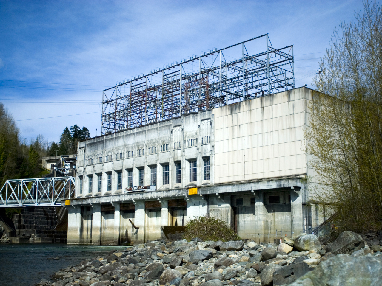
The Kemano Generating Station is situated 75 km (47 mi) southeast of Kitimat in the province of British Columbia, Canada. It was completed in 1954, providing hydroelectricity for Alcan's Kitimat Aluminum smelter. The powerhouse is built in a cavern created 427 m (1,400 ft) inside the base of Mt Dubose. It produces 896 MW of power from its eight generator units, each of which has a capacity of 112 MW. It was the largest producer in the province when it was built, and is now the fifth largest electrical plant in British Columbia. The Kemano I project was made possible by constructing the largest rockfill dam in the world at the time, the Kenney Dam on the east side of the Nechako reservoir, some 193 km (120 mi) to the east. On the west side of the Nechako reservoir, a long water intake tunnel running through the Coast Mountain range diverts river water to penstocks for a huge vertical drop to the power station at the former company town of Kemano, BC. ... [...More Info...] [...Related Items...] OR: [Wikipedia] [Google] [Baidu] |
Kemano, British Columbia
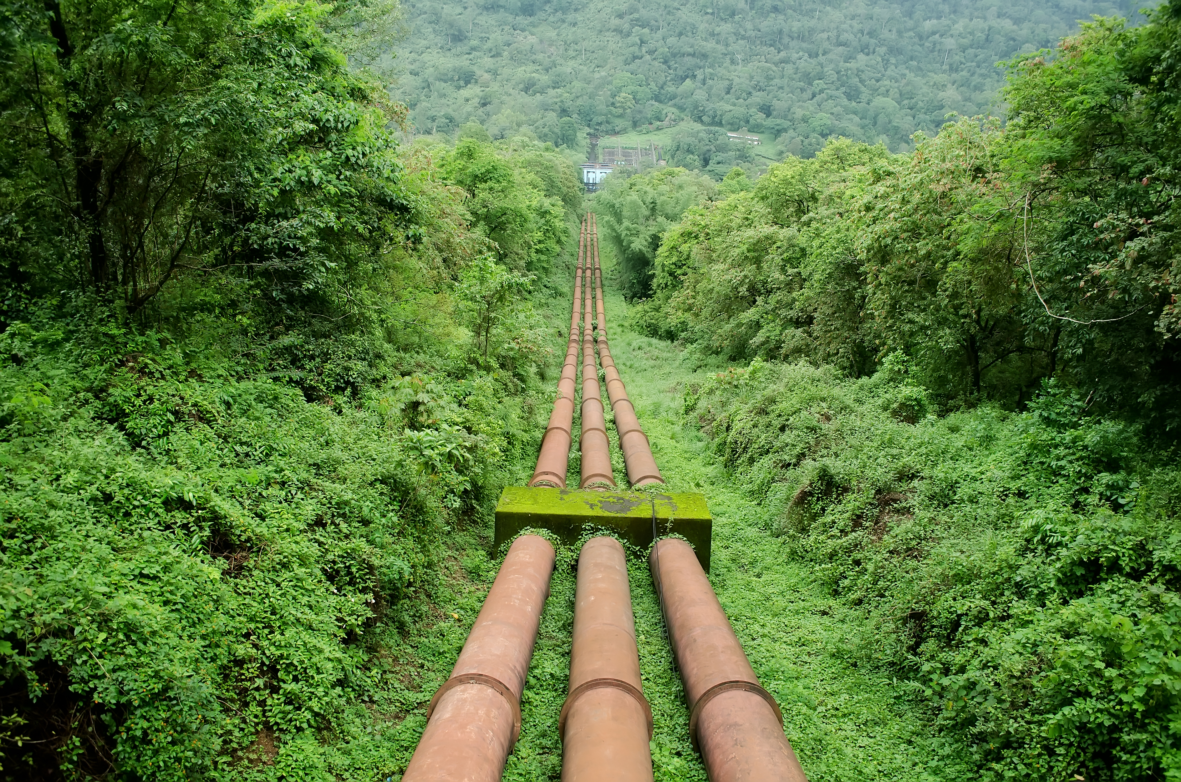
Kemano was a settlement situated 75 km (47 mi) southeast of Kitimat in the province of British Columbia in Canada. It was built to service a hydroelectric power station, built to provide energy for Alcan to smelt aluminum from its ore. The Kemano Generating Station is built 427 m (1,400 ft) inside the base of Mt Dubose in a blasted cavern. It produces 896 MW of power from its eight generators, each of which has a capacity of 112MW. History The plant comprises a 16 km (9.9 mi) long tunnel, the width of a two-lane highway, drilled and blasted through the coastal mountains to carry water to the penstocks of the Kemano powerhouse. The water plunges 800 m (2,600 ft) to drive the generators. The two 300 kV power transmission lines travel 82 km (51 mi) from Kemano to KitimatThe T ... [...More Info...] [...Related Items...] OR: [Wikipedia] [Google] [Baidu] |
Nechako Reservoir
The Nechako Reservoir, sometimes called the Ootsa Lake Reservoir, is a hydroelectric reservoir in British Columbia, Canada that was formed by the Kenney Dam making a diversion of the Nechako River through a 16-km intake tunnel in the Kitimat Ranges of the Coast Mountains to the 890 MW Kemano Generating Station at sea level at Kemano to service the then-new Alcan aluminum smelter at Kitimat. When it was constructed on the Nechako River in 1952, it resulted in the relocation of over 75 families. It was one of the biggest reservoirs built in Canada until the completion of the Columbia Treaty Dams and the W.A.C. Bennett Dam that created Lake Williston. The water level may swing 10 feet between 2790 and 2800 feet. The damming "linked the rivers and lakes of Ootsa, Intata, Whitesail, Chelaslie, Tetachuck, Tahtsa and Natalkuz into the reservoir with a surface area of over 90,000 hectares." "The water of these lakes and rivers was diverted westward to the Pacific Ocean, instead of eastwa ... [...More Info...] [...Related Items...] OR: [Wikipedia] [Google] [Baidu] |
Energy Infrastructure Completed In 1954
In physics, energy (from Ancient Greek: ἐνέργεια, ''enérgeia'', “activity”) is the quantitative property that is transferred to a body or to a physical system, recognizable in the performance of work and in the form of heat and light. Energy is a conserved quantity—the law of conservation of energy states that energy can be converted in form, but not created or destroyed. The unit of measurement for energy in the International System of Units (SI) is the joule (J). Common forms of energy include the kinetic energy of a moving object, the potential energy stored by an object (for instance due to its position in a field), the elastic energy stored in a solid object, chemical energy associated with chemical reactions, the radiant energy carried by electromagnetic radiation, and the internal energy contained within a thermodynamic system. All living organisms constantly take in and release energy. Due to mass–energy equivalence, any object that has mass ... [...More Info...] [...Related Items...] OR: [Wikipedia] [Google] [Baidu] |
Dams Completed In 1954
A dam is a barrier that stops or restricts the flow of surface water or underground streams. Reservoirs created by dams not only suppress floods but also provide water for activities such as irrigation, human consumption, industrial use, aquaculture, and navigability. Hydropower is often used in conjunction with dams to generate electricity. A dam can also be used to collect or store water which can be evenly distributed between locations. Dams generally serve the primary purpose of retaining water, while other structures such as floodgates or levees (also known as dikes) are used to manage or prevent water flow into specific land regions. The earliest known dam is the Jawa Dam in Jordan, dating to 3,000 BC. The word ''dam'' can be traced back to Middle English, and before that, from Middle Dutch, as seen in the names of many old cities, such as Amsterdam and Rotterdam. History Ancient dams Early dam building took place in Mesopotamia and the Middle East. Dams were used ... [...More Info...] [...Related Items...] OR: [Wikipedia] [Google] [Baidu] |
Hydroelectric Power Stations In British Columbia
Hydroelectricity, or hydroelectric power, is electricity generated from hydropower (water power). Hydropower supplies one sixth of the world's electricity, almost 4500 TWh in 2020, which is more than all other renewable sources combined and also more than nuclear power. Hydropower can provide large amounts of low-carbon electricity on demand, making it a key element for creating secure and clean electricity supply systems. A hydroelectric power station that has a dam and reservoir is a flexible source, since the amount of electricity produced can be increased or decreased in seconds or minutes in response to varying electricity demand. Once a hydroelectric complex is constructed, it produces no direct waste, and almost always emits considerably less greenhouse gas than fossil fuel-powered energy plants. [...More Info...] [...Related Items...] OR: [Wikipedia] [Google] [Baidu] |
List Of Generating Stations In British Columbia
This is a list of electrical generating stations in British Columbia, Canada. Hydroelectric List of most of the hydroelectric generating stations in British Columbia. Hydroelectric stations owned by BC Hydro A list of all grid-tied hydroelectric generation stations in British Columbia operated by BC Hydro Hydroelectric stations with partial BC Hydro ownership Waneta Dam has been wholly owned by BC Hydro since July 2018 after Fortis BC finalized an agreement with Teck to sell its 66% interest in the dam, but BC Hydro had first rights to purchase the remaining 66% from its first 1/3 ownership deal. Privately-owned hydroelectric stations This list includes all grid-connected hydroelectric generating stations not owned by the Crown Corporation BC Hydro. This list includes stations owned and operated by Independent Power Producers as well as by private utilities such as Nelson Hydro and FortisBC. In some cases, such as Lois Lake and Powell Lake, the electricity ... [...More Info...] [...Related Items...] OR: [Wikipedia] [Google] [Baidu] |
Powerex (electricity)
Powerex Corp. is the wholly owned energy marketing and trading subsidiary of BC Hydro. Powerex buys and sells wholesale electricity, natural gas and environmental energy products and services in Western North America (WECC). In business since 1988, Powerex Corp. is headquartered in Vancouver, British Columbia. Powerex also markets the Canadian Entitlement energy from the Columbia River Treaty. See also * Alberta interdependence *Western Interconnection The Western Interconnection is a wide area synchronous grid and one of the two major alternating current (AC) power grids in the North American power transmission grid. The other major wide area synchronous grid is the Eastern Interconnecti ... References External links * Energy companies of Canada Companies based in Vancouver BC Hydro {{Energy-company-stub ... [...More Info...] [...Related Items...] OR: [Wikipedia] [Google] [Baidu] |
Kemano
Kemano was a settlement situated 75 km (47 mi) southeast of Kitimat in the province of British Columbia in Canada. It was built to service a hydroelectric power station, built to provide energy for Alcan to smelt aluminum from its ore. The Kemano Generating Station is built 427 m (1,400 ft) inside the base of Mt Dubose in a blasted cavern. It produces 896 MW of power from its eight generators, each of which has a capacity of 112MW. History The plant comprises a 16 km (9.9 mi) long tunnel, the width of a two-lane highway, drilled and blasted through the coastal mountains to carry water to the penstocks of the Kemano powerhouse. The water plunges 800 m (2,600 ft) to drive the generators. The two 300 kV power transmission lines travel 82 km (51 mi) from Kemano to KitimatThe ... [...More Info...] [...Related Items...] OR: [Wikipedia] [Google] [Baidu] |
Penstock
A penstock is a sluice or gate or intake structure that controls water flow, or an enclosed pipe that delivers water to hydro turbines and sewerage systems. The term is inherited from the earlier technology of mill ponds and watermills. Hydroelectric systems and dams Penstocks for hydroelectric installations are normally equipped with a gate system and a surge tank. They can be a combination of many components such as anchor block, drain valve, air bleed valve, and support piers depending on the application. Flow is regulated by turbine operation and is nil when turbines are not in service. Penstocks, particularly where used in polluted water systems, need to be maintained by hot water washing, manual cleaning, antifouling coatings, and desiccation. The term is also used in irrigation dams to refer to the channels leading to and from high-pressure sluice gates. Penstocks are also used in mine tailings dam construction. The penstock is usually situated fairly clos ... [...More Info...] [...Related Items...] OR: [Wikipedia] [Google] [Baidu] |
Kenney Dam
Kenney may refer to: * Kenney (name) Places United States communities * Kenney, Illinois * Kenney, Texas Geographical features * Hotel Kenney, Rideau Lakes, Ontario, Canada * Kenney Dam, a hydroelectric dam on the Nechako River, British Columbia, Canada * Kenney Glacier, Trinity Peninsula, Antarctica * Kenney Nunatak, a nunatak rising in Waddington Glacier, Antarctica * Mount Kenney, a sharp summit in the Cathedral Peaks, Prince Olav Mountains, Antarctica See also * * Kenn (other) * Kennedy (other) * Kenny (other) * Kinne (other) Kinne may refer to: People * Derek Godfrey Kinne, British soldier * Frances Kinne (1917–2020), American author, academic administrator, and musician * G. J. Kinne (born 1988), American football quarterback * John Baxter Kinne (1877–1954), Am ... * Kinnie (other) * Kinney (other) {{disambiguation ... [...More Info...] [...Related Items...] OR: [Wikipedia] [Google] [Baidu] |
Nechako Reservoir
The Nechako Reservoir, sometimes called the Ootsa Lake Reservoir, is a hydroelectric reservoir in British Columbia, Canada that was formed by the Kenney Dam making a diversion of the Nechako River through a 16-km intake tunnel in the Kitimat Ranges of the Coast Mountains to the 890 MW Kemano Generating Station at sea level at Kemano to service the then-new Alcan aluminum smelter at Kitimat. When it was constructed on the Nechako River in 1952, it resulted in the relocation of over 75 families. It was one of the biggest reservoirs built in Canada until the completion of the Columbia Treaty Dams and the W.A.C. Bennett Dam that created Lake Williston. The water level may swing 10 feet between 2790 and 2800 feet. The damming "linked the rivers and lakes of Ootsa, Intata, Whitesail, Chelaslie, Tetachuck, Tahtsa and Natalkuz into the reservoir with a surface area of over 90,000 hectares." "The water of these lakes and rivers was diverted westward to the Pacific Ocean, instead of eastwa ... [...More Info...] [...Related Items...] OR: [Wikipedia] [Google] [Baidu] |


