|
Kaʻiana
Kaʻiana, also known as Keawe-Kaʻiana-a-Ahuula, (born about 1755 - died 1795) was a Native Hawaiian (kānaka ʻōiwi/maoli) warrior and ''aliʻi'' (noble) of Puna, Hawai‘i, who turned against Kamehameha I in 1795 during his conquest of Oahu and then sided with the island's ruler, Kalanikupule. Birth, siblings and cousins While Kaʻiana's place of birth is unknown, it is likely he was raised in Hilo. His mother was Kaupekamoku (w) the granddaughter of Ahia (w) from the ''"I"'' family of Hilo, Hawaii. His father was Ahuula-a-Keawe (k), a son of Keaweʻīkekahialiʻiokamoku (k). His name is sometimes recorded with different variations; Tianna, Tyaana, Ty-e-a-naa, Tianner, and Tayanah. Through his father, he is first cousin to much of the Island of Hawaii's nobility, including Kalaniʻōpuʻu (k), Keōua (k) and Keawema'uhili. His mother's pedigree included her paternal heritage to Oahu and Hilo, while her maternal line is from the Maui royal family. She was half sister to Ke ... [...More Info...] [...Related Items...] OR: [Wikipedia] [Google] [Baidu] |
Battle Of Nuʻuanu
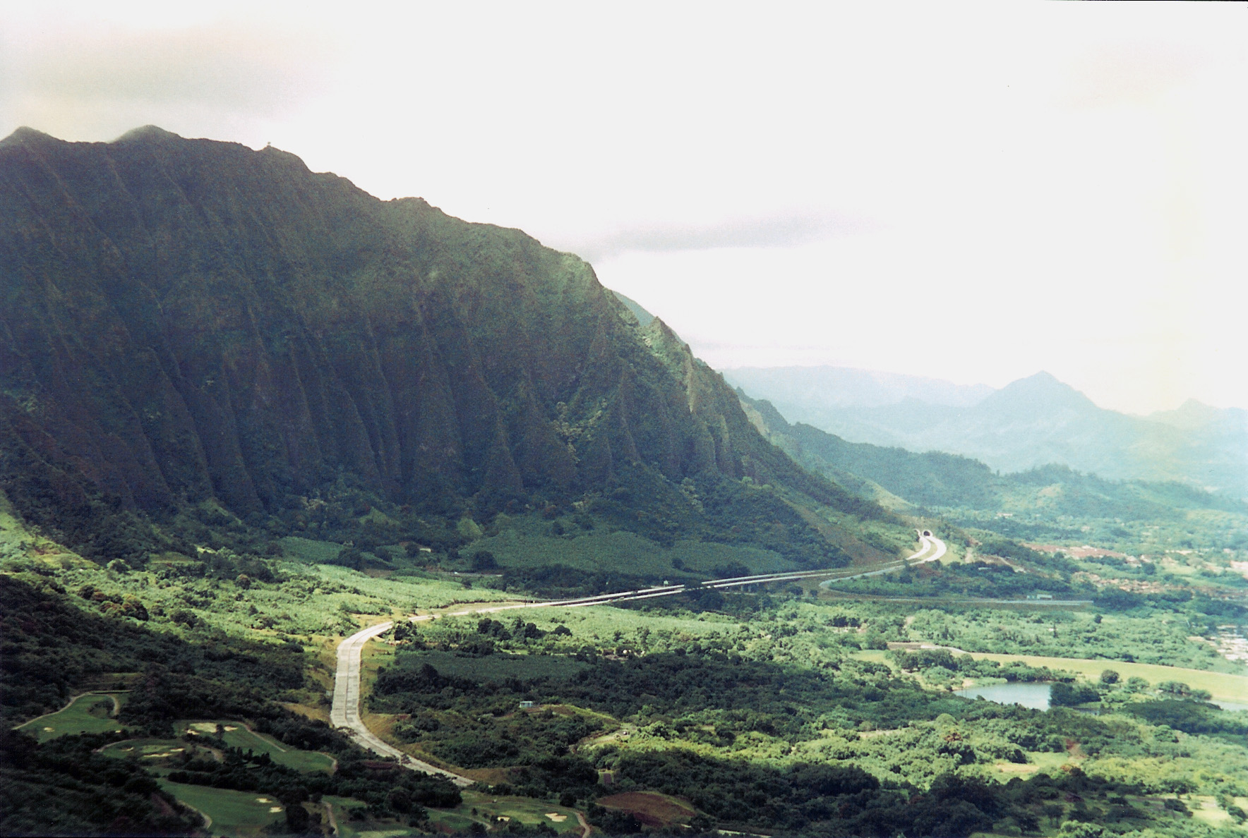
The Battle of Nuʻuanu ( Hawaiian: ''Kalelekaʻanae''; literally the leaping mullet), fought in May 1795 on the southern part of the island of Oʻahu, was a key battle in the final days of King Kamehameha I's wars to conquer the Hawaiian Islands. It is known in the Hawaiian language as ''Kalelekaʻanae'', which means "the leaping mullet", and refers to a number of Oʻahu warriors driven off the cliff in the final phase of the battle. There are "varied and sometimes conflicting histories of the Battle of Nuʻuanu." Prior to the battle Oʻahu Around the year 1792 (the exact date is unknown; the landing could have been as late as February 1795), Captain William Brown, an English merchant, landed in the harbor of Honolulu. As a maritime fur trader and gun seller, he made several voyages before from the Pacific Northwest coast to the Hawaiian islands in command of the Butterworth Squadron. Captain Brown landed several vessels on the island; the ones noted are the two sloops ''Prin ... [...More Info...] [...Related Items...] OR: [Wikipedia] [Google] [Baidu] |
Kamehameha I
Kamehameha I (; Kalani Paiea Wohi o Kaleikini Kealiikui Kamehameha o Iolani i Kaiwikapu kaui Ka Liholiho Kūnuiākea; – May 8 or 14, 1819), also known as Kamehameha the Great, was the conqueror and first ruler of the Kingdom of Hawaii. The state of Hawaii gave a statue of him to the National Statuary Hall Collection in Washington, D.C. as one of two statues it is entitled to install there. Birth and childhood Paternity and family history Kamehameha (known as Paiea at birth), was born to Kekuʻiapoiwa II, the niece of Alapainui, the usurping ruler of Hawaii Island who had killed the two legitimate heirs of Keaweʻīkekahialiʻiokamoku during civil war. By most accounts he was born in Ainakea, Kohala, Hawaii. His father was Keōua Kalanikupuapa'ikalaninui; however, Native Hawaiian historian Samuel Kamakau says that Maui monarch Kahekili II had '' hānai'' adopted (traditional, informal adoption) Kamehameha at birth, as was the custom of the time. Kamakau believes ... [...More Info...] [...Related Items...] OR: [Wikipedia] [Google] [Baidu] |
John Meares
John Meares (c. 1756 – 1809) was an English navigator, explorer, and maritime fur trader, best known for his role in the Nootka Crisis, which brought Britain and Spain to the brink of war. Career Meares' father was Charles Meares, "formerly an attorney of great eminence, and for several years pursuivant of his Majesty's Court of Exchequer in Dublin". In 1771, Meares joined the Royal Navy as a captain's servant and was commissioned a lieutenant in 1778. In 1783 he joined the merchant service and in 1785, based in India, formed the ''Northwest America Company'' for collecting sea otter furs by trade with the indigenous peoples of the Pacific Northwest Coast and selling them in China. The East India Company held a monopoly on British trade in the Pacific and required all British traders to be licensed with the company and pay duties. Meares did not license his ships with the East India Company and instead tried to conceal the illegal activity by using the flag of Portugal. Meares r ... [...More Info...] [...Related Items...] OR: [Wikipedia] [Google] [Baidu] |
Niʻihau
Niihau ( Hawaiian: ), anglicized as Niihau ( ), is the westernmost main and seventh largest inhabited island in Hawaii. It is southwest of Kauaʻi across the Kaulakahi Channel. Its area is . Several intermittent playa lakes provide wetland habitats for the Hawaiian coot, the Hawaiian stilt, and the Hawaiian duck. The island is designated as critical habitat for '' Brighamia insignis'', an endemic and endangered species of Hawaiian lobelioid. The United States Census Bureau defines Niihau and the neighboring island and State Seabird Sanctuary of Lehua as Census Tract 410 of Kauai County, Hawaii. Its 2000 census population was 160, most of whom are native Hawaiians; Its 2010 census population was 170. At the 2020 census, the population had fallen to 84. Elizabeth Sinclair purchased Niihau in 1864 for from the Kingdom of Hawaii. The island's private ownership passed on to her descendants, the Robinsons. During World War II, the island was the site of the Niihau inci ... [...More Info...] [...Related Items...] OR: [Wikipedia] [Google] [Baidu] |
Kaikioʻewa
Kaikioʻewa ( - April 10, 1839) was a cousin of Kamehameha I and the first governor of Kauai The Governor of Kauai ( haw, Kiaaina o Kauai) was the Governor, royal governor or viceroy of the Kauai, island of Kauai and Niʻihau, island of Niihau during the Hawaiian Kingdom, Kingdom of Hawaii. The Governor of Kauai was usually a Hawaiian chief .... He was born in Waimea in 1765. He moved to Hilo as a young man where he initially opposed his cousin until after the Battle of Hilo when he and other aliʻi joined Kamehameha. Kamehameha I saved Kaikioʻewa's life when he was about to be killed by another chief for stealing his wife. As Governor he was known as an easy target from merchants as he was known for spending a great deal for merchandise. He was married to Keaweamahi (w). Kaikioʻewa served as the first governor of Kauai from 1825 until his death, when his wife Keaweamahi would serve temporarily. References {{DEFAULTSORT:Kaikioewa People from Hawaii 1765 births 1839 deaths [...More Info...] [...Related Items...] OR: [Wikipedia] [Google] [Baidu] |
Puna, Hawaii
Puna is one of the 9 districts of Hawaii County on the Island of Hawaii (Big Island; County of Hawaii). It is located on the windward side (east side) of the island and shares borders with South Hilo district in the north and Kaū district in the west.Hawaii County Data Book With a size of just under or 500 sq. miles. Puna is slightly smaller than the island of Kauai. Puna cropland supports , nurseries and |
Kalaniʻōpuʻu
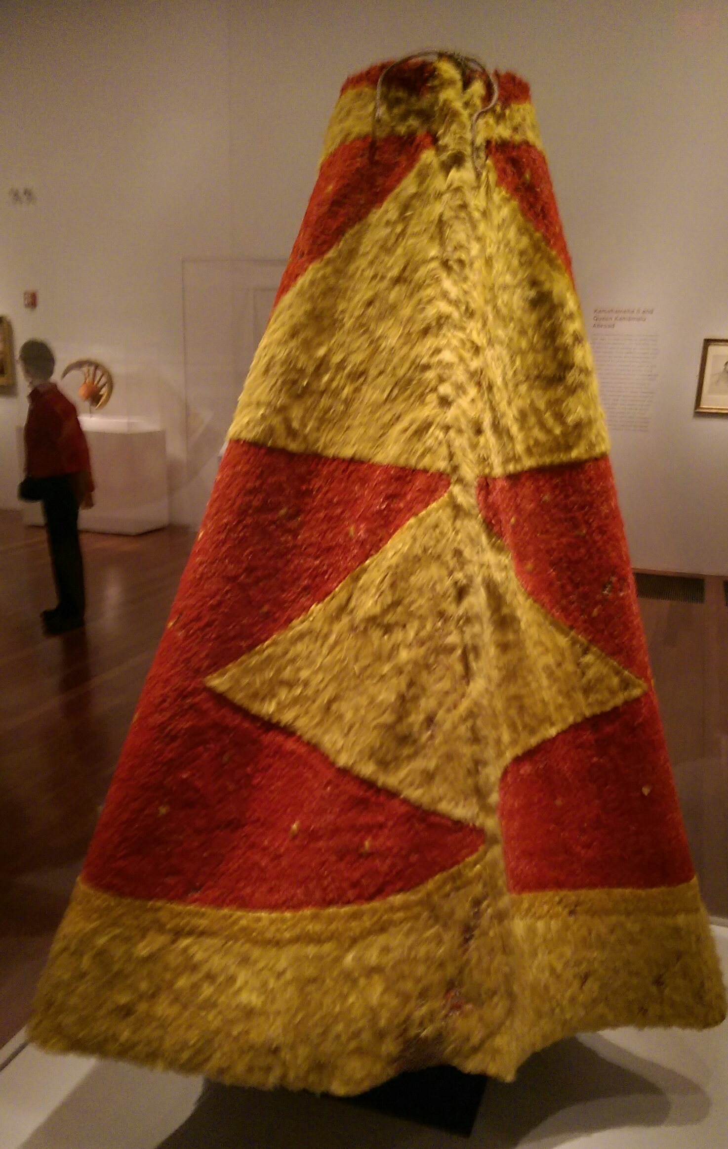
Kalaniōpuu-a-Kaiamamao (c. 1729 – April 1782) was the aliʻi nui (supreme monarch) of the island of Hawaiʻi. He was called ''Terreeoboo, King of Owhyhee'' by James Cook and other Europeans. His name has also been written as Kaleiopuu. Biography Kalaniʻōpuʻu was the son of Kalaninuiamamao (k) and his wife Kamākaʻimoku (w), a high ranking aliʻi wahine (female of hereditary nobility) who was also the mother of Keōua (k) with another husband named Kalanikeʻeaumoku (k). This made her the grandmother of Kamehameha I. During his reign, Alapainui had kept the two young princes, Kalaniʻōpuʻu and Keōua, close to him out of either kindness or politics. Kalaniōpuu-a-Kaiamamao was the king of the island during the times Captain James Cook came to Hawaiʻi and went aboard his ship on November 26, 1778. After Cook anchored at Kealakekua Bay in January 1779, Kalaniōpuu-a-Kaiamamao paid a ceremonial visit on January 26, 1779 and exchanged gifts including a ʻahuʻula ( ... [...More Info...] [...Related Items...] OR: [Wikipedia] [Google] [Baidu] |
Oʻahu
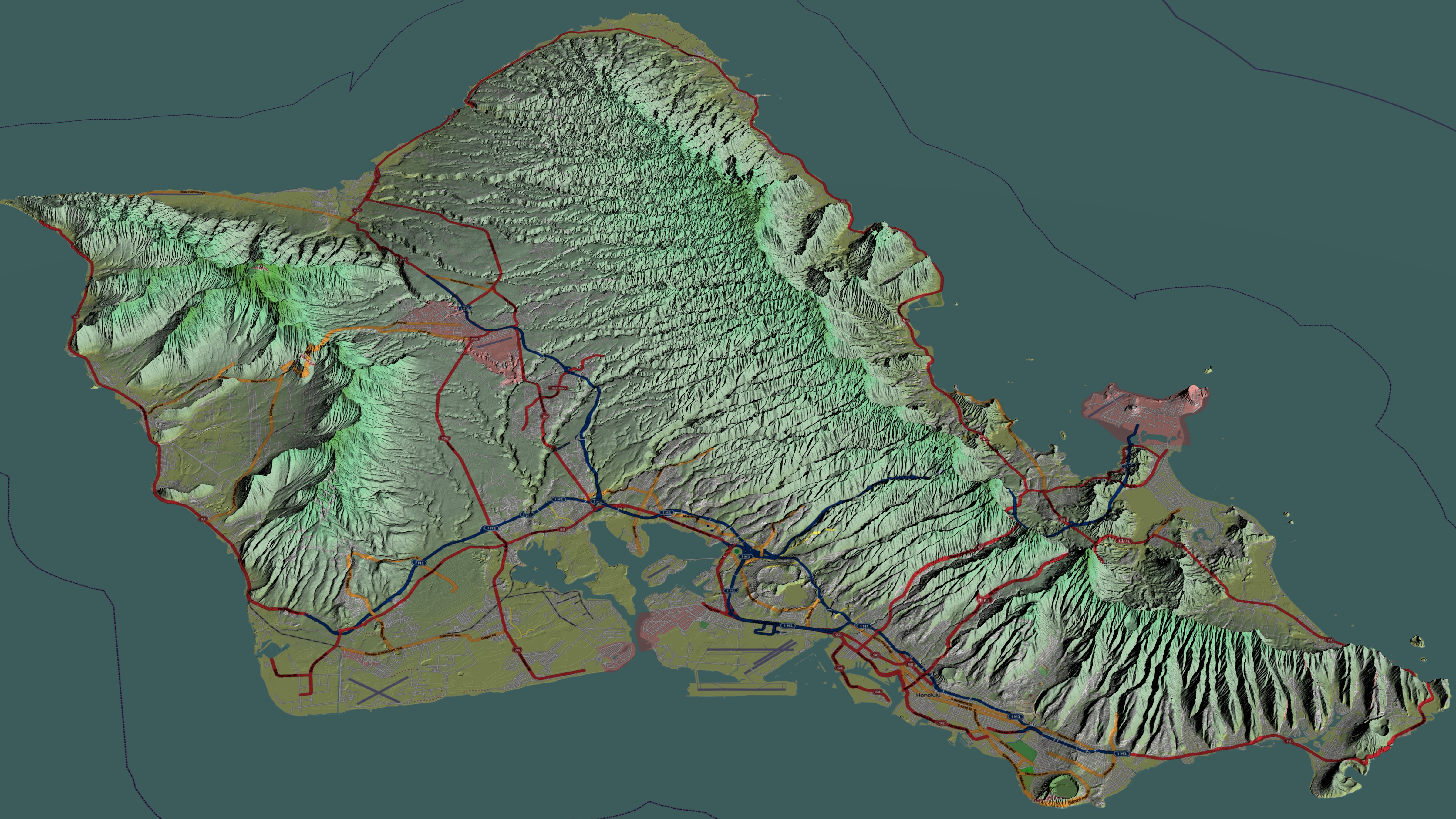
Oahu () ( Hawaiian: ''Oʻahu'' ()), also known as "The Gathering Place", is the third-largest of the Hawaiian Islands. It is home to roughly one million people—over two-thirds of the population of the U.S. state of Hawaii. The island of O’ahu and the Northwestern Hawaiian Islands constitute the City and County of Honolulu. The state capital, Honolulu, is on Oʻahu's southeast coast. Oʻahu had a population of 1,016,508 according to the 2020 U.S. Census, up from 953,207 people in 2010 (approximately 70% of the total 1,455,271 population of the State of Hawaii, with approximately 81% of those living in or near the Honolulu urban area). Name The Island of O{{okinaahu in Hawaii is often nicknamed (or translated as) ''"The Gathering Place"''. It appears that O{{okinaahu grew into this nickname; it is currently the most populated Hawaiian Island, however, in ancient times, O{{okinaahu was not populous and was outranked by the status of other islands. The translation of ''"ga ... [...More Info...] [...Related Items...] OR: [Wikipedia] [Google] [Baidu] |
Waikiki
Waikiki (; haw, Waikīkī; ; also known as Waikiki Beach) is a neighborhood of Honolulu on the south shore of the island of Oahu in the U.S. state of Hawaii. Waikiki is most famous for Waikiki Beach, which is one of six beaches in the district, along with Queen's Beach, Kuhio Beach, Gray's Beach, Fort DeRussy Beach and Kahanamoku Beach. Waikiki Beach is almost entirely man-made. There are beaches called Waikiki in other parts of the world, such as Tarragona (Spain), Western Australia ( Australia), or Lima ( Peru). Waikiki (Hawaii) is home to public places including Kapiolani Park, Fort DeRussy, Kahanamoku Lagoon, Kūhiō Beach Park and Ala Wai Harbor. Waikiki was the first capital of the Kingdom of Hawaii from 1795 to 1796. Etymology The Hawaiian language name means ''spouting fresh water'', for springs and streams that fed wetlands that once separated Waikiki from the interior. History The area was a retreat for Hawaiian royalty in the 1800s who enjoyed surfing ... [...More Info...] [...Related Items...] OR: [Wikipedia] [Google] [Baidu] |
Lahaina, Maui
Lahaina ( haw, Lāhainā) is the largest census-designated place (CDP) in West Maui, Maui County, Hawaii, United States and includes the Kaanapali and Kapalua beach resorts. As of the 2020 census, the CDP had a resident population of 12,702. Lahaina encompasses the coast along Hawaii Route 30 from a tunnel at the south end, through Olowalu and to the CDP of Napili-Honokowai to the north. During the tourist season, the population can swell to nearly 40,000 people. Lahaina's popularity as a tropical getaway has made its real estate some of the most expensive in Hawaii; many houses and condominiums sell for more than $5 million. History In days of native rule Lahaina was the royal capital of Maui Loa, ("high chief") of the island of Maui, after he ceded the royal seat of Hana to the ruler of Hawaii Island. In Lahaina, the focus of activity is along Front Street, which dates back to the 1820s. It is lined with stores and restaurants and often packed with tourists. The Bany ... [...More Info...] [...Related Items...] OR: [Wikipedia] [Google] [Baidu] |
Puʻu O Mahuka Heiau State Monument
Puʻu o Mahuka Heiau State Historic Site on the North Shore of Oʻahu is the largest heiau on the island, covering on a hilltop overlooking Waimea Bay and Waimea Valley. From its commanding heights, sentries could once monitor much of the northern shoreline of Oʻahu, and even spot signal fires from the Wailua Complex of Heiaus on Kauaʻi, with which it had ties. It was designated a National Historic Landmark in 1962, when it became the center of a state park. It was added to the National Register of Historic Places in 1966. Puʻu o Mahuka means "Hill of Escape." Hawaiian legends have it that from this point, the volcano goddess Pele leaped from Oʻahu to the next island, Molokaʻi. The highest of the heiau's three walled enclosures may date to the 17th century, with the lower two enclosures perhaps added during the 18th century. These were times of great conflict, and the upper platform appears to have functioned as a luakini heiau (a sacrificial temple) to bring success ... [...More Info...] [...Related Items...] OR: [Wikipedia] [Google] [Baidu] |
Waimea, Kauai County, Hawaii
Waimea (literally, "red water" in Hawaiian) is a census-designated place (CDP) in Kauai County, Hawaii, United States. The population was 2,057 at the 2020 census. The first Europeans to reach Hawaii landed in Waimea in 1778 (giving rise to Kauai's cheeky slogan: "Hawaii's ''Original'' Visitor Destination"). History Original settlers Between 200 and 600 AD, the first settlers arrived in Kaua‘i from the Marquesas Islands. It is not clear why the voyagers sought a new homeland. They brought taro, sweet potato, pigs and fowl, as well as seeds. They were experienced farmers and fishermen, with advanced irrigation techniques that allowed them to thrive on the land. Around 1000 AD, Tahitian explorers arrived in Hawai‘i and conquered the Marquesans. According to Hawaiian legend, the small-in-stature Marquesans were chased into the hills by the Tahitians, and became the "Menehune", thought to be responsible for bad luck. The Tahitians brought with them a social and political hi ... [...More Info...] [...Related Items...] OR: [Wikipedia] [Google] [Baidu] |


