|
Kawaguchi, Saitama
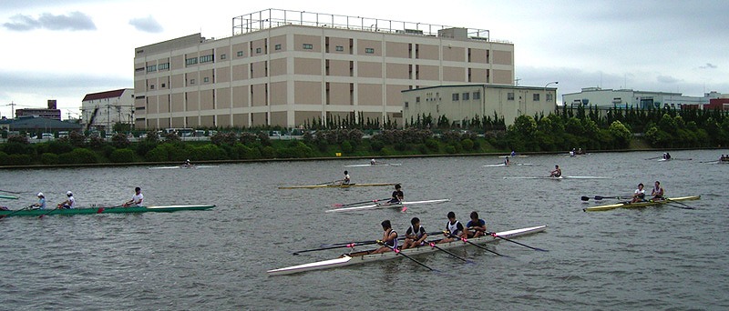
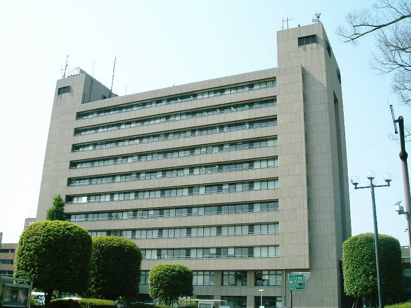
is a city located in Saitama Prefecture, Japan. , the city had an estimated population of 607,373 in 293,582 households and a population density of 9800 persons per km². The total area of the city is . It is the Greater Tokyo Area's 8th most populated city (after passing Hachioji), and second largest in Saitama Prefecture. Geography Kawaguchi is located near the center of the Kantō Plain in southern Saitama Prefecture, and is bordered by the Tokyo wards of Kita-ku and Adachi-ku to the south. The city area is mostly flat and mainly residential except for the Omiya tableland, which occupies part of the north and east area. The Arakawa River runs across the border with Kita-ku to the south. Surrounding municipalities Saitama Prefecture * Koshigaya * Sōka * Saitama * Warabi * Toda Tokyo Metropolis * Kita * Adachi Climate Kawaguchi has a humid subtropical climate (Köppen ''Cfa'') characterized by warm summers and cool winters with light to no snowfall. The average annua ... [...More Info...] [...Related Items...] OR: [Wikipedia] [Google] [Baidu] |
Core Cities Of Japan
A is a class or category of cities of Japan, Japanese cities. It is a local administrative division created by the national government.Web-Japan.org "Local self-government," p. 3 retrieved 2012-11-28. Core cities are delegated many functions normally carried out by Prefectures of Japan, prefectural governments, but not as many as Cities designated by government ordinance of Japan, designated cities. To become a candidate for core city status, a city must have a population greater than 300,000 and an area greater than 100 square kilometers, although special exceptions may be made by order of the cabinet for cities with populations under 300,000 but over 200,000. After the abolition of Special cities of Japan, special city status on April 1, 2015, any city with a population above 200,000 may apply for core city status. Application for designation is made by a city with the approval of both the city and prefectural assemblies. History The term "core city" was created by the first ... [...More Info...] [...Related Items...] OR: [Wikipedia] [Google] [Baidu] |
Kita-ku, Tokyo
is a special ward located in Tokyo Metropolis, Japan. The English translation of its Japanese self-designation is City of Kita. The ward was founded on March 15, 1947. As of May 1, 2015, the ward has an estimated population of 340,287, and a population density of 16,510 persons per km2. The total area is 20.61 km2. Districts and neighborhoods ;Akabane-Iwabuchi Area * Akabane * * * * * * * * * * ;Ōji Area * * * * * * * * * * ;Takinogawa Area * * * * * * * * * History The area was a collection of rural villages and towns until the 1880s, when it was connected by rail to central Tokyo ( Oji Station opening in 1883). Parts of the area joined Tokyo City in 1932 as the Ōji (former Ōji and Iwabuchi towns) and Takinogawa (former Takinogawa town) Wards. Kita was officially formed in 1947 by the merger of these wards. Geography The name ''Kita,'' meaning "north," reflects the location among the wards of Tokyo. To its north lie the cities of K ... [...More Info...] [...Related Items...] OR: [Wikipedia] [Google] [Baidu] |
Ice Age
An ice age is a long period of reduction in the temperature of Earth's surface and atmosphere, resulting in the presence or expansion of continental and polar ice sheets and alpine glaciers. Earth's climate alternates between ice ages and greenhouse periods, during which there are no glaciers on the planet. Earth is currently in the Quaternary glaciation. Individual pulses of cold climate within an ice age are termed ''glacial periods'' (or, alternatively, ''glacials, glaciations, glacial stages, stadials, stades'', or colloquially, ''ice ages''), and intermittent warm periods within an ice age are called '' interglacials'' or ''interstadials''. In glaciology, ''ice age'' implies the presence of extensive ice sheets in both northern and southern hemispheres. By this definition, Earth is currently in an interglacial period—the Holocene. The amount of anthropogenic greenhouse gases emitted into Earth's oceans and atmosphere is predicted to prevent the next glacial period for th ... [...More Info...] [...Related Items...] OR: [Wikipedia] [Google] [Baidu] |
100 Views Edo 020
1 (one, unit, unity) is a number representing a single or the only entity. 1 is also a numerical digit and represents a single unit of counting or measurement. For example, a line segment of ''unit length'' is a line segment of length 1. In conventions of sign where zero is considered neither positive nor negative, 1 is the first and smallest positive integer. It is also sometimes considered the first of the infinite sequence of natural numbers, followed by 2, although by other definitions 1 is the second natural number, following 0. The fundamental mathematical property of 1 is to be a multiplicative identity, meaning that any number multiplied by 1 equals the same number. Most if not all properties of 1 can be deduced from this. In advanced mathematics, a multiplicative identity is often denoted 1, even if it is not a number. 1 is by convention not considered a prime number; this was not universally accepted until the mid-20th century. Additionally, 1 is the s ... [...More Info...] [...Related Items...] OR: [Wikipedia] [Google] [Baidu] |
Nikkei Shimbun
''The Nikkei'', also known as , is the flagship publication of Nikkei, Inc. (based in Tokyo) and the world's largest financial newspaper, with a daily circulation exceeding 1.73 million copies. The Nikkei 225, a stock market index for the Tokyo Stock Exchange, has been calculated by the newspaper since 1950. It is one of the four national newspapers in Japan; the other three are ''The Asahi Shimbun'', the ''Yomiuri Shimbun'' and the ''Mainichi Shimbun''. History The roots of the Nikkei started with an in-house newspaper department of Mitsui & Company in 1876 when it started publication of ''Chugai Bukka Shimpo'' (literally ''Domestic and Foreign Commodity Price Newspaper''), a weekly market-quotation bulletin. The department was spun out as the ''Shokyosha'' in 1882. The paper became daily (except Sunday) in 1885 and was renamed ''Chugai Shōgyō Shimpo'' in 1889. It was merged with ''Nikkan Kōgyō'' and ''Keizai Jiji'' and renamed ''Nihon Sangyō Keizai Shimbun'' in 1942. ... [...More Info...] [...Related Items...] OR: [Wikipedia] [Google] [Baidu] |
Humid Subtropical Climate
A humid subtropical climate is a zone of climate characterized by hot and humid summers, and cool to mild winters. These climates normally lie on the southeast side of all continents (except Antarctica), generally between latitudes 25° and 40° and are located poleward from adjacent tropical climates. It is also known as warm temperate climate in some climate classifications. Under the Köppen climate classification, ''Cfa'' and ''Cwa'' climates are either described as humid subtropical climates or warm temperate climates. This climate features mean temperature in the coldest month between (or ) and and mean temperature in the warmest month or higher. However, while some climatologists have opted to describe this climate type as a "humid subtropical climate", Köppen himself never used this term. The humid subtropical climate classification was officially created under the Trewartha climate classification. In this classification, climates are termed humid subtropical when the ... [...More Info...] [...Related Items...] OR: [Wikipedia] [Google] [Baidu] |
Tokyo Metropolis
Tokyo (; ja, 東京, , ), officially the Tokyo Metropolis ( ja, 東京都, label=none, ), is the capital and List of cities in Japan, largest city of Japan. Formerly known as Edo, its metropolitan area () is the most populous in the world, with an estimated 37.468 million residents ; the city proper has a population of 13.99 million people. Located at the head of Tokyo Bay, the prefecture forms part of the Kantō region on the central coast of Honshu, Japan's largest island. Tokyo serves as Economy of Japan, Japan's economic center and is the seat of both the Government of Japan, Japanese government and the Emperor of Japan. Originally a fishing village named Edo, the city became politically prominent in 1603, when it became the seat of the Tokugawa shogunate. By the mid-18th century, Edo was one of the most populous cities in the world with a population of over one million people. Following the Meiji Restoration of 1868, the imperial capital in Kyoto was mov ... [...More Info...] [...Related Items...] OR: [Wikipedia] [Google] [Baidu] |
Toda, Saitama
is a city located in Saitama Prefecture, Japan. , the city had an estimated population of 140,902 in 66,765 households and a population density of 7700 persons per km². The total area of the city is . Geography Toda is located in the flat lowlands of far southeastern Saitama Prefecture, separated from Tokyo by the Arakawa River. The Sasame River also flows through the city before joining the Arakawa. Surrounding municipalities * Saitama Prefecture ** Saitama ** Asaka ** Kawaguchi ** Wakō ** Warabi * Tokyo Metropolis ** Itabashi ** Kita Climate Toda has a humid subtropical climate (Köppen ''Cfa'') characterized by warm summers and cool winters with light to no snowfall. The average annual temperature in Toda is 14.8 °C. The average annual rainfall is 1482 mm with September as the wettest month. The temperatures are highest on average in August, at around 26.6 °C, and lowest in January, at around 3.2 °C. Demographics Per Japanese census data, the ... [...More Info...] [...Related Items...] OR: [Wikipedia] [Google] [Baidu] |
Warabi, Saitama
is a city located in Saitama Prefecture, Japan. , the city had an estimated population of 75,697 in 39,563 households and a population density of 15,000 persons per km². The total area of the city is . Warabi has the smallest area of any municipality in Japan, and highest population density outside of the special wards of Tokyo. Geography Warabi is located southeastern part of Saitama Prefecture, bordering Saitama City in the north, Toda in the west, and Kawaguchi in the east. The city area is in the Arakawa lowland and averages 4.8 meters above sea level. Land use mainly consists of residential areas. Surrounding municipalities * Saitama Prefecture ** Kawaguchi ** Toda ** Saitama Climate Warabi has a humid subtropical climate (Köppen ''Cfa'') characterized by warm summers and cool winters with light to no snowfall. The average annual temperature in Warabi is 14.8 °C. The average annual rainfall is 1482 mm with September as the wettest month. The temperatures ar ... [...More Info...] [...Related Items...] OR: [Wikipedia] [Google] [Baidu] |
Saitama, Saitama
is the capital and the most populous city of Saitama Prefecture, Japan. Its area incorporates the former cities of Urawa, Ōmiya, Yono and Iwatsuki. It is a city designated by government ordinance. Being in the Greater Tokyo Area and lying 15 to 30 kilometres north of central Tokyo, many of its residents commute into Tokyo. , the city had an estimated population of 1,324,854, and a population density of 6,093 people per km² (15,781 people per mi²). Its total area is . Etymology The name "Saitama" originally comes from the of what is now the city of Gyōda in the northern part of what is now known as Saitama Prefecture. "Sakitama" has an ancient history and is mentioned in the famous 8th century poetry anthology '' Man'yōshū''. The pronunciation has changed from Sakitama to Saitama over the years. With the merger of Urawa, Ōmiya, and Yono it was decided that a new name, one fitting for this newly created prefectural capital, was needed. The prefectural name was chan ... [...More Info...] [...Related Items...] OR: [Wikipedia] [Google] [Baidu] |


