|
Katarmal
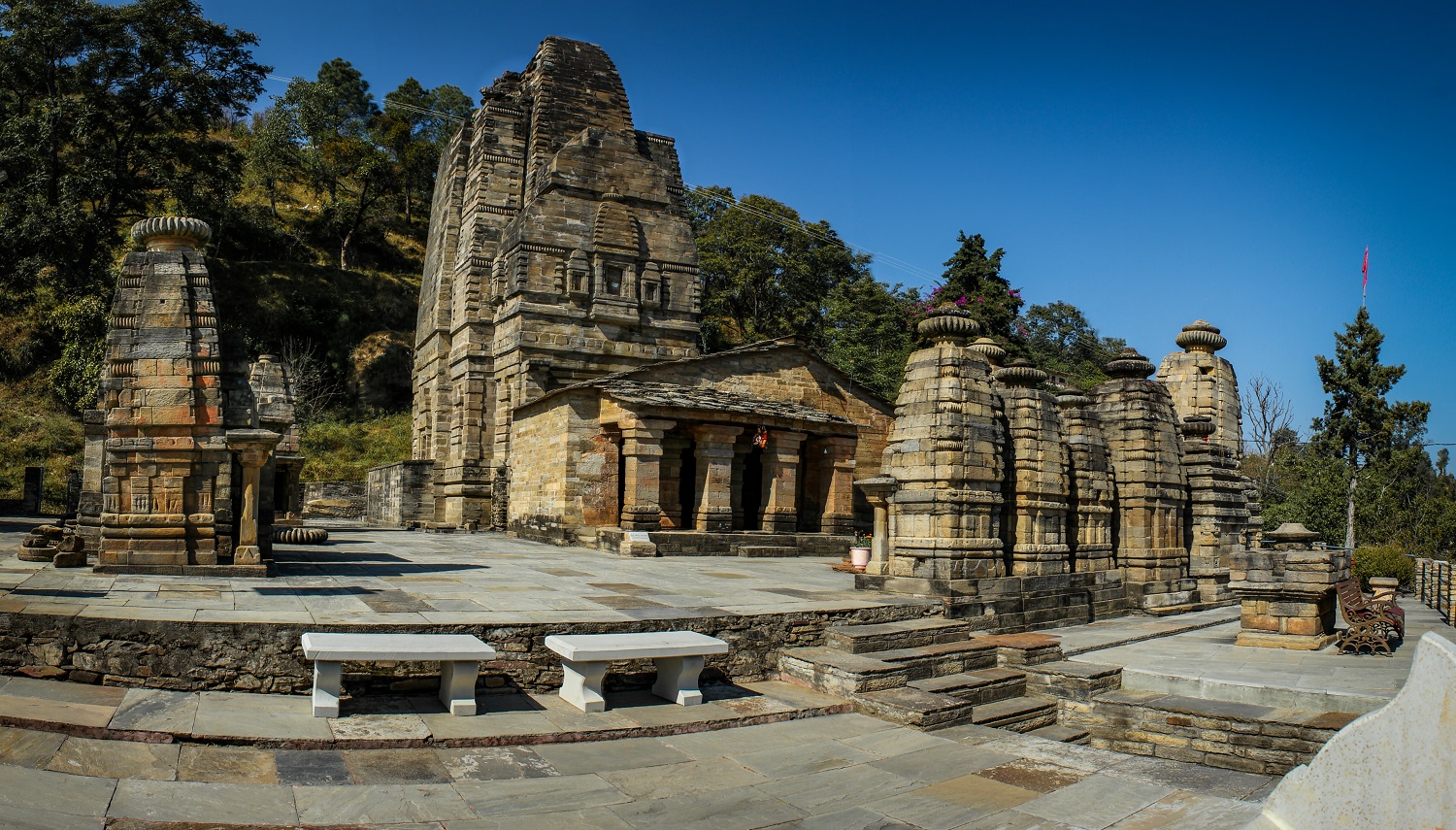
Katarmal is a remote village located in Kumaon Division, in Almora District, Uttarakhand, India. Location Katarmal is located at a distance of 1.5 km from Kosi village and 12 km from the district centre, Almora and 70 km from Nainital. Located at a height of 2116 meters above sea level, it is well connected by road, 30 km away from Khairna, Garampani (Nainital, Haldwani, Coordinates: 29°29'39"N 79°28'46"E) & 33 km from Ranikhet and Kausani the nearest connecting point being near Kosi village. The G.B. Pant Institute of Himalayan Environment and Development, established in 1988 serves as a nodal agency for research and development and was established here by Government of India. Surya temple Katarmal is known for a relatively rare Surya temple, constructed by the Katyuri Kings The Katyuri kings were a medieval Hindu Rajput's ruling clan of Khasha origin from Joshimath that ruled over the regions in present day regions of Kumaon, Uttarakhand ... [...More Info...] [...Related Items...] OR: [Wikipedia] [Google] [Baidu] |
Katyuri Kings
The Katyuri kings were a medieval Hindu Rajput's ruling clan of Khasha origin from Joshimath that ruled over the regions in present day regions of Kumaon, Uttarakhand in India and parts of Doti/Sudurpashchim Province in Nepal from 700 to 1200 CE. The founder of this dynasty, King Vasu Dev was originally a Buddhist ruler, but later he started following Hindu practices sometimes attributed to a vigorous campaign of Hindu philosopher Adi Shankara (788–820 CE). King Bhu Dev was known for extensively eradicating Buddhist practices in his kingdom and the Bageshwar stone inscription of Bhu Dev writes himself as "Brahmana Parayana" and "Parama Shramana Rupu" meaning a follower of Brahmans and an arch rival of Buddhist Bhikshus. The Katyuri Kings were known for constructing several Hindu temples in present-day Uttarakhand as later they followed Brahminical practices. After fragmentation and disestablishment of the Katyuri kingdoms, their offshoots rose as Askot Katyuri Paal Rajwar i ... [...More Info...] [...Related Items...] OR: [Wikipedia] [Google] [Baidu] |
Almora
Almora ( Kumaoni: ''Almāḍ'') is a municipal board and a cantonment town in the state of Uttarakhand, India. It is the administrative headquarters of Almora district. Almora is located on a ridge at the southern edge of the Kumaon Hills of the Himalaya range. Koshi (Kaushiki) and Suyal (Salmale) rivers flow along the city and snow-capped Himalayas can be seen in the background. Almora was founded in 1568 by King Kalyan Chand; however, there are accounts of human settlements in the hills and surrounding region in the Hindu epic Mahabharata (8th and 9th century BCE). Almora was the seat of Chand kings that ruled over the Kumaon Kingdom. It is considered the cultural heart of the Kumaon region of Uttarakhand. According to the provisional results of the 2019 national census of India Almora had a population of 179,000. Nestled within higher peaks of the Himalaya, Almora enjoys a year-round mild temperate climate. The town is visited by thousands of tourists annually from all ove ... [...More Info...] [...Related Items...] OR: [Wikipedia] [Google] [Baidu] |
Uttarakhand
Uttarakhand ( , or ; , ), also known as Uttaranchal ( ; the official name until 2007), is a state in the northern part of India. It is often referred to as the "Devbhumi" (literally 'Land of the Gods') due to its religious significance and numerous Hindu temples and pilgrimage centres found throughout the state. Uttarakhand is known for the natural environment of the Himalayas, the Bhabar and the Terai regions. It borders the Tibet Autonomous Region of China to the north; the Sudurpashchim Province of Nepal to the east; the Indian states of Uttar Pradesh to the south and Himachal Pradesh to the west and north-west. The state is divided into two divisions, Garhwal and Kumaon, with a total of 13 districts. The winter capital of Uttarakhand is Dehradun, the largest city of the state, which is a rail head. Bhararisain, a town in Chamoli district, is the summer capital of Uttarakhand. The High Court of the state is located in Nainital. Archaeological evidence supports the e ... [...More Info...] [...Related Items...] OR: [Wikipedia] [Google] [Baidu] |
Almora District
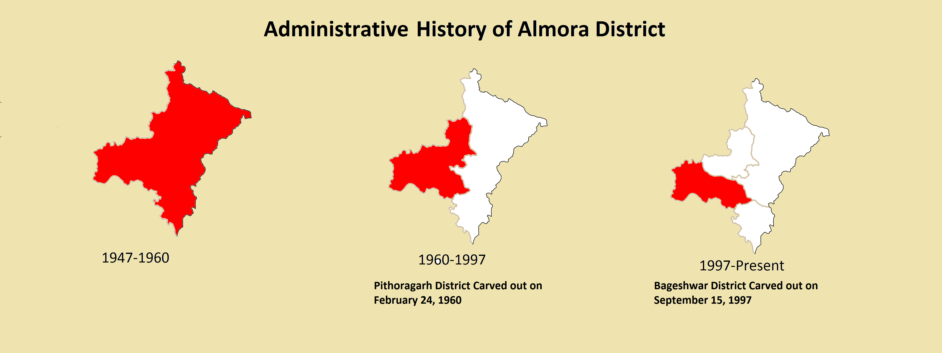
Almora is a District (India), district in the Kumaon Division of Uttarakhand state, India. The headquarters is at Almora. It is 1,638 meters above sea level. The neighbouring regions are Pithoragarh district to the east, Chamoli district to the west, Bageshwar district to the north and Nainital district to the south. History The ancient town of Almora was capital of the Kumaon Kingdom, before its establishment, it was under the possession of Katyuri Kings, Katyuri king Baichaldeo. Later on when the Chand dynasty was founded in Champawat, the town of Almora was founded at this centrally located place in 1568 by Kalyan Chand. Later Chand kings shifted the capital of the Kumaon Kingdom from Champawat to Almora. Almora town was the administrative headquarter of the Kumaun district; that was formed in 1815 following the defeat of Gorkha army in the Anglo-Gorkha war and the 1816 Treaty of Sugauli. The Kumaun district then consisted of the complete Kumaon Division excluding the Udham ... [...More Info...] [...Related Items...] OR: [Wikipedia] [Google] [Baidu] |
Surya
Surya (; sa, सूर्य, ) is the sun as well as the solar deity in Hinduism. He is traditionally one of the major five deities in the Smarta tradition, all of whom are considered as equivalent deities in the Panchayatana puja and a means to realise Brahman. Other names of Surya in ancient Indian literature include Aditya, Arka, Bhanu, Savitr, Pushan, Ravi, Martanda, Mitra, Bhaskara, Prabhakara, Kathiravan, and Vivasvan. The iconography of Surya is often depicted riding a chariot harnessed by horses, often seven in number which represent the seven colours of visible light, and the seven days of the week. During the medieval period, Surya was worshipped in tandem with Brahma during the day, Shiva at noon, and Vishnu in the evening. In some ancient texts and art, Surya is presented syncretically with Indra, Ganesha, and others. Surya as a deity is also found in the arts and literature of Buddhism and Jainism. In the Mahabharata and Ramayana, Surya is represented as the ... [...More Info...] [...Related Items...] OR: [Wikipedia] [Google] [Baidu] |
Kausani
Kausani ( Kumaoni: ''Kôsānī'') is a hill station and Village situated in Bageshwar district in the state of Uttarakhand, India. It is famous for its scenic splendour and its spectacular 300 km-wide panoramic view of Himalayan peaks like Trisul, Nanda Devi and Panchchuli. Mahatma Gandhi called this place the 'Switzerland of India', due to similarity in landscapes. History During Independence of India in 1947, Kausani was situated in the Almora District till 15 September 1997 after which Bageshwar district was carved out of Almora district. On 9 November 2000, the State of Uttarakhand was created from the Himalayan and adjoining northwestern districts of Uttar Pradesh. Geography Kausani is located at in Bageshwar district of Uttarakhand, India at a distance of from Bageshwar city, the administrative Headquarter of Bageshwar District. Kausani is located north of Almora, a major hill station and the historical capital of Kumaon Kingdom. Kausani lies in the Kumaon divisi ... [...More Info...] [...Related Items...] OR: [Wikipedia] [Google] [Baidu] |
Ranikhet
Ranikhet (Kumaoni language, Kumaoni: ) is a hill station and cantonment town, nearby Almora, Almora Town in Almora district in the Indian state of Uttarakhand. It is the home for the Military Hospital, Kumaon Regiment (KRC) and Naga Regiment and is maintained by the Indian Army. Ranikhet is at an altitude of 1,869 metres (6,132 ft) above sea level and within sight of the western peaks of the Himalayas. Ranikhet is a Class IV town with a civic status of a Cantonment board. History Ranikhet, which means ''Queen's Meadow'' in Kumaoni, gets its name from a local legend, which states that it was here, that Raja Sudhardev, a Katyuri kings, Katyuri ruler, won the heart of his queen, Rani Padmini, who subsequently chose the area for her residence, giving it the name, Ranikhet, though no palace exists in the area. Ranikhet had been under Nepalese rule after the Nepalese invasion of Kumaon Kingdom, Kumaon and Doti in 1790, and the Kumaoni people, Kumaonis won it under the leadershi ... [...More Info...] [...Related Items...] OR: [Wikipedia] [Google] [Baidu] |
Haldwani
Haldwani (Kumaoni language, Kumaoni: ''Haldvānī'') is the largest city of Kumaon division, Kumaon. It is also the third List of cities in Uttarakhand by population, most populous city and largest commercial market in the Indian state of Uttarakhand. Haldwani is said to be the financial capital of Uttarakhand, having the most commercial, economic and industrial activities of the state. Haldwani is located in the Nainital District, and is one of its List of tehsils of Uttarakhand, eight Subdivisions. The Haldwani Urban agglomeration has 232,060 people as of 2011, and is the fourth most populous UA in Uttarakhand, after Dehradun, Haridwar and Roorkee. Being situated in the immediate foothills of Kumaon Himalayas, the Kathgodam neighbourhood of Haldwani is known as the "Gateway to Kumaon". Located in the Bhabar, Bhabhar region in the Himalayan foothills on the banks of the Gaula River (India), Gaula River, the c:File:Chhota_Kailash_through_morning_mists_from_Haldwani,_Nainital_regio ... [...More Info...] [...Related Items...] OR: [Wikipedia] [Google] [Baidu] |
Khairna
Khairna, also spelled Khyrna, is a small hamlet in the Nainital district of the Indian state of Uttarakhand which grew up around the bridge of the same name which has linked two sides of the Kosi River at this site since the Colonial Era. The Bridge was created in late nineteenth century, when The British Government decided to create a new road along the Khairna river to directly connect the cantonment town of Ranikhet to Nainital the then summer capital of United Provinces. Several shops were established in further years by individuals giving the area the name Khairna Market. Geography Khairna is located on the confluence of Kosi and Khairna Rivers, around the Khairna Bridge at . It is located at a distance of 30 km from Nainital and Ranikhet. The Khairna Bridge marks the junction of the National Highway 109 with the Bhowali-Ranikhet Road. The river bed at Khairna is abundant in ironstone and quartzite Quartzite is a hard, non- foliated metamorphic rock which wa ... [...More Info...] [...Related Items...] OR: [Wikipedia] [Google] [Baidu] |
Nainital
Nainital ( Kumaoni: ''Naintāl''; ) is a city and headquarters of Nainital district of Kumaon division, Uttarakhand, India. It is the judicial capital of Uttarakhand, the High Court of the state being located there and is the headquarters of an eponymous district. It also houses the Governor of Uttarakhand, who resides in the Raj Bhavan. Nainital was the summer capital of the United Provinces. Nainital is located in the Kumaon foothills of the Jagbeer Himalayas at a distance of from the state capital Dehradun and from New Delhi, the capital of India. Situated at an altitude of above sea level, the city is set in a valley containing an eye-shaped lake, approximately two miles in circumference, and surrounded by mountains, of which the highest are Naina Peak () on the north, Deopatha () on the west, and Ayarpatha () on the south. From the tops of the higher peaks, "magnificent views can be obtained of the vast plain to the south, or of the mass of tangled ridges lying no ... [...More Info...] [...Related Items...] OR: [Wikipedia] [Google] [Baidu] |


