|
Karkopf (Mieming Chain)
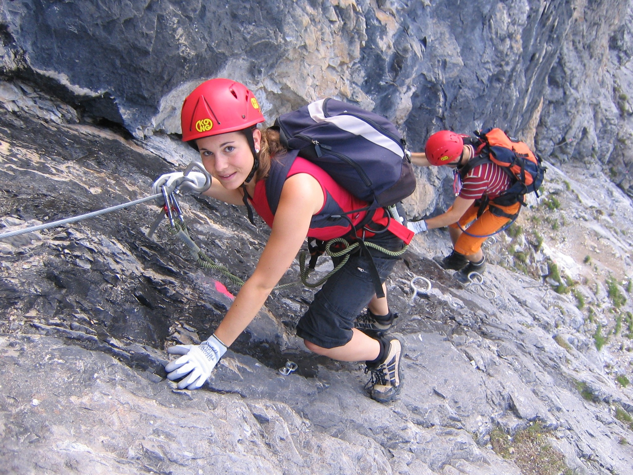
The Karkopf is a mountain, 1,738 m, and the highest peak of the whole Lattengebirge range in the German state of Bavaria. It lies exactly on the boundary between the municipality of Bayerisch Gmain ( parish of Forst St. Zeno) to the west and the municipality of Bischofswiesen (parish of Bischofswiesener Forst) to the east. As a consequence of its good long-distance views over the whole mountain massif, the mountain is a popular walking area. The mountains of Untersberg, Hoher Göll and Watzmann may be seen to the south, and the Zwiesel and Hochstaufen to the north. The summit may be ascended from various sides, e.g. via the Predigtstuhl or along the Törlschneid from Winkl. The ascent on the ''Alpgartensteig'' path has an easy '' klettersteig'' character with several ladders, steps and cables as protection. The route is only suited to experienced mountain walkers, because you need to have a head for heights and sure-footedness. From the top, you can walk to the top ... [...More Info...] [...Related Items...] OR: [Wikipedia] [Google] [Baidu] |
Bavaria
Bavaria ( ; ), officially the Free State of Bavaria (german: Freistaat Bayern, link=no ), is a state in the south-east of Germany. With an area of , Bavaria is the largest German state by land area, comprising roughly a fifth of the total land area of Germany. With over 13 million inhabitants, it is second in population only to North Rhine-Westphalia, but due to its large size its population density is below the German average. Bavaria's main cities are Munich (its capital and largest city and also the third largest city in Germany), Nuremberg, and Augsburg. The history of Bavaria includes its earliest settlement by Iron Age Celtic tribes, followed by the conquests of the Roman Empire in the 1st century BC, when the territory was incorporated into the provinces of Raetia and Noricum. It became the Duchy of Bavaria (a stem duchy) in the 6th century AD following the collapse of the Western Roman Empire. It was later incorporated into the Holy Roman Empire, became an ind ... [...More Info...] [...Related Items...] OR: [Wikipedia] [Google] [Baidu] |
Hochstaufen
The Hochstaufen is the easternmost mountain of the Chiemgau Alps, Germany. It is located in the north of Bad Reichenhall (Landkreis Berchtesgadener Land). The mountain belongs to the ''Staufen'' massif and is a popular destination for mountaineering. In the 17th century there were some mines at the Hochstaufen, the best known gallery was the ''Doktor-Oswald-Gallery'', located only 60 m underneath the summit. At an altitude of 1,750 m is the ''Reichenhaller Haus'', an alpine hut of the ''Deutscher Alpenverein'' (Section Bad Reichenhall). Routes * Bad Reichenhall (Padinger Alm) – Barthlmahd – Reichenhaller Haus – Hochstaufen * Bad Reichenhall (Padinger Alm) – Buchmahd – "Steinerne Jaeger" – Reichenhaller Haus – Hochstaufen * Piding (Urwies or Mauthausen) – Mairalm – "Steinerne Jaeger" – Reichenhaller Haus – Hochstaufen * Piding (Urwies or Mauthausen) – Mairalm – Pidinger Klettersteig (fixed rope route) – Hochstaufen * Piding or Aufham-Anger – S ... [...More Info...] [...Related Items...] OR: [Wikipedia] [Google] [Baidu] |
Mountains Of Bavaria
A mountain is an elevated portion of the Earth's crust, generally with steep sides that show significant exposed bedrock. Although definitions vary, a mountain may differ from a plateau in having a limited summit area, and is usually higher than a hill, typically rising at least 300 metres (1,000 feet) above the surrounding land. A few mountains are isolated summits, but most occur in mountain ranges. Mountains are formed through tectonic forces, erosion, or volcanism, which act on time scales of up to tens of millions of years. Once mountain building ceases, mountains are slowly leveled through the action of weathering, through slumping and other forms of mass wasting, as well as through erosion by rivers and glaciers. High elevations on mountains produce colder climates than at sea level at similar latitude. These colder climates strongly affect the ecosystems of mountains: different elevations have different plants and animals. Because of the less hospitable terrain and ... [...More Info...] [...Related Items...] OR: [Wikipedia] [Google] [Baidu] |
Predigtstuhl Cable Car
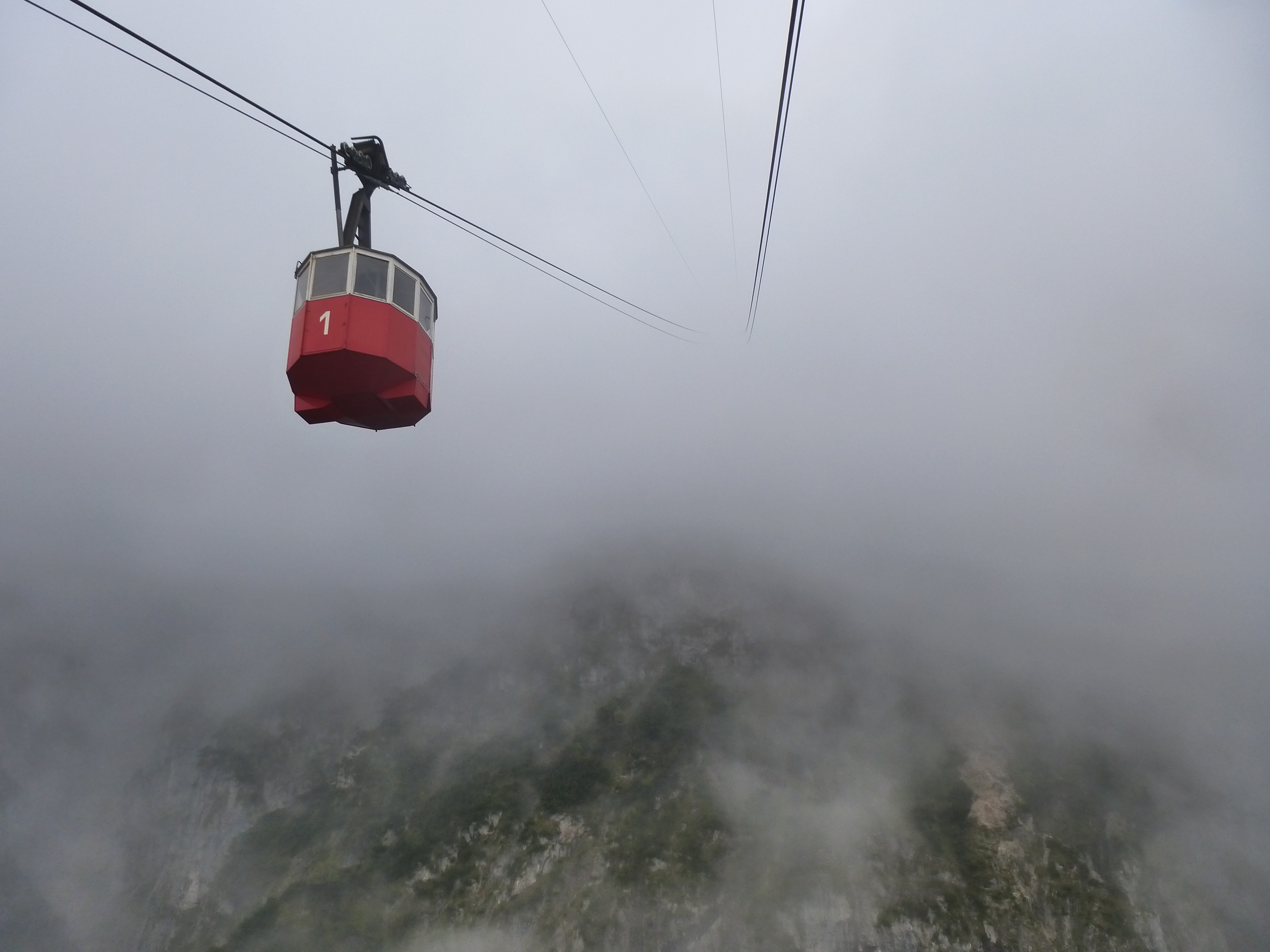
The Predigtstuhl Cable Car (german: Predigtstuhlbahn) has been in operation since 1928 and is the second oldest (the oldest being the Spanish Aerocar across the Niagara River in CanadaWhirlpool Aero Car), still running, original large-cabin cable car in the world. Since 2006, the ropeway has been placed under the protection of monuments. In 2013 the "Predigstuhlbahn" as well as the hotel and mountain-top restaurant came under new ownership, "Marga und Josef Posch", which belongs to the German businessman group Max Eicher. History and construction The cable car began operations on 1 July 1928, after only a year of construction. The production of the cables was assigned to the Westphalian Wire Industry (''Westfälische Drahtindustrie''). The building of the three pylons, at heights of 22, 32 and 9 metres was contracted to Hochtief AG, from Munich. The heartpiece, the wire ropeway drive technology and the two elegant pavilion passengers cabins were manufactured by the German, at th ... [...More Info...] [...Related Items...] OR: [Wikipedia] [Google] [Baidu] |
Top Station
A top station or upper stationFor example, se''Chairlift Blausee (upper station)''at www.outdooractive.com. Retrieved 15 May 2019. is usually the highest station of an aerial lift, a funicular, a T-bar lift or a rack railway. The lowest station is the valley station. Passengers or skiers usually alight at the top station. Top stations on a cable car may be ordinary buildings with a docking bay or open steel structures. Gondola lifts have horizontally arranged top stations. The top stations on chair lifts may have a simple jump-off point or a more substantial design. Gallery File:Dachstein-berg2.jpg, Dachstein cable car, Austria File:Saentis-Gebaeude.jpg, The ''Saentisbahn'', Switzerland File:Mount Roberts Tramway in Juneau, Alaska.jpg, Mount Roberts Tramway, Juneau, Alaska File:Telecabina Masada.JPG, Masada cableway, Israel File:10_Sommet_TS.JPG, Top station of a simple chair lift File:Bergstation Carmenna.jpg, Top station of the Aroser Weisshorn, Carmenna Chairlift, Arosa File ... [...More Info...] [...Related Items...] OR: [Wikipedia] [Google] [Baidu] |
Sure-footedness
Sure-footedness is the ability, especially when hiking or mountain climbing, to negotiate difficult or rough terrain safely. Such situations place demands on a person's coordination and reserves of strength as well as requiring sufficient appreciation of the terrain. A person who is sure-footed is thus unlikely to slip or stumble, and will have a good head for heights when required. On many hiking trails and mountain tours, sure-footedness is assumed to be a prerequisite without ever being defined. The term is frequently used in the literature presumably to ensure that the reader is made sufficiently aware that, under certain circumstances, one false step may lead to serious consequences. Required attributes Although there is no standard definition of sure-footedness, [...More Info...] [...Related Items...] OR: [Wikipedia] [Google] [Baidu] |
Head For Heights
To have a head for heights means that one has no acrophobia, an irrational fear of heights, and is not particularly prone to fear of falling or suffering from vertigo, the spinning sensation that can be triggered, for example, by looking down from a high place. A head for heights is frequently cited as a requirement when mountain hiking or climbing for a particular route as well as paragliding and hang-gliding. It is needed for certain jobs, such as for wind turbine technicians, chimney sweeps, roofers, steeplejacks and window cleaners. Mohawk ironworkers have worked for generations erecting New York City skyscrapers, though it is a myth they have an innate skill for doing so. Unlike acrophobia, a natural fear of heights is a normal phenomenon. When one finds oneself in an exposed place at a great height, one feels one's own posture as unstable. A normal fear of heights can generate feelings of anxiety as well as autonomic symptoms like outbreaks of sweat. Causes of fear of he ... [...More Info...] [...Related Items...] OR: [Wikipedia] [Google] [Baidu] |
Klettersteig
A via ferrata (Italian language, Italian for "iron path", plural ''vie ferrate'' or in English ''via ferratas'') is a protected climbing route found in the Alps and certain other locations. The term "via ferrata" is used in most countries and languages except notably in German-speaking regions, which use ''Klettersteig''—"climbing path" (plural ''Klettersteige''). Infrastructure A via ferrata is a climbing route that employs steel cables, rungs or ladders, fixed to the rock to which the climbers affix #Safety and equipment, a harness with two leashes, which allows the climbers to secure themselves to the metal fixture and limit any fall. The cable and other fixtures, such as iron rungs (stemples), pegs, carved steps, and ladders and bridges, provide both footings and handholds, as well. This allows climbing on otherwise dangerous routes without the risks of unprotected scrambling and climbing or the need for technical climbing equipment. They expand the opportunities for acce ... [...More Info...] [...Related Items...] OR: [Wikipedia] [Google] [Baidu] |
Predigtstuhl (Lattengebirge)
The Predigtstuhl (German for "pulpit") is a mountain, above sea level (NHN), in the Lattengebirge range of the Berchtesgaden Alps. It is located about 2.5 km south of the town of Bad Reichenhall and one of the few mountains in the area that is accessible by cable car, making it a popular tourist attraction. Infrastructure The Predigtstuhl was opened up for tourism in 1928 with the construction of the Predigtstuhl Cable Car which runs from Bad Reichenhall to the summit, as well as a restaurant and a hotel near the cable car's top station. An alpine hut serving food is located at nearby Schlegelmulde. The hotel has been closed for renovations since 2014. Activities The summit can be reached on foot from the surrounding towns of Bad Reichenhall, Bayerisch Gmain and Schneizlreuth. It is commonly used as a starting point for hikes to mountains deeper in the Lattengebirge such as the Dreisesselberg and the Karkopf The Karkopf is a mountain, 1,738 m, and the highest peak of ... [...More Info...] [...Related Items...] OR: [Wikipedia] [Google] [Baidu] |
Zwiesel (mountain)
The Zwiesel is a mountain, 1,782 metres high, in the Chiemgau Alps in Bavaria, Germany Germany,, officially the Federal Republic of Germany, is a country in Central Europe. It is the second most populous country in Europe after Russia, and the most populous member state of the European Union. Germany is situated betwe .... Mountains of Bavaria Chiemgau Alps One-thousanders of Germany Mountains of the Alps {{Bavaria-geo-stub ... [...More Info...] [...Related Items...] OR: [Wikipedia] [Google] [Baidu] |


