|
Karara, Queensland
Karara () is a rural town and locality in the Southern Downs Region, Queensland, Australia. In the , the locality of Karara had a population of 123 people. Geography The town is on the Darling Downs on the Cunningham Highway, south west of the state capital, Brisbane. The highway passes through the locality from the east to the south-west. The Toowoomba–Karara Road ( State Route 48) connects the highway through to the north of the locality to Leyburn and ultimately through to Toowoomba. The South Western railway line passes through the locality roughly parallel and to the north of the highway with the locality served by two railway stations: * Durikai railway station, now abandoned () * Karara railway station, serving the town (). Both the line and Karara railway station are no longer in active use. The Durakai State Forest occupies the southern and eastern areas within the locality; otherwise it is freehold land predominantly used for farming apart from a small urban ... [...More Info...] [...Related Items...] OR: [Wikipedia] [Google] [Baidu] |
AEST
Australia uses three main time zones: Australian Western Standard Time (AWST; UTC+08:00), Australian Central Standard Time (ACST; UTC+09:30), and Australian Eastern Standard Time (AEST; UTC+10:00). Time is regulated by the individual state governments, some of which observe daylight saving time (DST). Australia's external territories observe different time zones. Standard time was introduced in the 1890s when all of the Australian colonies adopted it. Before the switch to standard time zones, each local city or town was free to determine its local time, called local mean time. Now, Western Australia uses Western Standard Time; South Australia and the Northern Territory use Central Standard Time; while New South Wales, Queensland, Tasmania, Victoria (Australia), Victoria, Jervis Bay Territory, and the Australian Capital Territory use Eastern Standard Time. Daylight saving time (+1 hour) is used in jurisdictions in the south and south-east: South Australia, New South Wales, Vict ... [...More Info...] [...Related Items...] OR: [Wikipedia] [Google] [Baidu] |
Queensland
) , nickname = Sunshine State , image_map = Queensland in Australia.svg , map_caption = Location of Queensland in Australia , subdivision_type = Country , subdivision_name = Australia , established_title = Before federation , established_date = Colony of Queensland , established_title2 = Separation from New South Wales , established_date2 = 6 June 1859 , established_title3 = Federation , established_date3 = 1 January 1901 , named_for = Queen Victoria , demonym = , capital = Brisbane , largest_city = capital , coordinates = , admin_center_type = Administration , admin_center = 77 local government areas , leader_title1 = Monarch , leader_name1 = Charles III , leader_title2 = Governor , leader_name2 = Jeannette Young , leader_title3 = Premier , leader_name3 = Annastacia Palaszczuk ( ALP) , legislature = Parliament of Queensland , judiciary = Supreme Court of Queensland , national_representation = Parliament of Australia , national_representation_type ... [...More Info...] [...Related Items...] OR: [Wikipedia] [Google] [Baidu] |
Queensland Country Women's Association
The Queensland Country Women's Association (QCWA) is the Queensland chapter of the Country Women's Association in Australia. The association seeks to serve the interests of women and children in rural areas in Australia through a network of local branches. Established in 1922, local branches provide friendship and mutual support to their members while contributing to the betterment of life in their local communities. Over time, many branches have evolved to include support for wider issues such as domestic violence campaigns and fund-raising for international initiatives such as orphanages. In 2019 the QWCA received a Queensland Greats Awards, Queensland Greats Award from the Queensland Government.2019 Queensland Greats recipients , Queensland Government website. Retrieved 11 June 2019. [...More Info...] [...Related Items...] OR: [Wikipedia] [Google] [Baidu] |
Mobile Library
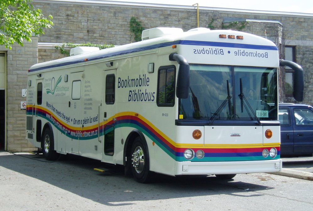
A bookmobile or mobile library is a vehicle designed for use as a library. They have been known by many names throughout history, including traveling library, library wagon, book wagon, book truck, library-on-wheels, and book auto service. Bookmobiles expand the reach of traditional libraries by transporting books to potential readers, providing library services to people in otherwise underserved locations (such as remote areas) and/or circumstances (such as residents of retirement homes). Bookmobile services and materials (such as Internet access, large print books, and audiobooks), may be customized for the locations and populations served. Bookmobiles have been based on various means of conveyance, including bicycles, carts, motor vehicles, trains, watercraft, and wagons, as well as camels, donkeys, elephants, horses, and mules. History 19th century In the United States of America, The American School Library (1839) was a traveling frontier library published by Harper & Bro ... [...More Info...] [...Related Items...] OR: [Wikipedia] [Google] [Baidu] |
Southern Downs Regional Council
The Southern Downs Region is a local government area in the Darling Downs region of Queensland, Australia, along the state's boundary with New South Wales. It was created in 2008 from a merger of the Shire of Warwick and the Shire of Stanthorpe. It has an estimated operating budget of A$22.8 million. History The majority of the former Warwick Shire is home to the Githabul people who have lived around this area for tens of thousands of years before the arrival of Europeans in the early 1840s. The current area of the Southern Downs Region existed as two distinct local government areas: * the Shire of Warwick; which in turn consisted of four previous local government areas: ** the City of Warwick; ** the Shire of Allora; ** the Shire of Glengallan; ** the Shire of Rosenthal; * and the Shire of Stanthorpe. The City of Warwick came into being as the Warwick Municipality on 25 May 1861 under the ''Municipalities Act 1858'', a piece of New South Wales legislation inherited by Qu ... [...More Info...] [...Related Items...] OR: [Wikipedia] [Google] [Baidu] |
Receiving Office
A post office is a public facility and a retailer that provides mail services, such as accepting letters and parcels, providing post office boxes, and selling postage stamps, packaging, and stationery. Post offices may offer additional services, which vary by country. These include providing and accepting government forms (such as passport applications), and processing government services and fees (such as road tax, postal savings, or bank fees). The chief administrator of a post office is called a postmaster. Before the advent of postal codes and the post office, postal systems would route items to a specific post office for receipt or delivery. During the 19th century in the United States, this often led to smaller communities being renamed after their post offices, particularly after the Post Office Department began to require that post office names not be duplicated within a state. Name The term "post-office" has been in use since the 1650s, shortly after the legalisa ... [...More Info...] [...Related Items...] OR: [Wikipedia] [Google] [Baidu] |
Condamine River
The Condamine River, part of the Balonne catchment that is part of the Murray-Darling Basin, drains the northern portion of the Darling Downs, an area of sub-coastal southern Queensland, Australia. The river is approximately 500 kilometers (310 mi) long and rises on Mount Superbus, South East Queensland's highest peak, on the western slopes of the Great Dividing Range, approximately from the east coast of Queensland, and then flows north west across the Darling Downs, then west.Shaw, John H., ''Collins Australian Encyclopedia'', Collins, Sydney, 1984, The Condamine River is a tributary of the Darling River. Course and features The headwaters of the river rise on the slopes of Mount Superbus, part of the Main Range, before passing through Cambanoora Gorge. The river flows through the towns of , , and Chinchilla and the tributary Gowrie Creek drains the slopes around Toowoomba. At Surat the Condamine turns to the south-west and becomes known as the Balonne River. The Con ... [...More Info...] [...Related Items...] OR: [Wikipedia] [Google] [Baidu] |
Drainage Basin
A drainage basin is an area of land where all flowing surface water converges to a single point, such as a river mouth, or flows into another body of water, such as a lake or ocean. A basin is separated from adjacent basins by a perimeter, the '' drainage divide'', made up of a succession of elevated features, such as ridges and hills. A basin may consist of smaller basins that merge at river confluences, forming a hierarchical pattern. Other terms for a drainage basin are catchment area, catchment basin, drainage area, river basin, water basin, and impluvium. In North America, they are commonly called a watershed, though in other English-speaking places, "watershed" is used only in its original sense, that of a drainage divide. In a closed drainage basin, or endorheic basin, the water converges to a single point inside the basin, known as a sink, which may be a permanent lake, a dry lake, or a point where surface water is lost underground. Drainage basins are similar ... [...More Info...] [...Related Items...] OR: [Wikipedia] [Google] [Baidu] |
Queensland Government
The Queensland Government is the democratic administrative authority of the Australian state of Queensland. The Government of Queensland, a parliamentary constitutional monarchy was formed in 1859 as prescribed in its Constitution, as amended from time to time. Since the Federation of Australia in 1901, Queensland has been a State of Australia, with the Constitution of Australia regulating the relationships between all state and territory governments and the Australian Government. Under the Australian Constitution, all states and territories (including Queensland) ceded powers relating to certain matters to the federal government. The government is influenced by the Westminster system and Australia's federal system of government. The Governor of Queensland, as the representative of Charles III, King of Australia, holds nominal executive power, although in practice only performs ceremonial duties. In practice executive power lies with the Premier and Cabinet. The Cabinet of ... [...More Info...] [...Related Items...] OR: [Wikipedia] [Google] [Baidu] |
South Western Railway Line, Queensland
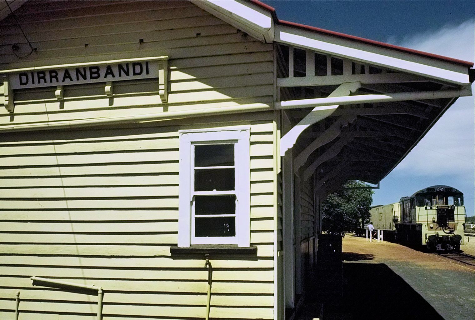
The South Western line is a narrow gauge railway line in the southern part of the state of Queensland, Australia. It junctions from the Southern line immediately south of Warwick station and proceeded westwards for a distance of 413 km to the town of Dirranbandi. A western extension to Boomie in New South Wales, approved by the Queensland Parliament in 1914, was never constructed. The Thallon-to-Dirranbandi section was closed on 2 September 2010. It services the small towns of Inglewood (junction of the now closed Texas branch) and Goondiwindi as well as the villages of Yelarbon and Thallon among others. History The South Western line opened as far as Thane on 1 July 1904 and was completed to Dirranbandi on 21 May 1913. A further extension of the line west of Dirranbandi was approved by Parliament in 1914 but never constructed. Services The South Western Mail was introduced as a twice weekly service in 1910. Upon the opening of the line to Dirranbandi, the train de ... [...More Info...] [...Related Items...] OR: [Wikipedia] [Google] [Baidu] |
List Of Road Routes In Queensland
Road routes in Queensland assist drivers navigating roads throughout the state, by identifying important through-routes. Queensland is in the process of converting to an alphanumeric route numbering system, with a letter denoting the importance and standard of the route. The previous shield-based system consisted of various route types – national highways, national routes, and state routes – with each type depicted by a different route marker design. Some routes have been converted to the alphanumeric system, while other routes are being maintained as shield-based routes – but with signs designed to be subsequentially retrofitted with a replacement alphanumeric route. Tourist drives will continue to use a shield-based system. Unless stated otherwise, all information in this article is derived from Google Maps. Alphanumeric routes Brisbane routes Regional routes Active Metroads National Highways and Routes State Routes State Routes on the Gold Coast and in re ... [...More Info...] [...Related Items...] OR: [Wikipedia] [Google] [Baidu] |


