|
Kanpur Dehat
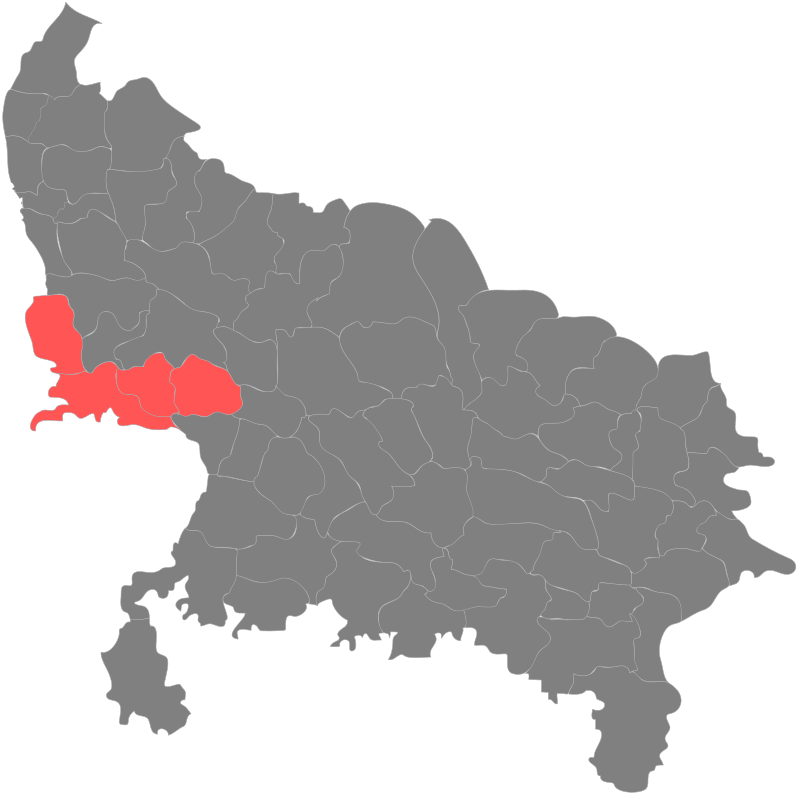
Kanpur Dehat district is a district in Uttar Pradesh state in northern India. The administrative headquarters of the district are at Mati- Akbarpur. This district is part of Kanpur division. Kanpur was formerly spelled Cawnpore. History The site of the Battle of Madarpur, fought between the Bhumihar zamindars and the Mughal Empire in 1528CE took place within the present-day Kanpur Dehat district. Kanpur District was divided into two districts, namely Kanpur Nagar and Kanpur Dehat in year 1977. The two were reunited again in 1979 and again separated in 1981. Uttar Pradesh government decided to rename Kanpur Dehat district as Ramabai Nagar district on 1 July 2010. In July 2012, it was returned to Kanpur Dehat. Tehsils in Kanpur Dehat district # Akbarpur #Bhognipur #Derapur #Rasulabad #Sikandara # Maitha Political representatives Legislative Council Legislative Assembly Parliamentary constituencies Transport The district is well connected by railways. Three rail track ... [...More Info...] [...Related Items...] OR: [Wikipedia] [Google] [Baidu] |
Akbarpur, Kanpur Dehat
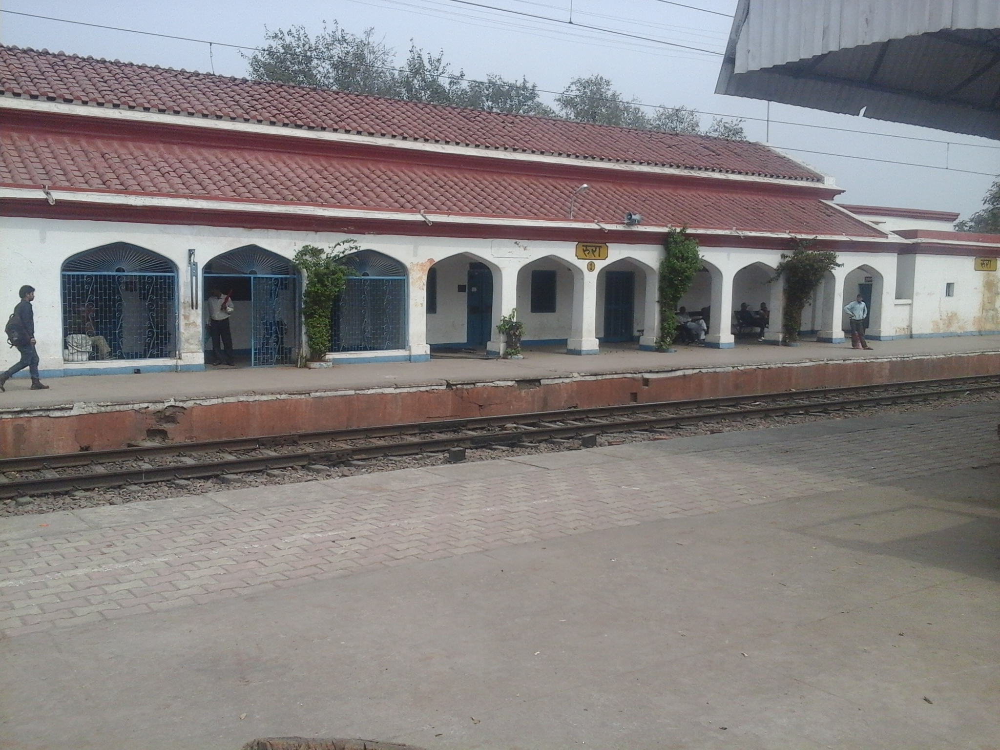
Akbarpur is a town in Kanpur Dehat district in the state of Uttar Pradesh, India. Demographics India census, Akbarpur had a population of 17,368. Males constitute 53% of the population and females 47%. Akbarpur has an average literacy rate of 57%, lower than the national average of 59.5%; with 58% of the males and 42% of females literate. 18% of the population is under 6 years of age. Connectivity Railways Akbarpur is not Railway station but it is connected with Rura (NCR) Railway station. Rura is connected with express &super fast trains to Delhi, Howrah, Lucknow.Agra, Patna, Meerut, Jammu etc. Rura is a main Railway Station of Akbarpur, (Kanpur Dehat) . Another mini railway station is Lalpur. Airways Kanpur Airport is nearest airport. Roadways Golden Quadrilateral National Highway 19 (India) passes through Akbarpur city District Kanpur Dehat. Which is connected to all major cities of India. Lucknow-Jhansi another National High Way passes through its. A C, non A C & Sle ... [...More Info...] [...Related Items...] OR: [Wikipedia] [Google] [Baidu] |
List Of Districts Of Uttar Pradesh ...
Uttar Pradesh, the most populous state in India, has 75 districts. These districts, most of which have populations above 10 lakhs, and are grouped into 18 divisions for administrative convenience. Division wise listing of districts Area-wise listing of districts Demand for new Districts Uttar Pradesh Cabinet Minister and MLA from Aonla, Dharampal Singh demanded new Aonla District to be carved out of Bareilly District. See also * Divisions of Uttar Pradesh * List of RTO districts in Uttar Pradesh * List of urban local bodies in Uttar Pradesh References {{DEFAULTSORT:Districts of Uttar Pradesh Uttar Pradesh-related lists Uttar Pradesh Uttar Pradesh (; , 'Northern Province') is a state in northern India. With over 200 million inhabitants, it is the most populated state in India as well as the most populous country subdivision in the world. It was established in 1950 ... [...More Info...] [...Related Items...] OR: [Wikipedia] [Google] [Baidu] |
Kannauj (Lok Sabha Constituency)
Kannauj is a Lok Sabha parliamentary constituency in Uttar Pradesh. Assembly segments Members of Parliament ^ by poll Election results General election 2019 General election 2014 Bye Election 2012 Dimple Yadav from Samajwadi Party elected unopposed in 2012 bypoll. General election 2009 General election 2004 Bye Election 2000 General election 1999 General election 1996 See also * Kannauj * List of Constituencies of the Lok Sabha The Lok Sabha, the lower house of the Parliament of India, is made up of Members of Parliament ( MPs). Each MP, represents a single geographic constituency. There are currently 543 constituencies while maximum seats will fill up to 550 (after ar ... External links 1971 to 2014 Kannauj Lok Sabha Election Results in Detail References * http://www.indiapress.org/election/archives/lok11/biodata/11up50.php {{DEFAULTSORT:Kannauj Lok Sabha constituency Lok Sabha co ... [...More Info...] [...Related Items...] OR: [Wikipedia] [Google] [Baidu] |
Zamindars
A zamindar ( Hindustani: Devanagari: , ; Persian: , ) in the Indian subcontinent was an autonomous or semiautonomous ruler of a province. The term itself came into use during the reign of Mughals and later the British had begun using it as a native synonym for “estate”. The term means ''land owner'' in Persian. Typically hereditary, from whom they reserved the right to collect tax on behalf of imperial courts or for military purposes. During the period of British colonial rule in India many wealthy and influential zamindars were bestowed with princely and royal titles such as ''maharaja'' (great king), ''raja/rai'' (king) and ''nawab''. During the Mughal Empire, zamindars belonged to the nobility and formed the ruling class. Emperor Akbar granted them mansabs and their ancestral domains were treated as jagirs. Some zamindars who were Hindu by religion and brahmin or kayastha or kshatriya by caste were converted into Muslims by the Mughals. During the colonial era, the ... [...More Info...] [...Related Items...] OR: [Wikipedia] [Google] [Baidu] |
Bhumihar
Bhumihars, also called Babhan, are a Hindu caste mainly found in Bihar (including the Mithila region), the Purvanchal region of Uttar Pradesh, Jharkhand, the Bundelkhand region of Madhya Pradesh, and Nepal. The Bhumihars claim Brahmin status, and are also referred to as 'Bhumihar Brahmin'. In Bihar, they are also known as 'Babhan' and they have also been called 'Bhuinhar'. The Bhumihars were a prominent land-owning group of eastern India until the 20th century, and controlled some small princely states and zamindari estates in the region. The Bhumihar community played an important role in the peasant movements of India, and was highly influential in politics of Bihar in the 20th century. Etymology The word ''bhūmihār'' is of relatively recent origin, first used in the records of United Provinces of Agra and Oudh in 1865. It derives from the words ''bhūmi'' ("land") and ''hāra'' ("one who seizes or confiscates"), referring to the caste's landowner status. The term ''B ... [...More Info...] [...Related Items...] OR: [Wikipedia] [Google] [Baidu] |
Battle Of Madarpur
As per popular belief, The Battle of Madarpur was a battle fought between a small army of brothers named as Maharaja Kam Dev Misir, Maharaja Dham Dev Misr and Maharja Vikram Pratap Dev Singh misr and the Mughal, The Mughals were led by Babur. The Brahmin zamindars, of Kashyap gotra , and Kanyakubja origin from Madarpur, a place in present-day Kanpur district of Uttar Pradesh. The zamindars were defeated and massacred; the survivors migrated to other places in present-day Uttar Pradesh and Bihar. The battle is Mentioned in Kanyakubja Brahmin Vanshavali and Kanyakubja Prabodhini. References {{reflist * Acharya Hazari Prasad Dwivedi Rachnawali, Rajkamal Prakashan, Delhi. * Bibha Jha's Ph.D thesis ''Bhumihar Brahmins: A Sociological Study'' submitted to the Patna University Patna University is a public state university in Patna, Bihar, India. It was established on 1 October 1917 during the British Raj. It is the first university in Bihar and the seventh oldest universit ... [...More Info...] [...Related Items...] OR: [Wikipedia] [Google] [Baidu] |
India
India, officially the Republic of India (Hindi: ), is a country in South Asia. It is the seventh-largest country by area, the second-most populous country, and the most populous democracy in the world. Bounded by the Indian Ocean on the south, the Arabian Sea on the southwest, and the Bay of Bengal on the southeast, it shares land borders with Pakistan to the west; China, Nepal, and Bhutan to the north; and Bangladesh and Myanmar to the east. In the Indian Ocean, India is in the vicinity of Sri Lanka and the Maldives; its Andaman and Nicobar Islands share a maritime border with Thailand, Myanmar, and Indonesia. Modern humans arrived on the Indian subcontinent from Africa no later than 55,000 years ago., "Y-Chromosome and Mt-DNA data support the colonization of South Asia by modern humans originating in Africa. ... Coalescence dates for most non-European populations average to between 73–55 ka.", "Modern human beings—''Homo sapiens''—originated in Africa. Then, int ... [...More Info...] [...Related Items...] OR: [Wikipedia] [Google] [Baidu] |
Districts Of Uttar Pradesh ...
Uttar Pradesh, the most populous state in India, has 75 districts. These districts, most of which have populations above 10 lakhs, and are grouped into 18 divisions for administrative convenience. Division wise listing of districts Area-wise listing of districts Demand for new Districts Uttar Pradesh Cabinet Minister and MLA from Aonla, Dharampal Singh demanded new Aonla District to be carved out of Bareilly District. See also * Divisions of Uttar Pradesh * List of RTO districts in Uttar Pradesh * List of urban local bodies in Uttar Pradesh References {{DEFAULTSORT:Districts of Uttar Pradesh Uttar Pradesh-related lists Uttar Pradesh Uttar Pradesh (; , 'Northern Province') is a state in northern India. With over 200 million inhabitants, it is the most populated state in India as well as the most populous country subdivision in the world. It was established in 1950 ... [...More Info...] [...Related Items...] OR: [Wikipedia] [Google] [Baidu] |
Indian Standard Time
Indian Standard Time (IST), sometimes also called India Standard Time, is the time zone observed throughout India, with a time offset of UTC+05:30. India does not observe daylight saving time or other seasonal adjustments. In military and aviation time, IST is designated E* ("Echo-Star"). It is indicated as Asia/Kolkata in the IANA time zone database. History After Independence in 1947, the Union government established IST as the official time for the whole country, although Kolkata and Mumbai retained their own local time (known as Calcutta Time and Bombay Time) until 1948 and 1955, respectively. The Central observatory was moved from Chennai to a location at Shankargarh Fort in Allahabad district, so that it would be as close to UTC+05:30 as possible. Daylight Saving Time (DST) was used briefly during the China–India War of 1962 and the Indo-Pakistani Wars of 1965 and 1971. Calculation Indian Standard Time is calculated from the clock tower in Mirzapur nearly exa ... [...More Info...] [...Related Items...] OR: [Wikipedia] [Google] [Baidu] |
Bhognipur Assembly Constituency
Bhognipur Assembly constituency is a part of the Kanpur Dehat district of Uttar Pradesh and it comes under Jalaun Lok Sabha constituency. Members of Legislative Assembly *1957: Ram Swaroop, Independent *1962: Raj Narain Misra, Indian National Congress *1967: Keshari Lal, Samyukta Socialist Party *1969: Jwala Prasad Kureel, Indian National Congress *1974: Keshari Lal, Bharatiya Kranti Dal *1977: Mauji Lal Kureel, Janata Party *1980: Ganga Sagar Sankhwar, Indian National Congress (Indira) *1985: Radhey Shyam, Indian National Congress *1989: Pyare Lal Sankhwar, Janata Dal *1991: Pyare Lal Sankhwar, Janata Dal *1993: Bhagwati Prasad Sagar, Bahujan Samaj Party *1996: Radhey Shyam Kori, Bahujan Samaj Party *2002: Arun Kumari Kori, Samajwadi Party *2007: Raghunath Prasad Sankhwar, Bahujan Samaj Party *2012: Yogendra Pal Singh, Samajwadi Party *2017: Vinod Kumar Katiyar, Bharatiya Janata Party *2022: Rakesh Sachan, Bharatiya Janata Party The Bharatiya Janata Party ... [...More Info...] [...Related Items...] OR: [Wikipedia] [Google] [Baidu] |
Sikandra Assembly Constituency , a tehsil or sub division in Kanpur Dehat district of Uttar Pradesh
{{Disambiguation, geo ...
Sikandra may refer to: *Sikandra, a suburb of Agra, the location of Akbar's tomb *Sikandara, a town in Kanpur Dehat district in the Indian state of Uttar Pradesh. ** Sikandra (Vidhan Sabha constituency), a constituency of Uttar Pradesh Legislative assembly **Sikandara Sikandara is a town in Kanpur Dehat district in the Indian state of Uttar Pradesh. It is headquarters of tehsil Sikandara. Location It is located on NH-2 about 80 km away from kanpur toward west and towards south from Jhinjhak at a dista ... [...More Info...] [...Related Items...] OR: [Wikipedia] [Google] [Baidu] |
Akbarpur-Raniya Assembly Constituency
Akbarpur-Raniya Assembly constituency is one of 403 legislative assembly seats of the Uttar Pradesh. It is part of the Akbarpur Lok Sabha constituency. It is part of Kanpur Dehat district. Overview Akbarpur-Raniya comprises KCs 1-Akbarpur, 3-Raniya, 4-Rura, 5-Shiwali, Shiwali TA, Akbarpur TA & Rura TA of 3-Akbarpur Tehsil. Members of Legislative Assembly Election results 2022 2017 , - ! style="background-color:#E9E9E9" align=left width=225, Party ! style="background-color:#E9E9E9" align=Seats won ! style="background-color:#E9E9E9" align=Seat change , - , align=left, Bharatiya Janata Party , align="center" , 5 , align="center" , 4 , - , align=left, Samajwadi Party , align="center" , 0 , align="center" , 4 , - , align=left, Bahujan Samaj Party , align="center" , 0 , align="center" , 0 , - , align=left, Indian National Congress , align="center" , 0 , align="center" , 0 , - See also * List of Vidhan Sabha constituenc ... [...More Info...] [...Related Items...] OR: [Wikipedia] [Google] [Baidu] |


