|
Kamianets-Podilskyi
Kamianets-Podilskyi ( uk, Ка́м'яне́ць-Поді́льський, russian: Каменец-Подольский, Kamenets-Podolskiy, pl, Kamieniec Podolski, ro, Camenița, yi, קאַמענעץ־פּאָדאָלסק / קאַמעניץ, Kamenetz-Podolsk / Kamenitz) is a city on the Smotrych River in western Ukraine, to the north-east of Chernivtsi. Formerly the administrative center of the Khmelnytskyi Oblast, the city is now the administrative center of the Kamianets-Podilskyi district within the Khmelnytskyi province. It hosts the administration of Kamianets-Podilskyi urban hromada. Current population has been estimated as In 1919–1920, during the unfolding Ukrainian–Soviet War, the city officially served as the temporary capital of the Ukrainian People's Republic. Name The first part of the city's dual name originates from ' ( uk, камiнь) or ', meaning 'stone' in Old Slavic. The second part of its name relates to the historic region of Podolia ( uk, По� ... [...More Info...] [...Related Items...] OR: [Wikipedia] [Google] [Baidu] |
Kamianets-Podilskyi Raion
Kamianets-Podilskyi Raion ( uk, Кам'янець-Подільський район, ) is one of the three administrative raions (a ''district'') of the Khmelnytskyi Oblast in western Ukraine. Its administrative center is located in the city of Kamianets-Podilskyi. Its population was 75,506 in the 2001 Ukrainian Census and On 18 July 2020, as part of the administrative reform of Ukraine, the number of raions of Khmelnytskyi Oblast was reduced to three, and the area of Kamianets-Podilskyi Raion was significantly expanded. Three abolished raions, Chemerivtsi, Dunaivtsi, and Nova Ushytsia Raions, as well as the city of Kamianets-Podilskyi, which was previously incorporated as a city of oblast significance and did not belong to the raion, were merged into Kamianets-Podilskyi Raion. The January 2020 estimate of the raion population was Geography Kamianets-Podilskyi Raion is located in the southernmost part of the Khmelnytskyi Oblast, corresponding to the modern-day boundaries of ... [...More Info...] [...Related Items...] OR: [Wikipedia] [Google] [Baidu] |
Khmelnytskyi Oblast
Khmelnytskyi Oblast ( uk, Хмельни́цька о́бласть, translit=Khmelnytska oblast; also referred to as Khmelnychchyna — uk, Хмельни́ччина) is an oblast (province) of western Ukraine covering portions of the historical regions of western Podolia and southern Volhynia. The administrative center of the oblast is the city of Khmelnytskyi. The current estimated population is around . Created in 1937 out of border okrugs of Vinnytsia Oblast, in 1941–44 it was under Nazi Germany occupation and part of the Reichskommissariat Ukraine (Wolhynien und Podolien general district). Following the Kamenets-Podolsky pocket in spring of 1944 as part of the Proskurov-Chernovtsy operation, Soviet troops removed the German occupation in the region. Until 4 February 1954 it was called Kamianets-Podilsky Oblast () and was centered in Kamianets-Podilsky until 1941. The region rebranding took place after the official renaming of the region's administrative center to ... [...More Info...] [...Related Items...] OR: [Wikipedia] [Google] [Baidu] |
Smotrych River
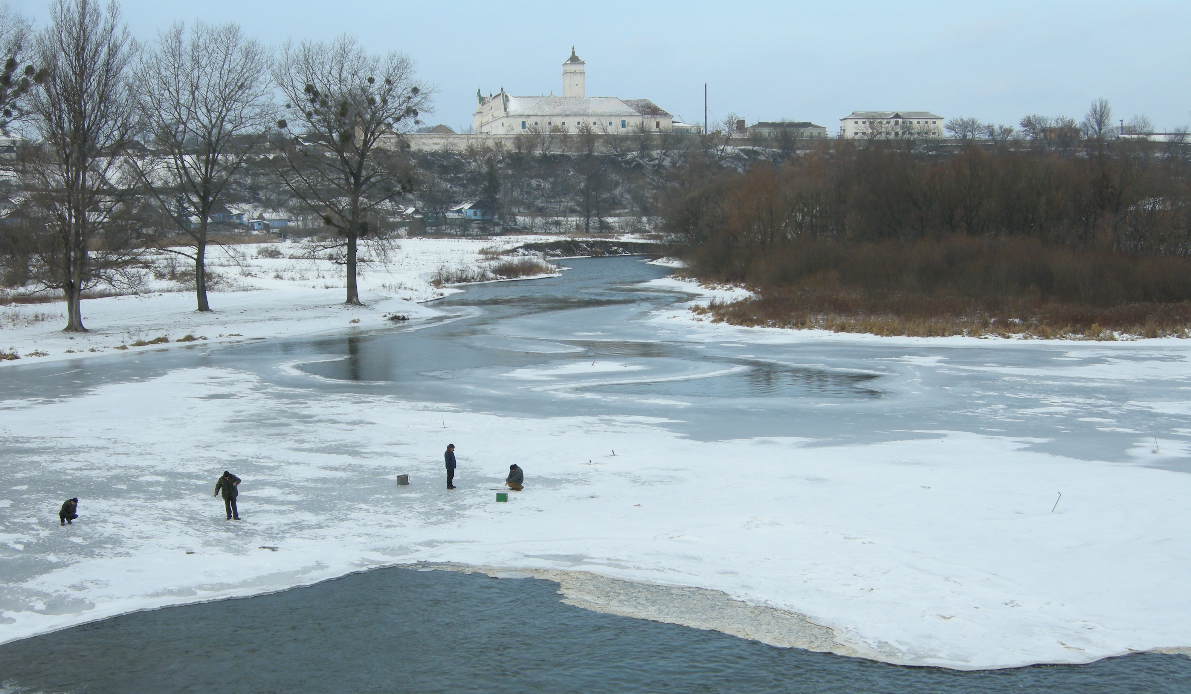
, name_etymology = , image = Smotrych River.JPG , image_size = , image_caption = The Smotrych River seen near the historic city of Kamianets-Podilskyi, Ukraine. , map = , map_size = , map_caption = , pushpin_map =Ukraine Khmelnytskyi Oblast#Ukraine , pushpin_map_size = , pushpin_map_caption= , subdivision_type1 = Country , subdivision_name1 = Ukraine , subdivision_type2 = Oblast , subdivision_name2 = Khmelnytskyi Oblast , subdivision_type3 = , subdivision_name3 = , subdivision_type4 = , subdivision_name4 = , subdivision_type5 = City , subdivision_name5 = Kamianets-Podilskyi , length = , width_min = , width_avg = , width_max = , depth_min = , depth_avg = , depth_max = , discharge1_location= , discharge1_min = , discharge1_avg = , discharge1_max = , source1 ... [...More Info...] [...Related Items...] OR: [Wikipedia] [Google] [Baidu] |
Western Ukraine
Western Ukraine or West Ukraine ( uk, Західна Україна, Zakhidna Ukraina or , ) is the territory of Ukraine linked to the former Kingdom of Galicia–Volhynia, which was part of the Polish–Lithuanian Commonwealth, the Austrian Empire, Austria-Hungary and the Second Polish Republic, and came fully under the control of the Soviet Union (via the Ukrainian Soviet Socialist Republic) only in 1939, following the Molotov–Ribbentrop Pact. There is no universally accepted definition of the territory's boundaries (see the map, right), but the contemporary Ukrainian administrative regions or Oblasts of Chernivtsi, Ivano-Frankovsk, Lviv, Ternopil and Transcarpathia (which were part of the former Austro-Hungarian Empire) are nearly always included and the Lutsk and Rivne Oblasts (parts of the annexed from Poland during its Third Partition) are usually included. It is less common to include the Khmelnytski and, especially, the Vinnytsia and Zhytomyr Oblasts in ... [...More Info...] [...Related Items...] OR: [Wikipedia] [Google] [Baidu] |
Raions Of Ukraine
Raions of Ukraine (often translated as "districts"; Ukrainian: ра́йон, tr. ''raion''; plural: райо́ни, tr. ''raiony'') are the second level of administrative division in Ukraine, below the oblast. Raions were created in a 1922 administrative reform of the Soviet Union, to which Ukraine, as the Ukrainian Soviet Socialist Republic, belonged. On 17 July 2020, the Verkhovna Rada (Ukraine's parliament) approved an administrative reform to merge most of the 490 raions, along with the " cities of regional significance", which were previously outside the raions, into just 136 reformed raions. Most tasks of the raions (education, healthcare, sport facilities, culture, and social welfare) were taken over by new hromadas, the subdivisions of raions. [...More Info...] [...Related Items...] OR: [Wikipedia] [Google] [Baidu] |
Dolný Kubín
Dolný Kubín (; also known by other names) is a town in northern Slovakia in the Žilina Region. It is the historical capital and the largest settlement of the Orava region. Names The name is derived from the archaic Slovak word meaning a "glade covered by smoke after burnt roots".. ''Dolný Kubín'' means "Lower Kubín", in contrast with to Vyšný ("Upper") Kubín. The location and the settlement was known also as ''Kublen'' (1314), ''Clbin'' (1393), ''Culbyn'' (1408), ''Kubyn Nysny'' (1547), ''Dolny Kubin'' (1773). Other names in the past include german: Unterkubin, hu, Alsókubin. Geography Dolný Kubín lies at an altitude of above sea level and covers an area of . It is located in northern Slovakia on the Orava River, between the Lesser Fatra, Oravská Magura and Chočské vrchy mountains. It is located around from Ružomberok, from the Polish border and from Bratislava. The town is composed of the following boroughs: ''Banisko'', ''Beňova Lehota'', ''Brezovec' ... [...More Info...] [...Related Items...] OR: [Wikipedia] [Google] [Baidu] |
Ukmergė
Ukmergė (; previously ''Vilkmergė''; pl, Wiłkomierz) is a city in Vilnius County, Lithuania, located northwest of Vilnius, with a population of about 20,000. Etymology and variant names The city took its original name ''Vilkmergė'' from the Vilkmergėlė River, which was initially called Vilkmergė and assumed a diminutive form after the growth of the settlement. It is commonly thought that the name may be translated as "she-wolf", from the combination of ''Vilkas'' (wolf) and ''Merga'' (maiden). More likely the second root of the dual-stemmed name is the verb ''merg-/merk-'' meaning "to submerge" or "to dip". According to local legend, Vilkmergė was a girl raised by wolves, who bridged the divide between animals and humans, in the same way as Rudyard Kipling's Mowgli. The folk etymology of "Ukmergė", by contrast, is "farm girl" (Lith. ''ūkis'' = farm). The original name has been adopted by the local soccer team, "Vilkmergė Ukmergė" as well as popular HBH Vilkmergė b ... [...More Info...] [...Related Items...] OR: [Wikipedia] [Google] [Baidu] |
Zalău
Zalău (, unofficial and former official name: ro, Zălau (; german: Zillenmarkt or , hu, Zilah, tr, Zile) is the seat of Sălaj County, Romania. In 2011, its estimated population was 56,202. History Ancient times Zalău is situated in the area inhabited by "Free Dacians", away from the historical landmark of Porolissum, a well-preserved Roman Castrum with an imposing fortress, an amphitheater, temples, houses and a customs house in the ancient Roman province of Dacia. Zalău was the crossing point between Central Europe and Transylvania, along the so-called "Salt Route". Archaeological discoveries revealed evidence of human existence in this area since the Neolithic, approx. 6500 years ago. Dacian coins found in archaeological perimeters of the city central area and on the Valea Mâții, west of the city, plus important items belonging to Roman culture, are evidence of free Dacian continuity in this area and of developing economic relations with the Roman ancient city o ... [...More Info...] [...Related Items...] OR: [Wikipedia] [Google] [Baidu] |
Głogów
Głogów (; german: Glogau, links=no, rarely , cs, Hlohov, szl, Głogōw) is a city in western Poland. It is the county seat of Głogów County, in Lower Silesian Voivodeship (since 1999), and was previously in Legnica Voivodeship (1975–1998). Głogów is the sixth largest town in the Voivodeship; its population in 2021 was 65,400. The name of the town derives from , the Polish name for hawthorn. Among the oldest towns in Poland, Głogów was founded in the 10th century as a Piast defensive settlement and obtained city rights in the 13th century from Duke Konrad I. Due to the town's strategic location on several trade routes, the townspeople received many privileges and benefits, which brought wealth and greatly reflected on the city's architecture. Over time, Głogów grew to be one of the largest fortified towns in Lower Silesia. The demolition of fortifications at the beginning of the 20th century improved the chances for further growth. However, towards the end of th ... [...More Info...] [...Related Items...] OR: [Wikipedia] [Google] [Baidu] |
Przemyśl
Przemyśl (; yi, פשעמישל, Pshemishl; uk, Перемишль, Peremyshl; german: Premissel) is a city in southeastern Poland with 58,721 inhabitants, as of December 2021. In 1999, it became part of the Subcarpathian Voivodeship; it was previously the capital of Przemyśl Voivodeship. Przemyśl owes its long and rich history to the advantages of its geographic location. The city lies in an area connecting mountains and lowlands known as the Przemyśl Gate (Brama Przemyska), with open lines of transportation, and fertile soil. It also lies on the navigable San River. Important trade routes that connect Central Europe from Przemyśl ensure the city's importance. The Old Town of Przemyśl is listed as a Historic Monument of Poland. Names Different names in various languages have identified the city throughout its history. Selected languages include: cz, Přemyšl; german: Premissel, Prömsel, Premslen; la, Premislia; uk, Перемишль (Peremyshlj) and (Pshemyslj); ... [...More Info...] [...Related Items...] OR: [Wikipedia] [Google] [Baidu] |
Kalisz
(The oldest city of Poland) , image_skyline = , image_caption = ''Top:'' Town Hall, Former "Calisia" Piano Factory''Middle:'' Courthouse, "Gołębnik" tenement''Bottom:'' Aerial view of the Kalisz Old Town , image_flag = POL Kalisz flag.svg , flag_border = no , image_shield = POL Kalisz COA.svg , pushpin_map = Poland Greater Poland Voivodeship#Poland , pushpin_relief = 1 , pushpin_label_position = bottom , subdivision_type = Country , subdivision_name = , subdivision_type1 = Voivodeship , subdivision_name1 = , subdivision_type2 = County , subdivision_name2 = ''city-county'' , leader_title = Mayor , leader_name = Krystian Kinastowski , established_title = Established , established_date = 9th century , established_title3 = Town rights , established_date3 = after 1268 , area_total_km2 = 69.42 , population_as_of = 31 December 2021 , population_total = 97,905 ( 38th) Data for territorial unit 3061000. , population_density_km2 = 1472 , timezone = CET , utc ... [...More Info...] [...Related Items...] OR: [Wikipedia] [Google] [Baidu] |
Ponte Lambro
Ponte Lambro ( Brianzöö: ) is a ''comune'' (municipality) in the Province of Como in the Italian region Lombardy, located about north of Milan and about east of Como. Ponte Lambro borders the following municipalities: Caslino d'Erba, Castelmarte, Erba. Demographic evolution Colors= id:lightgrey value:gray(0.9) id:darkgrey value:gray(0.8) id:sfondo value:rgb(1,1,1) id:barra value:rgb(0.6,0.7,0.8) ImageSize = width:455 height:303 PlotArea = left:50 bottom:50 top:30 right:30 DateFormat = x.y Period = from:0 till:5000 TimeAxis = orientation:vertical AlignBars = justify ScaleMajor = gridcolor:darkgrey increment:1000 start:0 ScaleMinor = gridcolor:lightgrey increment:200 start:0 BackgroundColors = canvas:sfondo BarData= bar:1861 text:1861 bar:1871 text:1871 bar:1881 text:1881 bar:1901 text:1901 bar:1911 text:1911 bar:1921 text:1921 bar:1931 text:1931 bar:1936 text:1936 bar:1951 text:1951 bar:1961 text:1961 bar:1971 text:1971 bar:19 ... [...More Info...] [...Related Items...] OR: [Wikipedia] [Google] [Baidu] |


