|
Kallkkulam Taluk
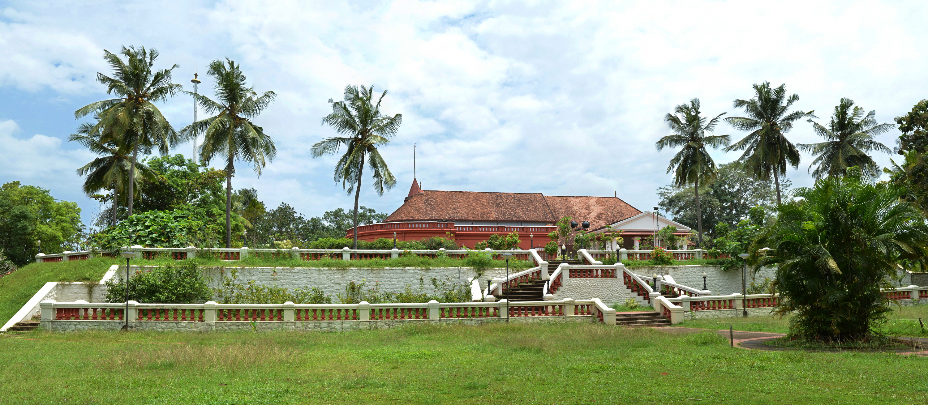
Kallkkulam taluk is a taluk of Kanyakumari district of the Indian state of Tamil Nadu. The headquarters of the taluk is the town of Kallkkulam.Up to 1957, Kallkkulam Taluk formed part of the Travancore Kingdom and subsequently the Travancore-Cochin State. It was when the States were divided on linguistic basis that Kallkkulam, Thovalai, Vilavancode Vilavancode, also spelt as Viḷavaṅgōḍu, is a town panchayat in Kanyakumari district in Tamil Nadu state, India. It is part of territory among several taluks that were with the Thiruvananthapuram district that with the passage of the Sta ..., and Agastheeswaram Taluks of the erstwhile Thiruvananthapuram District of the then Travancore-Cochin State were included in the then Madras State (later renamed as Tamil Nadu) as Kanyakumari District. Kallkkulam taluk has been an important administrative division of the erstwhile Travancore Kingdom. Padmanabhapuram, the erstwhile capital of Travancore State is situated with in K ... [...More Info...] [...Related Items...] OR: [Wikipedia] [Google] [Baidu] |
Taluk
A tehsil (, also known as tahsil, taluka, or taluk) is a local unit of administrative division in some countries of South Asia. It is a subdistrict of the area within a district including the designated populated place that serves as its administrative centre, with possible additional towns, and usually a number of villages. The terms in India have replaced earlier terms, such as '' pargana'' (''pergunnah'') and ''thana''. In Andhra Pradesh and Telangana, a newer unit called mandal (circle) has come to replace the system of tehsils. It is generally smaller than a tehsil, and is meant for facilitating local self-government in the panchayat system. In West Bengal, Bihar, Jharkhand, community development blocks are the empowered grassroots administrative unit, replacing tehsils. As an entity of local government, the tehsil office (panchayat samiti) exercises certain fiscal and administrative power over the villages and municipalities within its jurisdiction. It is the ultimate execu ... [...More Info...] [...Related Items...] OR: [Wikipedia] [Google] [Baidu] |
Kanyakumari District
Kanniyakumari district is one of the 38 districts in Tamil Nadu state and the southernmost district in mainland India. It stands second in terms of population density among the districts of Tamil Nadu. It is also the richest district in Tamil Nadu in terms of per capita income, and also tops the state in Human Development Index (HDI), literacy, and education. The district's headquarters is Nagercoil. Kanniyakumari district has a varied topography with the sea on three sides and the mountains of the Western Ghats bordering the northern side. Except for a small stretch of land to the east of Kanniyakumari town, almost the entire district is sandwiched between the Western Ghats and the Arabian Sea – the only district in Tamilnadu state facing the Arabian Sea. Geologically, the landmass of the district is much younger when compared to the rest of the state – faulted as late as 2.5 million years during the Miocene, after which numerous transgression, as well as regression of se ... [...More Info...] [...Related Items...] OR: [Wikipedia] [Google] [Baidu] |
Indian State
India is a federal union comprising 28 states and 8 union territories, with a total of 36 entities. The states and union territories are further subdivided into districts and smaller administrative divisions. History Pre-independence The Indian subcontinent has been ruled by many different ethnic groups throughout its history, each instituting their own policies of administrative division in the region. The British Raj mostly retained the administrative structure of the preceding Mughal Empire. India was divided into provinces (also called Presidencies), directly governed by the British, and princely states, which were nominally controlled by a local prince or raja loyal to the British Empire, which held ''de facto'' sovereignty ( suzerainty) over the princely states. 1947–1950 Between 1947 and 1950 the territories of the princely states were politically integrated into the Indian union. Most were merged into existing provinces; others were organised into ... [...More Info...] [...Related Items...] OR: [Wikipedia] [Google] [Baidu] |
Tamil Nadu
Tamil Nadu (; , TN) is a States and union territories of India, state in southern India. It is the List of states and union territories of India by area, tenth largest Indian state by area and the List of states and union territories of India by population, sixth largest by population. Its capital and largest city is Chennai. Tamil Nadu is the home of the Tamil people, whose Tamil language—one of the longest surviving Classical languages of India, classical languages in the world—is widely spoken in the state and serves as its official language. The state lies in the southernmost part of the Indian peninsula, and is bordered by the Indian union territory of Puducherry (union territory), Puducherry and the states of Kerala, Karnataka, and Andhra Pradesh, as well as an international maritime border with Sri Lanka. It is bounded by the Western Ghats in the west, the Eastern Ghats in the north, the Bay of Bengal in the east, the Gulf of Mannar and Palk Strait to the south-eas ... [...More Info...] [...Related Items...] OR: [Wikipedia] [Google] [Baidu] |
Kallkkulam
Kalkulam is a small village located in Kalkulam taluk, Kanyakumari district, Tamil Nadu, India. The taluk was among several in Thiruvananthapuram district that with the passage of the States Reorganisation Act, 1956, States Reorganisation Act of 1956 were transferred from Thiruvananthapuram district, Travancore-Cochin State to the newly created Kanyakumari district of Madras State (the latter later renamed as Tamil Nadu State). History Boundary Kalkulam Taluk was part of the Princely state Travancore Kingdom; the latter which subsequently became part of the then Travancore-Cochin State. Part of The States Reorganisation Act of 1956 aligned state boundaries on linguistic affiliations. Thovalai, Kalkulam, Vilavancode, and Agastheeswaram Taluks were transferred from Thiruvananthapuram District of the Travancore-Cochin State to Kanyakumari district, Madras State. Madras was later renamed as Tamil Nadu). Demographics As per the 2001 census, Kalkulam had a total population of 6 ... [...More Info...] [...Related Items...] OR: [Wikipedia] [Google] [Baidu] |
Thovalai
Thovalai is a small village located in Kanyakumari, Tamil Nadu, India. The area is well known in India for its production of flowers, especially jasmine. The taluk was among several in Thiruvananthapuram district that with the passage of the States Reorganisation Act of 1956 were transferred from Thiruvananthapuram district, Travancore-Cochin State to the newly created Kanyakumari district of Madras State (the latter later renamed as Tamil Nadu State). History Thovalai Taluk was part of the Princely state Travancore Kingdom, the latter which subsequently became part of the then Travancore-Cochin State. Part of The States Reorganisation Act of 1956 aligned state boundaries on linguistic affiliations. Thovalai, Kalkulam, Vilavancode, and Agastheeswaram Taluks were transferred from Thiruvananthapuram District of the Travancore-Cochin State to Kanyakumari district, Madras State. Madras was later renamed as Tamil Nadu). Religions Temples Sree Mutharaman Thirukovil, Vadakoor ... [...More Info...] [...Related Items...] OR: [Wikipedia] [Google] [Baidu] |
Vilavancode
Vilavancode, also spelt as Viḷavaṅgōḍu, is a town panchayat in Kanyakumari district in Tamil Nadu state, India. It is part of territory among several taluks that were with the Thiruvananthapuram district that with the passage of the States Reorganisation Act of 1956 transferred from Thiruvananthapuram district, Travancore-Cochin State to the newly created Kanyakumari district of Madras State (the latter later renamed as Tamil Nadu State). History Boundary Vilavancode was part of Travancore Kingdom, the latter which subsequently became part of the then Travancore-Cochin State. Part of The States Reorganisation Act of 1956 aligned state boundaries on linguistic affiliations. Thovalai, Kalkulam, Vilavancode, and Agastheeswaram Agastheeswaram is a panchayat town in Kanniyakumari district in the Indian state of Tamil Nadu. History Agasteeswaram is named after Sage Agastya who had visited this place to teach Ramayana. Most of the people from this village are well educa ... [...More Info...] [...Related Items...] OR: [Wikipedia] [Google] [Baidu] |
Agastheeswaram
Agastheeswaram is a panchayat town in Kanniyakumari district in the Indian state of Tamil Nadu. History Agasteeswaram is named after Sage Agastya who had visited this place to teach Ramayana. Most of the people from this village are well educated when compared with other districts in Tamil Nadu. Vivekanandha college is located in Agasteeswararam. Along with the talukas of Thovalay, Kalculam, Eraneel and Velavancode, Agasteeswaram was a part of the southern division (aka Padmanabhapuram division) of the erstwhile Kingdom of Travancore until its union with Cochin in 1949 and continued to be a part of the state of Travancore- Cochin until November 1, 1956. File:Agastya.jpg, Sage Agastya Agastheeswaram Below are the words extracted from the Travancore state manual about the Agastisvaram Nadan rich chieftain who enjoyed special benefits from the Trovancore Rajah, that family belonged to the sub-caste Nadan an endogamous group among the Nadars. The Travancore state manual says "T ... [...More Info...] [...Related Items...] OR: [Wikipedia] [Google] [Baidu] |
Thiruvananthapuram District
Thiruvananthapuram District (), is the southernmost district in the Indian state of Kerala. The district was created in 1949, with its headquarters in the city of Thiruvananthapuram, which is also Kerala's administrative centre. The present district was created in 1956 by separating the four southernmost Taluks of the erstwhile district to form Kanyakumari district. The city of Thiruvananthapuram is also known as the Information technology capital of the State, since it is home to the first and largest IT park in India, Technopark, established in 1990. The district is home to more than 9% of total population of the state. The district covers an area of . At the 2011 census, it had a population of 3,301,427, making it the second most populous district in Kerala after Malappuram district. Its population density is the highest in Kerala, with . The district is divided into six subdistricts: Thiruvananthapuram, Chirayinkeezhu, Neyyattinkara, Nedumangadu, Varkala, and Kattakada. ... [...More Info...] [...Related Items...] OR: [Wikipedia] [Google] [Baidu] |
Madras State
Madras State was a state of India during the mid-20th century. At the time of its formation in 1950, it included the whole of present-day Tamil Nadu (except Kanyakumari district), Coastal Andhra, Rayalaseema, the Malabar region of North and central Kerala, Bellary, South Canara and Kollegal. Coastal Andhra and Rayalaseema were separated to form Andhra State in 1953, while South Canara and Bellary districts along with the Kollegalam taluka of Coimbatore district were merged with Mysore State, and Malabar District with the State of Travancore-Cochin to form Kerala in 1956. Post State Reorganization in 1956, the remaining Madras State was renamed to Tamil Nadu on January 14, 1969. History After Indian Independence, the Madras Presidency became the Madras Province on 15 August 1947. On 26 January 1950, it was formed as Madras State by the Government of India. As a result of the 1956 States Reorganisation Act, the state's boundaries were re-organized following linguistic line ... [...More Info...] [...Related Items...] OR: [Wikipedia] [Google] [Baidu] |
Kanyakumari
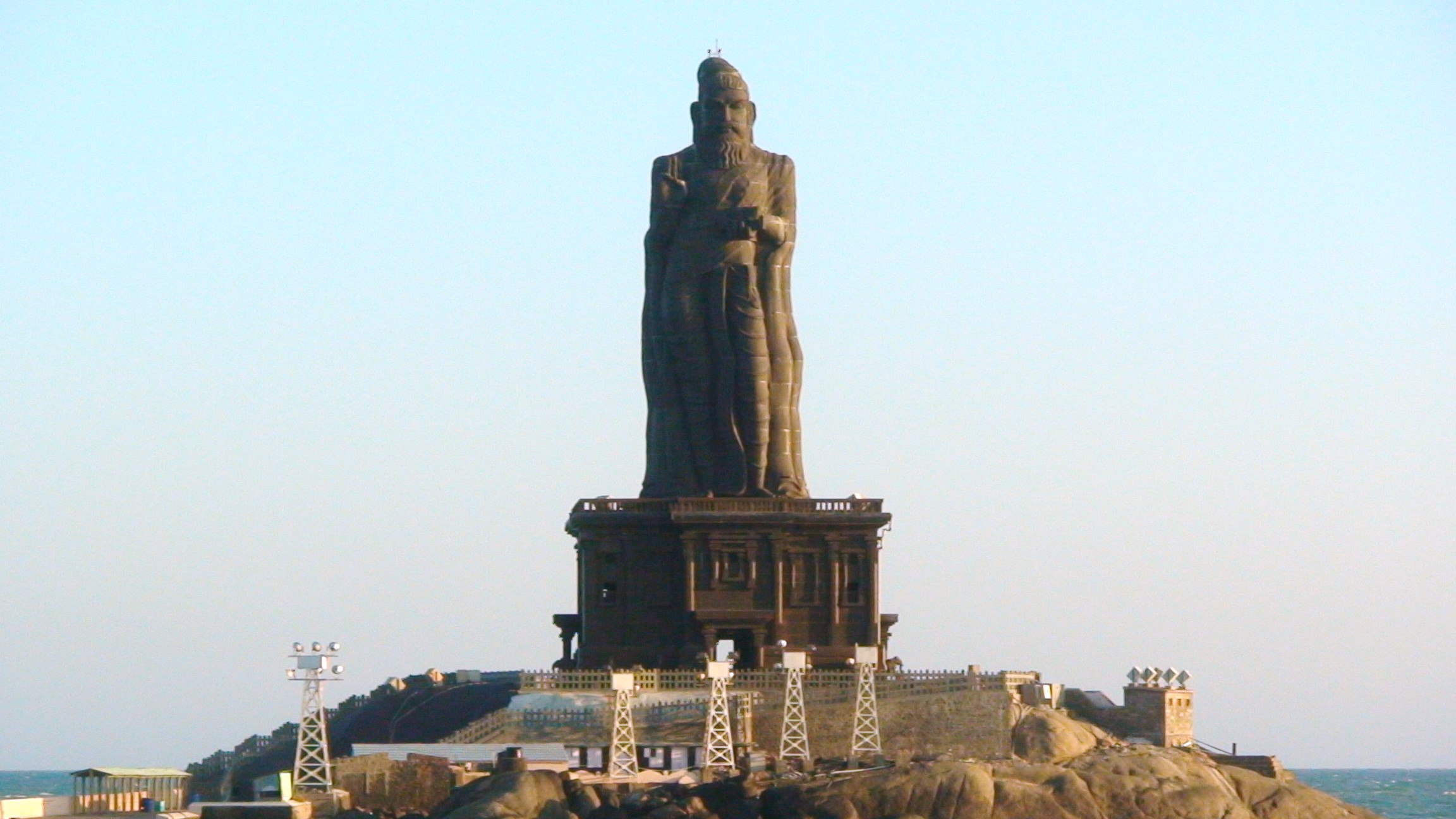
Kanniyakumari (; , referring to Devi Kanya Kumari), also known as Cape Comorin, is a city in Kanniyakumari district in the state of Tamil Nadu, India. It is the southern tip of the Indian subcontinent and the southernmost city in mainland India, thus referred to as 'The Land's End'. The city is situated south of Thiruvananthapuram city, and about south of Nagercoil, the headquarters of Kanniyakumari district. Kanniyakumari is a popular tourist destination and pilgrimage centre in India. Notable tourist spots include its unique sunrise and sunset points, the Thiruvalluvar Statue and Vivekananda Rock Memorial off the coast. Lying at the tip of peninsular India, the town is bordered on the west, south and east by the Laccadive Sea. It has a coastal line of stretched on the three sides. On the shores of the city is a temple dedicated to Goddess Kanniyakumari (the virgin Goddess), after which the town is named.https://thehinduimages.com/details-page.php?id=157918128 ... [...More Info...] [...Related Items...] OR: [Wikipedia] [Google] [Baidu] |


