|
Kaiserdamm
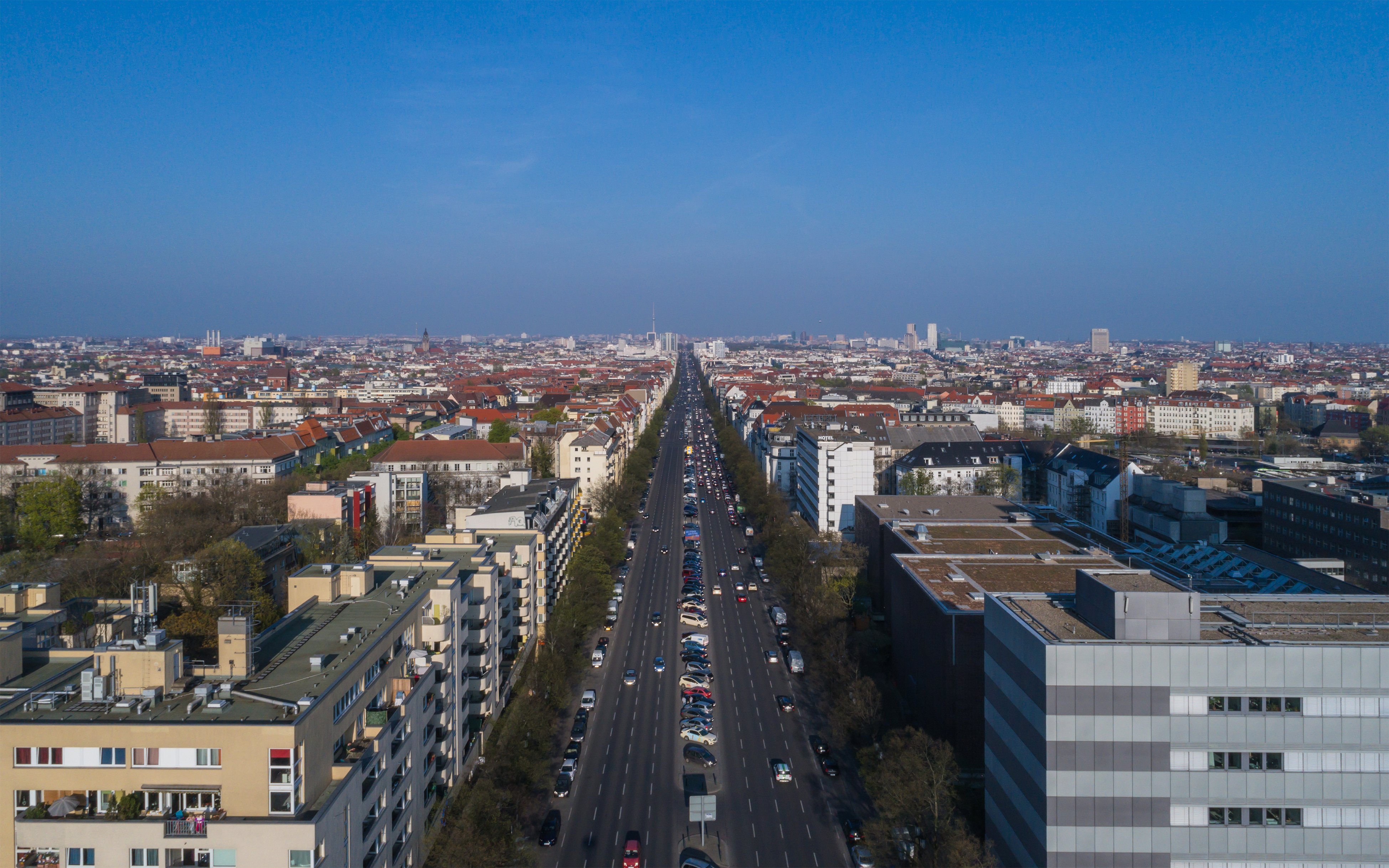
Kaiserdamm is a boulevard in the Westend and Charlottenburg districts of Berlin, Germany. Route Kaiserdamm is a 50m wide road, that runs for between Sophie-Charlotte-Platz in the east to Theodor-Heuss-Platz in the west. It forms a westward continuation of Bismarckstraße, Straße des 17. Juni and the Unter den Linden boulevard. History Originally an unpaved track, the road was inaugurated at the behest of Wilhelm II (after whom it is named), and opened to traffic in 1906. The road was rebuilt in 1939 as part of the East-West Axis of the planned Welthauptstadt Germania, and much of the road as it is today dates from this time. Buildings Kaiserdamm is served by the Kaiserdamm U-Bahn station positioned halfway between the Theodor-Heuss-Platz U-Bahn station and Sophie-Charlotte-Platz U-Bahn stations. Prominent buildings on the road include the studios of Rundfunk Berlin-Brandenburg Rundfunk Berlin-Brandenburg (; "Berlin-Brandenburg Broadcasting"; abbreviated: RBB , s ... [...More Info...] [...Related Items...] OR: [Wikipedia] [Google] [Baidu] |
Kaiserdamm (Berlin U-Bahn)
Kaiserdamm is a Berlin U-Bahn station located on line U2. It is linked to the Messe Nord/ICC station of the Berlin S-Bahn. Opened in 1908, this station was built by A. Grenander. In 1936, it was renamed to Kaiserdamm/Messedamm; in 1967 it got the name Adenauerdamm (Messedamm). However, protests from the people living nearby led to another change to the former name (Adenauer — the chancellor of West Germany was not well liked in Berlin in these days).J. Meyer-Kronthaler: Berlins U-Bahnhöfe. be.bra Verlag (1996) See also *Messe Berlin *International Congress Centrum *Zentraler Omnibusbahnhof Berlin The Zentraler Omnibusbahnhof Berlin (short: ''ZOB Berlin'') is a central bus station located at the Funkturm Berlin in the Berlin district Westend of the Charlottenburg-Wilmersdorf district. It was initiated by Gustav Severin (founder of the Asso ... References External links U2 (Berlin U-Bahn) stations Buildings and structures in Charlottenburg-Wilmersdorf Railway sta ... [...More Info...] [...Related Items...] OR: [Wikipedia] [Google] [Baidu] |
Westend (Berlin)
Westend () is a Boroughs and localities of Berlin, locality of the Berlin borough Charlottenburg-Wilmersdorf in Germany. It emerged in the course of Berlin's 2001 administrative reform on the grounds of the former Charlottenburg borough. Originally a mansion colony, it is today a quite densely settled, still affluent territory adjacent to Berlin's inner city in the east. Geography Westend is situated west of Berlin's inner city on Spandauer Berg, the northern peak of the sandy Teltow (region), Teltow plateau between the river valleys of Spree (river), Spree and Havel. It is centered on Theodor-Heuss-Platz, a large square, from where the Heerstraße (Berlin), Heerstraße arterial road, part of the Bundesstraße 2 and Bundesstraße 5 highways, runs west towards the Berlin city limits. In the west and north, Westend borders on the Berlin Spandau borough. The locality also includes the neighbourhoods of Neu-Westend and Ruhleben, a suburban housing area of the 1920s. The site of the for ... [...More Info...] [...Related Items...] OR: [Wikipedia] [Google] [Baidu] |
Theodor-Heuss-Platz (Berlin U-Bahn)
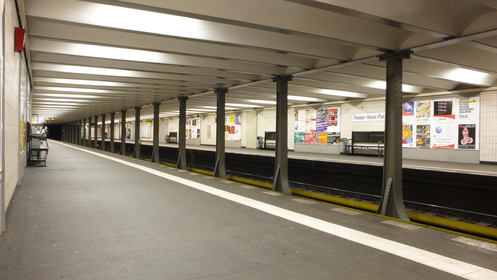
Theodor-Heuss-Platz is a station on line U2 of the Berlin U-Bahn, located in the Westend district. Overview When the station first opened on 29 March 1908, it was named ''Reichskanzlerplatz'' after the eponymous square laid out between 1904 and 1908, referring to the office of Chancellor of Germany and its inaugural holder, Otto von Bismarck. It had been built according to the plans of Alfred Grenander in the course of the second western extension of the 1902 ''Stammstrecke'' route, which originally ran from Warschauer Brücke (now Warschauer Straße) to Knie (now Ernst-Reuter-Platz). At the same time, the Sophie-Charlotte-Platz and Kaiserdamm stations were opened. Two weeks before the opening, Emperor William II had the occasion of a first trip on the new line on 14 March 1908. ''Reichskanzlerplatz'' remained the western terminus until the Stadion (now Olympia-Stadion) station opened in 1913. In the course of the Nazi takeover, the square and the station were renamed ''Ado ... [...More Info...] [...Related Items...] OR: [Wikipedia] [Google] [Baidu] |
Sophie-Charlotte-Platz (Berlin U-Bahn)
Sophie-Charlotte-Platz is a Berlin U-Bahn station on line U2. History The station was built by A. Grenander and opened in 1908. In 1935, the windows on top were removed. In 1938, the entrances of the station had to be moved. In 1988, twenty-six large paintings were attached to the walls showing the history of the subway before the First World War World War I (28 July 1914 11 November 1918), often abbreviated as WWI, was one of the deadliest global conflicts in history. Belligerents included much of Europe, the Russian Empire, the United States, and the Ottoman Empire, with fightin ....J. Meyer-Kronthaler: Berlins U-Bahnhöfe. be.bra Verlag (1996) It was heavily damaged by air raids on 15 February 1944. References U2 (Berlin U-Bahn) stations Buildings and structures in Charlottenburg-Wilmersdorf Railway stations in Germany opened in 1908 {{Berlin-railstation-stub ... [...More Info...] [...Related Items...] OR: [Wikipedia] [Google] [Baidu] |
Theodor-Heuss-Platz
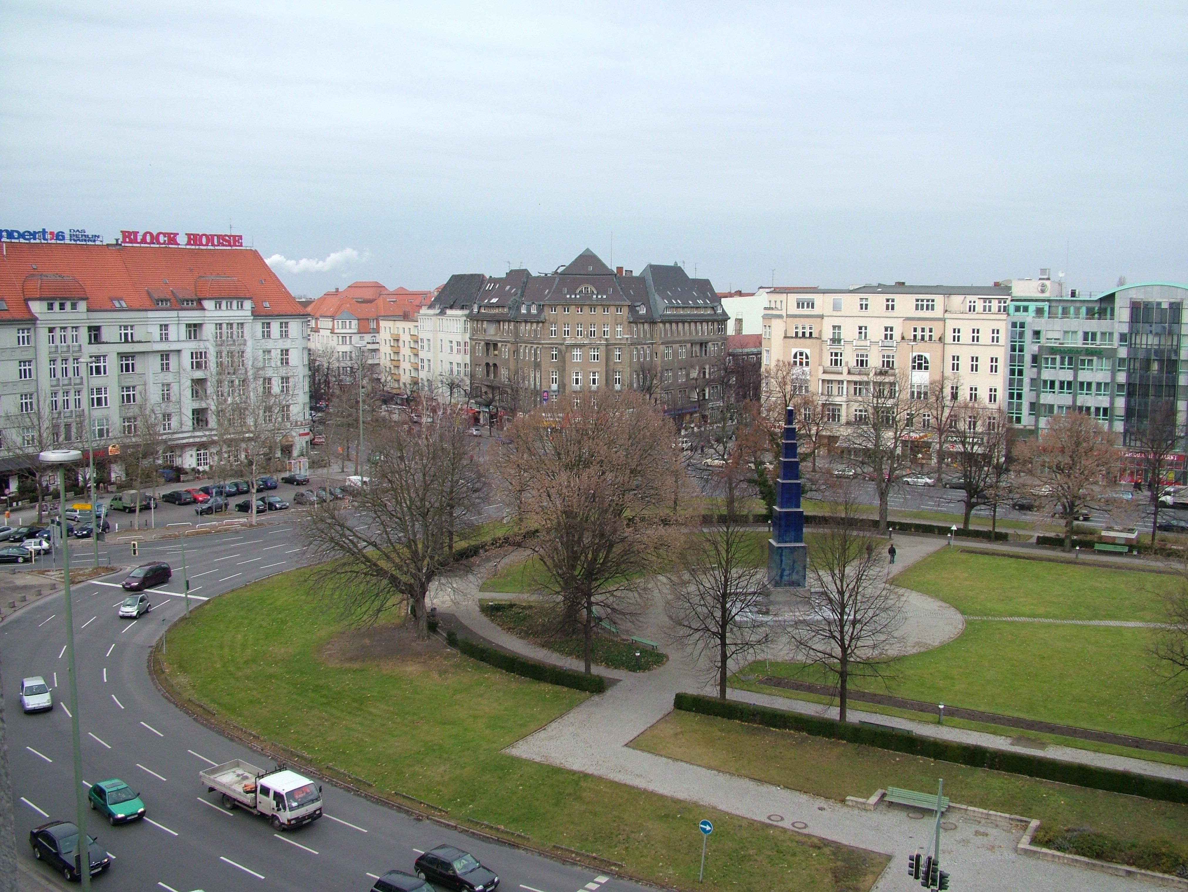
Theodor-Heuss-Platz (; colloquially called Theo by locals, ) is a large city square in the Westend district of Berlin, Germany. It is named after Theodor Heuss (1884–1963), the first President of Germany after World War II. Location The square is located at the western end of the wide Kaiserdamm boulevard, leading via Bismarckstraße, Straße des 17. Juni with the Berlin Victory Column and Brandenburg Gate in a direct line to Pariser Platz, Unter den Linden and the site of the City Palace in Berlin-Mitte. The axis is continued to the west by the Heerstraße up to Scholzplatz and further towards Spandau and the Berlin city limits. Underneath the square is the U-Bahn station Theodor-Heuss-Platz. History The square was laid out as part of the development of the new Westend district between 1904 and 1908 and then named ''Reichskanzlerplatz'' after the office of the Imperial Chancellor. When the eponymous U-Bahn station was inaugurated by Emperor Wilhelm II on 29 March 1908, t ... [...More Info...] [...Related Items...] OR: [Wikipedia] [Google] [Baidu] |
Berlin Th-Heuss-Platz UAV 04-2017 Img1
Berlin is the capital and largest city of Germany, both by area and by population. Its more than 3.85 million inhabitants make it the European Union's most populous city, as measured by population within city limits having gained this status after the United Kingdom's, and thus London's, departure from the European Union. Simultaneously, the city is one of the states of Germany, and is the third smallest state in the country in terms of area. Berlin is surrounded by the state of Brandenburg, and Brandenburg's capital Potsdam is nearby. The urban area of Berlin has a population of over 4.5 million and is therefore the most populous urban area in Germany. The Berlin-Brandenburg capital region has around 6.2 million inhabitants and is Germany's second-largest metropolitan region after the Rhine-Ruhr region, and the fifth-biggest metropolitan region by GDP in the European Union. Berlin was built along the banks of the Spree river, which flows into the Havel in the western bor ... [...More Info...] [...Related Items...] OR: [Wikipedia] [Google] [Baidu] |
Charlottenburg Kaiserdamm West
Charlottenburg () is a locality of Berlin within the borough of Charlottenburg-Wilmersdorf. Established as a town in 1705 and named after Sophia Charlotte of Hanover, Queen consort of Prussia, it is best known for Charlottenburg Palace, the largest surviving royal palace in Berlin, and the adjacent museums. Charlottenburg was an independent city to the west of Berlin until 1920 when it was incorporated into "Groß-Berlin" (Greater Berlin) and transformed into a borough. In the course of Berlin's 2001 administrative reform it was merged with the former borough of Wilmersdorf becoming a part of a new borough called Charlottenburg-Wilmersdorf. Later, in 2004, the new borough's districts were rearranged, dividing the former borough of Charlottenburg into the localities of Charlottenburg proper, Westend and Charlottenburg-Nord. Geography Charlottenburg is located in Berlin's inner city, west of the Großer Tiergarten park. Its historic core, the former village green of Alt Lie ... [...More Info...] [...Related Items...] OR: [Wikipedia] [Google] [Baidu] |
Boulevard
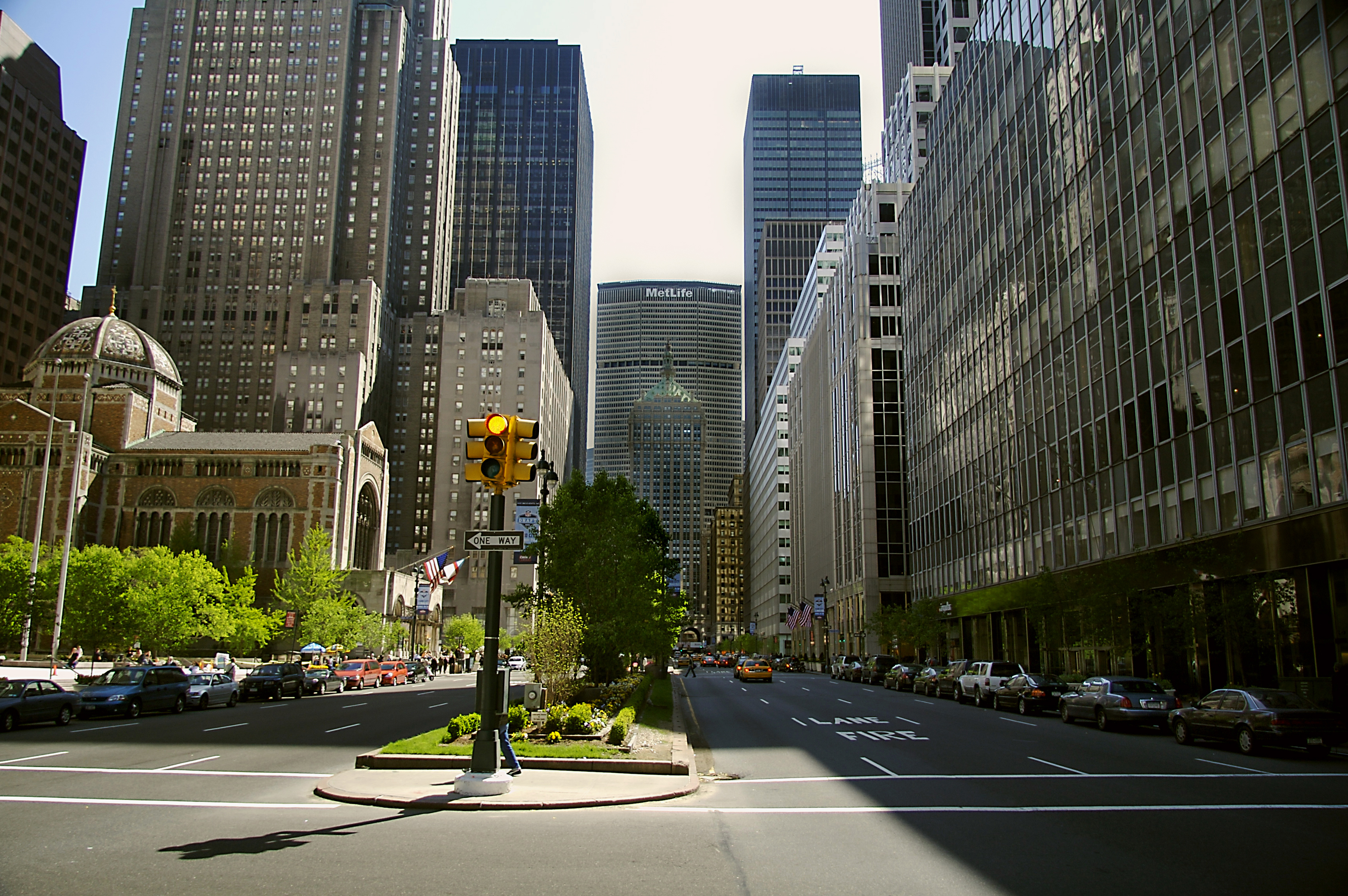
A boulevard is a type of broad avenue planted with rows of trees, or in parts of North America, any urban highway. Boulevards were originally circumferential roads following the line of former city walls. In American usage, boulevards may be wide, multi-lane arterial thoroughfares, often divided with a central median, and perhaps with side-streets along each side designed as slow travel and parking lanes and for bicycle and pedestrian usage, often with an above-average quality of landscaping and scenery. Etymology The word ''boulevard'' is borrowed from French. In French, it originally meant the flat surface of a rampart, and later a promenade taking the place of a demolished fortification. It is a borrowing from the Dutch word ' 'bulwark'. Usage world-wide Asia Cambodia Phnom Penh has numerous boulevards scattered throughout the city. Norodom Boulevard, Monivong Boulevard, Sihanouk Boulevard, and Kampuchea Krom Boulevard are the most famous. India * Bengaluru's Maha ... [...More Info...] [...Related Items...] OR: [Wikipedia] [Google] [Baidu] |
Charlottenburg
Charlottenburg () is a Boroughs and localities of Berlin, locality of Berlin within the borough of Charlottenburg-Wilmersdorf. Established as a German town law, town in 1705 and named after Sophia Charlotte of Hanover, Queen consort of Kingdom of Prussia, Prussia, it is best known for Charlottenburg Palace, the largest surviving royal palace in Berlin, and the adjacent museums. Charlottenburg was an independent city to the west of Berlin until 1920 when it was incorporated into "Greater Berlin Act, Groß-Berlin" (Greater Berlin) and transformed into a borough. In the course of Berlin's 2001 administrative reform it was merged with the former borough of Wilmersdorf becoming a part of a new borough called Charlottenburg-Wilmersdorf. Later, in 2004, the new borough's districts were rearranged, dividing the former borough of Charlottenburg into the localities of Charlottenburg proper, Westend (Berlin), Westend and Charlottenburg-Nord. Geography Charlottenburg is located in Berlin ... [...More Info...] [...Related Items...] OR: [Wikipedia] [Google] [Baidu] |
Berlin
Berlin ( , ) is the capital and largest city of Germany by both area and population. Its 3.7 million inhabitants make it the European Union's most populous city, according to population within city limits. One of Germany's sixteen constituent states, Berlin is surrounded by the State of Brandenburg and contiguous with Potsdam, Brandenburg's capital. Berlin's urban area, which has a population of around 4.5 million, is the second most populous urban area in Germany after the Ruhr. The Berlin-Brandenburg capital region has around 6.2 million inhabitants and is Germany's third-largest metropolitan region after the Rhine-Ruhr and Rhine-Main regions. Berlin straddles the banks of the Spree, which flows into the Havel (a tributary of the Elbe) in the western borough of Spandau. Among the city's main topographical features are the many lakes in the western and southeastern boroughs formed by the Spree, Havel and Dahme, the largest of which is Lake Müggelsee. Due to its l ... [...More Info...] [...Related Items...] OR: [Wikipedia] [Google] [Baidu] |
Unter Den Linden
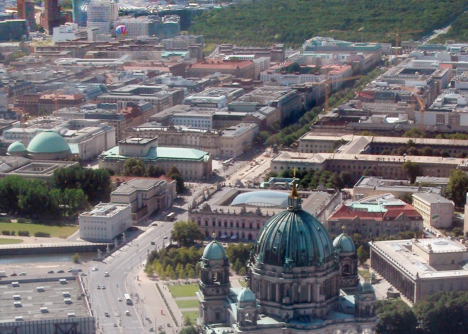
Unter den Linden (, "under the linden trees") is a boulevard in the central Mitte district of Berlin, the capital of Germany. Running from the City Palace to Brandenburg Gate, it is named after the linden (lime in England and Ireland, not related to citrus lime) trees that line the grassed pedestrian mall on the median and the two broad carriageways. The avenue links numerous Berlin sights, landmarks and rivers for sightseeing. Overview Unter den Linden runs east–west from the site of the Stadtschloss royal palace (main residence of the House of Hohenzollern) at the Lustgarten park, where the demolished Palace of the Republic once stood, to Pariser Platz and Brandenburg Gate. Eastward the boulevard crosses the Spree river at Berlin Cathedral and continues as Karl-Liebknecht-Straße. The western continuation behind Brandenburg Gate is Straße des 17. Juni. Major north–south streets crossing Unter den Linden are Friedrichstraße and Wilhelmstrasse. Unter den Linden, w ... [...More Info...] [...Related Items...] OR: [Wikipedia] [Google] [Baidu] |
