|
Kyzyl-Kiya Airport
The Kyzyl-Kiya Airport ( Kyrgyz: Кызыл-Кыя аэропорту, Russian: Кызыл-Кийский аэропорт) serves Kyzyl-Kiya and Pulgon, towns in Kadamjay District of Batken Province (''oblast''), Kyrgyzstan. The Russian IATA code for Kyzyl-Kiya Airport is КЫК. Kyzyl-Kiya Airport started operations in the 1930s as a landing strip near the mining town. The current runway and terminal were built in the 1970s. It is a regional class 3C airport. The runway has a weight limit of 22 tonnes, and has no instrument landing facilities and operates only during daylight hours. Although Kyzyl-Kiya Airport is near the border with Uzbekistan, it has no customs and border control checks and serves only flights within Kyrgyzstan. Until 2002, Kyzyl-Kiya had year-round links with Bishkek, Osh and Cholpon-Ata Cholpon-Ata ( ky, Чолпон-Ата, ''Çolpon-Ata'', چولپون-اتا, pronounced , literally "Venus-father", the name of a mythological protecting spirit) is ... [...More Info...] [...Related Items...] OR: [Wikipedia] [Google] [Baidu] |
Kyzyl-Kiya
Kyzyl-Kyya ( ky, Кызыл-Кыя, russian: Кызыл-Кия ''Kyzyl-Kiya'') is a city in Batken Region, in southwestern Kyrgyzstan. It is a city of regional significance, not part of a district, and consists of the town proper and the villages Karavan, Ak-Bulak and Jin-Jigen. Its area is , and its resident population was 56,819 in 2021 (both including the villages Karavan, Ak-Bulak and Jin-Jigen). It is situated on the southern edge of the Fergana Valley, 32 km southeast of Fergana, and 65 km southwest of Osh. The town is one of the oldest centers of the coal mining industry in Kyrgyzstan. Population Geography Climate Kyzyl-Kyya has a cold semi-arid climate (Köppen climate classification The Köppen climate classification is one of the most widely used climate classification systems. It was first published by German-Russian climatologist Wladimir Köppen (1846–1940) in 1884, with several later modifications by Köppen, notabl ... ''BSk''). The average annua ... [...More Info...] [...Related Items...] OR: [Wikipedia] [Google] [Baidu] |
Kadamjay District
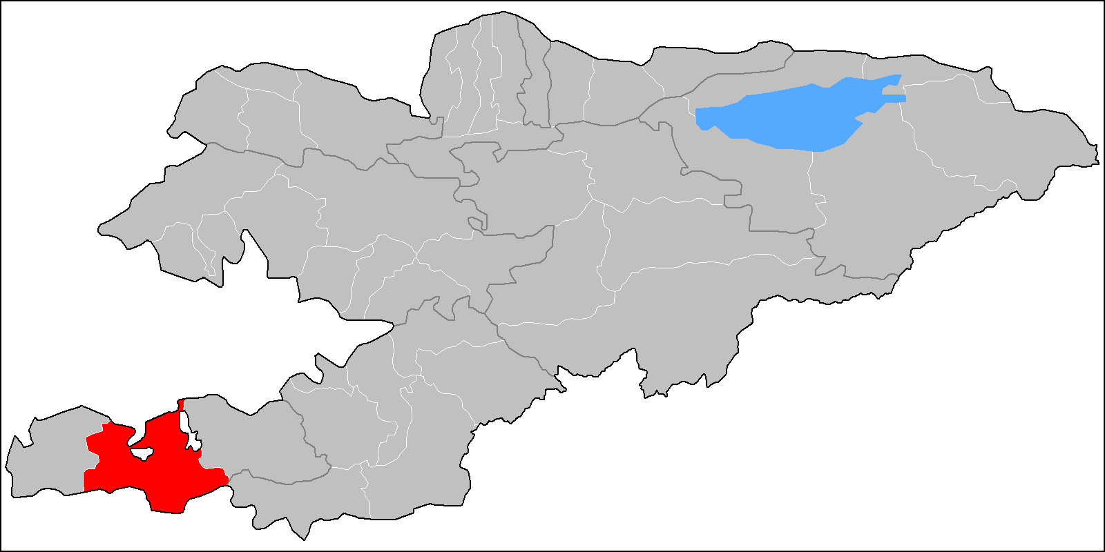
Kadamjay District ( ky, Кадамжай району; russian: Кадамжайский район) is a district in Batken Region, in south-western Kyrgyzstan. The administrative seat lies at Kadamjay. The district area is , and its resident population was 201,457 in 2021. The largest town of the district, Kadamjay, is located between the cities of Aydarken (Khaidarkan) and Kyzyl-Kyya. The district is thought to have the second largest mercury-antimony deposit in the world. Kadamjay Antimony Factory is one of the biggest factories in Kyrgyzstan. Khaidarkan Mercury Plant, built in 1942, was reported, as of 2005, to produce 300 to 600 metric tons of mercury per year. Ak-Suu (white river) is the river which passes through Kadamjay. Jiydelik lake is a favorite picnic spot. Population Rural communities and villages In total, Kadamjay District include 2 cities and 115 villages in 13 rural communities (). Each rural community can consist of one or several villages. The rural com ... [...More Info...] [...Related Items...] OR: [Wikipedia] [Google] [Baidu] |
Kyrgyzstan Air Company
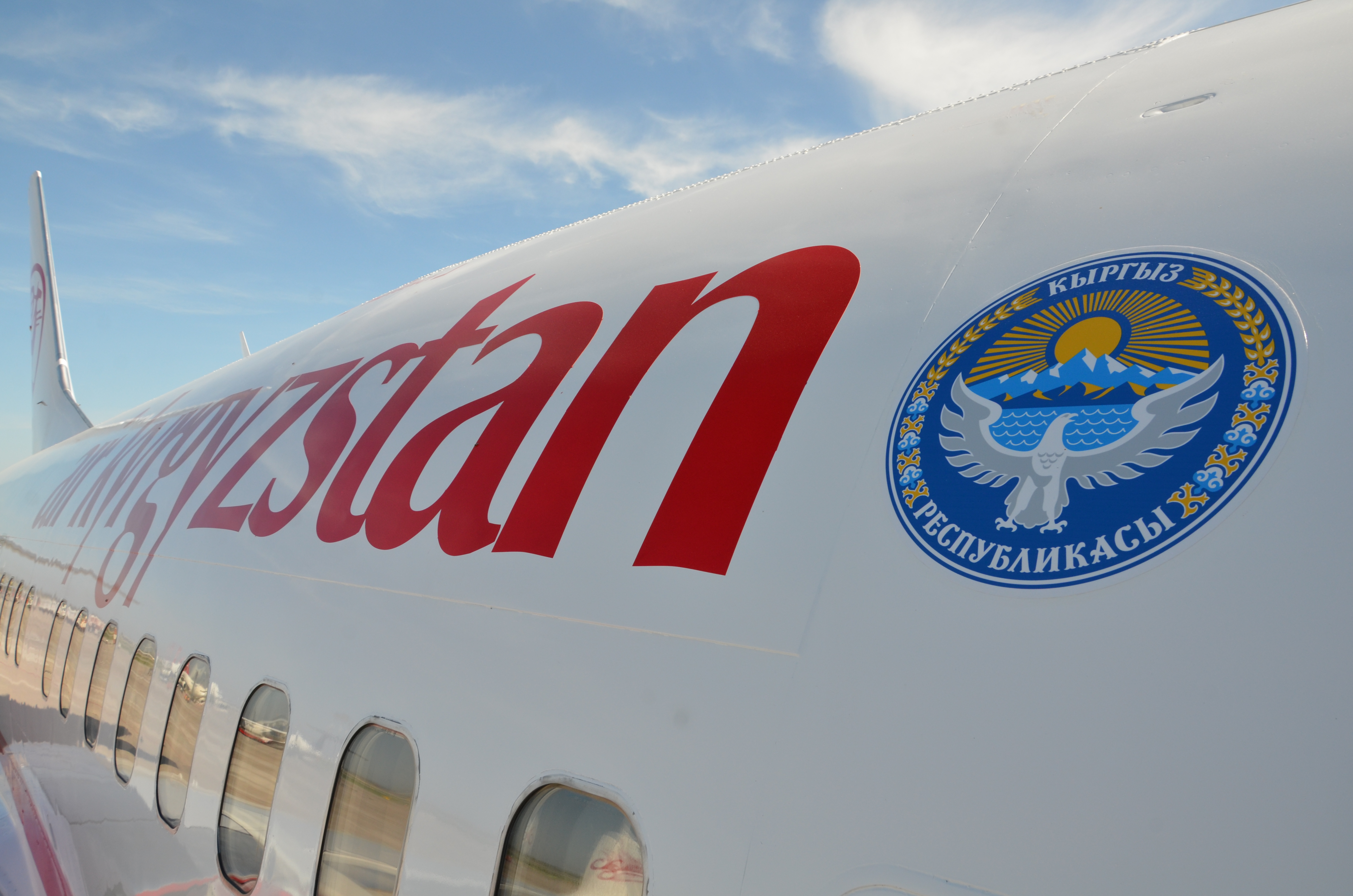
Kyrgyzstan Air Company, operating as Air Kyrgyzstan ( ky, Эйр Кыргызстан Авиакомпаниясы, ''Eýr Kyrgyzstan Aviakompaniýasy''; russian: Авиакомпания «Эйр Кыргызстан», ''Aviakompaniya «Air Kyrgyzstan»''), is the flag carrier of Kyrgyzstan based in Bishkek. It operates scheduled domestic and international services to 13 destinations as well as charter services. Its main hub is Manas International Airport in Bishkek, with a hub at Osh Airport in Osh. The owner of 100% of the shares is the Government of the Kyrgyz Republic represented by the Fund for State Property Management under the Government of the Kyrgyz Republic. The airline along with all airlines based in Kyrgyzstan are on the list of air carriers banned in the European Union. History The airline was founded in April 2001 as Altyn Air. It was rebranded as Kyrgyzstan Air Company on 28 July 2006, after taking over former national carrier Kyrgyzstan Airlines. On Dec ... [...More Info...] [...Related Items...] OR: [Wikipedia] [Google] [Baidu] |
Kyrgyz Language
Kyrgyz (; autonym: , tr. ''Kyrgyz tili'', ) is a Turkic language of the Kipchak branch spoken in Central Asia. Kyrgyz is the official language of Kyrgyzstan and a significant minority language in the Kizilsu Kyrgyz Autonomous Prefecture in Xinjiang, China and in the Gorno-Badakhshan Autonomous Region of Tajikistan. There is a very high level of mutual intelligibility between Kyrgyz, Kazakh, and Altay. A dialect of Kyrgyz known as Pamiri Kyrgyz is spoken in Afghanistan and Pakistan. Kyrgyz is also spoken by many ethnic Kyrgyz through the former Soviet Union, Afghanistan, Turkey, parts of northern Pakistan, and Russia. Kyrgyz was originally written in Göktürk script, gradually replaced by the Perso-Arabic alphabet (in use until 1928 in the USSR, still in use in China). Between 1928 and 1940 a Latin-script alphabet, the Uniform Turkic Alphabet, was used. In 1940, Soviet authorities replaced the Latin script with the Cyrillic alphabet for all Turkic countries. When Kyrgy ... [...More Info...] [...Related Items...] OR: [Wikipedia] [Google] [Baidu] |
Russian Alphabet
The Russian alphabet (russian: ру́сский алфави́т, russkiy alfavit, , label=none, or russian: ру́сская а́збука, russkaya azbuka, label=none, more traditionally) is the script used to write the Russian language. It comes from the Cyrillic script, which was devised in the 9th century for the first Slavic literary language, Old Slavonic. Initially an old variant of the Bulgarian alphabet, it became used in the Kievan Rusʹ since the 10th century to write what would become the Russian language. The modern Russian alphabet consists of 33 letters: twenty consonants (, , , , , , , , , , , , , , , , , , , ), ten vowels (, , , , , , , , , ), a semivowel / consonant (), and two modifier letters or "signs" (, ) that alter pronunciation of a preceding consonant or a following vowel. Letters : An alternative form of the letter El () closely resembles the Greek letter lambda (). Historic letters Letters eliminated in 1917–18 * — Identical ... [...More Info...] [...Related Items...] OR: [Wikipedia] [Google] [Baidu] |
Batken Province
Batken Region ( ky, Баткен облусу, Batken oblusu; russian: Баткенская область, Batkenskaya oblast) is a region ('' oblus'') of Kyrgyzstan. Its capital is Batken. It is bounded on the east by Osh Region, on the south, west and north by Tajikistan, and on the northeast by Uzbekistan. The northern part of the region is part of the flat, agricultural Ferghana Valley. The land rises southward to the mountains on the southern border: the Alay Mountains in the east, and the Turkestan Range in the west. Its total area is . The resident population of the region was 548,247 as of January 2021. The region has sizeable Uzbek (14.7% in 2009) and Tajik (6.9% in 2009) minorities. History Batken Region was created on 15 October 1999 from the westernmost section of Osh Region. This was partly in response to the activities of the Islamic Movement for Uzbekistan (IMU), with bases in Tajikistan. In 1999 they kidnapped a group of Japanese geologists and in 2000 some Amer ... [...More Info...] [...Related Items...] OR: [Wikipedia] [Google] [Baidu] |
Oblast
An oblast (; ; Cyrillic (in most languages, including Russian and Ukrainian): , Bulgarian: ) is a type of administrative division of Belarus, Bulgaria, Kazakhstan, Kyrgyzstan, Russia, and Ukraine, as well as the Soviet Union and the Kingdom of Yugoslavia. Official terms in successor states of the Soviet Union differ, but some still use a cognate of the Russian term, e.g., ''vobłasć'' (''voblasts'', ''voblasts'', official orthography: , Taraškievica: , ) is used for regions of Belarus, ' (plural: ') for regions of Kazakhstan, and ''oblusu'' (') for regions of Kyrgyzstan. The term is often translated as "area", "zone", "province" or "region". The last translation may lead to confusion, because "raion" may be used for other kinds of administrative division, which may be translated as "region", "district" or "county" depending on the context. Unlike "province", translations as "area", "zone", and "region" may lead to confusion because they have very common meanings other t ... [...More Info...] [...Related Items...] OR: [Wikipedia] [Google] [Baidu] |
Kyrgyzstan
Kyrgyzstan,, pronounced or the Kyrgyz Republic, is a landlocked country in Central Asia. Kyrgyzstan is bordered by Kazakhstan to the north, Uzbekistan to the west, Tajikistan to the south, and the People's Republic of China to the east. Its capital and largest city is Bishkek. Ethnic Kyrgyz make up the majority of the country's seven million people, followed by significant minorities of Uzbeks and Russians. The Kyrgyz language is closely related to other Turkic languages. Kyrgyzstan's history spans a variety of cultures and empires. Although geographically isolated by its highly mountainous terrain, Kyrgyzstan has been at the crossroads of several great civilizations as part of the Silk Road along with other commercial routes. Inhabited by a succession of tribes and clans, Kyrgyzstan has periodically fallen under larger domination. Turkic nomads, who trace their ancestry to many Turkic states. It was first established as the Yenisei Kyrgyz Khaganate later in the ... [...More Info...] [...Related Items...] OR: [Wikipedia] [Google] [Baidu] |
Bishkek
Bishkek ( ky, Бишкек), ), formerly Pishpek and Frunze, is the capital and largest city of Kyrgyzstan. Bishkek is also the administrative centre of the Chüy Region. The region surrounds the city, although the city itself is not part of the region but rather a region-level unit of Kyrgyzstan. Bishkek is situated near the Kazakhstan–Kyrgyzstan border. Its population was 1,074,075 in 2021. In 1825, the Khanate of Kokand established the fortress of Pishpek to control local caravan routes and to collect tribute from Kyrgyz tribes. On 4 September 1860, with the approval of the Kyrgyz, Russian forces led by Colonel Apollon Zimmermann destroyed the fortress. In the present day, the fortress ruins can be found just north of Jibek jolu street, near the new main mosque. In 1868, a Russian settlement was established on the site of the fortress under its original name, Pishpek. It lay within the General Governorship of Russian Turkestan and its Semirechye Oblast. In 1925, the K ... [...More Info...] [...Related Items...] OR: [Wikipedia] [Google] [Baidu] |
Cholpon-Ata
Cholpon-Ata ( ky, Чолпон-Ата, ''Çolpon-Ata'', چولپون-اتا, pronounced , literally "Venus-father", the name of a mythological protecting spirit) is a resort town on the northern shore of Lake Issyk-Kul in Kyrgyzstan with a population of 14,237 (2021). It is the administrative center of the Issyk-Kul District of Issyk-Kul Region; this district occupies most of the lake's north shore. To the west along highway A363 is Tamchy and to the east, Bosteri. The town contains numerous large and small sanatoria, hotels and guesthouses to accommodate the many visitors who descend upon the lake in summer. During the Soviet era it was much frequented by vacationers brought here in organized mass tours from other parts of the USSR. Holidaymakers now usually visit on their own or in small groups and originate mainly from Kyrgyzstan, Kazakhstan and Uzbekistan. Attracting more demanding foreign tourists will require substantial upgrading of the existing facilities, but the location ... [...More Info...] [...Related Items...] OR: [Wikipedia] [Google] [Baidu] |
Airports In Kyrgyzstan
This is a list of airports in Kyrgyzstan, sorted by location. __TOC__ Airports Airport names shown in bold indicate the airport has scheduled service on commercial airlines. Out of 86 airports, aerodromes and landing strips ever built in Kyrgyzstan, only the ones with functioning runways are listed below. See also * Transport in Kyrgyzstan * List of airports by ICAO code: U#UA - Kazakhstan, Kyrgyzstan * Wikipedia:WikiProject Aviation/Airline destination lists: Asia#Kyrgyzstan References * * – includes IATA codes Great Circle Mapper: Airports in Kyrgyzstannbsp;– IATA and ICAO codes World Aero Data: Kyrgyzstannbsp;– ICAO codes and coordinates {{Asia in topic, List of airports in, state=expanded Kyrgyzstan Airports Airports Kyrgyzstan Kyrgyzstan,, pronounced or the Kyrgyz Republic, is a landlocked country in Central Asia. Kyrgyzstan is bordered by Kazakhstan to the north, Uzbekistan to the west, Tajikistan to the south, and the People's Re ... [...More Info...] [...Related Items...] OR: [Wikipedia] [Google] [Baidu] |

