|
Kew Gardens–Union Turnpike Station
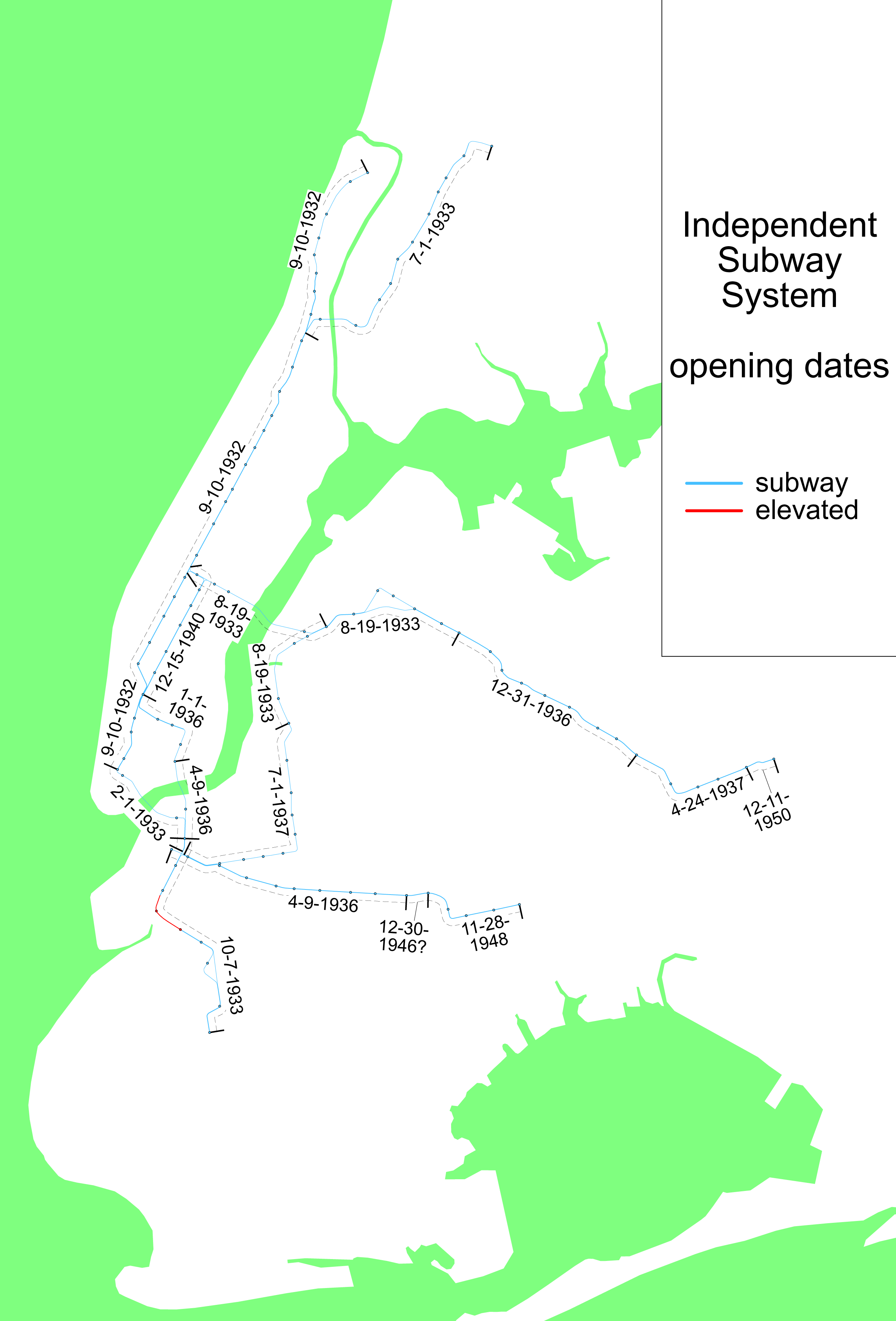
The Kew Gardens–Union Turnpike station (signed as Union Turnpike–Kew Gardens station on overhead and entrance signs) is an express station on the IND Queens Boulevard Line of the New York City Subway. Located at Union Turnpike and Queens Boulevard on the border of Kew Gardens and Forest Hills, Queens, it is served by the E and F trains at all times, and the <F> train during rush hours in the reverse peak direction. Despite the station's name, Union Turnpike forms the border between Kew Gardens and Forest Hills, and the station straddles that border, with multiple entrances located in each neighborhood. The station opened on December 31, 1936 as the new terminal for the Independent Subway System's Queens Boulevard Line. The opening of the station brought significant growth to the adjacent communities of Forest Hills and Kew Gardens, transforming them from quiet residential communities to active population centers. The station became compliant with the Americans w ... [...More Info...] [...Related Items...] OR: [Wikipedia] [Google] [Baidu] |
Union Turnpike (New York)
Union Turnpike is a thoroughfare stretching across part of Long Island in southern New York state, mostly within central and eastern Queens in New York City. It runs from Myrtle Avenue in Glendale, Queens, to Marcus Avenue in North New Hyde Park, Nassau County, about outside New York City border. The name memorializes the Union Racetrack, once a famous attraction for Queens residents. Union Turnpike from Myrtle Avenue to the Nassau County border is long. The turnpike crosses into Nassau County at the city's easternmost point on Langdale Street, two blocks past the city's highest-numbered street (271st Street). North of the turnpike at this point is Glen Oaks and south of it is Floral Park, both sharing the same ZIP code (11004). It then enters the hamlet of North New Hyde Park. Description Starting from the intersection of Myrtle Avenue, 86th Street and the Jackie Robinson Parkway's east-bound exit 5 ramps in Glendale, Union Turnpike crosses Woodhaven Boulevard. It ... [...More Info...] [...Related Items...] OR: [Wikipedia] [Google] [Baidu] |
Q37 (New York City Bus)
The Q37 bus route constitutes a public transit line in Queens, New York City, running primarily along 111th Street between Kew Gardens and South Ozone Park. The Q37 was formerly privately operated by Green Bus Lines, under a subsidized franchise with the New York City Department of Transportation (NYCDOT). The route is now operated by MTA Regional Bus Operations under the MTA Bus Company brand. The Q37 serves the Resorts World Casino in South Ozone Park. During weekdays, some buses bypass the Resorts World Casino and are designated Q37B. Route description and service The Q37 bus originates at Queens Boulevard and Union Turnpike, where a vast majority of the riders of the Q37 transfer to the New York City Subway at the Kew Gardens–Union Turnpike subway station. The bus turns via Kew Gardens Road, and then turns south via 80th Road, and then buses turn onto Park Lane. Buses at this point going northbound continue via Park Lane and then turn on Union Turnpike. After running ... [...More Info...] [...Related Items...] OR: [Wikipedia] [Google] [Baidu] |
Q10 (New York City Bus)
The Q10 bus route constitutes a public transit line in Queens, New York City, running primarily along Lefferts Boulevard between a transfer with the New York City Subway in Kew Gardens to the AirTrain JFK's Lefferts Boulevard station at John F. Kennedy International Airport. Formerly privately operated by Green Bus Lines, the route is currently city-operated under the MTA Bus Company brand of MTA Regional Bus Operations. Route description and service There are two variants of the Q10: a local-stop version making all stops, and a limited-stop service that skips certain stops. The limited-stop service runs every day from about 6:00 AM to 9:00 PM. The southbound Q10 begins at the Kew Gardens–Union Turnpike subway station at Kew Gardens Road and 80th Road, where transfer is available to the . It then turns left on 80th Road, and then left onto Austin Street, heading southeast. Afterward, the Q10 turns right onto Lefferts Boulevard, where it continues south until Rockaway Boulev ... [...More Info...] [...Related Items...] OR: [Wikipedia] [Google] [Baidu] |
Q46 (New York City Bus)
The Q46 bus route constitutes a public transit line in Queens, New York City, running primarily along Union Turnpike. Its western terminus is a major transfer with the New York City Subway's IND Queens Boulevard Line at the Kew Gardens–Union Turnpike station. At its eastern end, the Q46 has branches to the Glen Oaks neighborhood of Queens and to Long Island Jewish Hospital (LIJ) in the village of Lake Success in Nassau County. Formerly named the Q44A, the bus route was originally operated by the North Shore Bus Company from December 4, 1939 to 1947 when the company's routes were taken over by the New York City Board of Transportation. In 1974, the route was extended into Nassau County at Lakeville Road to serve LIJ Hospital. In 1977, limited-stop service on the route commenced, speeding up travel times for passengers in Eastern Queens. On April 12, 1990, the bus route was renumbered to Q46. It was extended from Lakeville Road to LIJ Hospital on September 7, 1997. Overnigh ... [...More Info...] [...Related Items...] OR: [Wikipedia] [Google] [Baidu] |
Americans With Disabilities Act Of 1990
The Americans with Disabilities Act of 1990 or ADA () is a civil rights law that prohibits discrimination based on disability. It affords similar protections against discrimination to Americans with disabilities as the Civil Rights Act of 1964, which made discrimination based on race, religion, sex, national origin, and other characteristics illegal, and later sexual orientation and gender identity. In addition, unlike the Civil Rights Act, the ADA also requires covered employers to provide reasonable accommodations to employees with disabilities, and imposes accessibility requirements on public accommodations. In 1986, the National Council on Disability had recommended the enactment of an Americans with Disabilities Act (ADA) and drafted the first version of the bill which was introduced in the House and Senate in 1988. A broad bipartisan coalition of legislators supported the ADA, while the bill was opposed by business interests (who argued the bill imposed costs on b ... [...More Info...] [...Related Items...] OR: [Wikipedia] [Google] [Baidu] |
Independent Subway System
The Independent Subway System (IND or ISS), formerly known as the Independent City-Owned Subway System (ICOSS) or the Independent City-Owned Rapid Transit Railroad (ICORTR), was a rapid transit rail system in New York City that is now part of the New York City Subway. It was first constructed as the Eighth Avenue Line in Manhattan in 1932. One of three rail networks that became part of the modern New York City subway, the IND was intended to be fully owned and operated by the municipal government, in contrast to the privately operated or jointly funded Interborough Rapid Transit Company (IRT) and Brooklyn–Manhattan Transit Corporation (BMT) companies. It was merged with these two networks in 1940. The original IND service lines are the modern subway's A, B, C, D, E, F, and G services. In addition, the BMT's M, N, Q and R now run partly on IND trackage. The Rockaway Park Shuttle supplements the A service. For operational purposes, the IND and BMT lines and service ... [...More Info...] [...Related Items...] OR: [Wikipedia] [Google] [Baidu] |
Fd (New York City Subway Service)
The F and <F> Queens Boulevard Express/Sixth Avenue Local are two rapid transit services in the B Division of the New York City Subway. Their route bullets are colored , since they use and are part of the IND Sixth Avenue Line in Manhattan. The F operates at all times between 179th Street in Jamaica, Queens and Stillwell Avenue in Coney Island, Brooklyn, making all stops except for an express section in Queens between Forest Hills–71st Avenue and 21st Street–Queensbridge. Some trains terminate at Church Avenue or Kings Highway. Two scheduled rush hour trips in the peak direction run express in Brooklyn between Jay Street–MetroTech and Church Avenue, making one stop in between at Seventh Avenue. This express service was introduced in September 2019. In Brooklyn, local service is denoted as (F) in a circle-shaped bullet while express service is denoted as <F> in a diamond-shaped bullet. From 1968 to 1976, the F ran express along the IND Culver Line in Br ... [...More Info...] [...Related Items...] OR: [Wikipedia] [Google] [Baidu] |
F (New York City Subway Service)
The F and <F> Queens Boulevard Express/Sixth Avenue Local are two rapid transit services in the B Division of the New York City Subway. Their route bullets are colored , since they use and are part of the IND Sixth Avenue Line in Manhattan. The F operates at all times between 179th Street in Jamaica, Queens and Stillwell Avenue in Coney Island, Brooklyn, making all stops except for an express section in Queens between Forest Hills–71st Avenue and 21st Street–Queensbridge. Some trains terminate at Church Avenue or Kings Highway. Two scheduled rush hour trips in the peak direction run express in Brooklyn between Jay Street–MetroTech and Church Avenue, making one stop in between at Seventh Avenue. This express service was introduced in September 2019. In Brooklyn, local service is denoted as (F) in a circle-shaped bullet while express service is denoted as <F> in a diamond-shaped bullet. From 1968 to 1976, the F ran express along the IND Culver Line in ... [...More Info...] [...Related Items...] OR: [Wikipedia] [Google] [Baidu] |
E (New York City Subway Service)
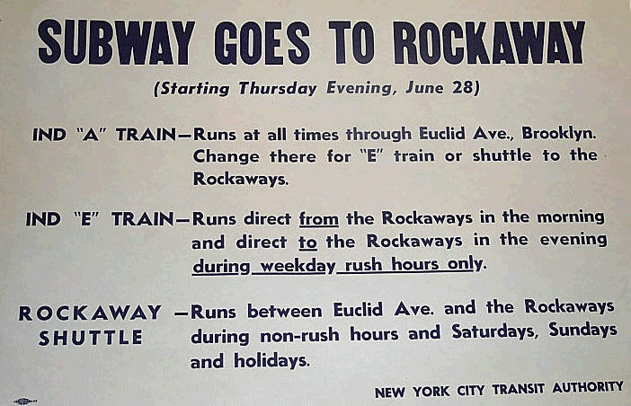
The E Eighth Avenue Local is a rapid transit service in the B Division of the New York City Subway. Its route emblem, or "bullet", is blue since it uses the IND Eighth Avenue Line in Manhattan. The E operates at all times between Jamaica Center–Parsons/Archer in Jamaica, Queens, and the World Trade Center in Lower Manhattan; additional service during weekday rush hours originates and terminates at Jamaica–179th Street instead of Jamaica Center–Parsons/Archer. Daytime service operates express in Queens and local in Manhattan; late night service makes local stops along its entire route. E service, which is one of the most heavily used services in the subway system, started in 1933 with the opening of the IND Queens Boulevard Line. In its early years, the E train ran along the Rutgers Street Tunnel and South Brooklyn Line to Brooklyn, though this service pattern stopped by 1940. Until 1976, E train ran to Brooklyn and Queens via the IND Fulton Street Line and I ... [...More Info...] [...Related Items...] OR: [Wikipedia] [Google] [Baidu] |
New York City Subway
The New York City Subway is a rapid transit system owned by the government of New York City and leased to the New York City Transit Authority, an affiliate agency of the state-run Metropolitan Transportation Authority (MTA). Opened on October 27, 1904, the New York City Subway is one of the world's oldest public transit systems, one of the most-used, and the one with the most stations, with 472 stations in operation (424 if stations connected by transfers are counted as single stations). Stations are located throughout the boroughs of Manhattan, Brooklyn, Queens, and the Bronx. The system has operated 24/7 service every day of the year throughout most of its history, barring emergencies and disasters. By annual ridership, the New York City Subway is the busiest rapid transit system in both the Western Hemisphere and the Western world, as well as the seventh-busiest rapid transit rail system in the world. In , the subway delivered rides, or about per weekday as of . ... [...More Info...] [...Related Items...] OR: [Wikipedia] [Google] [Baidu] |
Metro Station
A metro station or subway station is a station for a rapid transit system, which as a whole is usually called a "metro" or "subway". A station provides a means for passengers to purchase tickets, board trains, and evacuate the system in the case of an emergency. In the United Kingdom, they are known as underground stations, most commonly used in reference to the London Underground. Location The location of a metro station is carefully planned to provide easy access to important urban facilities such as roads, commercial centres, major buildings and other transport nodes. Most stations are located underground, with entrances/exits leading up to ground or street level. The bulk of the station is typically positioned under land reserved for public thoroughfares or parks. Placing the station underground reduces the outside area occupied by the station, allowing vehicles and pedestrians to continue using the ground-level area in a similar way as before the station's constructio ... [...More Info...] [...Related Items...] OR: [Wikipedia] [Google] [Baidu] |
_56.jpg)


