|
Jōren Falls
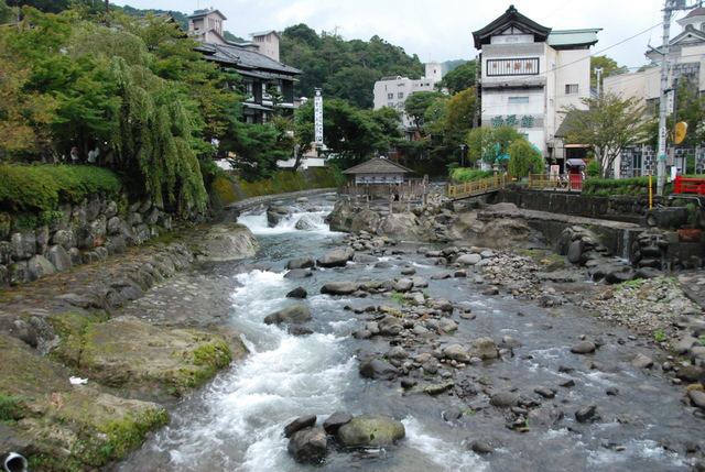
is a waterfall in the Yugashima district of Izu, Shizuoka, Izu city, Shizuoka Prefecture, Japan, in central Izu Peninsula on the upper reaches of the Kano River. It is a Shizuoka Prefectural Natural Monument. It is one of "Japan’s Top 100 Waterfalls", in a listing published by the Japanese Ministry of the Environment (Japan), Ministry of the Environment in 1990. According to Japanese folklore, Jōren Falls is home to the ''jorōgumo'', a spider that can transform into a seductive woman. References External linksJōren Falls tourism home page Waterfalls of Japan Landforms of Shizuoka Prefecture Tourist attractions in Shizuoka Prefecture Izu, Shizuoka {{Shizuoka-geo-stub ... [...More Info...] [...Related Items...] OR: [Wikipedia] [Google] [Baidu] |
Izu, Shizuoka
is a city located in central Izu Peninsula in Shizuoka Prefecture, Japan. , the city had an estimated population of 30,678 in 13,390 households, and a population density of 84 persons per km2. The total area of the city was . Geography Izu is located in the north-central portion of the Izu Peninsula, and includes most of the Amagi Mountains. The region is hilly and some 80% of the city area is covered by forest. The Kano River runs through the city, which has a short coastline to the west on Suruga Bay of the Pacific Ocean. The area is part of the Izu-Tobu volcanic region, and is therefore subject to frequent earthquakes, and the city also has numerous hot springs as a result. Warmed by the Kuroshio Current, the area enjoys a warm maritime climate with hot, humid summers and mild, cool winters. Surrounding municipalities *Shizuoka Prefecture **Numazu **Izunokuni ** Itō ** Higashiizu ** Kawazu ** Nishiizu Demographics Per Japanese census data, the population of Izu has ... [...More Info...] [...Related Items...] OR: [Wikipedia] [Google] [Baidu] |
Japan
Japan ( ja, 日本, or , and formally , ''Nihonkoku'') is an island country in East Asia. It is situated in the northwest Pacific Ocean, and is bordered on the west by the Sea of Japan, while extending from the Sea of Okhotsk in the north toward the East China Sea, Philippine Sea, and Taiwan in the south. Japan is a part of the Ring of Fire, and spans Japanese archipelago, an archipelago of List of islands of Japan, 6852 islands covering ; the five main islands are Hokkaido, Honshu (the "mainland"), Shikoku, Kyushu, and Okinawa Island, Okinawa. Tokyo is the Capital of Japan, nation's capital and largest city, followed by Yokohama, Osaka, Nagoya, Sapporo, Fukuoka, Kobe, and Kyoto. Japan is the List of countries and dependencies by population, eleventh most populous country in the world, as well as one of the List of countries and dependencies by population density, most densely populated and Urbanization by country, urbanized. About three-fourths of Geography of Japan, the c ... [...More Info...] [...Related Items...] OR: [Wikipedia] [Google] [Baidu] |
Kano River
The is an A class river in Shizuoka Prefecture of central Japan. It is long and has a watershed of . The Kano River originates from Mount Amagi in central Izu Peninsula and follows a generally northern path into Suruga Bay at Numazu is a city located in eastern Shizuoka Prefecture, Japan. , the city had an estimated population of 189,486 in 91,986 households, and a population density of 1,014 persons per km2. The total area of the city is . Geography Numazu is at the nor .... The Izu Peninsula is characterized by heavy rainfall, and the Kano River has a steep gradient with rapid flow and is prone to flooding. During Typhoon Ida in September 1958, the river caused heavy damage to towns along its banks, resulting in 1269 deaths. upriver from the river's mouth at Numazu, a flood diversion canal has been constructed to divert flood water into Suruga Bay. The canal is in length with and long sets of triple tunnels. The Jōren Falls, one of Japan's Top 100 Waterfalls is ... [...More Info...] [...Related Items...] OR: [Wikipedia] [Google] [Baidu] |
Waterfall
A waterfall is a point in a river or stream where water flows over a vertical drop or a series of steep drops. Waterfalls also occur where meltwater drops over the edge of a tabular iceberg or ice shelf. Waterfalls can be formed in several ways, but the most common method of formation is that a river courses over a top layer of resistant bedrock before falling on to softer rock, which Erosion, erodes faster, leading to an increasingly high fall. Waterfalls have been studied for their impact on species living in and around them. Humans have had a distinct relationship with waterfalls for years, travelling to see them, exploring and naming them. They can present formidable barriers to navigation along rivers. Waterfalls are religious sites in many cultures. Since the 18th century they have received increased attention as tourist destinations, sources of hydropower, andparticularly since the mid-20th centuryas subjects of research. Definition and terminology A waterfall is gen ... [...More Info...] [...Related Items...] OR: [Wikipedia] [Google] [Baidu] |
Shizuoka Prefecture
is a prefecture of Japan located in the Chūbu region of Honshu. Shizuoka Prefecture has a population of 3,637,998 and has a geographic area of . Shizuoka Prefecture borders Kanagawa Prefecture to the east, Yamanashi Prefecture to the northeast, Nagano Prefecture to the north, and Aichi Prefecture to the west. Shizuoka is the capital and Hamamatsu is the largest city in Shizuoka Prefecture, with other major cities including Fuji, Numazu, and Iwata. Shizuoka Prefecture is located on Japan's Pacific Ocean coast and features Suruga Bay formed by the Izu Peninsula, and Lake Hamana which is considered to be one of Japan's largest lakes. Mount Fuji, the tallest volcano in Japan and cultural icon of the country, is partially located in Shizuoka Prefecture on the border with Yamanashi Prefecture. Shizuoka Prefecture has a significant motoring heritage as the founding location of Honda, Suzuki, and Yamaha, and is home to the Fuji International Speedway. History Shizuoka Prefe ... [...More Info...] [...Related Items...] OR: [Wikipedia] [Google] [Baidu] |
Izu Peninsula
The is a large mountainous peninsula with a deeply indented coastline to the west of Tokyo on the Pacific coast of the island of Honshu, Japan. Formerly known as Izu Province, Izu peninsula is now a part of Shizuoka Prefecture. The peninsula has an area of and its estimated population in 2005 was 473,942 people. The peninsula’s populated areas are located primarily on the north and east. Geology Tectonically, the Izu peninsula results from the Philippine Sea Plate colliding with the Okhotsk Plate at the Nankai Trough. The Philippine Sea Plate, the Amurian Plate, and the Okhotsk Plate meet at Mount Fuji, a triple junction. The peninsula itself lies on the Philippine Sea Plate. The southern portion of the peninsula is composed largely of breccia, and the central and northern portions consist of numerous highly eroded volcanoes. The Amagi Mountain Range dominates the center of the peninsula with Mount Amagi () and Mount Atami () in the east and Mount Daruma () in the west ... [...More Info...] [...Related Items...] OR: [Wikipedia] [Google] [Baidu] |
Japan’s Top 100 Waterfalls
is a list of waterfalls in Japan compiled by the Japanese Ministry of the Environment in 1990. Background According to the Japanese government, there are 517 named waterfalls in Japan. Many of these waterfalls are located in remote mountain locations, but with an increase in hiking and tourism in recent years, the number of visitors has greatly increased, placing significant pressure on the surrounding environment. Listing Gallery File:Hagoromonotaki.jpg, 1. Hagoromo Falls File: Inkura.jpg, 2. Inkura Falls File:Garoh-Fall.jpg, 3. Garō Falls File:Ginganotaki.jpg, 4. Ryusei-Ginga Falls File:Asiribetu.jpg, 5. Ashiribetsu Falls File:Oshinkoshin-no-taki.jpg, 6. Oshinkoshin Falls File:Kurokumanotaki.jpg, 7. Kurokuma Falls File: Waterfall of Fudou in Hatimantai.JPG, 9. Fudō Falls File:Akiu Otaki.jpg, 10. Akiu Great Falls File:Sankai_no_taki_5nov07.jpg, 11. Sankai Falls File:Nanataki Falls 2008-02-29.jpg, 12. Nanataki Falls File:Chagamanotakiw.jpg, 13. Chagama Falls File:Hot ... [...More Info...] [...Related Items...] OR: [Wikipedia] [Google] [Baidu] |
Ministry Of The Environment (Japan)
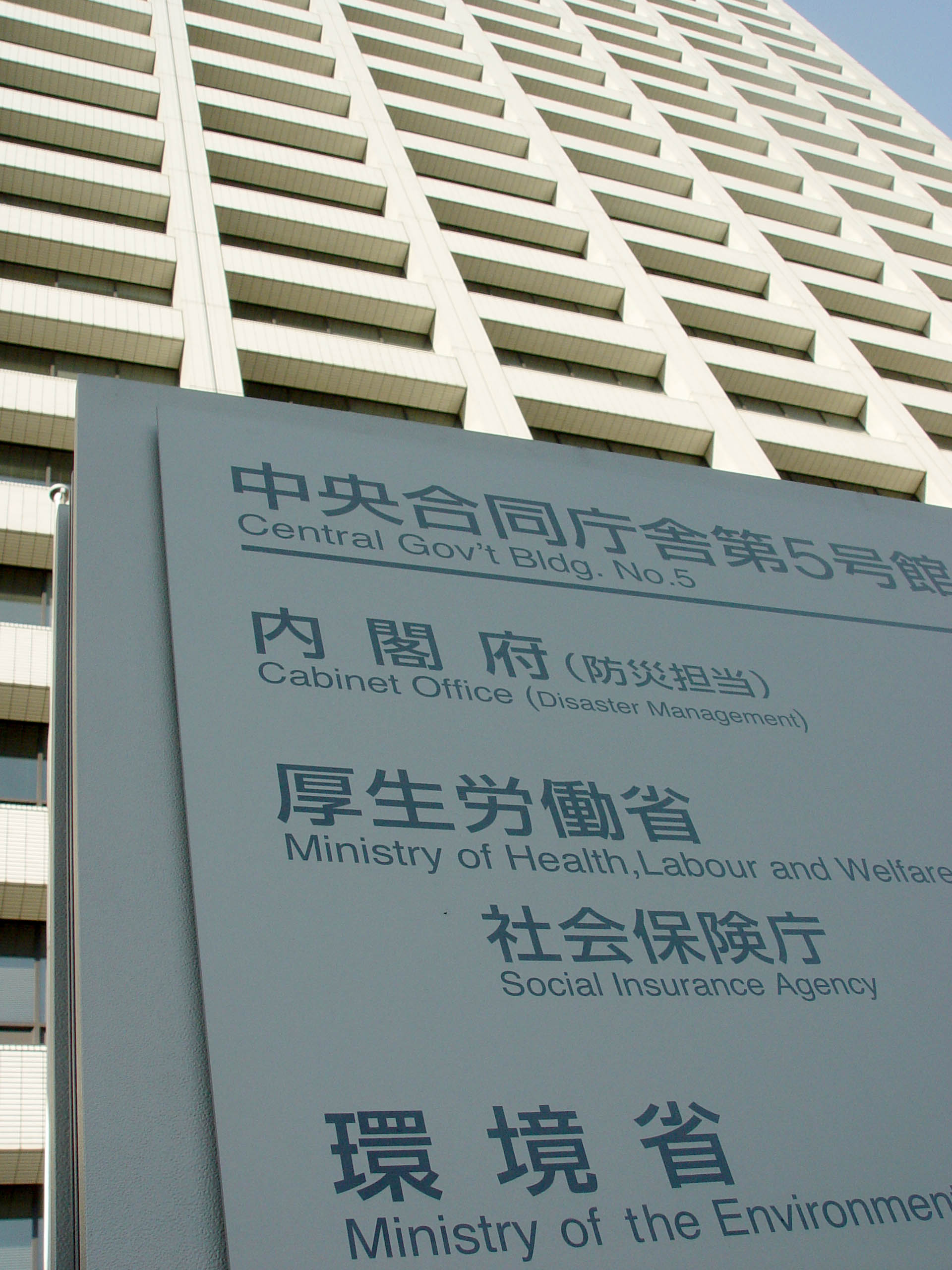
The is a Cabinet-level ministry of the government of Japan responsible for global environmental conservation, pollution control, and nature conservation. The ministry was formed in 2001 from the sub-cabinet level Environmental Agency established in 1971. The Minister of the Environment is a member of the Cabinet of Japan and is chosen by the Prime Minister, usually from among members of the Diet. In March 2006, the then-Minister of the Environment Yuriko Koike, created a ''furoshiki'' cloth to promote its use in the modern world. In August 2011, the Cabinet of Japan approved a plan to establish a new energy watchdog under the Environment Ministry, and the Nuclear Regulation Authority was founded on September 19, 2012. Organization * Minister's Secretariat (大臣官房) * (総合環境政策統括官) * Global Environment Bureau (地球環境局) * Environment Management Bureau (水・大気環境局) * Nature Conservation Bureau (自然環境局) * (環境再生・資源循� ... [...More Info...] [...Related Items...] OR: [Wikipedia] [Google] [Baidu] |
Japanese Folklore
Japanese folklore encompasses the informally learned folk traditions of Japan and the Japanese people as expressed in its oral traditions, customs, and material culture. In Japanese, the term is used to describe folklore. The academic study of folklore is known as . Folklorists also employ the term or to refer to the objects and arts they study. Folk religion Men dressed as namahage, wearing ogre-like masks and traditional straw capes (''mino'') make rounds of homes, in an annual ritual of the Oga Peninsula area of the Northeast region. These ogre-men masquerade as kami looking to instill fear in the children who are lazily idling around the fire. This is a particularly colorful example of folk practice still kept alive. A parallel custom is the secretive ritual of the Yaeyama Islands, Okinawa which does not allow itself to be photographed. Many, though increasingly fewer households maintain a kamidana or a small Shinto altar shelf. The Shinto version of the kitchen go ... [...More Info...] [...Related Items...] OR: [Wikipedia] [Google] [Baidu] |
Jorōgumo
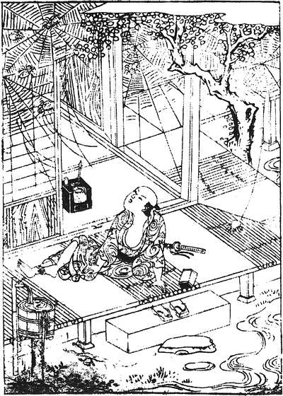
''Jorōgumo'' ( ja, 絡新婦 , じょろうぐも ) is a type of ''yōkai'', a creature of Japanese folklore. It can shapeshift into a beautiful woman, so the kanji that represent its actual meaning are (); the kanji which are used to write it instead, () have a ''jukujikun'' pronunciation that is related to the meaning, but not the sound of the word. In Toriyama Sekien's Gazu Hyakki Yagyō, it is depicted as a spider woman manipulating small fire-breathing spiders. Jorōgumo can also refer to some species of spiders, such as the Nephila and Argiope spiders. Japanese-speaking entomologists use the katakana form of ''jorōgumo'' () to refer exclusively to the spider species ''Trichonephila clavata'', and this has been adopted into English as "Jorō spider". Stories In Edo period writings such as the ''Taihei-Hyakumonogatari'' () and the ''Tonoigusa'' (), there are "jorogumo" that shapeshift into women. ''Tonoigusa'' "Things That Ought to be Pondered, Even in Urgent Times" ( ... [...More Info...] [...Related Items...] OR: [Wikipedia] [Google] [Baidu] |
Waterfalls Of Japan
A waterfall is a point in a river or stream where water flows over a vertical drop or a series of steep drops. Waterfalls also occur where meltwater drops over the edge of a tabular iceberg or ice shelf. Waterfalls can be formed in several ways, but the most common method of formation is that a river courses over a top layer of resistant bedrock before falling on to softer rock, which erodes faster, leading to an increasingly high fall. Waterfalls have been studied for their impact on species living in and around them. Humans have had a distinct relationship with waterfalls for years, travelling to see them, exploring and naming them. They can present formidable barriers to navigation along rivers. Waterfalls are religious sites in many cultures. Since the 18th century they have received increased attention as tourist destinations, sources of hydropower, andparticularly since the mid-20th centuryas subjects of research. Definition and terminology A waterfall is generally d ... [...More Info...] [...Related Items...] OR: [Wikipedia] [Google] [Baidu] |
Landforms Of Shizuoka Prefecture
A landform is a natural or anthropogenic land feature on the solid surface of the Earth or other planetary body. Landforms together make up a given terrain, and their arrangement in the landscape is known as topography. Landforms include hills, mountains, canyons, and valleys, as well as shoreline features such as bays, peninsulas, and seas, including submerged features such as mid-ocean ridges, volcanoes, and the great ocean basins. Physical characteristics Landforms are categorized by characteristic physical attributes such as elevation, slope, orientation, stratification, rock exposure and soil type. Gross physical features or landforms include intuitive elements such as berms, mounds, hills, ridges, cliffs, valleys, rivers, peninsulas, volcanoes, and numerous other structural and size-scaled (e.g. ponds vs. lakes, hills vs. mountains) elements including various kinds of inland and oceanic waterbodies and sub-surface features. Mountains, hills, plateaux, and plains are the fo ... [...More Info...] [...Related Items...] OR: [Wikipedia] [Google] [Baidu] |


.jpg)