|
Juranpur Satipith
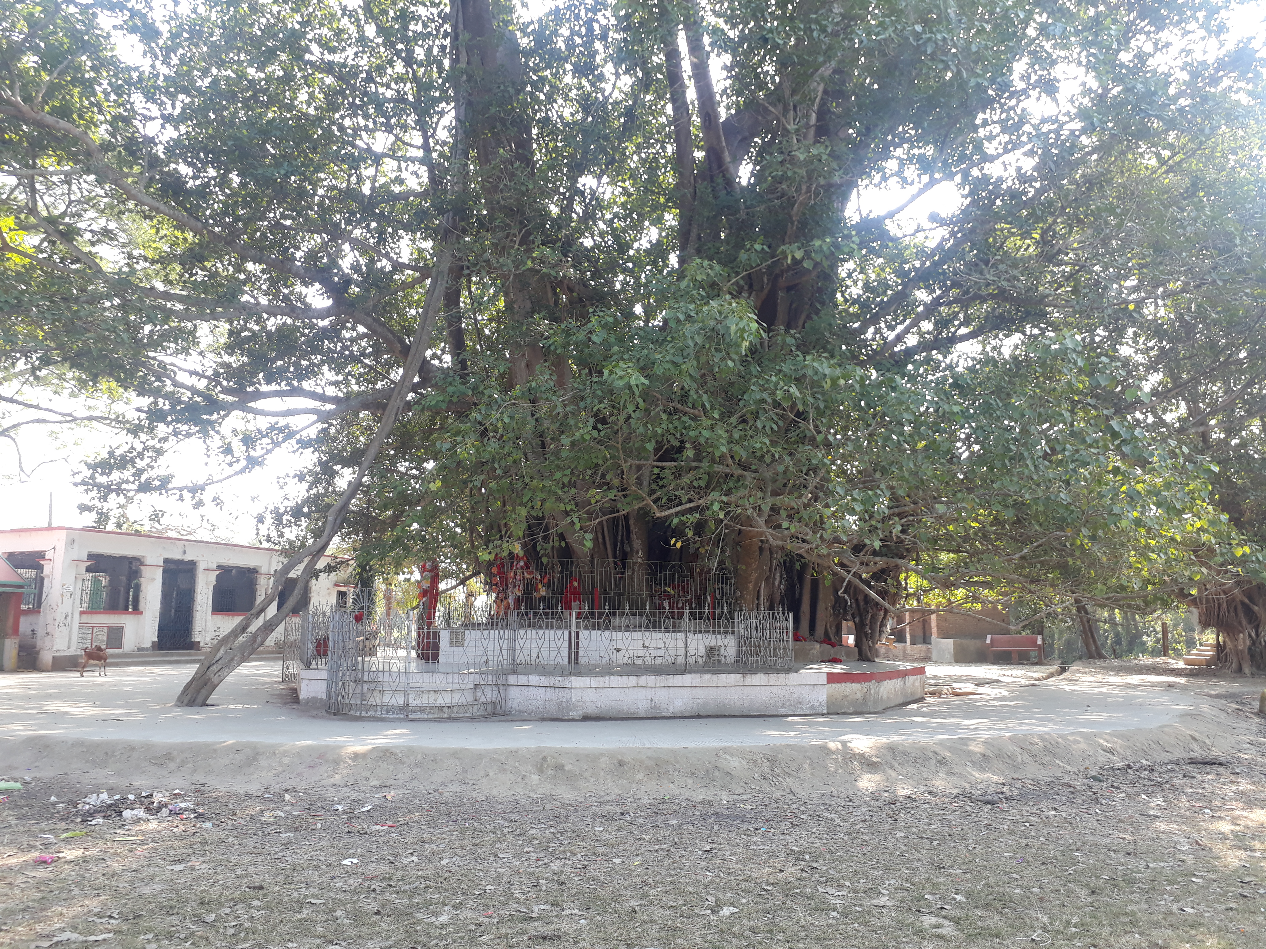
Juranpur Satipith is one of the 51 Hindu holy places (Shakti Peetha) in India in the village of Juranpur, under Kaligunge CD Block in Nadia district of West Bengal. According to Hindu mythology the forehead of Goddess Sati was fallen in this place after Daksha Jagga. Juranpur is a place for Hindu pilgrimage. Here a stone is worshipped as Goddess Joy Durga which is placed under a big Banyan tree. By the side of the tree there is a small temple where God is worshipped in the name of Bhairav. Up to the early 19th century, this Pith was situated on the bank of the Bhagirathi River, opposite of Katwa but today the river flows about one kilometer west of the Pith. A fair is organized there every year in Magha Purnima. History In this Pith, an underground channel was previously connected to the river Bhagirathi where many saints and revolutionaries took shelter before independence Independence is a condition of a person, nation, country, or state in which residents and pop ... [...More Info...] [...Related Items...] OR: [Wikipedia] [Google] [Baidu] |
Juranpur Satipith And Temple Campus At Juranpur 02 , a village in Nadia district, West Bengal, India
{{geodis ...
Juranpur may refer to: *Juranpur Satipith, a Shakti Peetha in Nadia district, West Bengal, India *Juranpur, Nadia Juranpur is a village and a gram panchayat in the Kaliganj CD block in the Krishnanagar Sadar subdivision of the Nadia district in the state of West Bengal, India. Geography Location Juranpur is located at . Area overview Nadia district ... [...More Info...] [...Related Items...] OR: [Wikipedia] [Google] [Baidu] |
Shakti Peetha
The Shakti Pitha or the Shakti Peethas ( sa, शक्ति पीठ, , ''seat of Shakti'') are significant shrines and pilgrimage destinations in Shaktism, the goddess-centric denomination in Hinduism. The shrines are dedicated to various forms of Adi Shakti. Various Puranas such as Srimad Devi Bhagavatam state the existence of varying number of 51, 64 and 108 Shakti peethas of which 18 are named as Astadasha ''Maha'' (major) in medieval Hindu texts. Various legends explain how the Shakti Peetha came into existence. The most popular is based on the story of the death of the goddess Sati. Out of grief and sorrow, Lord Shiva carried Sati's body, reminiscing about their moments as a couple, and roamed around the universe with it. Lord Vishnu had cut her body into 51 body parts, using his Sudarshana Chakra, which fell on Earth to become sacred sites where all the people can pay homage to the Goddess. To complete this massively long task, Lord Shiva took the form of Bhairava. ... [...More Info...] [...Related Items...] OR: [Wikipedia] [Google] [Baidu] |
Juranpur, Nadia
Juranpur is a village and a gram panchayat in the Kaliganj CD block in the Krishnanagar Sadar subdivision of the Nadia district in the state of West Bengal, India. Geography Location Juranpur is located at . Area overview Nadia district is mostly alluvial plains lying to the east of Hooghly River, locally known as Bhagirathi. The alluvial plains are cut across by such distributaries as Jalangi, Churni and Ichhamati. With these rivers getting silted up, floods are a recurring feature. The Krishnanagar Sadar subdivision, presented in the map alongside, has the Bhagirathi on the west, with Purba Bardhaman district lying across the river. The long stretch along the Bhagirathi has many swamps. The area between the Bhagirathi and the Jalangi, which flows through the middle of the subdivision, is known as Kalantar, a low-lying tract of black clay soil. A big part of the subdivision forms the Krishnanagar-Santipur Plain, which occupies the central part of the district. The Jalang ... [...More Info...] [...Related Items...] OR: [Wikipedia] [Google] [Baidu] |
Kaliganj (community Development Block)
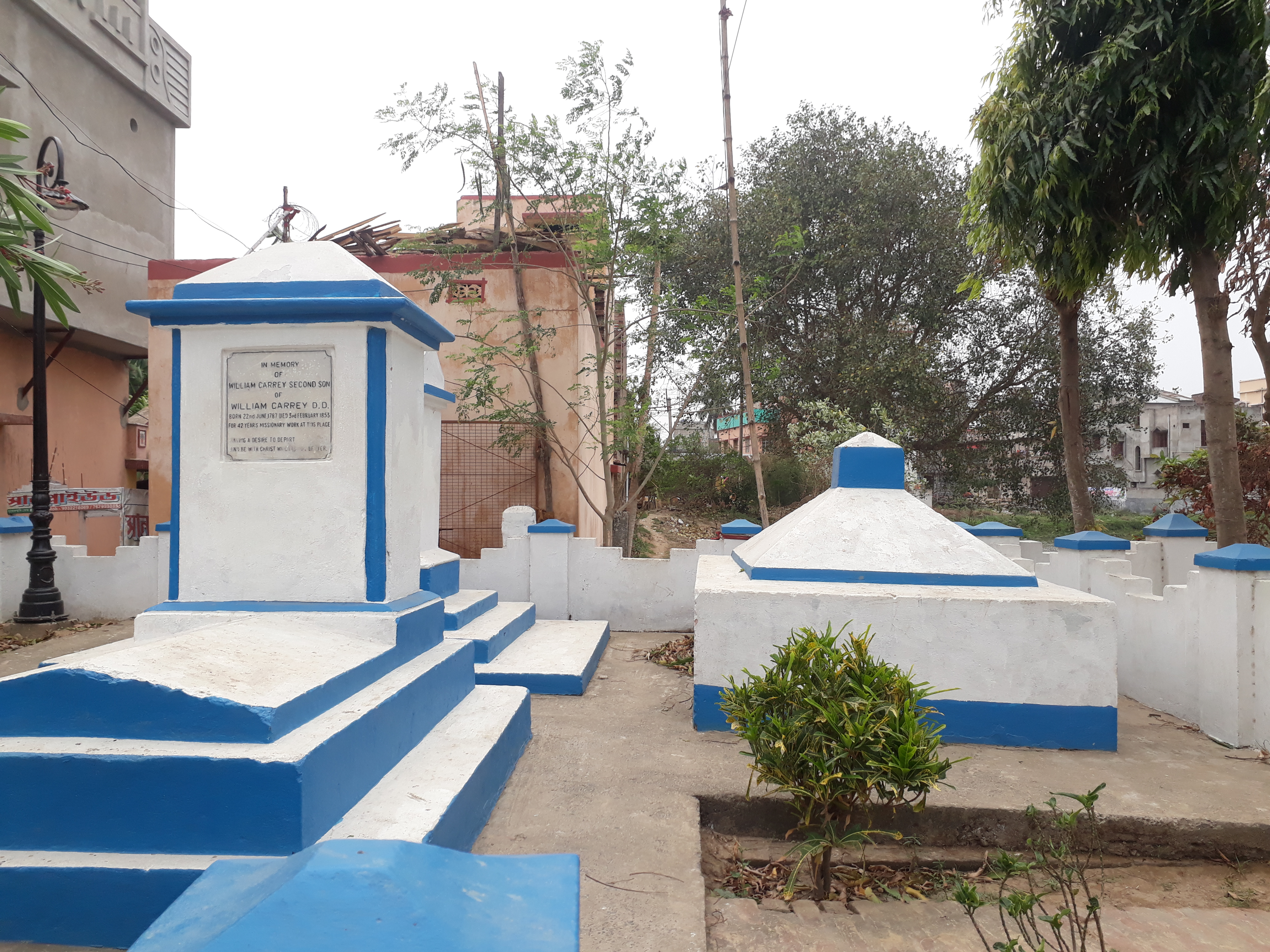
Kaliganj is a community development block that forms an administrative division in Krishnanagar Sadar subdivision of Nadia district in the Indian state of West Bengal. History The Battle of Plassey was fought at Palashi in this block on 23 June 1757 between Siraj ud-Daulah, the last independent ruler of Bengal and the forces of the British East India Company under Lord Clive. The victory of the British forces in the battle marked the advent of British rule in Bengal, which over the next century expanded to cover most of India. There is a memorial stone, set up in 1883, that marks the victory of the British. Geography Kaliganj is located at . Kaliganj CD Block is bounded by Beldanga II CD Block, in Murshidabad district, in the north, Tehatta II and Nakashipara CD Blocks in the east, Katwa II CD Block, in Bardhaman district across the Bhagirathi, in the south and Katwa I and Ketugram II CD Blocks, in Bardhaman district across the Bhagirathi, in the west. Nadia district is mostl ... [...More Info...] [...Related Items...] OR: [Wikipedia] [Google] [Baidu] |
Nadia District
Nadia () is a district in the state of West Bengal, India. It borders Bangladesh to the east, North 24 Parganas and Hooghly districts to the south, Purba Bardhaman to the west, and Murshidabad to the north. Nadia district is highly influential in the cultural history of Bengal. The standard version of Bengali, developed in the 19th century, is based off the dialect spoken around Nadia. Known as the "Oxford of Bengal", Nabadwip made many contributions to Indian philosophy, such as the Navya-Nyaya system of logic and is the birthplace of the Vaishnava saint Chaitanya Mahaprabhu. The district is still largely agricultural. Etymology "Nadia" is a shortened form of Nabadwip, the name for a historic city in the district. Nabadwip, literally "new island", was formerly an island created by alluvial deposits of the Ganga. Geography Nadia district is located in southern West Bengal, in the west-central Bengal region. The district is largely alluvial plain, formed by the constant sh ... [...More Info...] [...Related Items...] OR: [Wikipedia] [Google] [Baidu] |
West Bengal
West Bengal (, Bengali: ''Poshchim Bongo'', , abbr. WB) is a state in the eastern portion of India. It is situated along the Bay of Bengal, along with a population of over 91 million inhabitants within an area of . West Bengal is the fourth-most populous and thirteenth-largest state by area in India, as well as the eighth-most populous country subdivision of the world. As a part of the Bengal region of the Indian subcontinent, it borders Bangladesh in the east, and Nepal and Bhutan in the north. It also borders the Indian states of Odisha, Jharkhand, Bihar, Sikkim and Assam. The state capital is Kolkata, the third-largest metropolis, and seventh largest city by population in India. West Bengal includes the Darjeeling Himalayan hill region, the Ganges delta, the Rarh region, the coastal Sundarbans and the Bay of Bengal. The state's main ethnic group are the Bengalis, with the Bengali Hindus forming the demographic majority. The area's early history featured a succession ... [...More Info...] [...Related Items...] OR: [Wikipedia] [Google] [Baidu] |
Bhagirathi River
The Bhāgīrathī (Pron: /ˌbʌgɪˈɹɑːθɪ/) is a turbulent Himalayan river in the Indian state of Uttarakhand, and one of the two headstreams of the Ganges, the major river of Northern India and the holy river of Hinduism. In the Hindu faith, mythology, and culture, the Bhagirathi is considered the source stream of the Ganges. However, in hydrology, the other headstream, Alaknanda, is considered the source stream on account of its great length and discharge. The Bhagirathi and Alaknanda join at Devprayag in Garhwal and are thereafter known as the Ganges. Etymology Bhagiratha was a descendant of King Sagara of the Suryavanshi, or Surya Dynasty. He played an important role in the descent of the Ganges. The story of Bhagiratha is narrated in the ''Ramayana'', ''Mahabharata'', and Puranas. Wanting to show his sovereignty, King Sagara performed a ritual known as ashvamedha, where a horse was left to wander for one year. However, Indra stole the horse to prevent the ritual ... [...More Info...] [...Related Items...] OR: [Wikipedia] [Google] [Baidu] |
Katwa
Katwa is a sub-divisional town and railway junction in Purba Bardhaman district of the Indian state of West Bengal. It is the headquarters of the Katwa subdivision. The town was built at the confluence of Ganga and Ajay. Katwa is a border city of three districts; Purba Bardhaman District, Nadia District and Murshidabad District. Geography Location Katwa is located at . It has an average elevation of . It is situated between the Ajay River and the Hooghly River and so is bounded by water to the east, west, and north. Police station Katwa police station has jurisdiction over Katwa and Dainhat municipalities, and Katwa I and Katwa II CD Blocks. The area covered is 351.03 km2. Urbanisation 88.44% of the population of the Katwa subdivision live in rural areas. Only 11.56% of the population live in the urban areas. The map alongside presents some of the notable locations in the subdivision. All places marked on the map are linked in the larger full-screen map. History Ka ... [...More Info...] [...Related Items...] OR: [Wikipedia] [Google] [Baidu] |
Magha Purnima
Maghi Purnima, also known by the name of Magha Purnima, is known to be a day of the full moon that occurs during the Hindu calendar month of Magh. This day falls during the Gregorian calendar month of January or February. During this time period, the auspicious Kumbh Mela is held every twelve years, and the Magha Mela is held on an annual basis at the confluence of three rivers or Triveni Sangam In Hindu tradition, Triveni Sangam is the confluence (Sanskrit: ''sangama'') of three rivers that is also a sacred place, with a bath here said to flush away all of one's sins and free one from the cycle of rebirth. Triveni Sangam in Allaha ... all around north India, such as in cities like Allahabad or Prayag. Date in Gregorian calendar 2027 , , 9 February See also * Basant Panchmi References Observances held on the full moon Hindu festivals Festivals in India Kumbh Mela {{India-festival-stub ... [...More Info...] [...Related Items...] OR: [Wikipedia] [Google] [Baidu] |
Indian Independence Act 1947
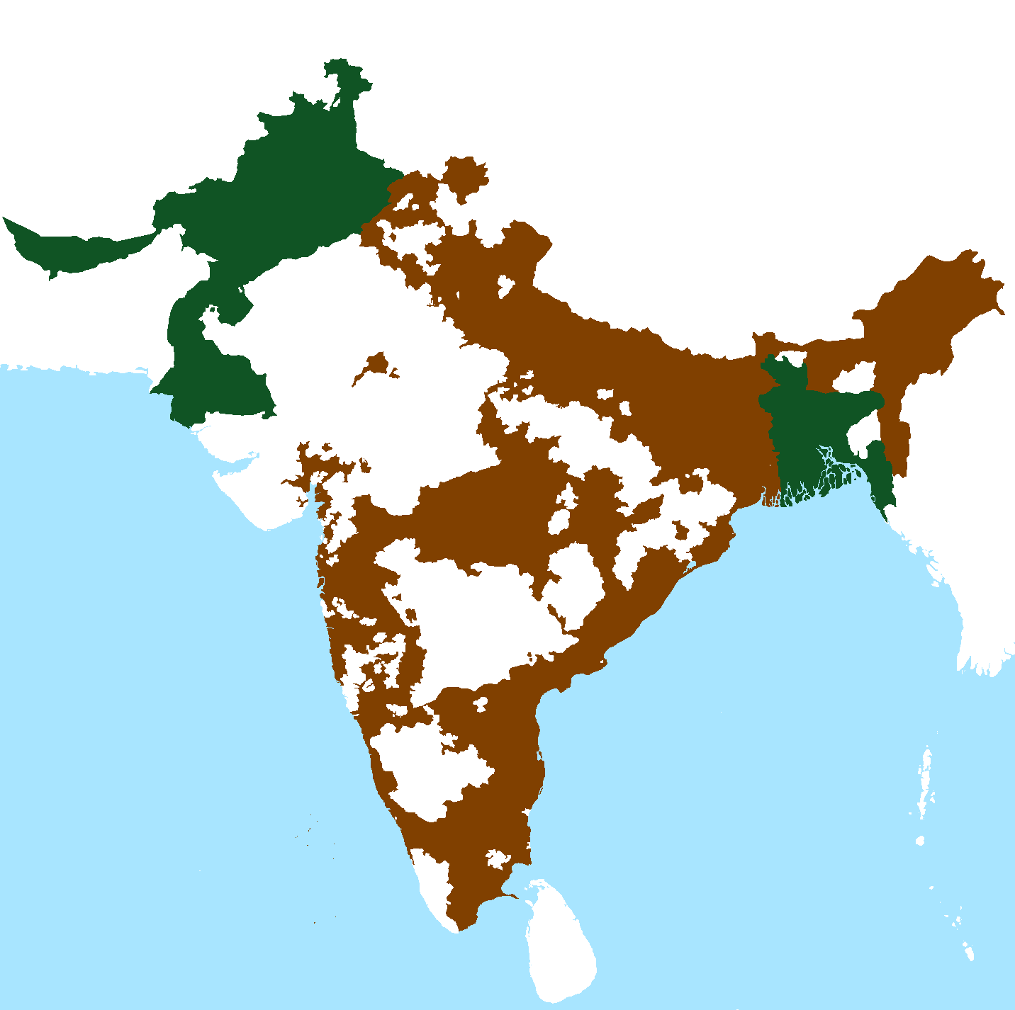
The Indian Independence Act 1947 947 CHAPTER 30 10 and 11 Geo 6is an Act of the Parliament of the United Kingdom that partitioned British India into the two new independent dominions of India and Pakistan. The Act received Royal Assent on 18 July 1947 and thus modern-day India and Pakistan, comprising west (modern day Pakistan) and east (modern day Bangladesh) regions, came into being on 15 August. The legislature representatives of the Indian National Congress, the Muslim League, and the Sikh community came to an agreement with Lord Mountbatten on what has come to be known as the ''3 June Plan'' or ''Mountbatten Plan''. This plan was the last plan for independence. Prelude Attlee's announcement Clement Attlee, the Prime Minister of the United Kingdom, announced on 20 February 1947 that: #The British Government would grant full self-government to British India by 30 June 1948 at the latest, #The future of the Princely States would be decided after the date of final transfer ... [...More Info...] [...Related Items...] OR: [Wikipedia] [Google] [Baidu] |
Mohan Lal Kashmiri
Mohan Lal Zutshi KLS (popularly known as Mohan Lal Kashmiri; 1812 – 1877) was an Indian traveler, diplomat, and author. He deserves to be credited as being an important player in the so-called Great Game—possibly the first notable Indian one. And he played a central role in the First Anglo-Afghan War of 1838–1842. His biography of Dost Mohammad Khan, the Emir of Afghanistan in Kabul, is a primary source on the war. Mohan Lal's wife, Hyderi Begum, was a Muslim scholar. During the Indian Rebellion of 1857, she was said to have maintained a diary of events in Delhi. Early life and family Mohan Lal (also called Ram Nath) was from a Zutshi family of Kashmiri Pandits. His great grandfather, Pandit Mani Ram, had a high rank at the Mughal Court in the reign of Shah Alam II. His father, Rai Brahm Nath, also known as Rae Budh Singh, worked for a time for Mountstuart Elphinstone on a diplomatic mission to Peshawar (1808–1809). Mohan Lal studied at the Delhi College, ... [...More Info...] [...Related Items...] OR: [Wikipedia] [Google] [Baidu] |
Siraj Ud-Daulah
Mirza Muhammad Siraj-ud-Daulah ( fa, ; 1733 – 2 July 1757), commonly known as Siraj-ud-Daulah or Siraj ud-Daula, was the last independent Nawab of Bengal. The end of his reign marked the start of the rule of the East India Company over Bengal and later almost all of the Indian subcontinent. Siraj succeeded his maternal grandfather, Alivardi Khan as the Nawab of Bengal in April 1756 at the age of 23. Betrayed by Mir Jafar, the commander of Nawab's army, Siraj lost the Battle of Plassey on 23 June 1757. The forces of the East India Company under Robert Clive invaded and the administration of Bengal fell into the hands of the company. Early life and background Siraj was born to the family of Mirza Muhammad Hashim and Amina Begum in 1733. Soon after his birth, Alivardi Khan, Siraj's maternal grandfather, was appointed the Deputy Governor of Bihar. Amina Begum was the youngest daughter of Alivardi Khan and Princess Sharfunnisa, the paternal aunt of Mir Jafar. His father, Mi ... [...More Info...] [...Related Items...] OR: [Wikipedia] [Google] [Baidu] |


