|
Juliusbanner
The ''Juliusbanner'' ("Julius banners") are elaborate silk banners given to the cantons and other entities of the Old Swiss Confederacy by Pope Julius II in 1512, in recognition of the support he received from Swiss mercenaries against France in the Pavia campaign (''Pavier Feldzug''). The Swiss contingents succeeded in forcing the French forces to abandon Pavia on 14 June. As a reward for this service, Julius on 5 July granted to the Swiss the title of ''Ecclesiasticae libertatis defensores'' and gave them two large banners, besides a blessed sword and hat. The Julius banners themselves were given by papal legate Matthias Schiner. This gift was a matter of considerable prestige for the recipients, seen as such both by the recipients and by their neighbours. This was true especially of the blessed sword and hat, which had previously only been bestowed on kings and princes, while the Swiss were still considered not fully sovereign, but subjects of the Holy Roman Emperor. The ... [...More Info...] [...Related Items...] OR: [Wikipedia] [Google] [Baidu] |
Rapperswil - Juliusbanner 1512 IMG 1828
Rapperswil (Swiss German: or ;Andres Kristol, ''Rapperswil SG (See)'' in: ''Dictionnaire toponymique des communes suisses – Lexikon der schweizerischen Gemeindenamen – Dizionario toponomastico dei comuni svizzeri (DTS, LSG)'', Centre de dialectologie, Université de Neuchâtel, Verlag Huber, Frauenfeld/Stuttgart/Wien 2005, and Éditions Payot, Lausanne 2005, , p. 727. short: ''Rappi'') is a former municipality and since January 2007 part of the municipality of Rapperswil-Jona in the ''Wahlkreis'' (constituency) of See-Gaster in the canton of St. Gallen in Switzerland, located at the east side of the Lake Zurich. Geography Rapperswil is located on Lake Zürich at the point at which the lake is cut in two by the Seedamm. Sights The town's main sights are concentrated in the Altstadt of Rapperswil and can be seen while strolling through the medieval alleys. The main sights of Rapperswil are its rose gardens, Rapperswil Castle, the reconstructed wooden bridge to Hurden ... [...More Info...] [...Related Items...] OR: [Wikipedia] [Google] [Baidu] |
Canton Of Uri
The canton of Uri (german: Kanton Uri rm, Chantun Uri; french: Canton d'Uri; it, Canton Uri) is one of the 26 cantons of Switzerland and a founding member of the Swiss Confederation. It is located in Central Switzerland. The canton's territory covers the valley of the Reuss between the St. Gotthard Pass and Lake Lucerne. The official language of Uri is (the Swiss variety of Standard) German, but the main spoken dialect is the Alemannic Swiss German called . Uri was once the only canton whose children in school had to learn Italian as their first foreign language, but in the school year of 2005/2006, that was changed to English, as in other Central and Northeastern Swiss cantons. The canton's population is about 35,000, of which 3,046 (or 8.7%) are foreigners. The legendary William Tell is said to have hailed from Uri. The historical landmark Rütli lies within the canton of Uri. Name The name of the valley is first mentioned in the 8th or 9th century, in the Latinized f ... [...More Info...] [...Related Items...] OR: [Wikipedia] [Google] [Baidu] |
Swiss Reformation
The Protestant Reformation in Switzerland was promoted initially by Huldrych Zwingli, who gained the support of the magistrate, Mark Reust, and the population of Zürich in the 1520s. It led to significant changes in civil life and state matters in Zürich and spread to several other cantons of the Old Swiss Confederacy. Seven cantons remained Catholic, however, which led to intercantonal wars known as the Wars of Kappel. After the victory of the Catholic cantons in 1531, they proceeded to institute Counter-Reformation policies in some regions. The schism and distrust between the Catholic and the Protestant cantons defined their interior politics and paralysed any common foreign policy until well into the 18th century. Despite their religious differences and an exclusively-Catholic defence alliance of the seven cantons (''Goldener Bund''), no other major armed conflicts directly between the cantons occurred. Soldiers from both sides fought in the French Wars of Religion. Dur ... [...More Info...] [...Related Items...] OR: [Wikipedia] [Google] [Baidu] |
Canton Of Fribourg
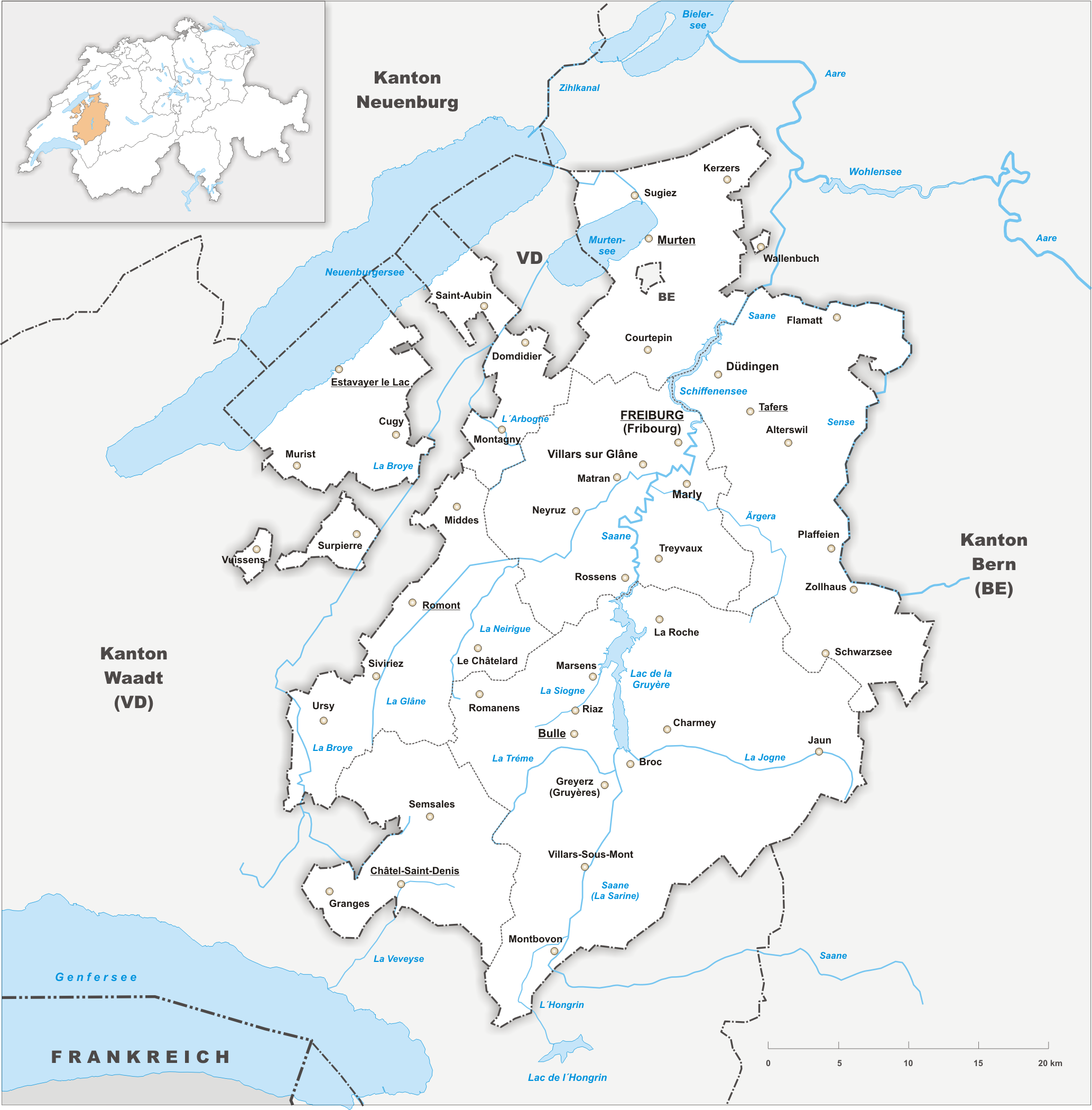
The canton of Fribourg, also canton of Freiburg (french: Canton de Fribourg ; german: Kanton Freiburg ; frp, Canton de Fribôrg rm, Chantun Friburg it, Canton Friburgo) is located in western Switzerland. The canton is bilingual, with French spoken by more than two thirds of the citizens and German by a little more than a quarter. Both are official languages in the canton. The canton takes its name from its capital city of Fribourg. History On the shores of Lake Neuchâtel and Lake Morat significant traces of prehistoric settlements have been unearthed. The canton of Fribourg joined the Swiss Confederation in 1481. The area is made up of lands acquired by the capital Fribourg. The present extent was reached in 1803 when Murten (Morat) was acquired. The canton of Fribourg joined the separatist league of Catholic cantons in 1846 (Sonderbund). The following year, its troops surrendered to the federal army. Geography The canton is bounded to the west by Lake Neuchâtel, to the ... [...More Info...] [...Related Items...] OR: [Wikipedia] [Google] [Baidu] |
Canton Of Basel
Basel was a canton of Switzerland that was in existence between 1501 and 1833, when it was split into the two half-cantons of Basel-City and Basel-Country. Background Before the Protestant Reformation, Basel was ruled by prince-bishops (see Bishop of Basel, whose memory is preserved in the crosier shown on the Basel coat of arms, as above). In the later 15th century, in the wake of the Council of Basel (1431–49), the city of Basel grew in wealth and importance. The University of Basel was established in 1459, and the city became an intellectual center of the German Renaissance in the years leading up to the Reformation. Erasmus of Rotterdam taught in Basel, and early printshops were set up by Johannes Petri and Johann Froben. In 1495, Basel was incorporated in the Upper Rhenish Imperial Circle, the bishop sitting on the Bench of the Ecclesiastical Princes. Establishment As a direct consequence of the Swabian War, resolved by the 1499 Treaty of Basel, Basel and ... [...More Info...] [...Related Items...] OR: [Wikipedia] [Google] [Baidu] |
Canton Of Glarus
The canton of Glarus (german: Kanton Glarus rm, Chantun Glaruna; french: Canton de Glaris; it, Canton Glarona) is a canton in east central Switzerland. The capital is Glarus. The population speaks a variety of Alemannic German. The majority of the population (81%) identifies as Christian, about evenly split between Protestants and Catholics. History According to legend, the inhabitants of the Linth Valley were converted to Christianity in the 6th century by the Irish monk Saint Fridolin, the founder of Säckingen Abbey in what is now the German state of Baden-Württemberg. From the 9th century, the area around Glarus was owned by Säckingen Abbey, the town of Glarus being recorded as ''Clarona''. The Alemanni began to settle in the valley from the early 8th century. The Alemannic German language took hold only gradually, and was dominant by the 11th century. By 1288, the Habsburgs had claimed all the abbey's rights. Glarus joined the Old Swiss Confederacy in 1352 as one of t ... [...More Info...] [...Related Items...] OR: [Wikipedia] [Google] [Baidu] |
Canton Of Zug
The canton of Zug, also Zoug (Standard German: , Alemannic German: , rm, Chantun Zug, french: Canton de Zoug, it, Canton Zugo) is one of the 26 cantons of Switzerland. It is located in central Switzerland and its capital is Zug. At the canton is one of the smallest of the Swiss cantons in terms of area. It is not subdivided into districts, but eleven municipalities. History The first trace of a settlement in the canton dates from approximately 14,000 BC, with additional finds from the Paleolithic (12,400-9250 BC) and the Mesolithic (9250-5500 BC). During the Neolithic (5500-2200 BC) and the Bronze Age (2200-850 BC) about 50 different stilt house villages were built in 33 locations around Lake Zug. Some of these sites are part of the UNESCO World Heritage Site Prehistoric pile dwellings around the Alps. Prehistoric sites around the lake and throughout the canton include examples from the Neolithic Egolzwiler, Cortaillod, Pfyn and Horgen cultures. Traces of the later Neolith ... [...More Info...] [...Related Items...] OR: [Wikipedia] [Google] [Baidu] |
Nidwalden
Nidwalden, also Nidwald (german: Kanton Nidwalden, ; rm, Chantun Sutsilvania; french: Canton de Nidwald; it, Canton Nidvaldo) is one of the 26 cantons forming the Swiss Confederation. It is composed of eleven municipalities and the seat of the government and parliament is in Stans. It is traditionally considered a " half-canton", the other half being Obwalden. Nidwalden lies in Central Switzerland. It borders the canton of Obwalden to the west, the cantons of Lucerne and Schwyz to the north, the canton of Uri to the east and the canton of Bern to the south. The canton is essentially in the Alps, south of Lake Lucerne. It is one of the smallest cantons, the population is 40,287 (in 2007). The largest town is Stans, followed by Hergiswil and Buochs. Together with Obwalden, Nidwalden was part of the forest canton of Unterwalden, one of the three participants in the foundation of the Old Swiss Confederacy, named in the Pact of Brunnen of 1315 with Uri and Schwyz. The division o ... [...More Info...] [...Related Items...] OR: [Wikipedia] [Google] [Baidu] |
Obwalden
Obwalden, also Obwald (german: Kanton Obwalden, rm, Chantun Sursilvania; french: Canton d'Obwald; it, Canton Obvaldo), is one of the 26 cantons forming the Swiss Confederation. It is composed of seven municipalities and the seat of the government and parliament is in Sarnen. It is traditionally considered a " half-canton", the other half being Nidwalden. Obwalden lies in Central Switzerland and contains the geographical centre of Switzerland. It is bordered by the canton of Lucerne to the north, the canton of Nidwalden and Uri to the east and the canton of Bern to the south. The canton is essentially in the valley of the Sarner Aa south of Lake Lucerne, with an enclave around Engelberg. It is one of the smallest cantons. The largest town is Sarnen, followed by Kerns and Alpnach. Together with Nidwalden, Obwalden was part of the forest canton of Unterwalden, one of the three participants in the foundation of the Old Swiss Confederacy, named in the Pact of Brunnen of 1315 with ... [...More Info...] [...Related Items...] OR: [Wikipedia] [Google] [Baidu] |
Canton Of Schwyz
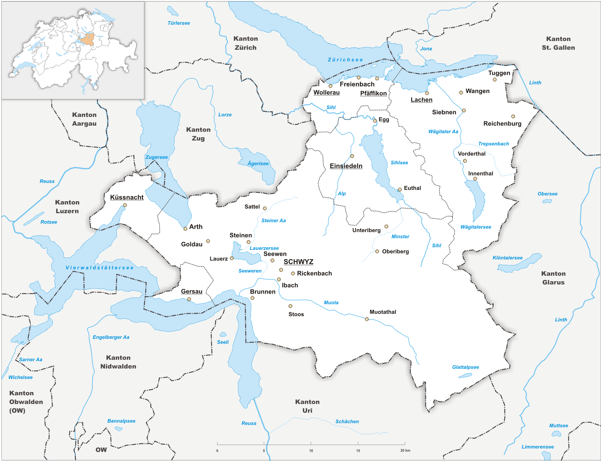
The canton of Schwyz (german: Kanton Schwyz rm, Chantun Sviz; french: Canton de Schwytz; it, Canton Svitto) is a canton in central Switzerland between the Alps in the south, Lake Lucerne to the west and Lake Zürich in the north, centred on and named after the town of Schwyz. It is one of the founding cantons of Switzerland; Switzerland's name is derived from the name of the canton, and the flag of Switzerland from its coat of arms. For the history of the name, see Schwyz. The Swiss Federal Charter is on display in Schwyz. Northeast of the town of Schwyz is Einsiedeln Abbey. History Prehistory to the Roman era The earliest traces of humans in Schwyz are from the Upper Paleolithic and Early Mesolithic, or about 12,500 BC. An excavation of the karst caves in the valley of the Muota river (''Muotatal'') revealed numerous sites, some dating to the Younger Dryas period (c. 10,000 BC). The alpine meadows at Bödmeren, Twärenen and Silberen were Stone Age hunter-gatherer camps. ... [...More Info...] [...Related Items...] OR: [Wikipedia] [Google] [Baidu] |
Canton Of Lucerne
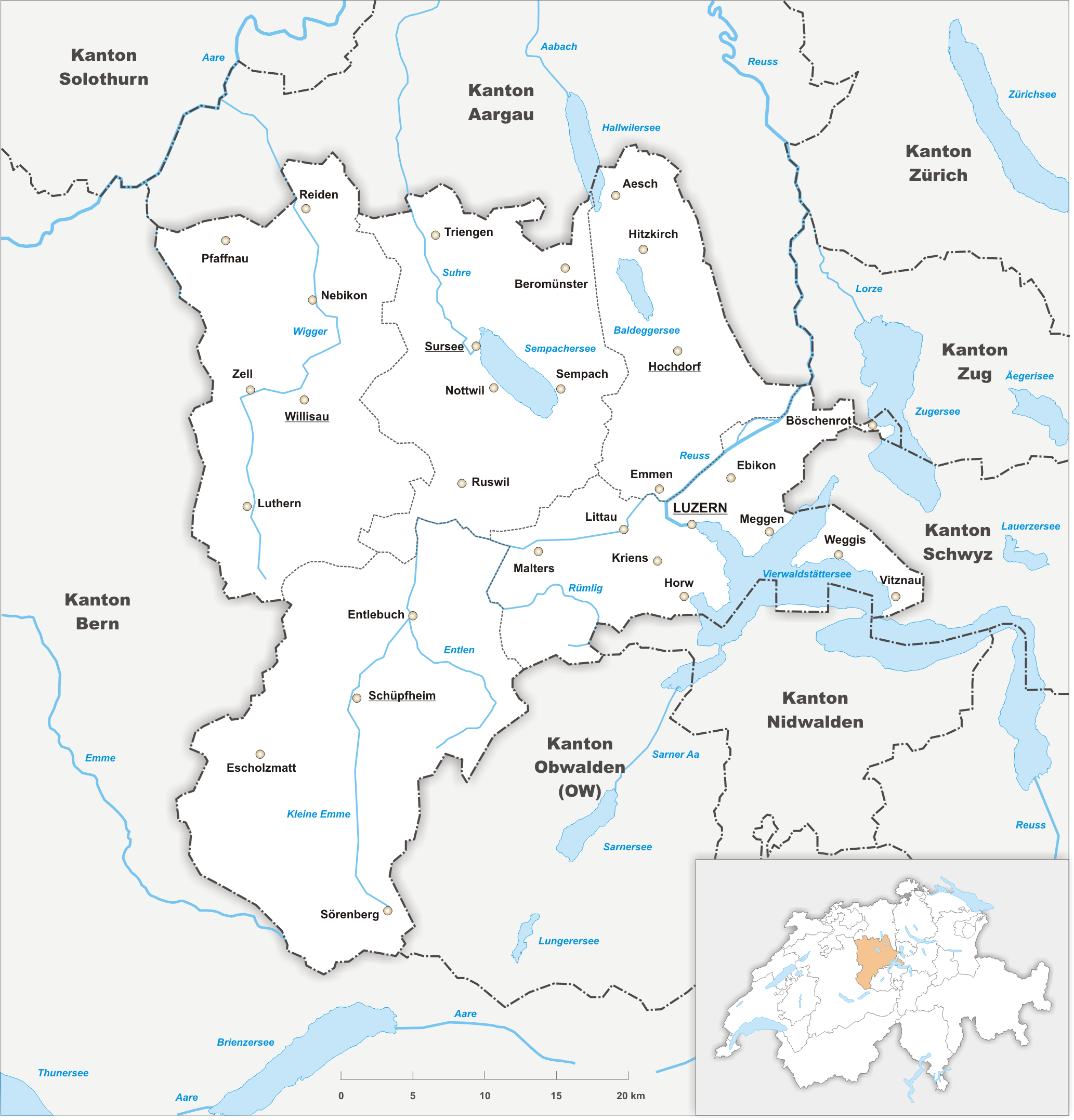
The canton of Lucerne (german: Kanton Luzern rm, Chantun Lucerna french: Canton de Lucerne it, Canton Lucerna) is a canton of Switzerland. It is located in the centre of Switzerland. The population of the canton (as of ) is . , the population included 57,268 foreigners, or about 15.8% of the total population. The cantonal capital is Lucerne. History The canton of Lucerne comprises territories acquired by its capital Lucerne, either by treaty, armed occupation or purchase. The first town acquired was Weggis (in 1380), Rothenburg, Kriens, Horw, Sempach and Hochdorf (all in 1394), Wolhusen and Entlebuch (1405), the so-called "Habsburger region" to the northeast of the town of Lucerne (1406), Willisau (1407), Sursee and Beromünster (1415), Malters (1477) and Littau (1481), while in 1803, in exchange for Hitzkirch, Merenschwand (held since 1397) was given up. Prehistory The oldest traces of humans in the Lucerne area are stone artifacts and cave bear bones found in the Ste ... [...More Info...] [...Related Items...] OR: [Wikipedia] [Google] [Baidu] |
Canton Of Bern
The canton of Bern or Berne (german: Kanton Bern; rm, Chantun Berna; french: canton de Berne; it, Canton Berna) is one of the 26 cantons forming the Swiss Confederation. Its capital city, Bern, is also the ''de facto'' capital of Switzerland. The bear is the heraldic symbol of the canton, displayed on a red-yellow background. Comprising ten districts, Bern is the second-largest canton by both surface area and population. Located in west-central Switzerland, it is surrounded by eleven cantons. It borders the canton of Jura and the canton of Solothurn to the north. To the west lie the canton of Neuchâtel, the canton of Fribourg and canton of Vaud. To the south lies the canton of Valais. East of the canton of Bern lie the cantons of Uri, Nidwalden, Obwalden, Lucerne and Aargau. The geography of the canton includes a large share of all three natural regions of Switzerland: the Jura Mountains (the Bernese Jura), the Swiss Plateau (the Bernese Mittelland) and the Alps (th ... [...More Info...] [...Related Items...] OR: [Wikipedia] [Google] [Baidu] |


