|
Jufra District
Jufra or Jofra ( ar, الجفرة, Al Jufrah) is one of the districts of Libya. It is in the centre of the country. Its capital is Hun. Jufra was originally one of the 25 baladiya in the administrative system of Libya established in 1988. In 2001, it became a ''Shabiya'', and its territorial extension was reduced. In 2007, under the new 22-shabiya system, its original boundaries were reintroduced. Jufra borders Sirte in the north, Al Wahat in northeast, Kufra in east, Murzuq in south, Sabha in southwest, Wadi al Shatii in west and Jabal al Gharbi in northwest. In 2012, the total population in the region was estimated at 157,747 with 150,353 Libyans. The average size of the household in the country was evaluated at 6.9, while the average household size of non-Libyans was established at 3.7. There were totally 22,713 households in the district, with 20,907 Libyan ones. The population density of the district was 1.86 persons per km2. Per 2006 census, there were totally 20,12 ... [...More Info...] [...Related Items...] OR: [Wikipedia] [Google] [Baidu] |
Districts Of Libya
In Libya there are currently 106 districts, second level administrative subdivisions known in Arabic as ''baladiyat'' (singular ''baladiyah''). The number has varied since 2013 between 99 and 108. The first level administrative divisions in Libya are currently the governorates (''muhafazat''), which have yet to be formally deliniated, but which were originally tripartite as: Tripolitania in the northwest, Cyrenaica in the east, and Fezzan in the southwest; and later divided into ten governorates. Prior to 2013 there were twenty-two first level administrative subdivisions known by the term ''shabiyah'' (Arabic singular ''šaʿbiyya'', plural ''šaʿbiyyāt'') which constituted the districts of Libya. In the 1990s the shabiyat had replaced an older baladiyat system. Historically the area of Libya was considered three provinces (or states), Tripolitania in the northwest, Cyrenaica in the east, and Fezzan in the southwest. It was the conquest by Italy in the Italo-Turkish War ... [...More Info...] [...Related Items...] OR: [Wikipedia] [Google] [Baidu] |
Libya
Libya (; ar, ليبيا, Lībiyā), officially the State of Libya ( ar, دولة ليبيا, Dawlat Lībiyā), is a country in the Maghreb region in North Africa. It is bordered by the Mediterranean Sea to the north, Egypt to Egypt–Libya border, the east, Sudan to Libya–Sudan border, the southeast, Chad to Chad–Libya border, the south, Niger to Libya–Niger border, the southwest, Algeria to Algeria–Libya border, the west, and Tunisia to Libya–Tunisia border, the northwest. Libya is made of three historical regions: Tripolitania, Fezzan, and Cyrenaica. With an area of almost 700,000 square miles (1.8 million km2), it is the fourth-largest country in Africa and the Arab world, and the List of countries and outlying territories by total area, 16th-largest in the world. Libya has the List of countries by proven oil reserves, 10th-largest proven oil reserves in the world. The largest city and capital, Tripoli, Libya, Tripoli, is located in western Libya and contains over ... [...More Info...] [...Related Items...] OR: [Wikipedia] [Google] [Baidu] |
Hun, Libya
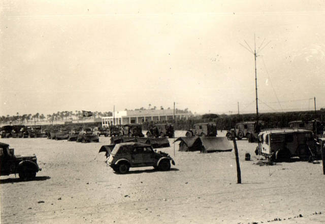
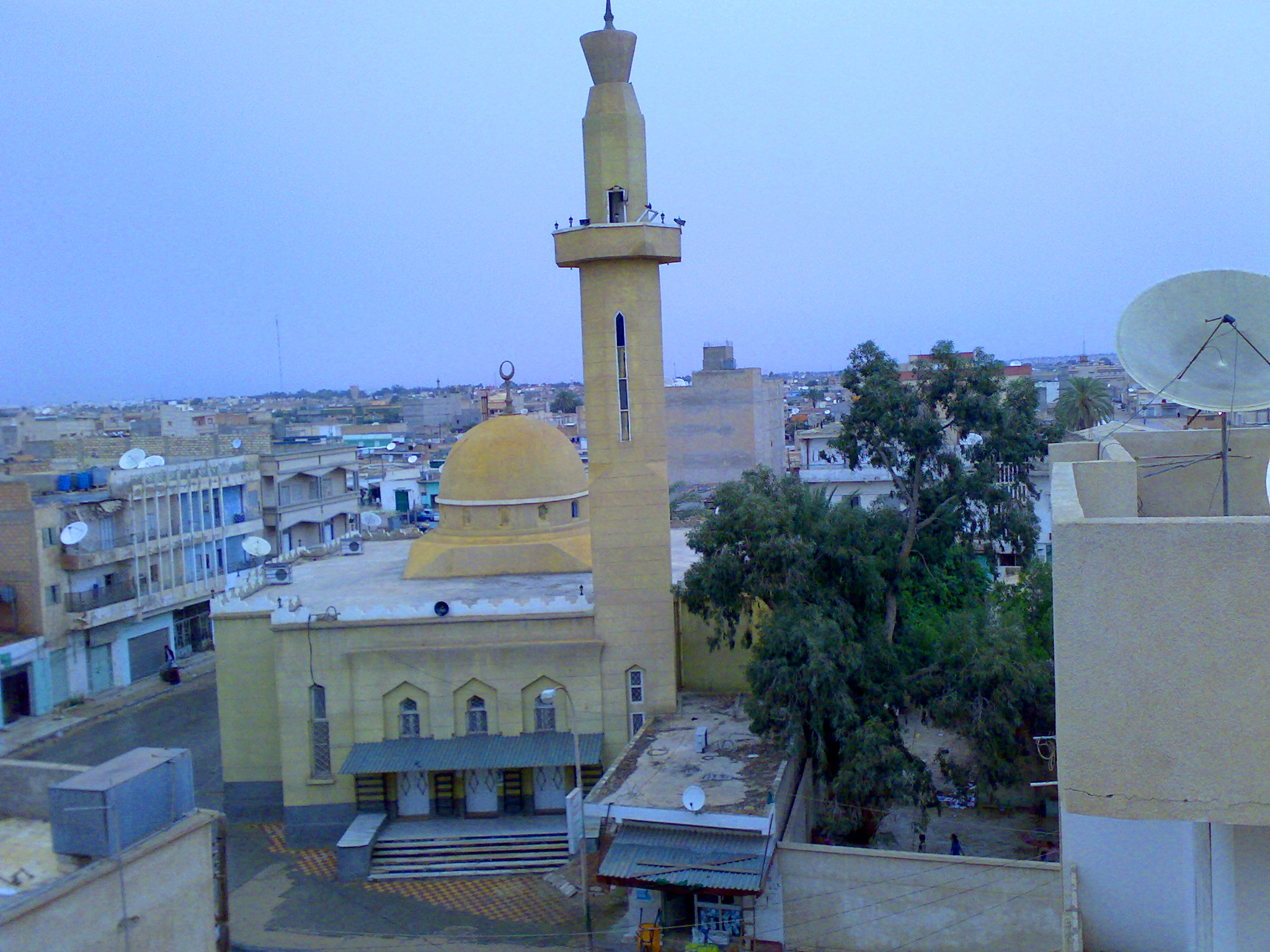
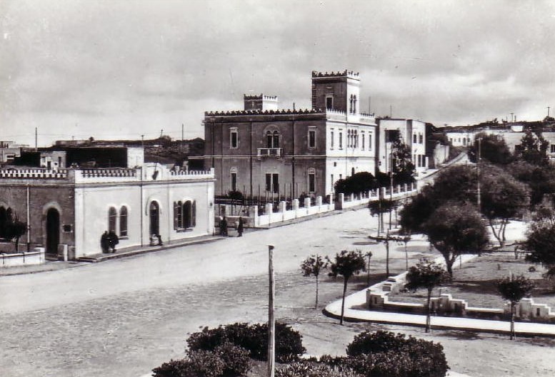
Hun or Houn ( ar, هون, Hūn) is an oasis town in the northern Fezzan region of southwest Libya. The town is the capital of the Jufra District. The "International Autumn Tourism Festival" is an annual festival usually held at the end of September. History During the colonial Italian Libya period, Hun was the administrative capital of the Italian Fezzan region, called '' Territorio del Sahara Libico''. Hun was the Italian military center of southern Italian Libya, and was not part of the national Fourth Shore territory of the Kingdom of Italy as Italian Tripolitania and Italian Cyrenaica. In the 1939 census Italians were 3% of the total population of 35,316 in the city. They disappeared from Hun after Italy's loss of Libya in World War II. An important Libyan Italian born in Hun was the internationally renowned painter Mario Schifano (1934–1998). In the 1930s the Italian government made some important improvements to the small town, including a connection to the coast via ... [...More Info...] [...Related Items...] OR: [Wikipedia] [Google] [Baidu] |
Vehicle Registration Plates Of Libya
Libya requires its residents to register their motor vehicles and display vehicle registration plates. Current plates are European standard 520 mm × 110 mm. Current Series Libya's current series of license plates entered circulation in 2013, after Libyan Revolution and the overthrow of Gaddafi. Numbers on license plates are in Latin Alphabet, and all plates carry the Arabic text ليبيا meaning ''Libya'', in Naskh Script, either on the right hand side or the right top corner. Private Vehicles Private vehicle license plates are black on white and follow the format ''# - 1 to 999999 The First number (#), a 1 or 2 digit number consists of a code corresponding to Municipality in Libya. This number is separated by a dash from the registration code, which can be 1 to 6 digits. In the city of Tripoli, due to its larger population, 7-digit registration codes are also issued. Foreigner-owned Private Vehicles Foreigner-owned Private vehicle license plates are black on w ... [...More Info...] [...Related Items...] OR: [Wikipedia] [Google] [Baidu] |
Districts Of Libya
In Libya there are currently 106 districts, second level administrative subdivisions known in Arabic as ''baladiyat'' (singular ''baladiyah''). The number has varied since 2013 between 99 and 108. The first level administrative divisions in Libya are currently the governorates (''muhafazat''), which have yet to be formally deliniated, but which were originally tripartite as: Tripolitania in the northwest, Cyrenaica in the east, and Fezzan in the southwest; and later divided into ten governorates. Prior to 2013 there were twenty-two first level administrative subdivisions known by the term ''shabiyah'' (Arabic singular ''šaʿbiyya'', plural ''šaʿbiyyāt'') which constituted the districts of Libya. In the 1990s the shabiyat had replaced an older baladiyat system. Historically the area of Libya was considered three provinces (or states), Tripolitania in the northwest, Cyrenaica in the east, and Fezzan in the southwest. It was the conquest by Italy in the Italo-Turkish War ... [...More Info...] [...Related Items...] OR: [Wikipedia] [Google] [Baidu] |
Sirte District
Sirte District (or ''Sirt'' or ''Surt'' District; ar, سرت ''Surt'', ), is one of the districts of Libya. It lies in the north of the country and borders the Gulf of Sidra. Its capital is the city of Sirte. Al-Tahadi University is located in Sirte. To the north, Sirte District has a shoreline on the Mediterranean Sea and bordered Al Wahat in the east, Jufra in the south, Jabal al Gharbi in the west and Misrata in the northwest. Per the census of 2012, the total population in the region was 157,747 with 150,353 Libyans. The average size of the household in the country was 6.9, while the average household size of non-Libyans being 3.7. There were totally 22,713 households in the district, with 20,907 Libyan ones. The population density of the district was 1.86 persons per km2. Geography The boundaries of Sirte district have changed several times, most recently in the 2007 administrative reorganization of Libyan districts (see maps). From 1983 to 1987 the Bin Jawad Distr ... [...More Info...] [...Related Items...] OR: [Wikipedia] [Google] [Baidu] |
Al Wahat District
Al Wahat or The Oases ( ar, الواحات ', en, The Oases), occasionally spelt ''Al Wahad'' or ''Al Wahah'' ( en, The Oasis) is one of the districts of Libya.''Statesman's Yearbook 2006'' Its capital and largest city is Ajdabiya. The district is home to much of Libya's petroleum extraction economic activity. History Traditionally Al Wahat was the western part of Cyrenaica. With the division of Libya into ten governorates in 1963, Al Wahat became part of the Misrata Governorate. In the 1973 reorganization it became part of Al Khalji Governorate. In 1983 Al Khalji was divided into a number of baladiyat (districts), with what is now Al Wahat being included in the Ajdabiya baladiyah and the Jalu baladiyah. In the 1988 reorganization, Jalu was subsumed within Ajdabiya baladiyah. The status of the area in the reorganization of 1995 which created thirteen districts is unclear; however, in the 1998 reorganization into twenty-six districts, the name "Al-Wahad" appears as a district ... [...More Info...] [...Related Items...] OR: [Wikipedia] [Google] [Baidu] |
Kufra District
Kufra or Kofra ( ar, الكفرة '), also spelled ''Cufra'' in Italian, is the largest district of Libya. Its capital is Al Jawf, one of the oases in Kufra basin. There is a very large oil refinery near the capital. In the late 15th century, Leo Africanus reported an oasis in the land of the ''Berdoa'', visited by a caravan coming from Awjila. It is possible that this oasis was identical with either the Al Jawf or the Taiserbo oasis, and on early modern maps, the Al Kufra region was often labelled as ''Berdoa'' based on this report. History The name ''Kufra'' (comes from Kufuh and Epher) itself is a derivation from ''kafir'', the Arabic term for non-Muslims. Kufra did not fall under the dominion of either the Arabs or the Ottomans and was owned by the Arab Bedouin tribe of the Zuwayya only in the mid 19th century, and eventually by the Italians by the 1930s. In 1931, during the campaign of Cyrenaica, General Rodolfo Graziani easily conquered Kufra, considered a strategic re ... [...More Info...] [...Related Items...] OR: [Wikipedia] [Google] [Baidu] |
Murzuq District
Murzuq ( ar, مرزق ''Murzuq'') is one of the districts of Libya. It is in the south of the country. Its capital is Murzuk. The city was occupied by the Ottoman Empire in 1578 and served as the capital of Fezzan off and on until the Ottomans ceded Libya to Italy in 1912. It was not occupied by the Italians until 1914. To the southeast, Murzuq borders the Bourkou-Ennedi-Tibesti Region of Chad, and to the southwest it borders the Agadez Department of Niger. The border crossing to Niger is at Tumu. Domestically, it borders Ghat in the west, Wadi al Hayaa in northwest, west of Sabha, Sabha in northwest, east of Wadi Al Hayaa, Jufra in north and Kufra in the east. Per the census of 2012, the total population in the region was 157,747 with 150,353 Libyans. The average size of the household in the country was 6.9, while the average household size of non-Libyans being 3.7. There were totally 22,713 households in the district, with 20,907 Libyan ones. The population density of ... [...More Info...] [...Related Items...] OR: [Wikipedia] [Google] [Baidu] |
Sabha District
Sabha ( ar, سبها ''Sabhā'') is one of the districts of Libya. It is located near the center of the country, in the Fezzan region. The capital is the city of Sabha. Sabha District borders the following districts, namely, Wadi Al Shatii in the north, Al Jufrah in the east, Murzuq in the south and Wadi Al Hayaa in the west. Per the census of 2012, the total population in the region was 157,747. The average size of the household in the country was 6.9. There were totally 22,713 households in the district, with 20,907 Libyan ones. The population density of the district was 1.86 persons per sq. km. Geography Sabha District borders the following districts, namely, Wadi Al Shatii in north, Al Jufrah in east, Murzuq in south and Wadi Al Hayaa in the west. Sabha District is in the Fezzen region (Libyan Desert), a section of the Sahara Desert. The Sabha Air Base is in the district. The Gaberoun oasis, on a spring fed lake, is a popular tourist attraction in the district. L ... [...More Info...] [...Related Items...] OR: [Wikipedia] [Google] [Baidu] |
Wadi Al Shatii District
Wadi al Shati ( ar, وادي الشاطئ ), sometimes referred to as ''Ashati'' ( ar, الشاطئ, links=no), is one of the districts of Libya in the central-west part of the country. The area is mostly desert. Wadi al Shati District is named after the depression (former lakebed) of the same name, Wadi Ashati. To the west, Wadi al Shati borders the Illizi Province of Algeria. After the 2007 administrative reorganization of districts, it borders on Nalut in northwest, Jabal al Gharbi in the north, Jufra in the east, Sabha in the southeast, Wadi al Hayaa in the south and Ghat in the southwest. Geography The depression extends east from the town of Ashkeda to the town of Ideary on the west, a distance of about 140 kilometers. To the west, Wadi al Shati borders the Illizi Province of Algeria. After the 2007 administrative reorganization of districts, it borders on the following districts, namely, Nalut in northwest, Jabal al Gharbi in the north, Jufra in the east, Sabha in t ... [...More Info...] [...Related Items...] OR: [Wikipedia] [Google] [Baidu] |
Jabal Al Gharbi District
Jabal al Gharbi or The Western Mountain ( ar, الجبل الغربي ''Al Ǧabal al Gharbi'', en, The Western Mountains) is one of the districts of Libya. It is named after the Nafusa Mountains. It was formed in 2007 from the former districts of Yafran, Gharyan and Mizda. From 1995 to 1998 Jabal al Gharbi also existed as a ''Baladiyah''. Jabal al Gharbi borders Sirte and Misrata to the east, Murqub to the northeast, Jafara and Zawiya to the north, Nuqat al Khams to the northwest, Nalut to the west, Tripoli to the north, Wadi al Shatii to the south and Jufra to the southeast. Per the census of 2012, the total population in the region was 157,747 with 150,353 Libyans. The average size of the household in the country was 6.9, while the average household size of non-Libyans being 3.7. There were totally 22,713 households in the district, with 20,907 Libyan ones. The population density of the district was 1.86 persons per km2. Per 2006 census, there were totally 104,584 econo ... [...More Info...] [...Related Items...] OR: [Wikipedia] [Google] [Baidu] |


