|
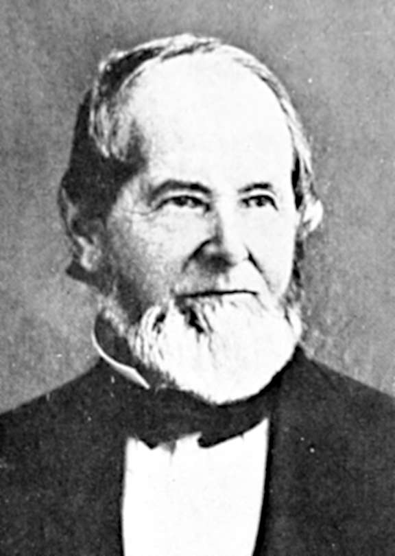
Joseph Gale
Joseph Goff Gale (April 29, 1807 – December 13, 1881) was an American pioneer, trapper, entrepreneur, and politician who contributed to the early settlement of the Oregon Country. There he assisted in the construction of the first sailing vessel built in what would become the state of Oregon, sailed the ship to California to trade for cattle, and later served as one of three co-executives ("governors") in the Provisional Government of Oregon. Originally a sailor, he also spent time in the fur trade, as a farmer, and a gold miner in the California Gold Rush. Early life Joseph Gale was born in Washington, D.C., on April 29, 1807, the son of Mary Gale (née Goff) and Joseph Gale, a sea captain from Pennsylvania. Both of his parents died when Joseph was young, but he did receive an education and some training as a sailor. Gale arrived on the Pacific Coast as early as 1828 with the Bean-Sinclair party that had been shipwrecked off the coast of California. From 1830 until 1839, the ... [...More Info...] [...Related Items...] OR: [Wikipedia] [Google] [Baidu] |
Provisional Government Of Oregon
The Provisional Government of Oregon was a popularly elected settler government created in the Oregon Country, in the Pacific Northwest region of North America. Its formation had been advanced at the Champoeg Meetings since February 17, 1841, and it existed from May 2, 1843 until March 3, 1849, and provided a legal system and a common defense amongst the mostly American pioneers settling an area then inhabited by the many Indigenous Nations. Much of the region's geography and many of the Natives were not known by people of European descent until several exploratory tours were authorized at the turn of the 18th and 19th centuries. The Organic Laws of Oregon were adopted in 1843 with its preamble stating that settlers only agreed to the laws "until such time as the United States of America extend their jurisdiction over us". According to a message from the government in 1844, the rising settler population was beginning to flourish among the "savages", who were "the chief obstru ... [...More Info...] [...Related Items...] OR: [Wikipedia] [Google] [Baidu] |
Santa Fe, New Mexico
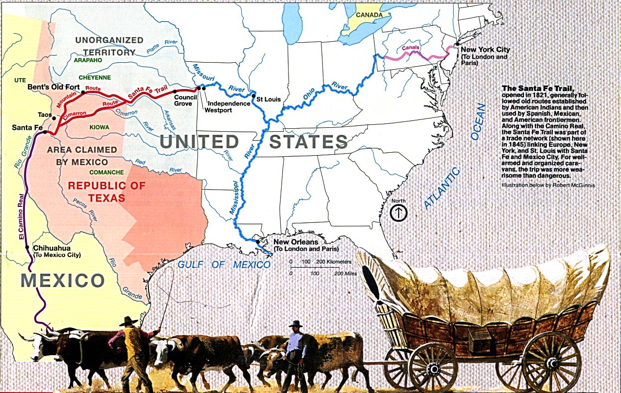
Santa Fe ( ; , Spanish for 'Holy Faith'; tew, Oghá P'o'oge, Tewa for 'white shell water place'; tiw, Hulp'ó'ona, label= Northern Tiwa; nv, Yootó, Navajo for 'bead + water place') is the capital of the U.S. state of New Mexico. The name “Santa Fe” means 'Holy Faith' in Spanish, and the city's full name as founded remains ('The Royal Town of the Holy Faith of Saint Francis of Assisi'). With a population of 87,505 at the 2020 census, it is the fourth-largest city in New Mexico. It is also the county seat of Santa Fe County. Its metropolitan area is part of the Albuquerque–Santa Fe–Las Vegas combined statistical area, which had a population of 1,162,523 in 2020. Human settlement dates back thousands of years in the region, the placita was founded in 1610 as the capital of . It replaced the previous capital, , near modern Española, at San Gabriel de Yungue-Ouinge, which makes it the oldest state capital in the United States. It is also at the highest altitude of ... [...More Info...] [...Related Items...] OR: [Wikipedia] [Google] [Baidu] |
Gallatin River
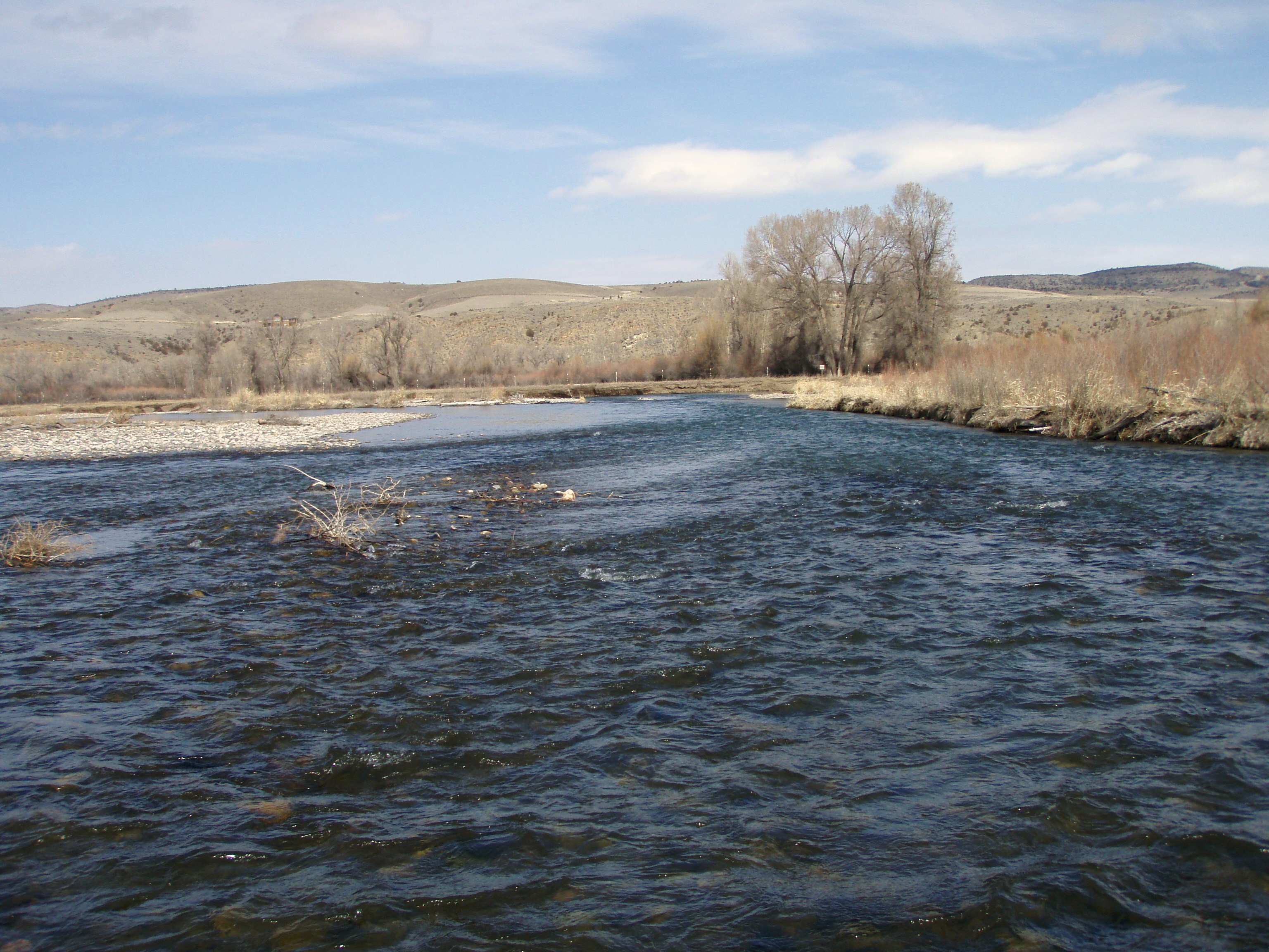
The Gallatin River is a tributary of the Missouri River, approximately 120 mi (193 km long), in the U.S. states of Wyoming and Montana. It is one of three rivers, along with the Jefferson and Madison, that converge near Three Forks, Montana, to form the Missouri. It originates in the northwest corner of Yellowstone National Park in northwestern Wyoming, in the Gallatin Range of the Rocky Mountains. It flows northwest through Gallatin National Forest, past Big Sky, Montana, and joins the Jefferson and Madison approximately 30 mi (48 km) northwest of Bozeman. U.S. Highway 191 follows the river from the Wyoming border to just outside Bozeman. The river was named in July 1805 by Meriwether Lewis at Three Forks. The eastern fork of the three, it was named for Albert Gallatin, the U.S. Treasury Secretary from 1801–14. The western fork was named for President Thomas Jefferson and the central fork for Secretary of State James Madison. The Gallatin River ... [...More Info...] [...Related Items...] OR: [Wikipedia] [Google] [Baidu] |
Fort Hall
Fort Hall was a fort in the western United States that was built in 1834 as a fur trading post by Nathaniel Jarvis Wyeth. It was located on the Snake River in the eastern Oregon Country, now part of present-day Bannock County in southeastern Idaho. Wyeth was an inventor and businessman from Boston, Massachusetts, who also founded a post at Fort William, in present-day Portland, Oregon, as part of a plan for a new trading and fisheries company. Unable to compete with the powerful British Hudson's Bay Company, based at Fort Vancouver, in 1837 Wyeth sold both posts to it. Great Britain and the United States both operated in the Oregon Country in these years. After being included in United States territory in 1846 upon settlement of the northern boundary with Canada, Fort Hall developed as an important station for emigrants through the 1850s on the Oregon Trail; it was located at the end of the common stretch from the East shared by the three far west emigrant trails. Soon after ... [...More Info...] [...Related Items...] OR: [Wikipedia] [Google] [Baidu] |
Willamette Valley
The Willamette Valley ( ) is a long valley in Oregon, in the Pacific Northwest region of the United States. The Willamette River flows the entire length of the valley and is surrounded by mountains on three sides: the Cascade Range to the east, the Oregon Coast Range to the west, and the Calapooya Mountains to the south. The valley is synonymous with the cultural and political heart of Oregon and is home to approximately 70 percent of its population including the five largest cities in the state: Portland, Eugene, Salem, Gresham, and Hillsboro. The valley's numerous waterways, particularly the Willamette River, are vital to the economy of Oregon, as they continuously deposit highly fertile alluvial soils across its broad, flat plain. A massively productive agricultural area, the valley was widely publicized in the 1820s as a "promised land of flowing milk and honey." Throughout the 19th century, it was the destination of choice for the oxen-drawn wagon trains of emigra ... [...More Info...] [...Related Items...] OR: [Wikipedia] [Google] [Baidu] |
Hall Jackson Kelley
Hall Jackson Kelley (February 24, 1790 – January 20, 1874) was an American settler and writer from New England known for his strong advocacy for settlement by the United States of the Oregon Country in the 1820s and 1830s. A native of New Hampshire, he was a school teacher in Maine and Massachusetts, and a longtime resident of the latter state after graduating from Harvard College. In 1834 Kelley led an expedition to Oregon Country. He became ill in the Northwest and was virtually deported by the head of the Hudson's Bay Company district office at Fort Vancouver. After his return to Massachusetts, he continued to write about the territory to encourage its settlement, also submitting materials to Congress. In 1868 he published a book about the region, by which time the emigrants on the Oregon Trail had already numbered into the tens of thousands. Kelley Point Park in Portland, Oregon, is named for him, as he had encouraged settlement at the confluence of the Willamette and Columb ... [...More Info...] [...Related Items...] OR: [Wikipedia] [Google] [Baidu] |
Yosemite Valley
Yosemite Valley ( ; ''Yosemite'', Miwok for "killer") is a glacial valley in Yosemite National Park in the western Sierra Nevada mountains of Central California. The valley is about long and deep, surrounded by high granite summits such as Half Dome and El Capitan, and densely forested with pines. The valley is drained by the Merced River, and a multitude of streams and waterfalls flow into it, including Tenaya, Illilouette, Yosemite and Bridalveil Creeks. Yosemite Falls is the highest waterfall in North America and is a big attraction especially in the spring, when the water flow is at its peak. The valley is renowned for its natural environment and is regarded as the centerpiece of Yosemite National Park. The valley is the main attraction in the park for the majority of visitors and a bustling hub of activity during tourist season in the summer months. Most visitors enter the valley from roads to the west and pass through the Tunnel View entrance. Visitor facil ... [...More Info...] [...Related Items...] OR: [Wikipedia] [Google] [Baidu] |
Sierra Nevada (U
The Sierra Nevada () is a mountain range in the Western United States, between the Central Valley of California and the Great Basin. The vast majority of the range lies in the state of California, although the Carson Range spur lies primarily in Nevada. The Sierra Nevada is part of the American Cordillera, an almost continuous chain of mountain ranges that forms the western "backbone" of the Americas. The Sierra runs north-south and its width ranges from to across east–west. Notable features include General Sherman, the largest tree in the world by volume; Lake Tahoe, the largest alpine lake in North America; Mount Whitney at , the highest point in the contiguous United States; and Yosemite Valley sculpted by glaciers from one-hundred-million-year-old granite, containing high waterfalls. The Sierra is home to three national parks, twenty wilderness areas, and two national monuments. These areas include Yosemite, Sequoia, and Kings Canyon National Parks; and ... [...More Info...] [...Related Items...] OR: [Wikipedia] [Google] [Baidu] |
Humboldt River
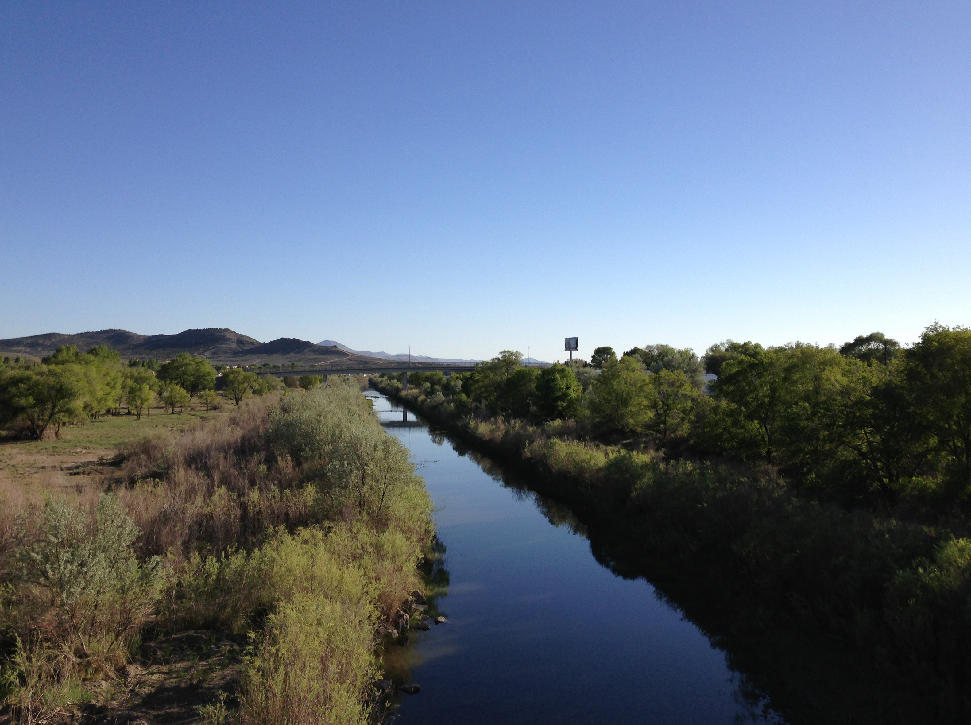
The Humboldt River is an extensive river drainage system located in north-central Nevada. It extends in a general east-to-west direction from its headwaters in the Jarbidge, Independence, and Ruby Mountains in Elko County, to its terminus in the Humboldt Sink, approximately 225 direct miles away in northwest Churchill County. Most estimates put the Humboldt River at to long however, due to the extensive meandering nature of the river, its length may be more closely estimated at 380 miles (612 km). It is located within the Great Basin Watershed and is the third longest river in the watershed behind the Bear River at 355 miles (570 km) and the Sevier River at 325 miles (523 km). The Humboldt River Basin is the largest sub-basin of the Great Basin encompassing an area of 16,840 square miles (43,615 km2). It is the only major river system wholly contained within the state of Nevada. It is the only natural transportation artery across the Great Basin and has ... [...More Info...] [...Related Items...] OR: [Wikipedia] [Google] [Baidu] |
Great Salt Lake
The Great Salt Lake is the largest saltwater lake in the Western Hemisphere and the eighth-largest terminal lake in the world. It lies in the northern part of the U.S. state of Utah and has a substantial impact upon the local climate, particularly through lake-effect snow. It is a remnant of Lake Bonneville, a prehistoric body of water that covered much of western Utah. The area of the lake can fluctuate substantially due to its low average depth of . In the 1980s, it reached a historic high of , and the West Desert Pumping Project was established to mitigate flooding by pumping water from the lake into the nearby desert. In 2021, after years of sustained drought and increased water diversion upstream of the lake, it fell to its lowest recorded area at 950 square miles (2,460 km²), falling below the previous low set in 1963. Continued shrinkage could turn the lake into a bowl of toxic dust, poisoning the air around Salt Lake City. The lake's three major tributaries, ... [...More Info...] [...Related Items...] OR: [Wikipedia] [Google] [Baidu] |
Joseph Reddeford Walker
Joseph R. Walker (December 13, 1798 – October 27, 1876) was a mountain man and experienced scout. He established the segment of the California Trail, the primary route for the emigrants to the gold fields during the California gold rush, from Fort Hall, Idaho to the Truckee River. The Walker River and Walker Lake in Nevada were named for him by John C. Frémont. Name The R. stood for Rutherford, but is also found as Reddford, Reddeford, and Redeford. "Rutherford" came from his great-grandmother's, Kathleen Rutherford Walker, line, and not his mother's, as incorrectly stated in some sources. Early years Walker was born in Roane County, Tennessee, the fourth child of seven born to Joseph and Susan Willis Walker. In 1819, the family emigrated to Missouri, settling west of Fort Osage. In 1820, he traveled to Santa Fe and was detained for a short while by Spanish authorities. He may have become one of the "Taos trappers" trapping beaver in the Spanish/Mexican territory of ... [...More Info...] [...Related Items...] OR: [Wikipedia] [Google] [Baidu] |
Green River (Colorado River Tributary)
The Green River, located in the western United States, is the chief tributary of the Colorado River. The watershed of the river, known as the Green River Basin, covers parts of the U.S. states of Wyoming, Utah, and Colorado. The Green River is long, beginning in the Wind River Mountains of Wyoming and flowing through Wyoming and Utah for most of its course, except for a short segment of in western Colorado. Much of the route traverses the arid Colorado Plateau, where the river has carved some of the most spectacular canyons in the United States. The Green is slightly smaller than Colorado when the two rivers merge but typically carries a larger load of silt. The average yearly mean flow of the river at Green River, Utah is per second. The status of the Green River as a tributary of the Colorado River came about mainly for political reasons. In earlier nomenclature, the Colorado River began at its confluence with the Green River. Above the confluence, Colorado was called the ... [...More Info...] [...Related Items...] OR: [Wikipedia] [Google] [Baidu] |


