|
Jorethang
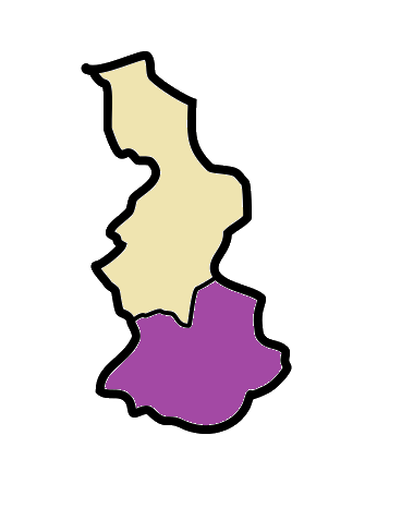
Jorethang is a major town in Namchi district in the Indian state of Sikkim. Jorethang lies on the bank of Rangeet River, which is a tributary of the Teesta River, on the way to Pelling from Darjeeling, Siliguri and Kalimpong. Demographics As of the 2011 Census of India, Jorethang had a population of 9,009. Males constitute 52% of the population and females 48%. Jorethang has an average literacy rate of 88.85%, higher than the state average of 81.42%: male literacy is 93.36%, and female literacy is 84.20%. In Jorethang, 10.63% of the population is under 6 years of age. Education Schools in Jorethang offer primary, secondary and senior secondary education. There are various school like New Buds Academy, St. Francis' School, Little Angles Academy, Govt. Sen. Sec. School. Maghe Sankranti Mela This festival is held on the first of Magh in the Bikram Samwat Nepali calendar (about 14 January), marking the sun's entrance into Makara rashi ( Capricorn). It is one of the main fe ... [...More Info...] [...Related Items...] OR: [Wikipedia] [Google] [Baidu] |
Sikkim
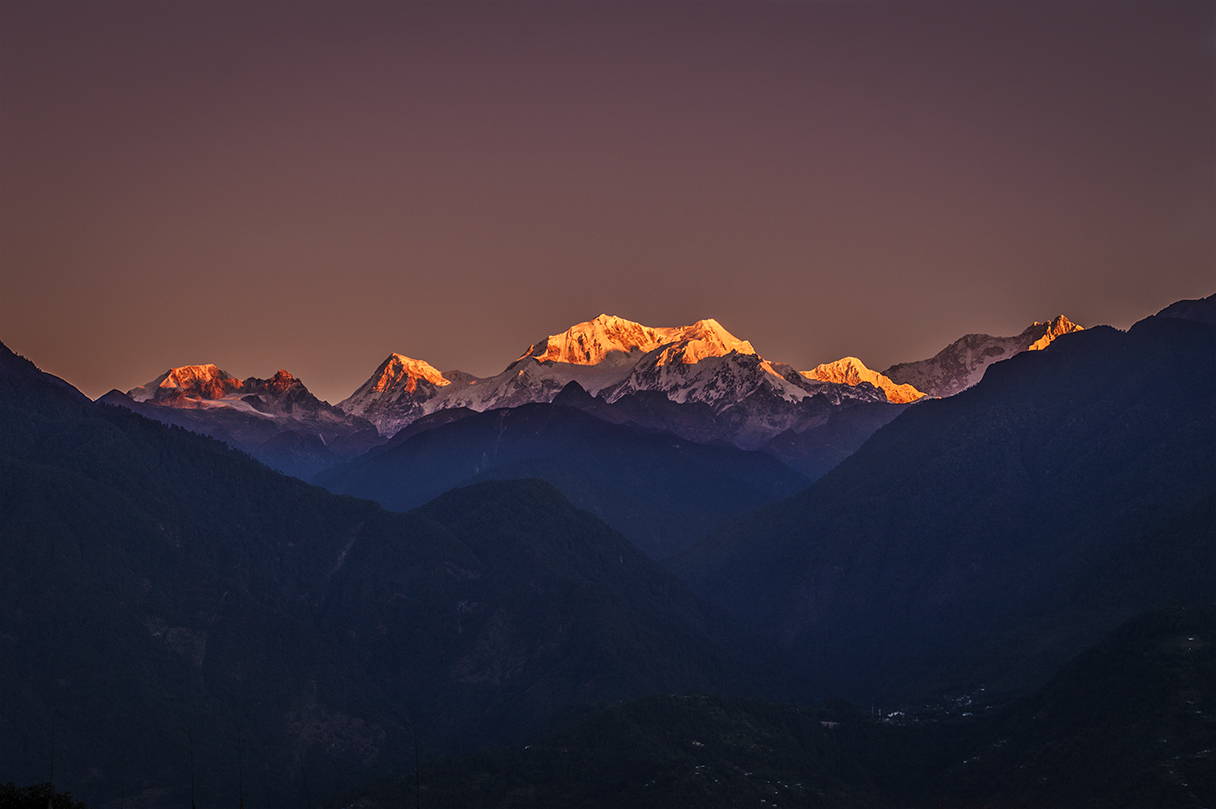
Sikkim (; ) is a state in Northeastern India. It borders the Tibet Autonomous Region of China in the north and northeast, Bhutan in the east, Province No. 1 of Nepal in the west and West Bengal in the south. Sikkim is also close to the Siliguri Corridor, which borders Bangladesh. Sikkim is the least populous and second smallest among the Indian states. Situated in the Eastern Himalaya, Sikkim is notable for its biodiversity, including alpine and subtropical climates, as well as being a host to Kangchenjunga, the highest peak in India and third highest on Earth. Sikkim's capital and largest city is Gangtok. Almost 35% of the state is covered by Khangchendzonga National Park – a UNESCO World Heritage Site. The Kingdom of Sikkim was founded by the Namgyal dynasty in the 17th century. It was ruled by Buddhist priest-kings known as the Chogyal. It became a princely state of British India in 1890. Following Indian independence, Sikkim continued its protectorate status with ... [...More Info...] [...Related Items...] OR: [Wikipedia] [Google] [Baidu] |
South Sikkim
Namchi District is a district of the Indian state of Sikkim. Its headquarters is at Namchi. Geography South Sikkim lies at an altitude of 400 to 2000 metres and has a temperate climate for most of the year. Major urban centres include Namchi, Ravangla, Jorethang and Melli. Assembly Constituencies The district was previously divided into eight assembly constituencies. * Barfung (BL) * Poklok-Kamrang * Namchi-Singhithang *Melli * Namthang-Rateypani * Temi-Namphing * Rangang-Yangang *Tumen-Lingi (BL) National protected area *Maenam Wildlife Sanctuary Economy South Sikkim is the most industrialised district in the state, owing to the availability of flat land. Since the geology is stable the roads are in good condition as compared to other parts of the state which suffer from landslides. The district is also known for Sikkim tea, which is grown near Namchi. Demographics According to the 2011 census South Sikkim district has a population of 146,850, roughly equal to ... [...More Info...] [...Related Items...] OR: [Wikipedia] [Google] [Baidu] |
Pelling
Pelling is a small hill town in the district of West Sikkim, India. Pelling is nestled at an altitude of 2,150 m (7,200 feet). The town is located at a distance of 10 km from the district headquarters of Geyzing and 131 km from Gangtok. A regular bus service connects the two towns. However, with the influx of tourists, the region is undergoing a metamorphosis, with the roads being repaired and hotels being set up. Location and surroundings The Himalayas and the Kanchenjanga may be viewed at close quarters from Pelling. Pelling also forms the base from where trekkers and other peripatetic adventurers undertake the strenuous and arduous treks in West Sikkim. The land around Pelling is still a virgin territory and is bathed with alpine vegetation, with numerous waterfalls lining the hillside. In the months of winter, Pelling is sometimes covered with a blanket of snow. Pelling is 115 km from the state capital Gangtok and about 135 km from Siligur ... [...More Info...] [...Related Items...] OR: [Wikipedia] [Google] [Baidu] |
Rangeet River
The Rangeet or Rangit is a tributary of the Teesta river, which is the largest river in the Indian state of Sikkim. The Rangeet river originates in the Himalayan mountains in West Sikkim district. The river also forms the boundary between Sikkim and Darjeeling district. A perennial river, it is fed by the melting snow of the Himalayas in early summer and the monsoon rains in June–September. It is popular among rafting enthusiasts owing to its turbulent waters. The river flows past the towns of Jorethang, Pelling and Legship. During its final few kilometres, it joins the Teesta River at a confluence known as Tribeni, which is a popular picnic spot. The Rangeet river has an NHPC hydropower Hydropower (from el, ὕδωρ, "water"), also known as water power, is the use of falling or fast-running water to Electricity generation, produce electricity or to power machines. This is achieved by energy transformation, converting the Pot ... plant with a capacity of capacity in Sik ... [...More Info...] [...Related Items...] OR: [Wikipedia] [Google] [Baidu] |
Nagar Panchayat
A nagar panchayat (town panchayat; ) or Notified Area Council (NAC) in India is a settlement in transition from rural to urban and therefore a form of an urban political unit comparable to a municipality. An urban centre with more than 12,000 and less than 40,000 inhabitants is classified as a nagar panchayat. Such councils are formed under the panchayati raj administrative system. In census data, the abbreviation T.P. is used to indicate a "town panchayat". Tamil Nadu was the first state to introduce the panchayat town as an intermediate step between rural villages and urban local bodies (ULB). The structure and the functions of the nagar panchayat are decided by the state government. Management Each nagar panchayat has a committee consisting of a chairman with ward members. Membership consists of a minimum of ten elected ward members and three nominated members. The NAC members of the Nagar are elected from the several wards of the nagar panchayat on the basis of adult fran ... [...More Info...] [...Related Items...] OR: [Wikipedia] [Google] [Baidu] |
Sunwar Language
Sunuwar, Sunuwar, or Kõinch (; ; other spellings are Koinch and Koincha), is a Kiranti language spoken in Nepal and India by the Sunuwar people. It was first comprehensively attested by the Himalayan Languages Project. It is also known as Kõits Lo ( ; ), Kiranti-Kõits ( ; ), Mukhiya ( ; ). The Sunwar language is one of the smaller members of the Tibeto-Burman language family. About 40,000 speakers are residing in eastern Nepal. Names The language is commonly known as ''Koic,'' for many ethnic Sunwar and Sunwar speakers also refer to the language as “''Sunuwar, Kõinch'' '', Koinch'' or ''Koincha'' (कोँइच); ''Kõits Lo'' (कोँइच लो), ''Kiranti-Kõits'' (किराँती-कोँइच) or ''Mukhiya'' (मुखिया).” Moreover, most Sunwar speakers have the surname (सुनुवार), ''Sunuvār'' in Latin script. Many affiliated Sunwar with Sunar; they share the initial syllable, ''sun'', “gold,” in Nepali, similar to the S ... [...More Info...] [...Related Items...] OR: [Wikipedia] [Google] [Baidu] |
Capricorn (astrology)
Capricorn () is the tenth astrological sign in the zodiac out of twelve total zodiac signs, originating from the constellation of Capricornus, the goat. It spans the 270–300th degree of the zodiac, corresponding to celestial longitude. Under the tropical zodiac, the sun transits this area from about December 22 to January 19. In astrology, Capricorn is considered an earth sign, negative sign, and one of the four cardinal signs. Capricorn is said to be ruled by the planet Saturn. There appears to be a connection between traditional characterizations of Capricorn as a sea goat and the Sumerian god of wisdom and waters, who also had the head and upper body of a goat and the lower body and tail of a fish. Later known as ''Ea'' in Akkadian and Babylonian mythology, Enki was the god of intelligence (''gestú'', literally "ear"), creation, crafts; magic; water, seawater and lake water (''a, aba, ab''). Cultural significance In India, the zodiac sign of Capricorn is celebrat ... [...More Info...] [...Related Items...] OR: [Wikipedia] [Google] [Baidu] |
Makara
''Makara'' ( sa, मकर, translit=Makara) is a legendary sea-creature in Hindu mythology. In Hindu astrology, Makara is equivalent to the Zodiac sign Capricorn. Makara appears as the vahana (vehicle) of the river goddess Ganga, Narmada, and of the god of the ocean, Varuna. Makara are considered guardians of gateways and thresholds, protecting throne rooms as well as entryways to temples; it is the most commonly recurring creature in Hindu and Buddhist temple iconography, and also frequently appears as a gargoyle or as a spout attached to a natural spring. Makara-shaped earrings called ''Makarakundalas'' are sometimes worn by Hindu deities, for example Shiva, Vishnu, Surya, and Chandi. Makara is also the insignia of the love god Kamadeva, who has no dedicated temples and is also known as ''Makaradhvaja'', "one whose flag depicts a makara". Etymology ''Makara'' is a Sanskrit word which means "sea-animal, crocodile". Josef Friedrich Kohl of Würzburg University and severa ... [...More Info...] [...Related Items...] OR: [Wikipedia] [Google] [Baidu] |
Bikram Samwat
Vikram Samvat (IAST: ''Vikrama Samvat''; abbreviated VS) or Bikram Sambat B.S. and also known as the Vikrami calendar, is a Hindu calendar historically used in the Indian subcontinent. Vikram Samvat is generally 57 years ahead of Gregorian Calendar, except during January to April, when it is ahead by 56 years. Alongside Nepal Sambat, it is one of the two official calendars used in Nepal. In India, it is used in several states. The traditional Vikram Samvat calendar, as used in India, uses lunar months and solar sidereal years. The Nepali Bikram Sambat introduced in 1901 CE, also uses a solar sidereal year. History A number of ancient and medieval inscriptions used the Vikram Samvat. Although it was reportedly named after the legendary king Vikramaditya, the term "Vikrama Samvat" does not appear in the historical record before the 9th century; the same calendar system is found with other names, such as Krita and Malava. In colonial scholarship, the era was believed to be base ... [...More Info...] [...Related Items...] OR: [Wikipedia] [Google] [Baidu] |
Magh (Nepali Calendar)
Magh ( ne, माघ) is the tenth month in Bikram Sambat or B.S., the official and Hindu religious calendar of the Nepalese speaking people native to the Indian subcontinent of Hindu Nepalese nationality and ethnic Hindu Nepalis of Indian nationality. This month approximately coincides with January 15 to February 12 of the Gregorian (western) calendar and is 29 days long. Important holidays: * Magh 1, Maghe Sankranti, also see Makar Sankranti * Magh 9, Basant Panchami Vasant Panchami, also called Saraswati Puja in honor of the Hindu goddess Saraswati, is a festival that marks the preparation for the arrival of spring. The festival is celebrated in Indian religions in different ways depending on the region. ... Months in Nepali calendar External links Nepali Calendar Nepali Calendar Nepali Calendar Nepali calendar with Events and FestivalsNepali Calendar Nepali Calendar Nepali calendar {{Nepal-stub ... [...More Info...] [...Related Items...] OR: [Wikipedia] [Google] [Baidu] |
2011 Census Of India
The 2011 Census of India or the 15th Indian Census was conducted in two phases, house listing and population enumeration. The House listing phase began on 1 April 2010 and involved the collection of information about all buildings. Information for National Population Register (NPR) was also collected in the first phase, which will be used to issue a 12-digit unique identification number to all registered Indian residents by Unique Identification Authority of India. The second population enumeration phase was conducted between 9 and 28 February 2011. Census has been conducted in India since 1872 and 2011 marks the first time biometric information was collected. According to the provisional reports released on 31 March 2011, the Indian population increased to 1.21 billion with a decadal growth of 17.70%. Adult literacy rate increased to 74.04% with a decadal growth of 9.21%. The motto of the census was 'Our Census, Our future'. Spread across 28 states and 8 union territories, t ... [...More Info...] [...Related Items...] OR: [Wikipedia] [Google] [Baidu] |
Kalimpong
Kalimpong (Hindi: कलिम्पोंग) is a town and the headquarters of an eponymous district in the Indian state of West Bengal. It is located at an average elevation of . The town is the headquarters of the Kalimpong district. The region comes under Gorkhaland Territorial Administration which is an autonomous governing body within the state of West Bengal. The Indian Army's 27 Mountain Division is located on the outskirts of the city. Kalimpong is known for its educational institutions, many of which were established during the British colonial period. It used to be a gateway in the trade between Tibet and India before China's annexation of Tibet and the Sino-Indian War. Kalimpong and neighbouring Darjeeling were major centres calling for a separate Gorkhaland state in the 1980s, and more recently in 2010. The municipality sits on a ridge overlooking the Teesta River and is a tourist destination owing to its temperate climate, natural environment and proximity to p ... [...More Info...] [...Related Items...] OR: [Wikipedia] [Google] [Baidu] |


