|
John Paul Hammerschmidt Lake
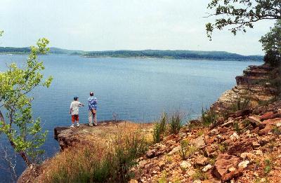
John Paul Hammerschmidt Lake is a reservoir on the Arkansas River and an integral part of the McClellan–Kerr Arkansas River Navigation System (MKARNS). It was formed by constructing the James W. Trimble Lock & Dam 13 across the river, near the city of Barling, Arkansas and extends upriver to W. D. Mayo Lock and Dam, which is located inside the state of Oklahoma. Although the Trimble facility was completed in 1969, it was not allowed to pass commercial barges until 1971, when upstream facilities were completed. The lake also serves as the boundary between Crawford County, Arkansas, Crawford and Sebastian County, Arkansas, Sebastian Counties, Arkansas, as well as dividing Van Buren, Arkansas, Van Buren, the county seat of Crawford County, and Fort Smith, the county seat of Sebastian County. The Arkansas-Oklahoma State Line is the western boundary of both Arkansas counties. [...More Info...] [...Related Items...] OR: [Wikipedia] [Google] [Baidu] |
Fort Smith, Arkansas
Fort Smith is the third-largest city in Arkansas and one of the two county seats of Sebastian County. As of the 2020 Census, the population was 89,142. It is the principal city of the Fort Smith, Arkansas–Oklahoma Metropolitan Statistical Area, a region of 298,592 residents that encompasses the Arkansas counties of Crawford, Franklin, and Sebastian, and the Oklahoma counties of Le Flore and Sequoyah. Fort Smith lies on the Arkansas–Oklahoma state border, situated at the confluence of the Arkansas and Poteau rivers, also known as Belle Point. Fort Smith was established as a western frontier military post in 1817, when it was also a center of fur trading. The city developed there. It became well known as a base for migrants' settling of the "Wild West" and for its law enforcement heritage. The city government is led by Mayor George McGill (D), who made history in 2018 when he was elected as the city's first African American mayor, and a city Board of Directors composed of ... [...More Info...] [...Related Items...] OR: [Wikipedia] [Google] [Baidu] |
Sequoyah County, Oklahoma
Sequoyah County is a county located in the U.S. state of Oklahoma. As of the 2020 census, the population was 39,281. The county seat is Sallisaw. Sequoyah County was created in 1907 when Oklahoma became a state. It was named after Sequoyah, who created the Cherokee syllabary and its written language. William L. Anderson, "Sequoyah County." ''Encyclopedia of Oklahoma History and Culture''. Accessed May 23, 2012. Sequoyah County is part of the Fort Smith, AR-OK Metropolitan Statistical ...
[...More Info...] [...Related Items...] OR: [Wikipedia] [Google] [Baidu] |
Geography Of Sequoyah County, Oklahoma
Geography (from Greek: , ''geographia''. Combination of Greek words ‘Geo’ (The Earth) and ‘Graphien’ (to describe), literally "earth description") is a field of science devoted to the study of the lands, features, inhabitants, and phenomena of Earth. The first recorded use of the word γεωγραφία was as a title of a book by Greek scholar Eratosthenes (276–194 BC). Geography is an all-encompassing discipline that seeks an understanding of Earth and its human and natural complexities—not merely where objects are, but also how they have changed and come to be. While geography is specific to Earth, many concepts can be applied more broadly to other celestial bodies in the field of planetary science. One such concept, the first law of geography, proposed by Waldo Tobler, is "everything is related to everything else, but near things are more related than distant things." Geography has been called "the world discipline" and "the bridge between the human and th ... [...More Info...] [...Related Items...] OR: [Wikipedia] [Google] [Baidu] |
Geography Of McIntosh County, Oklahoma
Geography (from Greek: , ''geographia''. Combination of Greek words ‘Geo’ (The Earth) and ‘Graphien’ (to describe), literally "earth description") is a field of science devoted to the study of the lands, features, inhabitants, and phenomena of Earth. The first recorded use of the word γεωγραφία was as a title of a book by Greek scholar Eratosthenes (276–194 BC). Geography is an all-encompassing discipline that seeks an understanding of Earth and its human and natural complexities—not merely where objects are, but also how they have changed and come to be. While geography is specific to Earth, many concepts can be applied more broadly to other celestial bodies in the field of planetary science. One such concept, the first law of geography, proposed by Waldo Tobler, is "everything is related to everything else, but near things are more related than distant things." Geography has been called "the world discipline" and "the bridge between the human and ... [...More Info...] [...Related Items...] OR: [Wikipedia] [Google] [Baidu] |
Geography Of Sebastian County, Arkansas
Geography (from Greek: , ''geographia''. Combination of Greek words ‘Geo’ (The Earth) and ‘Graphien’ (to describe), literally "earth description") is a field of science devoted to the study of the lands, features, inhabitants, and phenomena of Earth. The first recorded use of the word γεωγραφία was as a title of a book by Greek scholar Eratosthenes (276–194 BC). Geography is an all-encompassing discipline that seeks an understanding of Earth and its human and natural complexities—not merely where objects are, but also how they have changed and come to be. While geography is specific to Earth, many concepts can be applied more broadly to other celestial bodies in the field of planetary science. One such concept, the first law of geography, proposed by Waldo Tobler, is "everything is related to everything else, but near things are more related than distant things." Geography has been called "the world discipline" and "the bridge between the human and ... [...More Info...] [...Related Items...] OR: [Wikipedia] [Google] [Baidu] |
Geography Of Crawford County, Arkansas
Geography (from Greek: , ''geographia''. Combination of Greek words ‘Geo’ (The Earth) and ‘Graphien’ (to describe), literally "earth description") is a field of science devoted to the study of the lands, features, inhabitants, and phenomena of Earth. The first recorded use of the word γεωγραφία was as a title of a book by Greek scholar Eratosthenes (276–194 BC). Geography is an all-encompassing discipline that seeks an understanding of Earth and its human and natural complexities—not merely where objects are, but also how they have changed and come to be. While geography is specific to Earth, many concepts can be applied more broadly to other celestial bodies in the field of planetary science. One such concept, the first law of geography, proposed by Waldo Tobler, is "everything is related to everything else, but near things are more related than distant things." Geography has been called "the world discipline" and "the bridge between the human and ... [...More Info...] [...Related Items...] OR: [Wikipedia] [Google] [Baidu] |
Infrastructure Completed In 1969
Infrastructure is the set of facilities and systems that serve a country, city, or other area, and encompasses the services and facilities necessary for its economy, households and firms to function. Infrastructure is composed of public and private physical structures such as roads, railways, bridges, tunnels, water supply, sewers, electrical grids, and telecommunications (including Internet connectivity and broadband access). In general, infrastructure has been defined as "the physical components of interrelated systems providing commodities and services essential to enable, sustain, or enhance societal living conditions" and maintain the surrounding environment. Especially in light of the massive societal transformations needed to mitigate and adapt to climate change, contemporary infrastructure conversations frequently focus on sustainable development and green infrastructure. Acknowledging this importance, the international community has created policy focused on sustainab ... [...More Info...] [...Related Items...] OR: [Wikipedia] [Google] [Baidu] |
Lakes Of Oklahoma
The following is a list of lakes in Oklahoma located entirely (or partially, as in the case of Lake Texoma) in the state. Oklahoma has more than 200 lakes created by dams. All lakes listed are man-made. Oklahoma's only natural lakes are oxbow and playa lakes. Oklahoma has sixty-two oxbow lakes at least 10 acres in size. The largest, near the Red River in McCurtain County is 272 acres. Playa lakes are found in saucer-shaped depressions in the high plains region. They are usually intermittent, holding water only after rains. Oklahoma has about 600 playa lakes. Lakes and reservoirs by size Ranked by surface acres, Lake Eufaula is the 34th largest lake in the United States and Lake Texoma is the 38th largest. Source: ''Oklahoma Water Atlas' an accessed Mar 1, 2011. Some inconsistencies exist between the two sources. Lakes geography and administration Lakes and reservoirs (alphabetically) * Altus City Reservoir * Lake Altus-Lugert * American Horse Lake * Lake o ... [...More Info...] [...Related Items...] OR: [Wikipedia] [Google] [Baidu] |
Lakes Of Arkansas
There are at least 2340 named lakes and reservoirs in Arkansas. The following list contains lists of lakes and reservoirs in Arkansas by county. A lake is a terrain feature (or physical feature), a body of liquid on the surface of a world that is localized to the bottom of basin (another type of landform or terrain feature; that is not global). Another definition is a body of fresh or salt water of considerable size that is surrounded by land. On Earth a body of water is considered a lake when it is inland, not part of the ocean, is larger and deeper than a pond. A reservoir (etymology from French ''réservoir'' a "storehouse ) is an artificial lake used to store water. Reservoirs may be created in river valleys by the construction of a dam or may be built by excavation in the ground or by conventional construction techniques such a brickwork or cast concrete. Major lakes/reservoirs List of lakes by county * List of lakes of Arkansas County, Arkansas * List of lakes of As ... [...More Info...] [...Related Items...] OR: [Wikipedia] [Google] [Baidu] |
LeFlore County, Oklahoma
LeFlore County is a county along the eastern border of the U.S state of Oklahoma. As of the 2010 census, the population was 50,384. Its county seat is Poteau. The county is part of the Fort Smith metropolitan area and the name honors a Choctaw family named LeFlore. The United States District Court for the Eastern District of Oklahoma is the federal district court with jurisdiction in LeFlore County. History The Choctaw Nation signed the Treaty of Doak's Stand in 1820, ceding part of their ancestral home in the Southeastern U. S. and receiving a large tract in Indian Territory. They signed the Treaty of Dancing Rabbit Creek in 1830, which ceded the remainder of their original homeland. Most of the remainder of the Choctaw were removed to Indian Territory, escorted by federal military troops, in several waves. In 1832, the Federal Government constructed the Choctaw Agency in Indian Territory about west of Fort Smith, Arkansas. The town of Skullyville developed around the ag ... [...More Info...] [...Related Items...] OR: [Wikipedia] [Google] [Baidu] |
Sebastian County, Arkansas
Sebastian County is a county located in the U.S. state of Arkansas. As of the 2010 census, the population was 125,744, making it the fourth-most populous county in Arkansas. The county has two county seats, Greenwood and Fort Smith. Sebastian County is part of the Fort Smith, AR- OK Metropolitan Statistical Area. History Sebastian County is Arkansas's 56th county, formed on January 6, 1851, and named for William K. Sebastian, United States Senator from Arkansas. Geography According to the U.S. Census Bureau, the county has a total area of , of which is land and (2.6%) is water. It is the second-smallest county by area in Arkansas. Major highways * Interstate 49 * Interstate 540 * U.S. Highway 64 * U.S. Highway 71 * U.S. Highway 271 * State Route 10 * State Route 22 * State Route 45 * State Route 59 * State Route 96 Adjacent counties *Crawford County (north) * Franklin County (east) *Logan County (southeast) * Scott County (south) *Le Flore County, Oklahoma (south ... [...More Info...] [...Related Items...] OR: [Wikipedia] [Google] [Baidu] |
Van Buren, Arkansas
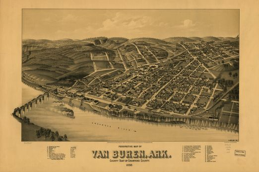
Van Buren ( ) is the second-largest city in the Fort Smith, Arkansas–Oklahoma Metropolitan Statistical Area and the county seat of Crawford County, Arkansas, United States. The city is located directly northeast of Fort Smith at the Interstate 40 – Interstate 540 junction. The city was incorporated in 1845 and as of the 2010 census had a population of 22,791, ranking it as the state's 22nd-largest city, behind Searcy. History Early history The area was settled by David Boyd and Thomas Martin in 1818. After Arkansas became a territory in 1819, Daniel and Thomas Phillips constructed a lumber yard in the community to serve as a fuel depot for traffic along the Arkansas River. In 1831, a post office was constructed for the community, at the time known as Phillips Landing. This post office was named after newly appointed Secretary of State and future President Martin Van Buren. John Drennen, along with his partner David Thompson, purchased the area for US$11,000. ... [...More Info...] [...Related Items...] OR: [Wikipedia] [Google] [Baidu] |


