|
Jdeide
Jdeide ( ar, جديده), also spelled Al Judaideh, or the New Fakehe, is a little village located in the northern part of the Baalbek District of Lebanon, on the main road between the city of Baalbek and the city of Hermel. the population of Jdeide originates mainly from the nearby village of Fakeha which is located about one km of road in a valley of the mountain range of Anti-Lebanon The Anti-Lebanon Mountains ( ar, جبال لبنان الشرقية, Jibāl Lubnān ash-Sharqiyyah, Eastern Mountains of Lebanon; Lebanese Arabic: , , "Eastern Mountains") are a southwest–northeast-trending mountain range that forms most of th .... Gallery Image:Jdeide1.jpg Image:Jdeide2.jpg {{coord, 34.247964, N, 36.387045, E, type:city_region:LB_source:nlwiki, display=title Beqaa Valley ... [...More Info...] [...Related Items...] OR: [Wikipedia] [Google] [Baidu] |
Districts Of Lebanon
The nine governorates of Lebanon are subdivided into 25 districts (''Aqdya'', singular''qadaa''). Beirut Governorate is not subdivided into districts, and Akkar Governorate comprises a single district. The districts are further divided into municipalities. List of districts Capitals (مراكز) of the governorates and districts are indicated in parentheses. #Akkar Governorate ( Halba) #*Akkar ( Halba) #Baalbek-Hermel Governorate ( Baalbek) #* Baalbek ( Baalbek) #*Hermel (Hermel) # Beirut Governorate (Beirut) #Beqaa Governorate (Zahlé) #*Rashaya (Rashaya) #* Western Beqaa (Joub Jannine - winter Saghbine - summer) #* Zahle (Zahlé) # Mount Lebanon Governorate (Baabda) #*Byblos (Byblos) #* Keserwan ( Jounieh) #*Aley (Aley) #*Baabda (Baabda) #*Chouf (Beiteddine) #*Matn/Metn (Jdeideh) #Nabatieh Governorate (Nabatieh) #*Bint Jbeil (Bint Jbeil) #*Hasbaya (Hasbaya) #*Marjeyoun (Marjeyoun) #*Nabatieh (Nabatieh) # North Governorate (Tripoli) #*Batroun (Batroun) #*Bsharri (Bsharri) #* ... [...More Info...] [...Related Items...] OR: [Wikipedia] [Google] [Baidu] |
Baalbek District
Baalbek District ( ar, قضاء بعلبك) is an administrative district in the Baalbek-Hermel Governorate of the Republic of Lebanon, having the city Baalbek as its capital. It is by far the largest district in the country comprising a total of . Major towns of the district are Hallanieh, Temnin el Fawka, Chmestar, Duris, Jdeide, Kasarnaba and Bodai Bodai ( ar, بوداي) is a Lebanese town in Baalbek District, Baalbek-Hermel Governorate, situated west of the Litani River in the foothills of Mount Lebanon. Bodai is located 15 km (9 miles) northwest of the ancient city of Baalbek an ... Districts of Lebanon {{lebanon-geo-stub ... [...More Info...] [...Related Items...] OR: [Wikipedia] [Google] [Baidu] |
Governorates Of Lebanon
Lebanon is divided into nine governorates (''muhafazah''). Each governorate is headed by a governor (''muhafiz''): All of the governorates except for Beirut and Akkar are divided into districts, which are further subdivided into municipalities. The newest governorate is Keserwan-Jbeil, which was gazetted on 7 September 2017 but whose first governor, Pauline Deeb, was not appointed until 2020. Implementation of the next most recently created governorates, Akkar and Baalbek-Hermel, also remains ongoing since the appointment of their first governors in 2014. See also * Politics of Lebanon References External links Lebanon 1 Governorates, Lebanon Governorates A governorate is an administrative division of a state. It is headed by a governor. As English-speaking nations tend to call regions administered by governors either states or provinces, the term ''governorate'' is often used in translation from ... Subdivisions of Lebanon {{Lebanon-geo-stub ... [...More Info...] [...Related Items...] OR: [Wikipedia] [Google] [Baidu] |
Baalbek-Hermel Governorate
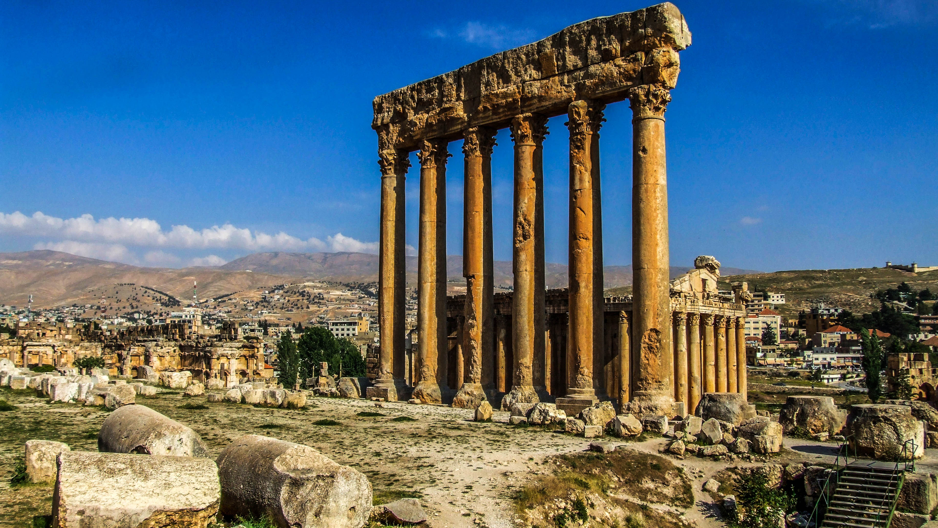
french: Baalbek-Hermel , settlement_type = Governorate , image_skyline = Baalbek (4594513263).jpg , image_caption = Baalbek , image_flag = , image_seal = , image_shield = , image_map = Baalbek-Hermel in Lebanon.svg , map_caption = Location of Baalbek-Hermel Governorate in Lebanon , pushpin_map = , coordinates = , subdivision_type = Country , subdivision_name = , established_title = Gazetted , established_date = 16 July 2003 , seat_type = Capital , seat = Baalbek , leader_party = , leader_title = Governor , leader_name = Bashir Khodr , area_footnotes = , area_total_km2 = 3009 , area_land_km2 = , area_water_km2 = , elevation_footnotes = , elevation_m = , pop_est_footnotes = , population_est = 41642 ... [...More Info...] [...Related Items...] OR: [Wikipedia] [Google] [Baidu] |
Lebanon
Lebanon ( , ar, لُبْنَان, translit=lubnān, ), officially the Republic of Lebanon () or the Lebanese Republic, is a country in Western Asia. It is located between Syria to the north and east and Israel to the south, while Cyprus lies to its west across the Mediterranean Sea; its location at the crossroads of the Mediterranean Basin and the Arabian hinterland has contributed to its rich history and shaped a cultural identity of religious diversity. It is part of the Levant region of the Middle East. Lebanon is home to roughly six million people and covers an area of , making it the second smallest country in continental Asia. The official language of the state is Arabic, while French is also formally recognized; the Lebanese dialect of Arabic is used alongside Modern Standard Arabic throughout the country. The earliest evidence of civilization in Lebanon dates back over 7000 years, predating recorded history. Modern-day Lebanon was home to the Phoenicians, a m ... [...More Info...] [...Related Items...] OR: [Wikipedia] [Google] [Baidu] |
Baalbek
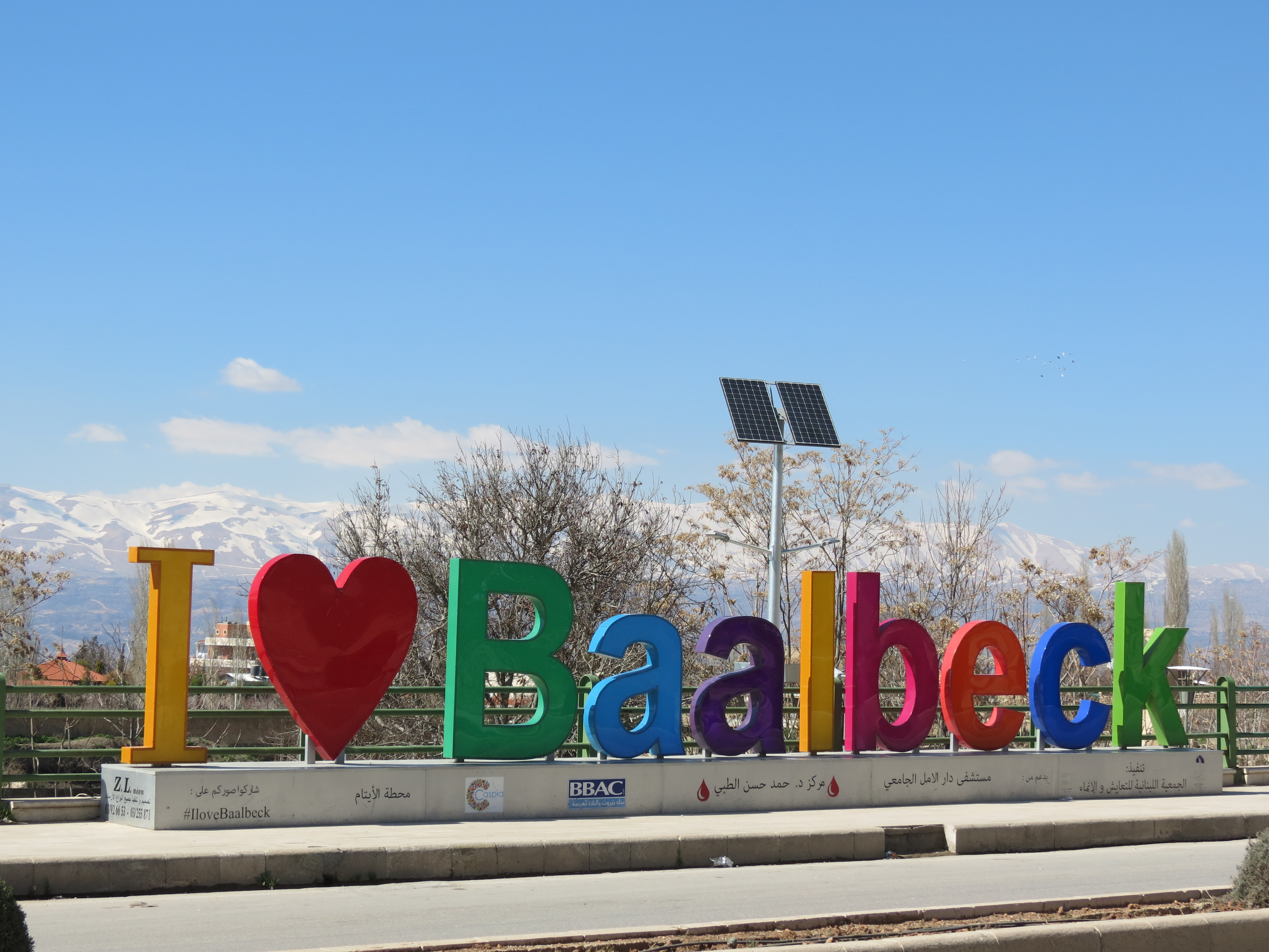
Baalbek (; ar, بَعْلَبَكّ, Baʿlabakk, Syriac-Aramaic: ܒܥܠܒܟ) is a city located east of the Litani River in Lebanon's Beqaa Valley, about northeast of Beirut. It is the capital of Baalbek-Hermel Governorate. In Greek and Roman times Baalbek was also known as Heliopolis (, Greek for "Sun City"). In 1998 Baalbek had a population of 82,608, mostly Shia Muslims, followed by Sunni Muslims and Christians. It is home to the Baalbek temple complex which includes two of the largest and grandest Roman temple ruins: the Temple of Bacchus and the Temple of Jupiter. It was inscribed in 1984 as an UNESCO World Heritage site. Name A few miles from the swamp from which the Litani (the classical Leontes) and the Asi (the upper Orontes) flow, Baalbek may be the same as the ''manbaa al-nahrayn'' ("Source of the Two Rivers"), the abode of El in the Ugaritic Baal Cycle discovered in the 1920s and a separate serpent incantation. Baalbek was called Heliopolis during the Roma ... [...More Info...] [...Related Items...] OR: [Wikipedia] [Google] [Baidu] |
Hermel
Hermel ( ar, الهرمل) is a town in Baalbek-Hermel Governorate, Lebanon. It is the capital of Hermel District. Hermel is home to a Lebanese Red Cross First Aid Center. Hermel's inhabitants are predominantly Shia Muslims. There is an ancient pyramid known as Kamouh el Hermel (Pyramid or Needle of Hermel) located about south of the town that is a popular attraction for local tourists. Archaeology Hermel plains The Hermel plains are an area of low hills around Hermel, through which runs the Orontes river and several wadis, which drain into the Homs basin. The area dominates the north of the Beqaa Valley and reaches north to the border with Syria. A curious and unpublished archaeological industry exists from finds of stone tools in this area. It consists of generally small tools whose typology is limited. It was termed the Shepherd Neolithic industry by Henri Fleisch. Hermel I (Mrah Abbas) Hermel I or Mrah Abbas was discovered by Shiat Ali el Karar w beit hmede and is nort ... [...More Info...] [...Related Items...] OR: [Wikipedia] [Google] [Baidu] |
Fakeha
Fakiha (also Fakeha or Fekeheh) ( ar, فاكهة) is a village in the Baalbek District, in Baalbek-Hermel Governorate, Lebanon Lebanon ( , ar, لُبْنَان, translit=lubnān, ), officially the Republic of Lebanon () or the Lebanese Republic, is a country in Western Asia. It is located between Syria to the north and east and Israel to the south, while Cyprus li .... References {{Baalbek District Populated places in Baalbek District Melkite Christian communities in Lebanon Sunni Muslim communities in Lebanon ... [...More Info...] [...Related Items...] OR: [Wikipedia] [Google] [Baidu] |
Anti-Lebanon
The Anti-Lebanon Mountains ( ar, جبال لبنان الشرقية, Jibāl Lubnān ash-Sharqiyyah, Eastern Mountains of Lebanon; Lebanese Arabic: , , "Eastern Mountains") are a southwest–northeast-trending mountain range that forms most of the border between Syria and Lebanon. The border is largely defined along the crest of the range. Most of the range lies in Syria. Etymology Its Western name ''Anti-Lebanon'' comes from the Greek and Latin , derived from its position opposite (') and parallel to the Mount Lebanon range (). Geology The Anti-Lebanon range is approximately in length. To the south, the range adjoins the lower-lying Golan Heights plateau, but includes the highest peaks, namely Mount Hermon (''Jabal el-Shaykh'', in Arabic), at 2,814 metres, and Ta'la't Musa, at 2,669 metres. These peaks, on the Lebanese-Syrian border, are snow-covered for much of the year. Anti-Lebanon mountains are an anticline. Their predominant rocks are limestone and chalk from the Juras ... [...More Info...] [...Related Items...] OR: [Wikipedia] [Google] [Baidu] |
.png)


