|
Jawahar Sagar Dam
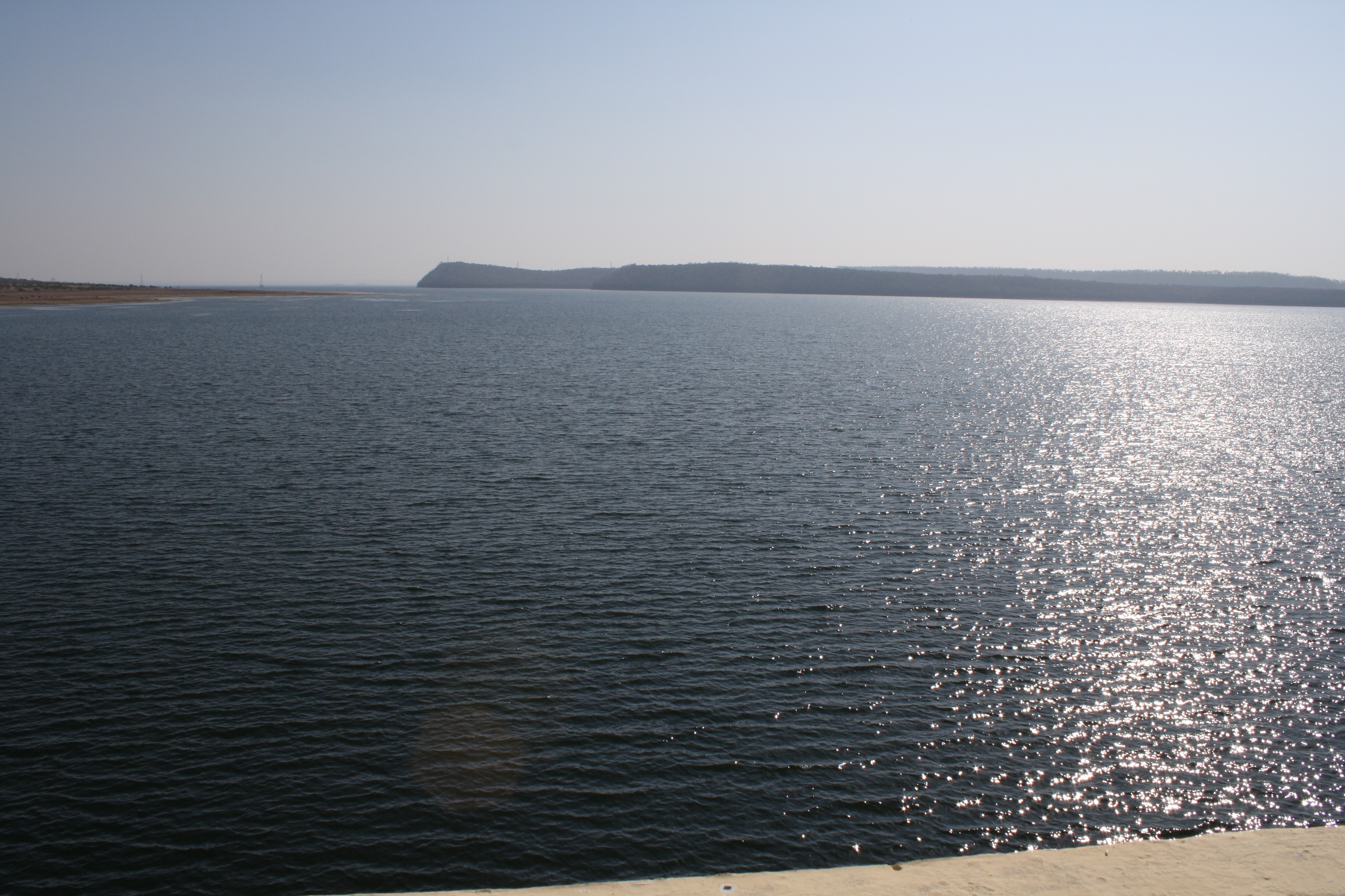
The Jawahar Sagar Dam is the third dam in the series of Chambal Valley Projects on the Chambal River, located 29 km upstream of Kota city and 26 km downstream of Rana Pratap Sagar dam. It is a concrete gravity dam, 45 meters high and 393 meters long, generating 60 MW of power with an installed capacity of 3 units of 33 MW. Its construction was completed in 1972. The dam's gross storage capacity is 67.07 million cubic meters (2.37 tmcft). The total catchment area of the dam is 27,195 km2, of which only 1,496 km2 are in Rajasthan. The free catchment area below Rana Pratap Sagar dam is 2,331 km2.Chambal River The dam is located after the Gandhi Sagar Dam and Rana Pratap Sagar Dam, but before the Kota Barrage. Geography The Chambal River (known in ancient times as the Chamranyavati River) raises in the Vindhya Range at an elevation of , west-southwest of the town of Mhow, near Indore. It flows north-northeast through Madhya Pradesh, runs for a time through ... [...More Info...] [...Related Items...] OR: [Wikipedia] [Google] [Baidu] |
Chambal River
The Chambal River is a tributary of the Yamuna River in Central and Northern India, and thus forms part of the greater Gangetic drainage system. The river flows north-northeast through Madhya Pradesh, running for a time through Rajasthan then forming the boundary between Rajasthan and Madhya Pradesh before turning southeast to join the Yamuna in Uttar Pradesh state. It is a legendary river and finds mention in ancient scriptures. The perennial Chambal originates at Janapav, south of Mhow town, near Manpur, Indore, on the south slope of the Vindhya Range in Madhya Pradesh. The Chambal and its tributaries drain the Malwa region of northwestern Madhya Pradesh, while its tributary, the Banas, which rises in the Aravalli Range, drains southeastern Rajasthan. It ends a confluence of five rivers, including the Chambal, Kwari, Yamuna, Sind, Pahuj, at Pachnada near Bhareh in Uttar Pradesh state, at the border of Bhind and Etawah districts. The Chambal River is considered pollution ... [...More Info...] [...Related Items...] OR: [Wikipedia] [Google] [Baidu] |
Pahuj River
Pahuj River is a river flowing through the city of Jhansi, Uttar Pradesh, India. It has been referred as the ''Pushpavati'' in religious texts. It is a small and dry river which passes through the Indian Grassland and Fodder Research Institute, Jhansi. It flows through the region of Bundelkhand region and a plays a major part in dividing the border of Uttar Pradesh and Madhya Pradesh. Generally it flows at a heavy water level outside its banks in the monsoon season but drastically can also go dry or with very little flow in the summers. Nowadays many electric plants in Uttar pradesh are discharging its waste in it due to which the water of the river getting contaminated day by day and also illegal mining at the banks of it is causing its state deteriorating day by day. The river is approx 195 km from its origin to mouth. Sources It originates near the hills of Jhansi or in Tikamgarh district of Madhya Pradesh. It is a tributary of the Sindh River, which joins the Yamuna River in ... [...More Info...] [...Related Items...] OR: [Wikipedia] [Google] [Baidu] |
Rana Pratap Sagar Dam
The Rana Pratap Sagar Dam is a gravity masonry dam of height built on the Chambal River at Rawatbhata in Rajasthan in India. It is part of integrated scheme of a cascade development of the river involving four projects starting with the Gandhi Sagar Dam in the upstream reach ( upstream) in Madhya Pradesh and the Jawahar Sagar Dam on the downstream ( downstream) with a terminal structure of the Kota Barrage ( further downstream) in Rajasthan for irrigation. The direct benefit from the dam is hydropower generation of 172 MW (with four units of 43 MW capacity each) at the dam toe powerhouse adjoining the spillway, with releases received from the Gandhi Sagar Dam and the additional storage created at the dam by the intercepted catchment area. The estimated generation potential of 473.0 GWh of generation has been exceeded in most years since its commissioning. The power station was officially declared open on 9 February 1970 by Indira Gandhi, the then Prime Minister of India. The d ... [...More Info...] [...Related Items...] OR: [Wikipedia] [Google] [Baidu] |
Irrigation
Irrigation (also referred to as watering) is the practice of applying controlled amounts of water to land to help grow Crop, crops, Landscape plant, landscape plants, and Lawn, lawns. Irrigation has been a key aspect of agriculture for over 5,000 years and has been developed by many cultures around the world. Irrigation helps to grow crops, maintain landscapes, and revegetation, revegetate disturbed soils in dry areas and during times of below-average rainfall. In addition to these uses, irrigation is also employed to protect crops from frost, suppress weed growth in grain fields, and prevent soil consolidation. It is also used to cool livestock, reduce dust, dispose of sewage, and support mining operations. Drainage, which involves the removal of surface and sub-surface water from a given location, is often studied in conjunction with irrigation. There are several methods of irrigation that differ in how water is supplied to plants. Surface irrigation, also known as gravity irri ... [...More Info...] [...Related Items...] OR: [Wikipedia] [Google] [Baidu] |
History Of The Republic Of India
History (derived ) is the systematic study and the documentation of the human activity. The time period of event before the invention of writing systems is considered prehistory. "History" is an umbrella term comprising past events as well as the memory, discovery, collection, organization, presentation, and interpretation of these events. Historians seek knowledge of the past using historical sources such as written documents, oral accounts, art and material artifacts, and ecological markers. History is not complete and still has debatable mysteries. History is also an academic discipline which uses narrative to describe, examine, question, and analyze past events, and investigate their patterns of cause and effect. Historians often debate which narrative best explains an event, as well as the significance of different causes and effects. Historians also debate the nature of history as an end in itself, as well as its usefulness to give perspective on the problems of the p ... [...More Info...] [...Related Items...] OR: [Wikipedia] [Google] [Baidu] |
Government Of India
The Government of India (ISO: ; often abbreviated as GoI), known as the Union Government or Central Government but often simply as the Centre, is the national government of the Republic of India, a federal democracy located in South Asia, consisting of 28 union states and eight union territories. Under the Constitution, there are three primary branches of government: the legislative, the executive and the judiciary, whose powers are vested in a bicameral Parliament, President, aided by the Council of Ministers, and the Supreme Court respectively. Through judicial evolution, the Parliament has lost its sovereignty as its amendments to the Constitution are subject to judicial intervention. Judicial appointments in India are unique in that the executive or legislature have negligible say. Etymology and history The Government of India Act 1833, passed by the British parliament, is the first such act of law with the epithet "Government of India". Basic structure The gover ... [...More Info...] [...Related Items...] OR: [Wikipedia] [Google] [Baidu] |
Gandhi Sagar Mandsaur1
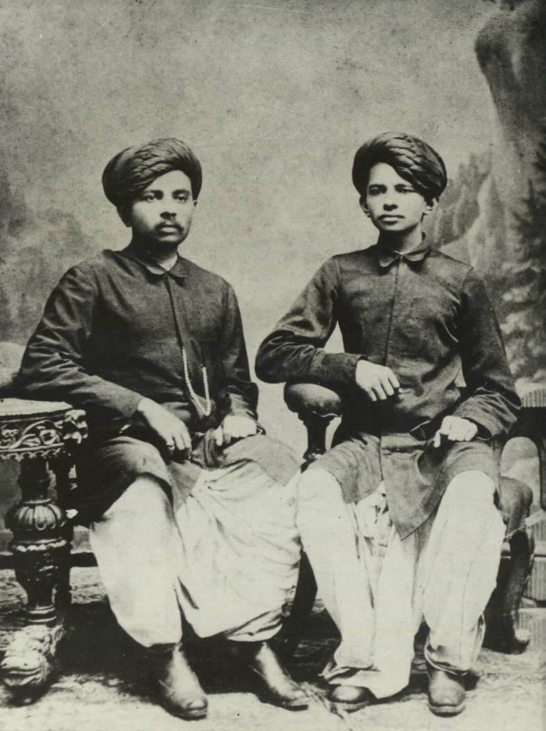
Mohandas Karamchand Gandhi (; ; 2 October 1869 – 30 January 1948), popularly known as Mahatma Gandhi, was an Indian lawyer, anti-colonial nationalist Quote: "... marks Gandhi as a hybrid cosmopolitan figure who transformed ... anti-colonial nationalist politics in the twentieth-century in ways that neither indigenous nor westernized Indian nationalists could." and political ethicist Quote: "Gandhi staked his reputation as an original political thinker on this specific issue. Hitherto, violence had been used in the name of political rights, such as in street riots, regicide, or armed revolutions. Gandhi believes there is a better way of securing political rights, that of nonviolence, and that this new way marks an advance in political ethics." who employed nonviolent resistance to lead the successful campaign for India's independence from British rule, and to later inspire movements for civil rights and freedom across the world. The honorific ''Mahātmā'' (Sanskrit: ... [...More Info...] [...Related Items...] OR: [Wikipedia] [Google] [Baidu] |
Mandsaur
Mandsaur is a city and a municipality in Mandsaur district located on Border of Mewar and Malwa Malwa is a historical region of west-central India occupying a plateau of volcanic origin. Geologically, the Malwa Plateau generally refers to the volcanic upland north of the Vindhya Range. Politically and administratively, it is also syno ... region of Madhya Pradesh state of central India. It is the administrative headquarters of Mandsaur District. The ancient Pashupatinath Temple, Mandsaur, Pashupatinath Temple is located in Mandsaur. History Aulikaras of Dashapura Epigraphical discoveries have brought to light two ancient royal houses, who call themselves as Aulikaras and ruled from Dashapura (present-day Mandsaur). The first dynasty, who ruled from Dashapura from the beginning comprised the following kings in the order of succession: Jayavarma, Simhavarma, Naravarma, Vishvavarma and Bandhuvarma. The Risthal stone slab inscription discovered in 1983 has brought to li ... [...More Info...] [...Related Items...] OR: [Wikipedia] [Google] [Baidu] |
Canyon
A canyon (from ; archaic British English spelling: ''cañon''), or gorge, is a deep cleft between escarpments or cliffs resulting from weathering and the erosion, erosive activity of a river over geologic time scales. Rivers have a natural tendency to cut through underlying surfaces, eventually wearing away rock layers as sediments are removed downstream. A river bed will gradually reach a baseline elevation, which is the same elevation as the body of water into which the river drains. The processes of weathering and erosion will form canyons when the river's River source, headwaters and estuary are at significantly different elevations, particularly through regions where softer rock layers are intermingled with harder layers more resistant to weathering. A canyon may also refer to a rift between two mountain peaks, such as those in ranges including the Rocky Mountains, the Alps, the Himalayas or the Andes. Usually, a river or stream carves out such splits between mountains. Examp ... [...More Info...] [...Related Items...] OR: [Wikipedia] [Google] [Baidu] |
Humidity
Humidity is the concentration of water vapor present in the air. Water vapor, the gaseous state of water, is generally invisible to the human eye. Humidity indicates the likelihood for precipitation, dew, or fog to be present. Humidity depends on the temperature and pressure of the system of interest. The same amount of water vapor results in higher relative humidity in cool air than warm air. A related parameter is the dew point. The amount of water vapor needed to achieve saturation increases as the temperature increases. As the temperature of a parcel of air decreases it will eventually reach the saturation point without adding or losing water mass. The amount of water vapor contained within a parcel of air can vary significantly. For example, a parcel of air near saturation may contain 28 g of water per cubic metre of air at , but only 8 g of water per cubic metre of air at . Three primary measurements of humidity are widely employed: absolute, relative, and specific. Ab ... [...More Info...] [...Related Items...] OR: [Wikipedia] [Google] [Baidu] |


.jpg)


