|
James Teare
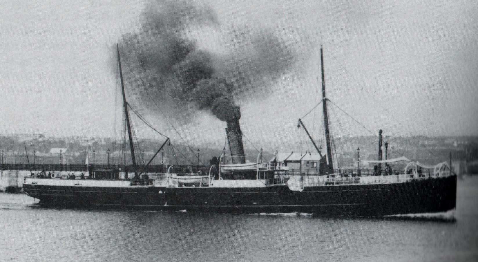
James Teare (6 August 1872 – 3 December 1909) was a Manx merchant navy officer who served as a seaman and later as an officer on numerous Isle of Man Steam Packet Company vessels. Capt. Teare is best known as the Master of the RMS ''Ellan Vannin'' on her ill-fated voyage from Ramsey, Isle of Man to Liverpool on 3 December 1909.''The Isle of Man Examiner.'' Saturday, 11 December 1909 Life and career James Teare was born in Peel, Isle of Man on 6 August 1872 and raised at St German's Place. He made his career at sea, joining the Isle of Man Steam Packet Company in 1891 as a seaman, rising through the ranks and serving on the ''Mona's Isle'' as well as various other company ships. As his career progressed he served as First Officer under Capt. Hill on the ''Snaefell'' and following Capt. Hill's resignation from the company he gained his first command on the ''Ellan Vannin'' which he assumed in July 1904. This was followed in turn by him taking command of the ''Fenella'' ... [...More Info...] [...Related Items...] OR: [Wikipedia] [Google] [Baidu] |
Peel, Isle Of Man
Peel ( gv, Purt ny h-Inshey – Port of the Island) is a seaside town and small fishing port in the Isle of Man, in the historic parish of German but administered separately. Peel is the third largest town in the island after Douglas and Ramsey but the fourth largest settlement, as Onchan has the second largest population but is classified as a village. Until 2016 (when it was merged with Glenfaba) Peel was also a House of Keys constituency, electing one Member of the House of Keys (MHK), who, from September 2015, was Ray Harmer. Peel has a ruined castle on St Patrick's Isle, and a cathedral, seat of the Diocese of Sodor and Man (the diocese was founded when Mann was ruled by the Norse). Geography Peel is on the west coast of the Isle of Man, on the east side of the mouth of the River Neb. To the north west is St Patrick's Isle, connected to the mainland by a causeway, and to the west across the river is Peel Hill. The A1 road connects Peel with Douglas. The A4 and A3 roads c ... [...More Info...] [...Related Items...] OR: [Wikipedia] [Google] [Baidu] |
SS Fenella (1881)
SS (RMS) ''Fenella'' (I), No.76303, was an Iron twin-screw steamer operated by the Isle of Man Steam Packet Company, and was the first ship in the company's history to bear the name. Construction and dimensions ''Fenella'' was built by the Barrow Shipbuilding Company of Barrow-in-Furness and was launched at Barrow by Miss Barnett on Thursday 9 June 1881.The Isle of Man Weekly Advertising Circular. Tuesday 14 June 1881. Tonnage ; length 200 ft; beam 26 ft; depth 13 ft. The vessel cost £18,750 and was certificated for a crew of 28 and 504 passengers. She had an indicated horsepower of 1,200 and a speed of 14 knots, with a boiler pressure of 85 psi. She was driven by two sets of vertical compound engines, each with cylinder bores of 23 and 42 inches, with a stroke of 24 inches. There was a slight delay in the construction of ''Fenella'', due to a misunderstanding about the construction of her sleeping accommodation. The Isle of Man Weekly Advertising C ... [...More Info...] [...Related Items...] OR: [Wikipedia] [Google] [Baidu] |
Shipwrecking
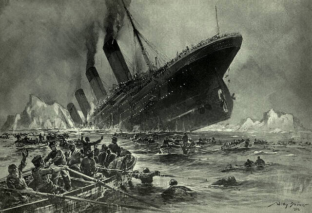
Shipwrecking is an event that causes a shipwreck, such as a ship striking something that causes the ship to sink; the stranding of a ship on rocks, land or shoal; poor maintenance; or the destruction of a ship either intentionally or by violent weather. Causes Factors for the loss of a ship may include: * poor design or failure of the ship's equipment or hull - pressure hull * instability, due to poor design, improperly stowed cargo, cargo that shifts its position or the free surface effect * navigation errors and other human errors, leading to collisions (with another ship, rocks, an iceberg (), etc.) or running aground (''Costa Concordia'') * bad weather and powerful or large waves or gale winds: This often leads to capsizing, also referred to as ''foundering'' * warfare, piracy, mutiny, or sabotage including: guns, torpedoes, depth charges, mines, bombs and missiles * fire * biofouling, such as accumulation of polychaete and other tube worms on wood hulls * overloading ... [...More Info...] [...Related Items...] OR: [Wikipedia] [Google] [Baidu] |
Wind Wave
In fluid dynamics, a wind wave, water wave, or wind-generated water wave, is a surface wave that occurs on the free surface of bodies of water as a result from the wind blowing over the water surface. The contact distance in the direction of the wind is known as the ''fetch''. Waves in the oceans can travel thousands of kilometers before reaching land. Wind waves on Earth range in size from small ripples, to waves over high, being limited by wind speed, duration, fetch, and water depth. When directly generated and affected by local wind, a wind wave system is called a wind sea. Wind waves will travel in a great circle route after being generated – curving slightly left in the southern hemisphere and slightly right in the northern hemisphere. After moving out of the area of fetch, wind waves are called '' swells'' and can travel thousands of kilometers. A noteworthy example of this is waves generated south of Tasmania during heavy winds that will travel across the Pacif ... [...More Info...] [...Related Items...] OR: [Wikipedia] [Google] [Baidu] |
Beaufort Scale
The Beaufort scale is an empirical measure that relates wind speed to observed conditions at sea or on land. Its full name is the Beaufort wind force scale. History The scale was devised in 1805 by the Irish hydrographer Francis Beaufort (later Rear Admiral), a Royal Navy officer, while serving on . The scale that carries Beaufort's name had a long and complex evolution from the previous work of others (including Daniel Defoe the century before) to when Beaufort was Hydrographer of the Navy in the 1830s, when it was adopted officially and first used during the voyage of HMS ''Beagle'' under Captain Robert FitzRoy, who was later to set up the first Meteorological Office (Met Office) in Britain giving regular weather forecasts. In the 18th century, naval officers made regular weather observations, but there was no standard scale and so they could be very subjective – one man's "stiff breeze" might be another's "soft breeze". Beaufort succeeded in standardising the sc ... [...More Info...] [...Related Items...] OR: [Wikipedia] [Google] [Baidu] |
Lightvessel
A lightvessel, or lightship, is a ship that acts as a lighthouse. They are used in waters that are too deep or otherwise unsuitable for lighthouse construction. Although some records exist of fire beacons being placed on ships in Roman times, the first modern lightvessel was off the Nore sandbank at the mouth of the River Thames in England, placed there by its inventor Robert Hamblin in 1734. The type has become largely obsolete; lighthouses replaced some stations as the construction techniques for lighthouses advanced, while large, automated buoys replaced others. Construction A crucial element of lightvessel design is the mounting of a light on a sufficiently tall mast. Initially, it consisted of oil lamps that could be run up the mast and lowered for servicing. Later vessels carried fixed lamps which were serviced in place. Fresnel lenses were used as they became available, and many vessels housed them in small versions of the lanterns used in lighthouses. Some lightship ... [...More Info...] [...Related Items...] OR: [Wikipedia] [Google] [Baidu] |
River Mersey
The River Mersey () is in North West England. Its name derives from Old English and means "boundary river", possibly referring to its having been a border between the ancient kingdoms of Mercia and Northumbria. For centuries it has formed part of the boundary between the Historic counties of England, historic counties of Lancashire and Cheshire. The Mersey starts at the confluence of the River Tame, Greater Manchester, River Tame and River Goyt in Stockport. It flows westwards through south Manchester, then into the Manchester Ship Canal at Irlam, becoming a part of the canal and maintaining its water levels. After it exits the canal, flowing towards Warrington where it widens. It then narrows as it passes between Runcorn and Widnes. From Runcorn the river widens into a large estuary, which is across at its widest point near Ellesmere Port. The course of the river then turns northwards as the estuary narrows between Liverpool and Birkenhead on the Wirral Peninsula to the west ... [...More Info...] [...Related Items...] OR: [Wikipedia] [Google] [Baidu] |
Barometric Pressure
Atmospheric pressure, also known as barometric pressure (after the barometer), is the pressure within the atmosphere of Earth. The standard atmosphere (symbol: atm) is a unit of pressure defined as , which is equivalent to 1013.25 millibars, 760mm Hg, 29.9212 inchesHg, or 14.696psi.International Civil Aviation Organization. ''Manual of the ICAO Standard Atmosphere'', Doc 7488-CD, Third Edition, 1993. . The atm unit is roughly equivalent to the mean sea-level atmospheric pressure on Earth; that is, the Earth's atmospheric pressure at sea level is approximately 1 atm. In most circumstances, atmospheric pressure is closely approximated by the hydrostatic pressure caused by the weight of air above the measurement point. As elevation increases, there is less overlying atmospheric mass, so atmospheric pressure decreases with increasing elevation. Because the atmosphere is thin relative to the Earth's radius—especially the dense atmospheric layer at low altitudes—the Earth's gravi ... [...More Info...] [...Related Items...] OR: [Wikipedia] [Google] [Baidu] |
Ellan Vannin Departing Douglas
Ellan is a village located on Singö (island), Singö in the north of Stockholm County. Public Transport Storstockholms Lokaltrafik, SL's bus line 637 goes a few times daily from Ellan to Norrtälje. Ellan is in fact Storstockholms Lokaltrafik, SL's northernmost stop. {{authority control Populated places in Norrtälje Municipality ... [...More Info...] [...Related Items...] OR: [Wikipedia] [Google] [Baidu] |


