|
Jaldapara
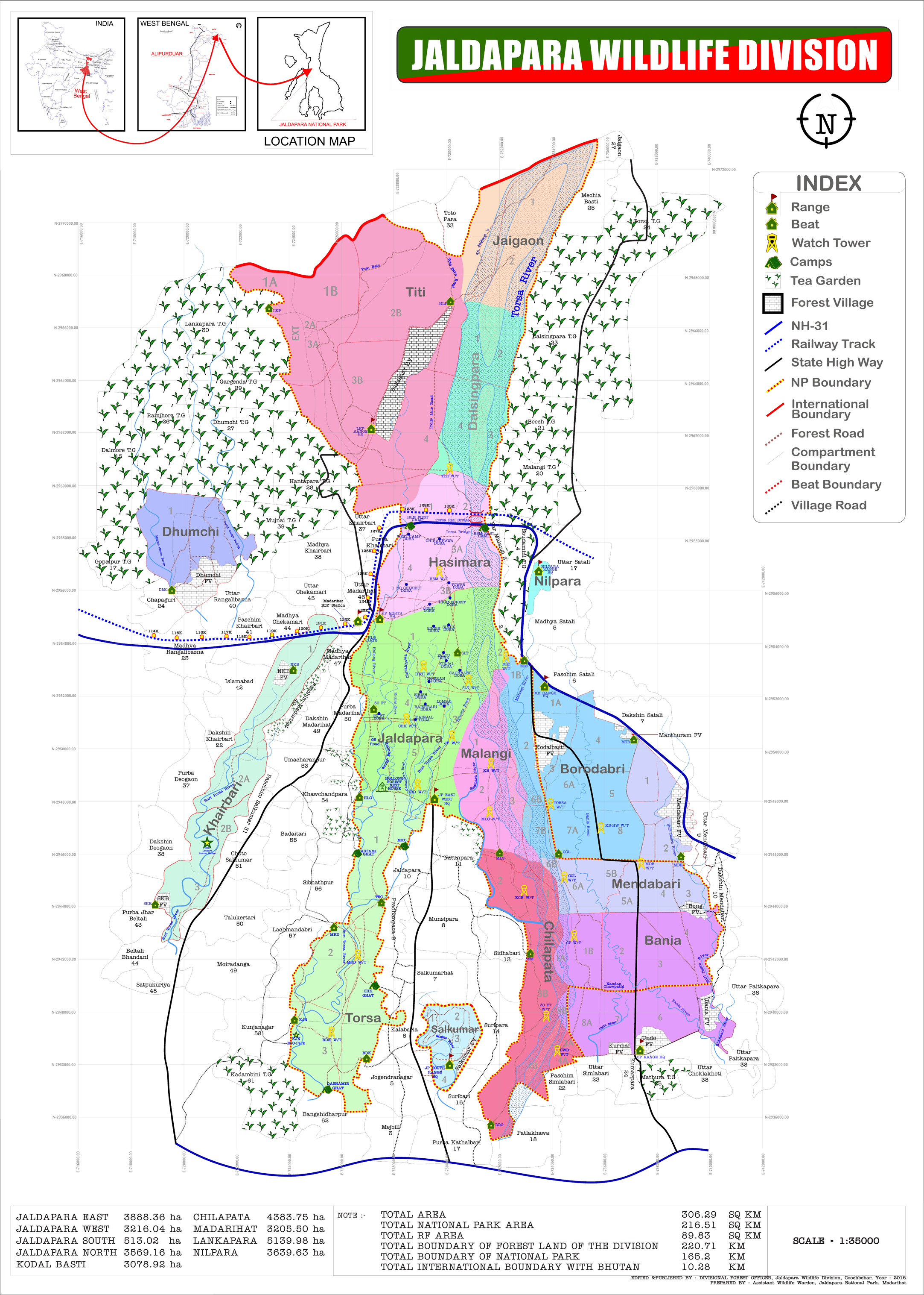
Jaldapara National Park (Pron: ˌʤʌldəˈpɑ:rə) is a national park situated at the foothills of the Eastern Himalayas in Alipurduar, Alipurduar District of northern West Bengal, India, and on the banks of the Torsa River. Jaldapara is situated at an altitude of 61 m and is spread across of vast grassland with patches of riverine forests. It was declared a sanctuary in 1941 for protection of its great variety of flora and fauna. Today, the park has the largest population of the Indian one-horned rhinoceros in the state, an animal threatened with extinction, and is a Habitat management area (Category IV). The nearby Chilapata Forests is an elephant corridor between Jaldapara and the Buxa Tiger Reserve. Nearby is the |
Madarihat
Madarihat (also referred to as Uttar Madarihat) is a census town and a gram panchayat in the Madarihat-Birpara CD block in the Alipurduar subdivision of the Alipurduar district, West Bengal, India. This town is situated on the outskirts of Jaldapara National Park, which is famous for Indian rhinoceros. This is one of the main tourist spots in North Bengal, surrounded by tea gardens, forests, hills, and small rivers, and also having highly diverse population. Madarihat is also world famous for the local wooden furniture. Geography Location Madarihat is located at . Area overview Alipurduar district is covered by two maps. It is an extensive area in the eastern end of the Dooars in West Bengal. It is undulating country, largely forested, with numerous rivers flowing down from the outer ranges of the Himalayas in Bhutan. It is a predominantly rural area with 79.38% of the population living in the rural areas. The district has 1 municipal town and 20 census towns and that means t ... [...More Info...] [...Related Items...] OR: [Wikipedia] [Google] [Baidu] |
Totopara
Totopara is a village in the Madarihat-Birpara CD block in the Alipurduar subdivision of the Alipurduar district of West Bengal, India. Geography Location Totopara is located at . Administratively, this village falls under the Madarihat police station. It is bounded by the foothills of Bhutan to the north, Torsa River to the east, and Hauri river and the Titi reserve forest on the south-west separated by the Hauri river. The nearest village is Ballalguri, which is about 5 km to the south of Totopara. There is a single lane motorable road leading to this village from the National Highway 31 through Hantapara. The area of the village is about 8.08 km2. The village is about 22 km from Madarihat, which is the entry point of the famous Jaldapara National Park. Area overview Alipurduar district is covered by two maps. It is an extensive area in the eastern end of the Dooars in West Bengal. It is undulating country, largely forested, with numerous rivers flowing d ... [...More Info...] [...Related Items...] OR: [Wikipedia] [Google] [Baidu] |
Chilapata Forests
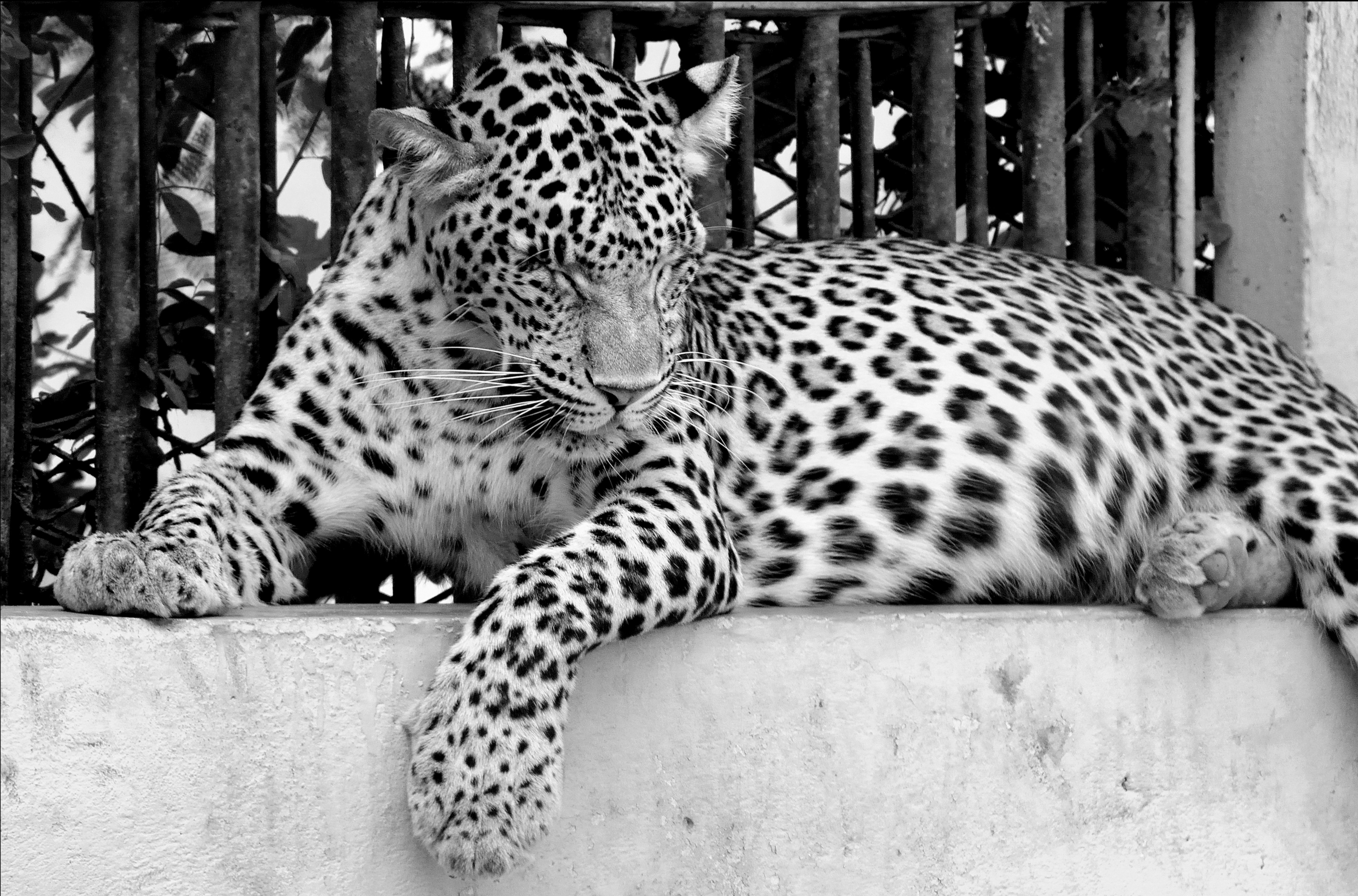
The Chilapata Forest is a dense forest near Jaldapara National Park in Dooars, Alipurduar district, West Bengal, India. It is about 40 km from Alipurduar, and just a few minutes away from Hasimara town. Ecology The forest forms an elephant corridor between Jaldapara National Park and the Buxa Tiger Reserve, and is rich in wildlife. New species continue to be found. The forest used to be home to large Rhinoceros populations. In hunting expeditions in 1892-1904, in and around Chilapata Forest, the Maharajah of Cooch Behar recorded killing one rhino, injury of one, and sighting of over 14. Rhinos now are extremely rare. Indian leopards are still common. It is hoped that eco-tourism will provide a new source of income for the indigenous Rabha people, who now depend on the forest mainly for firewood. Tourism West Bengal State Forest Development Agency (WBSFDA) runs an eco-tourism resort at Kodalbasti, providing basic accommodation. One of the main attractions is the ruined "Na ... [...More Info...] [...Related Items...] OR: [Wikipedia] [Google] [Baidu] |
Birpara
Birpara is a census town in Alipurduar I CD block in Alipurduar subdivision of Alipurduar district, West Bengal, India. Geography Location Birpara is located at . Area overview Alipurduar district is covered by two maps. It is an extensive area in the eastern end of the Dooars in West Bengal. It is undulating country, largely forested, with numerous rivers flowing down from the outer ranges of the Himalayas in Bhutan. It is a predominantly rural area with 79.38% of the population living in the rural areas. The district has 1 municipal town and 20 census towns and that means that 20.62% of the population lives in urban areas. The scheduled castes and scheduled tribes, taken together, form more than half the population in all the six community development blocks in the district. There is a high concentration of tribal people (scheduled tribes) in the three northern blocks of the district. Note: The map alongside presents some of the notable locations in the subdivision. All ... [...More Info...] [...Related Items...] OR: [Wikipedia] [Google] [Baidu] |
Alipurduar
Alipurduar is a city and a municipality in the Indian state of West Bengal. It is the headquarters of the Alipurduar district. Situated on the east bank of Kaljani River on the foothills of the Himalayas, the city is a gateway to Bhutan and northeastern states of India. Alipurduar was a sub-divisional town of Jalpaiguri district until 2007 when it was created a separate district. Geography Location Alipurduar is located at . Area overview Alipurduar district is covered by two maps. It is an extensive area in the eastern end of the Dooars in West Bengal. It is undulating country, largely forested, with numerous rivers flowing down from the outer ranges of the Himalayas in Bhutan. It is a predominantly rural area with 79.38% of the population living in the rural areas. The district has 1 municipal town and 20 census towns and that means that 20.62% of the population lives in the urban areas. The scheduled castes and scheduled tribes, taken together, form more than half the popul ... [...More Info...] [...Related Items...] OR: [Wikipedia] [Google] [Baidu] |
Gorumara National Park
Gorumara National Park (Pron: ˌgɔ:rʊˈmɑ:rə; ''Gorumara Jatio Uddan'') is a National Park in northern West Bengal, India. Located in the Dooars region of the Himalayan foothills, it is a medium-sized park with grasslands and forests. Gorumara National Park was established in 1992. It is primarily known for its population of Indian rhinoceros. The park has been declared as the best among the protected areas in India by the Ministry of Environment and Forests for the year 2009. ''The Telegraph''. Retrieved 1 January 2022. , the park is open for the tourists after staying closed for months due to the |
Buxa Tiger Reserve
, photo = Buxa Tiger Reserve forest 2014.jpg , iucn_category = II , map = India West Bengal , map_width = , label = Buxa NP , label_position = right , location = West Bengal, India , nearest_city = Alipurduar , coordinates = , area_km2 = 760 , established = 1983 , visitation_num = , visitation_year = , governing_body = Ministry of Environment Forests and Climate Change, Government of India Buxa Tiger Reserve is a tiger reserve and national park in northern West Bengal, India, covering an area of . In altitude, it ranges from in the Gangetic Plains to bordering the Himalayas in the north. At least 284 bird species inhabit the reserve. Mammals present include Asian elephant, gaur, Sambar deer, clouded leopard, Indian leopard, and Asian golden cat. History The historic Buxa Fort ( above m.s.l.). People have sentimental attachment with the fort on accounts of its association with the struggle for freedom. Buxa Tiger Reserve was created in 1983 as the 15th t ... [...More Info...] [...Related Items...] OR: [Wikipedia] [Google] [Baidu] |
Indian Rhinoceros
} The Indian rhinoceros (''Rhinoceros unicornis''), also called the Indian rhino, greater one-horned rhinoceros or great Indian rhinoceros, is a rhinoceros species native to the Indian subcontinent. It is listed as Vulnerable on the IUCN Red List, as populations are fragmented and restricted to less than . Moreover, the extent and quality of the rhino's most important habitat, the alluvial Terai-Duar savanna and grasslands and riverine forest, is considered to be in decline due to human and livestock encroachment. As of August 2018, the global population was estimated to comprise 3,588 individuals, including 2,939 individuals in India and 649 in Nepal. Kaziranga National Park alone had an estimated population of 2,048 rhinos in 2009. Pobitora Wildlife Sanctuary in Assam has the highest density of Indian rhinos in the world with 84 individuals in an area of in 2009. Indian rhinos once ranged throughout the entire stretch of the Indo-Gangetic Plain, but excessive hunting and ... [...More Info...] [...Related Items...] OR: [Wikipedia] [Google] [Baidu] |
Chital
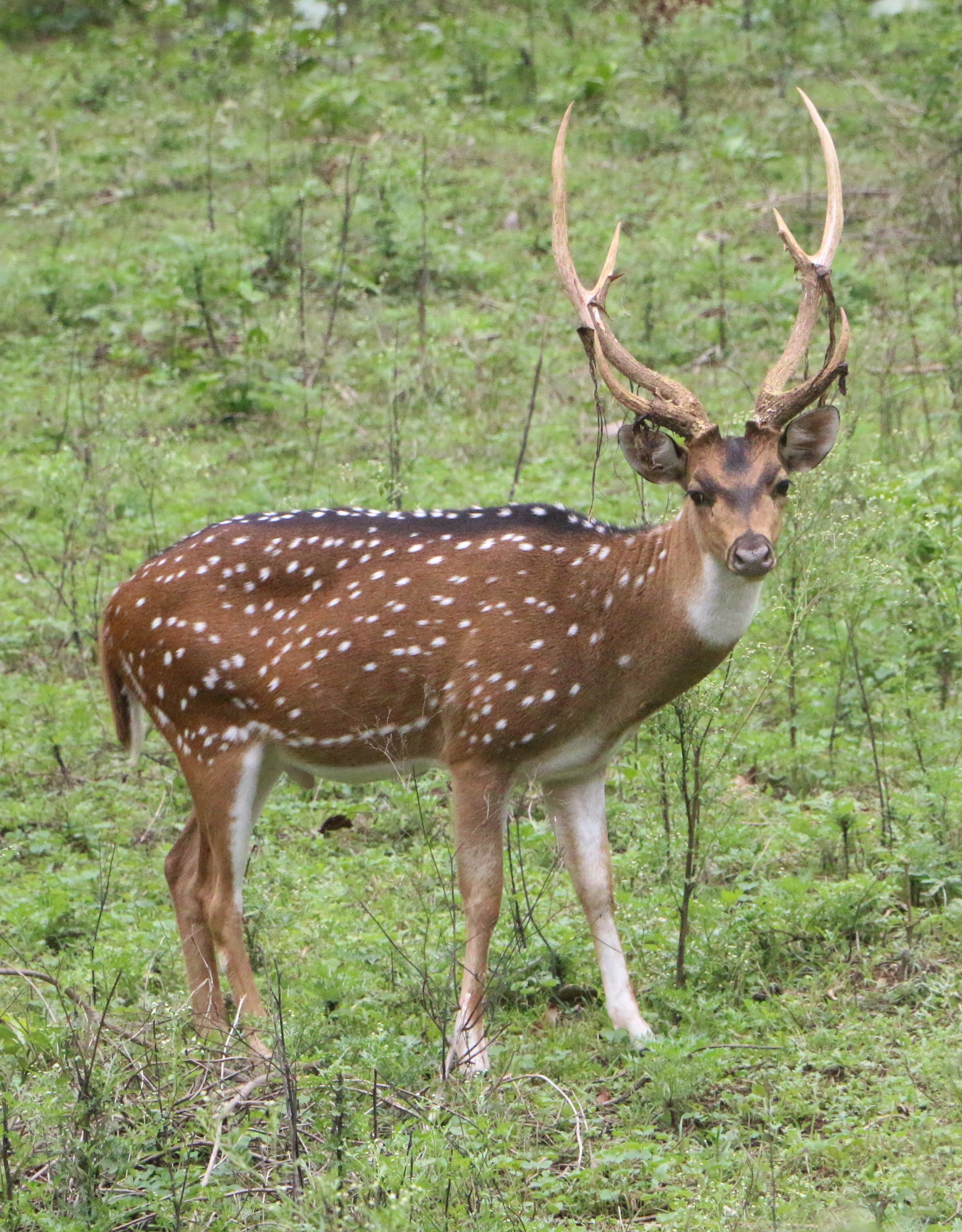
The chital or cheetal (''Axis axis''; ), also known as the spotted deer, chital deer, and axis deer, is a deer species native to the Indian subcontinent. It was first described and given a binomial name by German naturalist Johann Christian Polycarp Erxleben in 1777. A moderate-sized deer, male chital reach and females at the shoulder. While males weigh , females weigh around . It is sexually dimorphic; males are larger than females, and antlers are present only on males. The upper parts are golden to rufous, completely covered in white spots. The abdomen, rump, throat, insides of legs, ears, and tail are all white. The antlers, three-pronged, are nearly long. Etymology The vernacular name "chital" (pronounced ) comes from ''cītal'' ( hi, चीतल), derived from the Sanskrit word ' (चित्रल), meaning "variegated" or "spotted". The name of the cheetah has a similar origin. Variations of "chital" include "cheetal" and "cheetul". Other common names for the chita ... [...More Info...] [...Related Items...] OR: [Wikipedia] [Google] [Baidu] |
Hog Deer
''Axis'' is a genus of deer occurring in South and Southeast Asia. As presently defined by most authorities, four species are placed in the genus. Three of the four species are called hog deer. The genus name is a word mentioned in Pliny the Elder's Natural History. Species Following the third edition of ''Mammal Species of the World ''Mammal Species of the World: A Taxonomic and Geographic Reference'' is a standard reference work in mammalogy giving descriptions and bibliographic data for the known species of mammals. It is now in its third edition, published in late 2005, ...'' from 2005, which is also followed by the American Society of Mammalogists, four species are placed in ''Axis''. These four species are divided into two subgenera; ''Axis'' containing the chital, and ''Hyelaphus'' containing the 3 others. References {{Taxonbar, from=Q783065 Axis Cervines Mammal genera Taxa named by Charles Hamilton Smith ... [...More Info...] [...Related Items...] OR: [Wikipedia] [Google] [Baidu] |
Wild Boar
The wild boar (''Sus scrofa''), also known as the wild swine, common wild pig, Eurasian wild pig, or simply wild pig, is a suid native to much of Eurasia and North Africa, and has been introduced to the Americas and Oceania. The species is now one of the widest-ranging mammals in the world, as well as the most widespread suiform. It has been assessed as least concern on the IUCN Red List due to its wide range, high numbers, and adaptability to a diversity of habitats. It has become an invasive species in part of its introduced range. Wild boars probably originated in Southeast Asia during the Early Pleistocene and outcompeted other suid species as they spread throughout the Old World. , up to 16 subspecies are recognized, which are divided into four regional groupings based on skull height and lacrimal bone length. The species lives in matriarchal societies consisting of interrelated females and their young (both male and female). Fully grown males are usually solitary ... [...More Info...] [...Related Items...] OR: [Wikipedia] [Google] [Baidu] |
Bengal Florican
The Bengal florican (''Houbaropsis bengalensis''), also called the Bengal bustard, is a bustard species native to the Indian subcontinent, Cambodia, and Vietnam. It is listed as Critically Endangered on the IUCN Red List because fewer than 1,000 individuals were estimated to be alive as of 2017. It is the only member of the genus ''Houbaropsis''. Description The male Bengal florican has a black plumage from the head and neck to underparts. Its head carries a long lanky crest, and the neck has elongated display plumes. The upperside is buff with fine black vermiculations and black arrowhead markings, and there is a conspicuous large white patch from the wing coverts to the remiges. In flight, the male's wings appear entirely white except for the dark primary remiges. The feet and legs are yellow, the bill and irides are dark. The female is buff-brown similar to the males' back with a dark brown crown and narrow dark streaks down the side of the neck. Her wing coverts are light ... [...More Info...] [...Related Items...] OR: [Wikipedia] [Google] [Baidu] |


.jpg)
_male.jpg)

