|
Jaggayyapeta
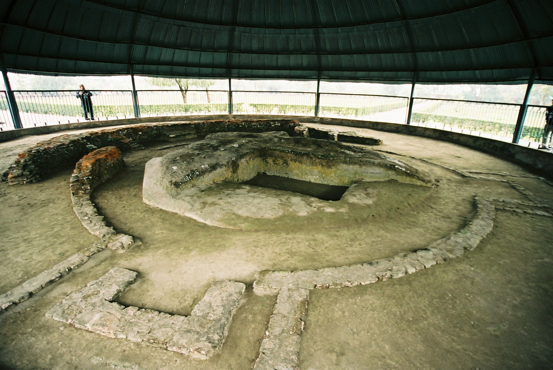
Jaggayyapeta, also spelled “Jaggiahpet”, is a census town in NTR district of the Indian state of Andhra Pradesh, located just southwest of the border with Telangana. It is also the mandal headquarters of Jaggayyapeta mandal of Nandigama revenue division. The town is located on the banks of the Paleru River which is a tributary of the Krishna River. Etymology Jaggaiahpeta was governed by a ruler, by name Sri Rajah Vasireddy Venkatadri Nayudu. It is said that he founded two towns, namely, Jaggayyapeta, named after his father Jaggayya, and Achampeta, named after his mother Atchamma. History Government records suggest the founder of the town was Venkatadri Nayudu, who developed and renamed the village of Betavolu to Jaggayyapeta. The region was then infested with robbers and hence the old village was called Dongala Betavolu (Robbers' Betavolu). For some time, Jaggayyapeta was mentioned in Government records with Betavolu written in brackets. This region has an ancient his ... [...More Info...] [...Related Items...] OR: [Wikipedia] [Google] [Baidu] |
NTR District
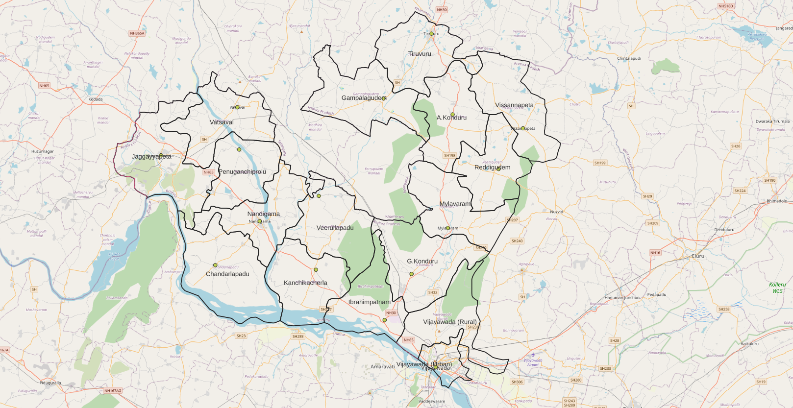
NTR district is a district in coastal Andhra Region in the Indian state of Andhra Pradesh. The administrative headquarters is located at Vijayawada. The district is named after former Chief Minister of Andhra Pradesh N. T. Rama Rao. History Named after former Chief Minister of Andhra Pradesh N. T. Rama Rao, NTR district was proposed on 26 January 2022 and became one of the List of districts of Andhra Pradesh, twenty-six districts in the state after the gazette notification was issued by the Government of Andhra Pradesh on 3 April 2022. The gazette notification came into force on 4 April 2022. The district was carved out of Krishna district, and consists of the existing Vijayawada revenue division along with Nandigama revenue division, Nandigama and Tiruvuru revenue divisions, which were formed along with the district. Geography NTR district is bordered with Krishna district and Eluru districts on the East, Palnadu district and Guntur districts on the South, Suryapet distri ... [...More Info...] [...Related Items...] OR: [Wikipedia] [Google] [Baidu] |
Jaggayyapeta Mandal
Jaggayyapeta mandal is one of the 20 mandals in NTR district of the state of Andhra Pradesh in India. It is under the administration of Nandigama revenue division and the headquarters are located at Jaggayyapeta town. Krishna River flows through the mandal and is bounded by Penuganchiprolu, Nandigama, Chandarlapadu mandals of Krishna district, some part of Guntur district, Nalgonda and Khammam districts of Telangana. Towns and villages census, the mandal has 18 settlements. It includes 1 town and 24 villages. The settlements in the mandal are listed below: ''Note: (CT)-Census town'' See also *Vijayawada revenue division Vijayawada revenue division (or Vijayawada division) is an administrative division in the NTR district of the Indian state of Andhra Pradesh. It is one of the 3 revenue divisions in the district with 8 mandals under its administration. Vijayawa ... References Mandals in NTR district {{AndhraPradesh-geo-stub ... [...More Info...] [...Related Items...] OR: [Wikipedia] [Google] [Baidu] |
Nandigama Revenue Division
Nandigama revenue division is an administrative division in the NTR district of the Indian state of Andhra Pradesh. It is one of the 3 revenue divisions in the district with 7 mandals under its administration and is formed on 4 April 2022 as part of a reorganisation of districts in the state. Nandigama serves as the headquarters of the division. Administration The mandals in the division are Nandigama, Kanchikacherla, Chandarlapadu, Veerullapadu, Jaggaiahpeta, Vatsavai and Penuganchiprolu Penuganchiprolu is a village in NTR district of the Indian state of Andhra Pradesh. It is the mandal headquarters of Penuganchiprolu mandal in Nandigama revenue division. Geography Penuganchiprolu is located at . It has an average elevation .... References Revenue divisions in NTR district {{AndhraPradesh-geo-stub ... [...More Info...] [...Related Items...] OR: [Wikipedia] [Google] [Baidu] |
Andhra Pradesh
Andhra Pradesh (, abbr. AP) is a state in the south-eastern coastal region of India. It is the seventh-largest state by area covering an area of and tenth-most populous state with 49,386,799 inhabitants. It is bordered by Telangana to the north-west, Chhattisgarh to the north, Odisha to the north-east, Tamil Nadu to the south, Karnataka to the west and the Bay of Bengal to the east. It has the second longest coastline in India after Gujarat, of about . Andhra State was the first state to be formed on a linguistic basis in India on 1 October 1953. On 1 November 1956, Andhra State was merged with the Telugu-speaking areas (ten districts) of the Hyderabad State to form United Andhra Pradesh. ln 2014 these merged areas of Hyderabad State are bifurcated from United Andhra Pradesh to form new state Telangana . Present form of Andhra similar to Andhra state.but some mandalas like Bhadrachalam still with Telangana. Visakhapatnam, Guntur, Kurnool is People Capital of And ... [...More Info...] [...Related Items...] OR: [Wikipedia] [Google] [Baidu] |
List Of Mandals In Andhra Pradesh
Mandal in Andhra Pradesh, India is a sub-District. History The Mandal system came into existence as an administrative reform, as part of reducing the size of erstwhile taluks and making them more effective and manageable. The decentralisation of taluks into mandals was done with a two-pronged strategy of modernising the revenue administration, record-keeping as well as further decentralising the panchayati raj system. It was hoped that the division of erstwhile large Talukas into mandals could make them more manageable, and also that the administration of the state government, especially the revenue administration, will become monitored closely. Talukas are large sub blocks in district. Almost every Taluka is divided into 4 or 5 mandals. The AP government announced the formation of the Mandal system on May 25, 1985. Mandals The article lists all the mandals in the 26 districts of Andhra Pradesh Andhra Pradesh (, abbr. AP) is a state in the south-eastern coastal reg ... [...More Info...] [...Related Items...] OR: [Wikipedia] [Google] [Baidu] |
Paleru
Paleru is a tributary of the Krishna river which joins the main river near Mukteswarapuram in Jaggayyapeta mandal of Krishna district in Andhra Pradesh. During the Nizam rule, a reservoir was constructed on the river at Paleru village, Kusumanchi. Hundreds of acres are irrigated with the help of this reservoir. Paleru reservoir acts as a balancing reservoir to the Nagarjunasagar left canal. Attraction There is a small park adjoining the reservoir where boating facility is available. Bhakta Ramadasu lift irrigation scheme Bhakta Ramadasu Lift Irrigation scheme is under final stages of completion for using 5.5 tmcft water for stabilising water supply to nearly 60,000 acres which was part of SRSP (stage II) irrigation project. Under this scheme, Nagarjuna Sagar Nagarjuna Sagar Dam is a masonry dam across the Krishna River at Nagarjuna Sagar which straddles the border between Nalgonda district in Telangana and Palnadu district in Andhra Pradesh. The dam provides irrigation ... [...More Info...] [...Related Items...] OR: [Wikipedia] [Google] [Baidu] |
Buddhist Stupa
A stupa ( sa, स्तूप, lit=heap, ) is a mound-like or hemispherical structure containing relics (such as ''śarīra'' – typically the remains of Buddhist monks or nuns) that is used as a place of meditation. In Buddhism, circumambulation or ''pradakhshina'' has been an important ritual and devotional practice since the earliest times, and stupas always have a ''pradakhshina'' path around them. The original South Asian form is a large solid dome above a tholobate or drum with vertical sides, which usually sits on a square base. There is no access to the inside of the structure. In large stupas there may be walkways for circumambulation on top of the base as well as on the ground below it. Large stupas have or had ''vedikā'' railings outside the path around the base, often highly decorated with sculpture, especially at the torana gateways, of which there are usually four. At the top of the dome is a thin vertical element, with one of more horizontal discs spreading ... [...More Info...] [...Related Items...] OR: [Wikipedia] [Google] [Baidu] |
Vasireddy Venkatadri Nayudu
Vasireddy Venkatadri Nayudu () was a hereditary zamindar of Chintapalli, later Amaravathi, in the Guntur district of India, under the Nizam of Hyderabad and the British East India Company. He had under his control 552 villages and towns located in Guntur and Krishna districts and their environs. Peeved by the perceived mistreatment by the East India Company, he abandoned his hereditary palace at Chintapalli and built a new palace and town at Amaravathi, the site of the ancient Satavahana capital. In the process of its construction, his workers unearthed the famous Amaravati Stupa as well as causing considerable damage to it. Family The Vasireddy zamindari family might have been founded by Vasireddy Verappanaidu, who obtained appointment as a Deshmukh of the Nandigama ''pargana'' in 1670 under the Golkonda Sultanate. Shortly afterwards, Golkonda became part of the Mughal Empire, but his estate was apparently continued. After his death, the estate got divided among his three son ... [...More Info...] [...Related Items...] OR: [Wikipedia] [Google] [Baidu] |
Stupa
A stupa ( sa, स्तूप, lit=heap, ) is a mound-like or hemispherical structure containing relics (such as ''śarīra'' – typically the remains of Buddhist monks or nuns) that is used as a place of meditation. In Buddhism, circumambulation or ''pradakhshina'' has been an important ritual and devotional practice since the earliest times, and stupas always have a ''pradakhshina'' path around them. The original South Asian form is a large solid dome above a tholobate or drum with vertical sides, which usually sits on a square base. There is no access to the inside of the structure. In large stupas there may be walkways for circumambulation on top of the base as well as on the ground below it. Large stupas have or had ''vedikā'' railings outside the path around the base, often highly decorated with sculpture, especially at the torana gateways, of which there are usually four. At the top of the dome is a thin vertical element, with one of more horizontal discs spreadin ... [...More Info...] [...Related Items...] OR: [Wikipedia] [Google] [Baidu] |
Archaeological Excavation
In archaeology, excavation is the exposure, processing and recording of archaeological remains. An excavation site or "dig" is the area being studied. These locations range from one to several areas at a time during a project and can be conducted over a few weeks to several years. Excavation involves the recovery of several types of data from a site. This data includes artifacts (portable objects made or modified by humans), features (non-portable modifications to the site itself such as post molds, burials, and hearths), ecofacts (evidence of human activity through organic remains such as animal bones, pollen, or charcoal), and archaeological context (relationships among the other types of data).Kelly&Thomas (2011). ''Archaeology: down to earth'' (4th ed.). Belmont, Calif.: Wadsworth, Cengage Learning. Before excavating, the presence or absence of archaeological remains can often be suggested by, non-intrusive remote sensing, such as ground-penetrating radar. Basic informat ... [...More Info...] [...Related Items...] OR: [Wikipedia] [Google] [Baidu] |
Town
A town is a human settlement. Towns are generally larger than villages and smaller than cities, though the criteria to distinguish between them vary considerably in different parts of the world. Origin and use The word "town" shares an origin with the German word , the Dutch word , and the Old Norse . The original Proto-Germanic word, *''tūnan'', is thought to be an early borrowing from Proto-Celtic *''dūnom'' (cf. Old Irish , Welsh ). The original sense of the word in both Germanic and Celtic was that of a fortress or an enclosure. Cognates of ''town'' in many modern Germanic languages designate a fence or a hedge. In English and Dutch, the meaning of the word took on the sense of the space which these fences enclosed, and through which a track must run. In England, a town was a small community that could not afford or was not allowed to build walls or other larger fortifications, and built a palisade or stockade instead. In the Netherlands, this space was a garden, mor ... [...More Info...] [...Related Items...] OR: [Wikipedia] [Google] [Baidu] |


.jpg)