|
Iwaizumi, Iwate
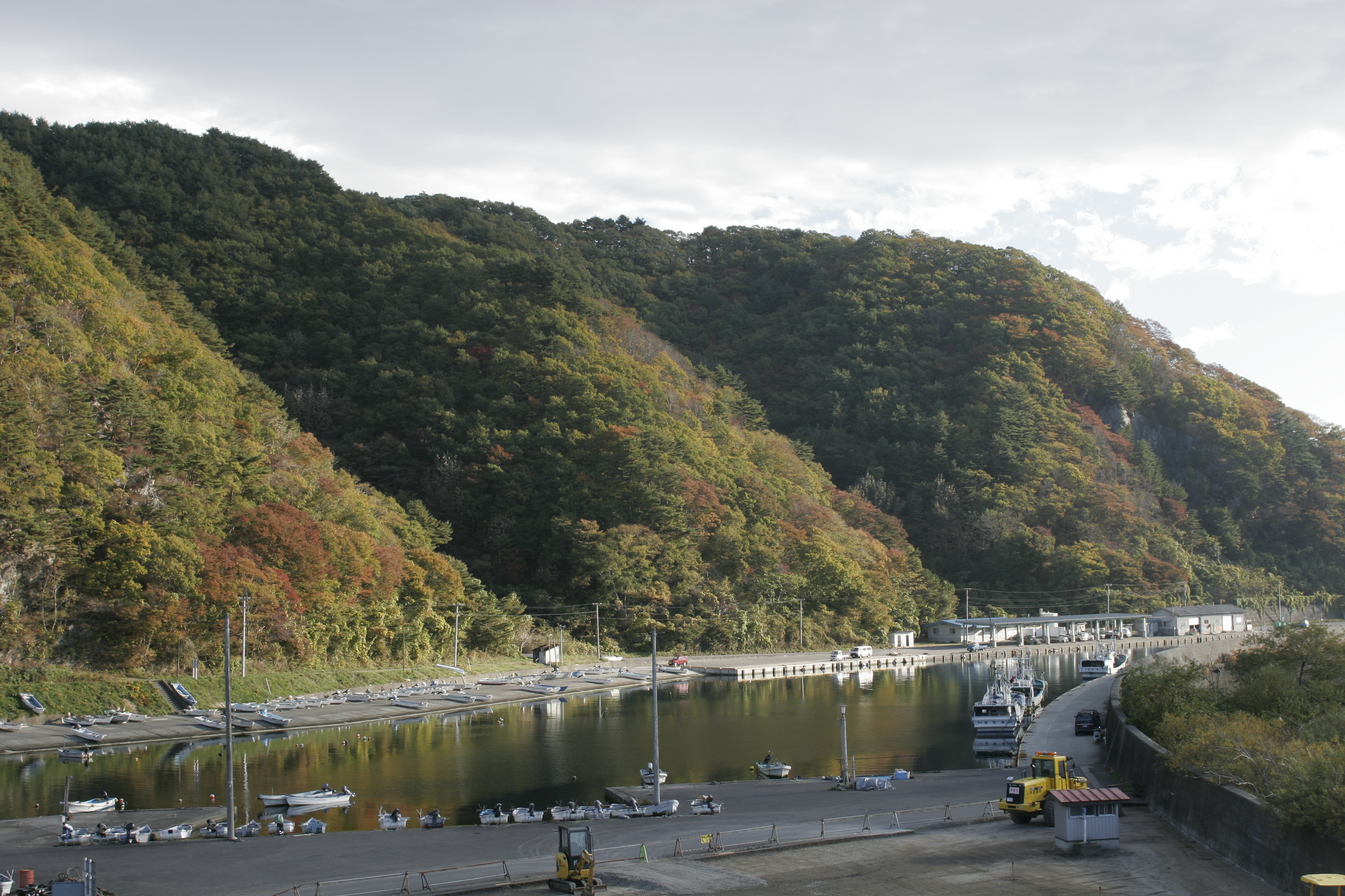
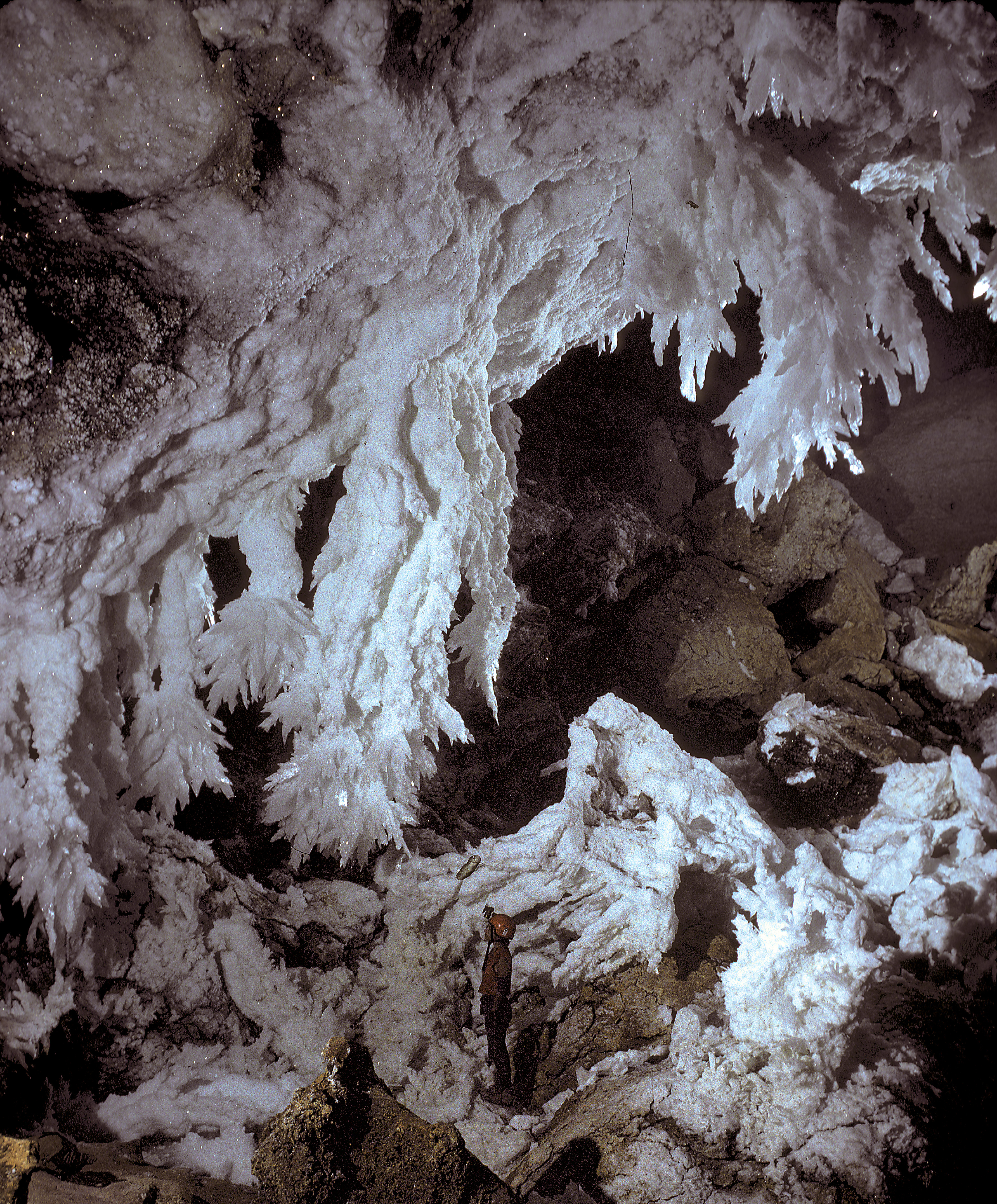
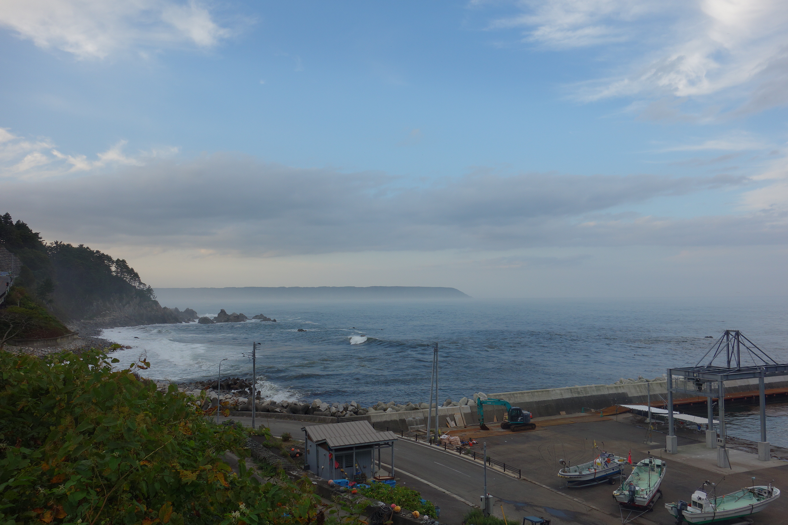
is a town located in Iwate Prefecture, Japan. , the town had an estimated population of 8,987, and a population density of 9.1 persons per km² in 4366 households. The total area of the town is . Geography Iwaizumi is in the Kitakami Mountains of northeast Iwate prefecture, east of the prefectural capital of Morioka. It has a small coastline on the Pacific Ocean to the east. The area has numerous limestone caves, including the Ryūsendō. Neighboring municipalities Iwate Prefecture *Morioka *Kuji * Miyako * Fudai * Tanohata * Kuzumaki *Noda Climate Iwaizumi has a humid climate (Köppen climate classification ''Cfa'') characterized by mild summers and cold winters with heavy snowfall. The average annual temperature in Iwaizumi is 9.5 °C. The average annual rainfall is 1283 mm with September as the wettest month and February as the driest month. The temperatures are highest on average in August, at around 22.3 °C, and lowest in January, at around −2.0 ... [...More Info...] [...Related Items...] OR: [Wikipedia] [Google] [Baidu] |
Towns Of Japan
A town (町; ''chō'' or ''machi'') is a local administrative unit in Japan. It is a local public body along with prefecture (''ken'' or other equivalents), city (''shi''), and village (''mura''). Geographically, a town is contained within a district. Note that the same word (町; ''machi'' or ''chō'') is also used in names of smaller regions, usually a part of a ward in a city. This is a legacy of when smaller towns were formed on the outskirts of a city, only to eventually merge into it. Towns See also * Municipalities of Japan * Japanese addressing system The Japanese addressing system is used to identify a specific location in Japan. When written in Japanese characters, addresses start with the largest geographical entity and proceed to the most specific one. When written in Latin characters, ad ... References {{reflist External links "Large_City_System_of_Japan";_graphic_shows_towns_compared_with_other_Japanese_city_types_at_p._1_[PDF_7_of_40/nowiki>">DF_7_of_4 ... [...More Info...] [...Related Items...] OR: [Wikipedia] [Google] [Baidu] |
Solutional Cave
A solutional cave, solution cave, or karst cave is a cave usually formed in the soluble rock limestone. It is the most frequently occurring type of cave. It can also form in other rocks, including chalk, dolomite, marble, salt beds, and gypsum. Process Bedrock is dissolved by natural acid in groundwater that seeps through bedding-planes, faults, joints and so on. Over geological epochs these openings expand as the walls are dissolved to become caves or cave systems. The portions of a solutional cave that are below the water table or the local level of the groundwater will be flooded. Limestone caves The largest and most abundant solutional caves are located in limestone. Limestone caves are often adorned with calcium carbonate formations produced through slow precipitation. These include flowstones, stalactites, stalagmites, helictites, soda straws, calcite rafts and columns. These secondary mineral deposits in caves are called ''speleothems''. Carbonic acid dissoluti ... [...More Info...] [...Related Items...] OR: [Wikipedia] [Google] [Baidu] |
Edo Period
The or is the period between 1603 and 1867 in the history of Japan, when Japan was under the rule of the Tokugawa shogunate and the country's 300 regional '' daimyo''. Emerging from the chaos of the Sengoku period, the Edo period was characterized by economic growth, strict social order, isolationist foreign policies, a stable population, perpetual peace, and popular enjoyment of arts and culture. The period derives its name from Edo (now Tokyo), where on March 24, 1603, the shogunate was officially established by Tokugawa Ieyasu. The period came to an end with the Meiji Restoration and the Boshin War, which restored imperial rule to Japan. Consolidation of the shogunate The Edo period or Tokugawa period is the period between 1603 and 1867 in the history of Japan, when Japan was under the rule of the Tokugawa shogunate and the country's regional '' daimyo''. A revolution took place from the time of the Kamakura shogunate, which existed with the Tennō's court, to the Tok ... [...More Info...] [...Related Items...] OR: [Wikipedia] [Google] [Baidu] |
Nambu Clan
The was a Japanese samurai clan who ruled most of northeastern Honshū in the Tōhoku region of Japan for over 700 years, from the Kamakura period through the Meiji Restoration of 1868. The Nanbu claimed descent from the Seiwa Genji of Kai Province and were thus related to the Takeda clan. The clan moved its seat from Kai to Mutsu Province in the early Muromachi period, and were confirmed as ''daimyō'' of Morioka Domain under the Edo-period Tokugawa shogunate. The domain was in constant conflict with neighboring Hirosaki Domain, whose ruling Tsugaru clan were once Nanbu retainers. During the Boshin War of 1868–69, the Nanbu clan fought on the side of the Ōuetsu Reppan Dōmei, supporting the Tokugawa regime. After Meiji Restoration, the Nanbu clan had much of its land confiscated, and in 1871, the heads of its branches were relieved of office. In the Meiji period, the former ''daimyō'' became part of the ''kazoku'' peerage, with Nanbu Toshiyuki receiving the title of '' ... [...More Info...] [...Related Items...] OR: [Wikipedia] [Google] [Baidu] |
Mutsu Province
was an old province of Japan in the area of Fukushima, Miyagi, Iwate and Aomori Prefectures and the municipalities of Kazuno and Kosaka in Akita Prefecture. Mutsu Province is also known as or . The term is often used to refer to the combined area of Mutsu and the neighboring province Dewa, which together make up the entire Tōhoku region. History Invasion by the Kinai government Mutsu, on northern Honshū, was one of the last provinces to be formed as land was taken from the indigenous Emishi, and became the largest as it expanded northward. The ancient regional capital of the Kinai government was Tagajō in present-day Miyagi Prefecture. * 709 ('' Wadō 2, 3rd month''), an uprising against governmental authority took place in Mutsu and in nearby Echigo Province. Troops were dispatched to subdue the revolt. * 712 (''Wadō 5''), Mutsu was separated from Dewa Province. Empress Genmei's ''Daijō-kan'' made cadastral changes in the provincial map of the Nara period ... [...More Info...] [...Related Items...] OR: [Wikipedia] [Google] [Baidu] |
Japan Meteorological Agency
The , abbreviated JMA, is an agency of the Ministry of Land, Infrastructure, Transport and Tourism. It is charged with gathering and providing results for the public in Japan that are obtained from data based on daily scientific observation and research into natural phenomena in the fields of meteorology, hydrology, seismology and volcanology, among other related scientific fields. Its headquarters is located in Minato, Tokyo. JMA is responsible for gathering and reporting weather data and forecasts for the general public, as well as providing aviation and marine weather. JMA other responsibilities include issuing warnings for volcanic eruptions, and the nationwide issuance of earthquake warnings of the Earthquake Early Warning (EEW) system. JMA is also designated one of the Regional Specialized Meteorological Centers of the World Meteorological Organization (WMO). It is responsible for forecasting, naming, and distributing warnings for tropical cyclones in the Northwestern ... [...More Info...] [...Related Items...] OR: [Wikipedia] [Google] [Baidu] |
Humid Subtropical Climate
A humid subtropical climate is a zone of climate characterized by hot and humid summers, and cool to mild winters. These climates normally lie on the southeast side of all continents (except Antarctica), generally between latitudes 25° and 40° and are located poleward from adjacent tropical climates. It is also known as warm temperate climate in some climate classifications. Under the Köppen climate classification, ''Cfa'' and ''Cwa'' climates are either described as humid subtropical climates or warm temperate climates. This climate features mean temperature in the coldest month between (or ) and and mean temperature in the warmest month or higher. However, while some climatologists have opted to describe this climate type as a "humid subtropical climate", Köppen himself never used this term. The humid subtropical climate classification was officially created under the Trewartha climate classification. In this classification, climates are termed humid subtropical when the ... [...More Info...] [...Related Items...] OR: [Wikipedia] [Google] [Baidu] |
Noda, Iwate
is a village located in Iwate Prefecture, Japan. , the village had an estimated population of 4,201, and a population density of 52 persons per km² in 1660 households. The total area of the village is . Geography Noda is located in far northeastern Iwate Prefecture, bordered by the Pacific Ocean to the east. The western portion of the village is within the Kitakami Mountains. Parts of the coastline of Noda are within the borders of the Sanriku Fukkō National Park. Neighboring municipalities Iwate Prefecture *Kuji * Iwaizumi * Fudai Climate Noda has a cold oceanic climate (Köppen climate classification ''Cfb'') characterized by mild summers and cold winters with heavy snowfall. The average annual temperature in Noda is 8.7 °C. The average annual rainfall is 1273 mm with September as the wettest month and February as the driest month. The temperatures are highest on average in August, at around 21.4 °C, and lowest in January, at around -2.9 °C. Demogra ... [...More Info...] [...Related Items...] OR: [Wikipedia] [Google] [Baidu] |
Kuzumaki, Iwate
is a town located in Iwate Prefecture, Japan. , the town had an estimated population of 5,632, and a population density of 13 persons per km². The total area of the town is . The town uses many alternative energy sources, producing a surplus of energy, including wind power and biomass. Geography Kuzumaki is located in a basin in north-central Iwate Prefecture with an average elevation of 400 meters, surrounded by the 1000 meter mountains of the Kitakami Mountains. Approximately 60% of the town area is mountains and forests. The Mabechi River flows through the town. Neighboring municipalities Iwate Prefecture *Morioka *Kuji * Iwate * Iwaizumi * Kunohe * Ichinohe Climate Kuzumaki has a humid continental climate (Köppen climate classification ''Dfb'') characterized by mild summers and cold winters. The average annual temperature in Kuzumaki is 7.0 °C. The average annual rainfall is 1434 mm with September as the wettest month and February as the driest month. The tempe ... [...More Info...] [...Related Items...] OR: [Wikipedia] [Google] [Baidu] |
Tanohata, Iwate
is a village located in Iwate Prefecture, Japan. , the village had an estimated population of 3,244, and a population density of 21 persons per km² in 1,398 households. The total area of the village is . Geography Tanohata is a coastal mountainous community situated on the rocky ria Sanriku Coast along the Pacific coast of Iwate. Parts of the village are within the borders of the Sanriku Fukkō National Park. Neighboring municipalities Iwate Prefecture * Iwaizumi * Fudai Climate Tanohata has a cold humid climate (Köppen climate classification ''Cfa'') characterized by mild summers and cold winters. The average annual temperature in Tanohata is 10.1 °C. The average annual rainfall is 1201 mm with September as the wettest month and February as the driest month. The temperatures are highest on average in August, at around 22.6 °C, and lowest in January, at around -1.1 °C. Demographics Per Japanese census data, the population of Tanohata peaked at around ... [...More Info...] [...Related Items...] OR: [Wikipedia] [Google] [Baidu] |
Fudai, Iwate
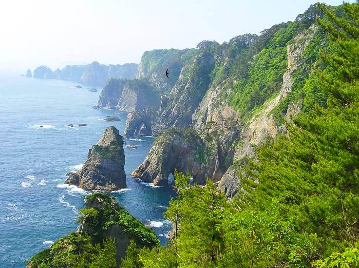
is a village located in Iwate Prefecture, Japan. , the village had an estimated population of 2,607, and a population density of 37.4 persons per km2 in 1,126 households. The total area of the village is . Geography Fudai is a coastal mountainous community situated on the Sanriku Coast ria along the Pacific Ocean in northern Iwate. The southern part of the village, an area called , included a part of the Rikuchu Kaigan National Park, which is now part of the Sanriku Fukkō National Park. It features an observation point to view scenic seaside cliffs. Neighboring municipalities Iwate Prefecture *Noda * Iwaizumi * Tanohata Climate Fudai has a cold humid climate (Köppen climate classification ''Cfa'') characterized by mild summers and cold winters. The average annual temperature in Fudai is 10.1 °C. The average annual rainfall is 1201 mm with September as the wettest month and February as the driest month. The temperatures are highest on average in August, at aroun ... [...More Info...] [...Related Items...] OR: [Wikipedia] [Google] [Baidu] |
Miyako, Iwate
is a city located in Iwate Prefecture, Japan. , the city had an estimated population of 51,150, and a population density of 41 persons per km2. The total area of the city is . Geography Miyako is located in central Iwate Prefecture, bordered by the Pacific Ocean to the east, with the main urban area fronting on Miyako Bay. It is located at the northern end of the rias coastal area of the Sanriku Coast, east of the prefectural capital of Morioka. The city area is the largest in Iwate Prefecture and the second largest in the Tōhoku region (after Tsuruoka, Yamagata). However, around 90% of the city area is covered by mountains and forest, so the habitable area is only about 9% of the total area, and therefore although the population density per total area is low, but the population density per habitable area exceeds the prefecture average. Miyako is connected to Morioka by an east–west train line and highway and the coastal highway also goes through the town. The city has a small ... [...More Info...] [...Related Items...] OR: [Wikipedia] [Google] [Baidu] |


