|
Isolina Rondón
Isolina Rondón (April 11, 1913 – October 2, 1990) was a political activist. She was one of the few witnesses of the killing of four Nationalists committed by local police officers in Puerto Rico during a confrontation with the supporters of the Nationalist Party that occurred in October 24, 1935, and which is known as the Río Piedras massacre. Rondón joined the political movement and became the Treasurer of the Puerto Rican Nationalist Party which staged various uprisings in Puerto Rico against the colonial Government of the United States in 1950. Early years Rondón was born in Río Piedras, Puerto Rico and was raised by her mother upon her father's death. Her mother was a housekeeper and at times Rondón helped. after Rondón began her primary education in her hometown and after completing her eighth grade she attended a secretarial school. She went on to study at the University of Puerto Rico where she worked in the office of the Dean of Social Sciences. Her cousin was a ... [...More Info...] [...Related Items...] OR: [Wikipedia] [Google] [Baidu] |
Río Piedras, Puerto Rico
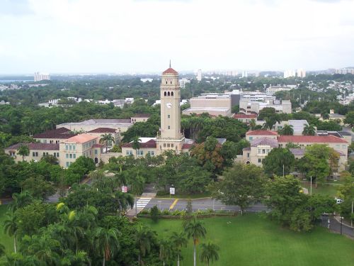
Río Piedras is a populous district of San Juan, and former town and municipality of Puerto Rico, which was merged with the municipality of San Juan in 1951. The district today is composed of various '' barrios'' (these are the primary legal divisions of municipalities in Puerto Rico) such as Pueblo and Universidad. The historic town was founded in 1714 as El Roble, it was given municipality rights in 1823, and since 1903 it has been the home of the University of Puerto Rico's main campus, earning the popular name of ''Ciudad Universitaria'' (similar to college town) today. The downtown and historic center of Río Piedras is officially known as the Pueblo barrio of the municipality of San Juan. Name In addition to being the name of the barrio and district, Río Piedras ( Piedras River) is also the name of a river that crosses the district. Río Piedras was also the name of the former municipality of Puerto Rico (1823-1950). History The area where Río Piedras is lo ... [...More Info...] [...Related Items...] OR: [Wikipedia] [Google] [Baidu] |
US Constitution
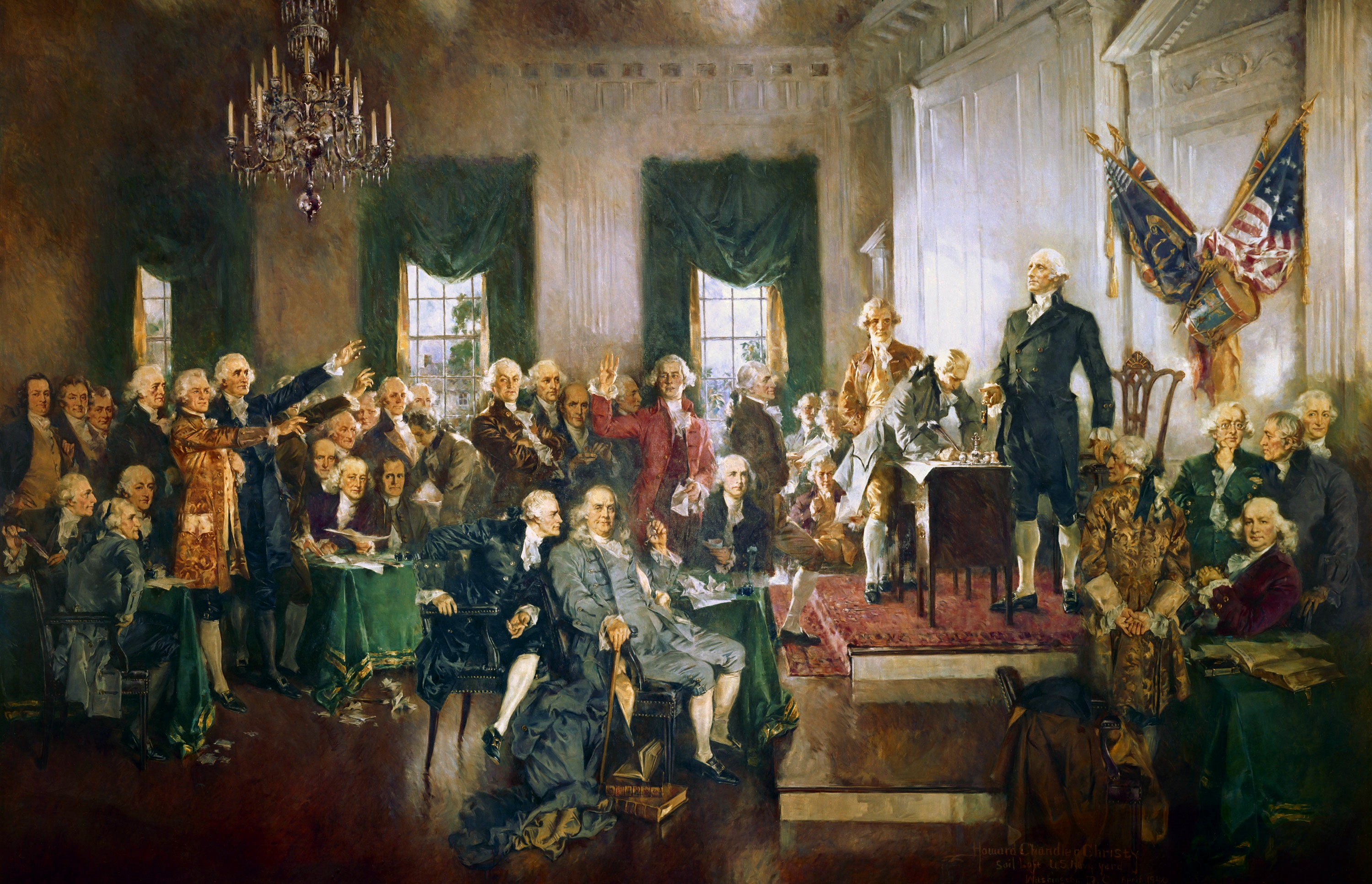
The Constitution of the United States is the supreme law of the United States of America. It superseded the Articles of Confederation, the nation's first constitution, in 1789. Originally comprising seven articles, it delineates the national frame of government. Its first three articles embody the doctrine of the separation of powers, whereby the federal government is divided into three branches: the legislative, consisting of the bicameral Congress (Article I); the executive, consisting of the president and subordinate officers ( Article II); and the judicial, consisting of the Supreme Court and other federal courts ( Article III). Article IV, Article V, and Article VI embody concepts of federalism, describing the rights and responsibilities of state governments, the states in relationship to the federal government, and the shared process of constitutional amendment. Article VII establishes the procedure subsequently used by the 13 states to ratify it. It is regarde ... [...More Info...] [...Related Items...] OR: [Wikipedia] [Google] [Baidu] |
Mayagüez, Puerto Rico
Mayagüez (, ) is a city and the eighth-largest municipality in Puerto Rico. It was founded as Nuestra Señora de la Candelaria de Mayagüez, and is also known as ''La Sultana del Oeste'' (The Sultaness of the West), ''Ciudad de las Aguas Puras'' (City of Pure Waters), or ''Ciudad del Mangó'' (Mango City). On April 6, 1894, the Spanish Crown granted it the formal title of ''Excelente Ciudad de Mayagüez'' (''Excellent City'' of Mayagüez). Mayagüez is located in the center of the western coast on the island of Puerto Rico. It has a population of 73,077 in the city proper, and it is a principal city of the Mayagüez Metropolitan Statistical Area (pop. 88,731) and the Mayagüez–San Germán–Cabo Rojo Combined Statistical Area (pop. 213,831). History The Mayagüez Metro Area (and part of Añasco) lies today on two former Taíno Cacicazgos (chiefdoms): Yaguex and Yagüeca, a region noted for its record of colonial resistance (i.e., Urayoán and Legend of Diego Salcedo). ... [...More Info...] [...Related Items...] OR: [Wikipedia] [Google] [Baidu] |
Jayuya Uprising
The Jayuya Uprising, also known as the Jayuya Revolt or El Grito de Jayuya, was a Nationalist insurrection that took place on October 30, 1950, in the town of Jayuya, Puerto Rico. The insurrection, led by Blanca Canales, was one of the multiple insurrections that occurred throughout Puerto Rico on that day against the Puerto Rican government supported by the United States. The insurrectionists were opposed to US sovereignty over Puerto Rico. Events leading to the revolt The Puerto Rican Nationalist Party was formed in 1922 to work for Puerto Rican Independence. By 1930 Pedro Albizu Campos, a lawyer who was the first Puerto Rican graduate from Harvard Law School, was elected president of the party. In the 1930s, the United States-appointed governor of Puerto Rico, Blanton Winship, and the police colonel, a former U.S. Army Colonel named Elisha Francis Riggs, applied harsh repressive measures against the Nationalist Party. In 1936, Albizu Campos and the leaders of the party were ... [...More Info...] [...Related Items...] OR: [Wikipedia] [Google] [Baidu] |
La Fortaleza
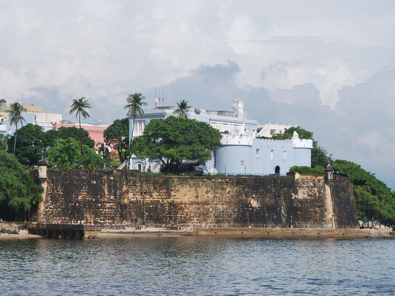
La Fortaleza (lit., "The Fortress" ) is the official residence of the governor of Puerto Rico. It was built between 1533 and 1540 to defend the harbor of San Juan. The structure is also known as Palacio de Santa Catalina (Saint Catherine's Palace). It is the oldest executive mansion in continuous use in the New World. It was listed by UNESCO in 1983 as part of the World Heritage Site "La Fortaleza and San Juan National Historic Site". During the 1640 reconstruction, the chapel of Santa Catalina, which originally stood outside the walls, was integrated into the walls of the structure, resulting in the alternate name Santa Catalina's Castle. The structure La Fortaleza was the first defensive fortification built for the city of San Juan, and the first of a series of military structures built to protect the city which included the Fort San Felipe del Morro and the Fort San Cristóbal. The construction was authorized by Charles V, Holy Roman Emperor as a defense against attacks ... [...More Info...] [...Related Items...] OR: [Wikipedia] [Google] [Baidu] |
San Juan Nationalist Revolt
The San Juan Nationalist revolt was one of many uprisings against United States Government rule which occurred in Puerto Rico on October 30, 1950 during the Puerto Rican Nationalist Party revolts. Amongst the uprising's main objectives were an attack on ''La Fortaleza'' (the governor's mansion in San Juan), and the U.S. Federal Court House Building in Old San Juan. Events leading to the revolt On September 17, 1922, the Puerto Rican Nationalist Party was formed. José Coll y Cuchí, a former member of the Union Party, was elected its first president. He wanted radical changes within the economy and social welfare programs of Puerto Rico. In 1924, Pedro Albizu Campos, a lawyer, joined the party and was named its vice president. Albizu Campos was the first Puerto Rican graduate of Harvard Law School. He had served as a Second Lieutenant in the U.S. Army during World War I, and believed that Puerto Rico should be an independent nation - even if that required an armed confrontation ... [...More Info...] [...Related Items...] OR: [Wikipedia] [Google] [Baidu] |
Jayuya
Jayuya (, ) is a town and municipality of Puerto Rico located in the mountainous center region of the island, north of Ponce; east of Utuado; and west of Ciales. Jayuya is spread over 10 barrios and Jayuya Pueblo (the downtown and administrative center of the city). It is the principal city of the Jayuya Micropolitan Statistical Area. Named after the Taíno tribal leader, Hayuya, Jayuya is known for its skilled wood carvers. Among its monuments are the statue of Nemesio Canales and the bust of Hayuya, both by the Puerto Rican sculptor Tomás Batista. History The town of Jayuya was founded in 1911, but history traces non-indigenous settlers living in the region as far back as 1878. At that time, a small community was established there, separated from the larger cities of the coasts with little to no communication. Near the end of the 19th century, the town focused on the production of coffee, which greatly boosted the local economy. In 1911, the town was officially declar ... [...More Info...] [...Related Items...] OR: [Wikipedia] [Google] [Baidu] |
Utuado
Utuado () is a town and municipality of Puerto Rico located in the central mountainous region of the island known as the '' Cordillera Central''. It is located north of Adjuntas and Ponce; south of Hatillo and Arecibo; east of Lares; and west of Ciales and Jayuya. It is the third-largest municipality in land area in Puerto Rico (after Arecibo and Ponce). According to the 2020 US Census, the municipality has a population of 28,287 spread over 24 barrios and Utuado pueblo (the downtown area and the administrative center of the city). Utuado is the main municipality of the Utuado micropolitan statistical area and is part of the San Juan-Caguas-Fajardo Combined Statistical Area. Etymology and nicknames The name Utuado derives from the Taíno word ''otoao'', meaning ''between mountains'' (i.e. valley). The municipality is known as ''Ciudad del Viví'' (Viví City), derived from the Viví River which runs through Utuado: one river branch comes from Adjuntas and the other f ... [...More Info...] [...Related Items...] OR: [Wikipedia] [Google] [Baidu] |
Ponce, Puerto Rico
Ponce (, , , ) is both a city and a municipality on the southern coast of Puerto Rico. The city is the seat of the municipal government. Ponce, Puerto Rico's most populated city outside the San Juan metropolitan area, was founded on 12 August 1692Some publications/reporters have erroneously stated Ponce's date of founding as 12 December 1692 (see, for example, Jose Fernandez-Colon, The Associated Press, at "Noticias Online" on 24 January 2009, a''Noticias Puerto Rico.''Accessed 23 March 2019.) Another incorrect date sometimes found is 12 September 1692 (See, for example, Jorge L. Perez (El Nuevo Dia) and Jorge Figueroa (Ponce Municipal Historian), a''Historic Buildings and Structures in Ponce, Puerto Rico.'' at the text accompanying Drawing #20, titled "Tumba de los Bomberos". Puerto Rico Historic Buildings Drawings Society. 2019. Accessed 4 February 2019. See als''Mapa de Municipios y Barrios: Ponce, Memoria Numero 27.'' Gobierno del Estado Libre Asociado de Puerto Rico. Junta d ... [...More Info...] [...Related Items...] OR: [Wikipedia] [Google] [Baidu] |
Arecibo
Arecibo (; ) is a city and municipality on the northern coast of Puerto Rico, on the shores of the Atlantic Ocean, located north of Utuado and Ciales; east of Hatillo; and west of Barceloneta and Florida. It is about west of San Juan, the capital city. Arecibo is the largest municipality in Puerto Rico by area, and it is the core city of the Arecibo Metropolitan Statistical Area and part of the greater San Juan Combined Statistical Area. It is spread over 18 ''barrios'' and Arecibo Pueblo (the downtown area and the administrative center of the city). Its population in 2020 was 87,754. The Arecibo Observatory, which housed the Arecibo telescope, the world's largest radio telescope until July 2016, is located in the municipality. The Arecibo telescope collapsed on December 1, 2020. Arecibo is the seat of the Roman Catholic Diocese of Arecibo. Etymology and nicknames The name ''Arecibo'' comes from the Taíno chief Xamaica Arasibo, cacique of the ''yucayeque'' (Taíno ... [...More Info...] [...Related Items...] OR: [Wikipedia] [Google] [Baidu] |
Naranjito, Puerto Rico
Naranjito (, ) is a town and municipality of Puerto Rico located in the central region of the island, south of Toa Alta; north of Barranquitas and Comerío; east of Corozal; and west of Bayamón. Naranjito is spread over 7 barrios and Naranjito Pueblo (the downtown area and the administrative center). It is part of the San Juan-Caguas-Guaynabo Metropolitan Statistical Area. History The intention to form the municipality of Naranjito began in 1810. After a series of major incidents with powerful political interests of the time, on December 3, 1824, Don Braulio Morales successfully founded the town of Naranjito. The town was founded in the neighborhood of the same name, on a land donated by Doña Manuela Rivera and Don Braulio Morales. Morales was named "Captain Settler" and at the same time was appointed mayor of the town in development. The name "Naranjito" is derived from a small orange tree that served as a reference point for travelers looking for in the shortest way to ... [...More Info...] [...Related Items...] OR: [Wikipedia] [Google] [Baidu] |


