|
Isinglass River
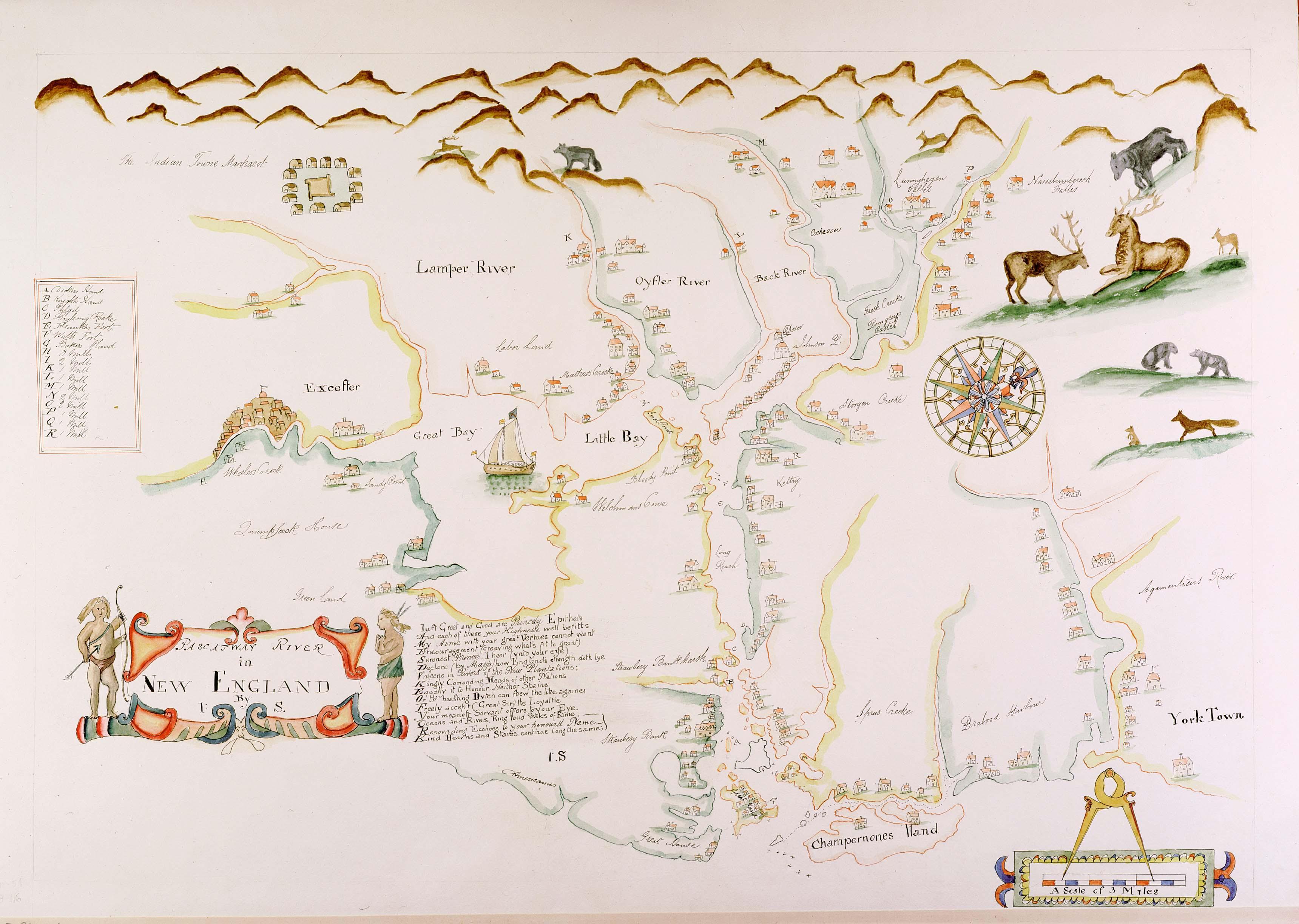
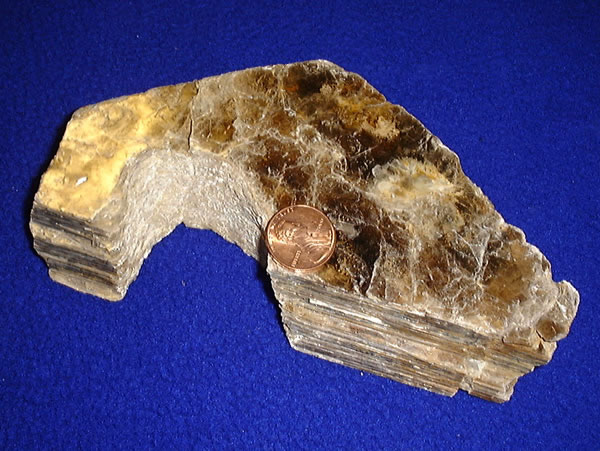
The Isinglass River is a river in Strafford County in southeastern New Hampshire, United States. It rises at Bow Lake in the town of Strafford, but is also fed through its tributaries by Ayer's, Nippo, Round and Long ponds in Barrington. The Isinglass flows east to meet the Cochecho River in the southern corner of Rochester. The river is part of the Piscataqua River watershed. The name In ''History of the Town of Rochester, N.H.,'' published 1892, author Franklin McDuffee remarks that the Isinglass River is "probably named from the mica in its bed or along its banks." Isinglass is a synonym for mica, an abundance of which makes rock at the Isinglass River sparkle. Isinglass River Management Plan The Isinglass River Management Plan is a state-supported plan implemented to protect the Isinglass River, the river corridor, and the greater Isinglass watershed. The Isinglass River is one of 15 rivers in the state of New Hampshire that are recognized for having outstanding natural ... [...More Info...] [...Related Items...] OR: [Wikipedia] [Google] [Baidu] |
United States
The United States of America (U.S.A. or USA), commonly known as the United States (U.S. or US) or America, is a country primarily located in North America. It consists of 50 states, a federal district, five major unincorporated territories, nine Minor Outlying Islands, and 326 Indian reservations. The United States is also in free association with three Pacific Island sovereign states: the Federated States of Micronesia, the Marshall Islands, and the Republic of Palau. It is the world's third-largest country by both land and total area. It shares land borders with Canada to its north and with Mexico to its south and has maritime borders with the Bahamas, Cuba, Russia, and other nations. With a population of over 333 million, it is the most populous country in the Americas and the third most populous in the world. The national capital of the United States is Washington, D.C. and its most populous city and principal financial center is New York City. Paleo-Americ ... [...More Info...] [...Related Items...] OR: [Wikipedia] [Google] [Baidu] |
Piscataqua River
The Piscataqua River (Abenaki: ''Pskehtekwis'') is a tidal river forming the boundary of the U.S. states of New Hampshire and Maine from its origin at the confluence of the Salmon Falls River and Cochecho River. The drainage basin of the river is approximately , including the subwatersheds of the Great Works River and the five rivers flowing into Great Bay: the Bellamy, Oyster, Lamprey, Squamscott, and Winnicut. The river runs southeastward, with New Hampshire to the south and west and Maine to the north and east, and empties into the Gulf of Maine east of Portsmouth, New Hampshire. The last before the sea are known as Portsmouth Harbor and have a tidal current of around . The cities/towns of Portsmouth, New Castle, Newington, Kittery and Eliot have developed around the harbor. History Named by the area's original Abenaki inhabitants, the word ''Piscataqua'' is believed to be a combination of ''peske'' (branch) with ''tegwe'' (a river with a strong current, possibl ... [...More Info...] [...Related Items...] OR: [Wikipedia] [Google] [Baidu] |
List Of Rivers Of New Hampshire
This is a list of rivers and significant streams in the U.S. state of New Hampshire. All watercourses named "River" (freshwater or tidal) are listed here, as well as other streams which are either subject to thNew Hampshire Comprehensive Shoreland Protection Actor are more than long. New Hampshire rivers and streams qualify for state shoreland protection (and are listed here in bold) if they are ''fourth-order'' or larger water bodies, based on the Strahler method of stream order classification. Strahler, A. N. (1952). "Dynamic basis of geomorphology". ''Geological Society of America Bulletin'', 63, 923–938. By drainage basin All New Hampshire rivers ultimately flow to the Atlantic Ocean. The list is sorted by major drainage basin, running from north to south along the Atlantic coast, with respective tributaries arranged based on their entry into the main stream from mouth to source. Where several tributaries enter a single lake, they are listed running clockwise from the lak ... [...More Info...] [...Related Items...] OR: [Wikipedia] [Google] [Baidu] |
New Hampshire Fish And Game Department
The New Hampshire Fish and Game Department (NHF&G) is a department within the government of New Hampshire in the United States. The Fish and Game Department manages New Hampshire's fish, game, and aquatic plant resources. Structure The Department was created in 1865 to both propagate and conserve the state's fish and game. The Governor of New Hampshire appoints 11 Fish and Game Commission members; one from each of the state's ten counties, plus one from the Seacoast Region. The Department maintains four regional offices within the state: The Department also has a Law Enforcement Division, which operates in six districts across the state. Each district is staffed by a lieutenant, a sergeant, and several Conservation Officers (CO). Districts do not exactly align to county boundaries. Wild Life Heritage Foundation of New Hampshire In 2006, the Wildlife Heritage Foundation of New Hampshire was formed due to falling revenues from the Fish & Game Department's licenses for hunting ... [...More Info...] [...Related Items...] OR: [Wikipedia] [Google] [Baidu] |
New Hampshire House Of Representatives
The New Hampshire House of Representatives is the lower house in the New Hampshire General Court, the bicameral legislature of the state of New Hampshire. The House of Representatives consists of 400 members coming from 204 legislative districts across the state, created from divisions of the state's counties. On average, each legislator represents about 3,300 residents, which is the smallest lower house representative-to-population ratio in the country. New Hampshire has by far the largest lower house of any American state; the second-largest, the Pennsylvania House of Representatives, has 203 members. The House is the fourth-largest lower house in the English-speaking world (behind the 435-member United States House of Representatives, 543-member Lok Sabha of India, and 650-member House of Commons of the United Kingdom). Districts vary in number of seats based on their populations, with the least-populous districts electing only one member and the most populous electing 11. ... [...More Info...] [...Related Items...] OR: [Wikipedia] [Google] [Baidu] |
Isinglass (mineral)
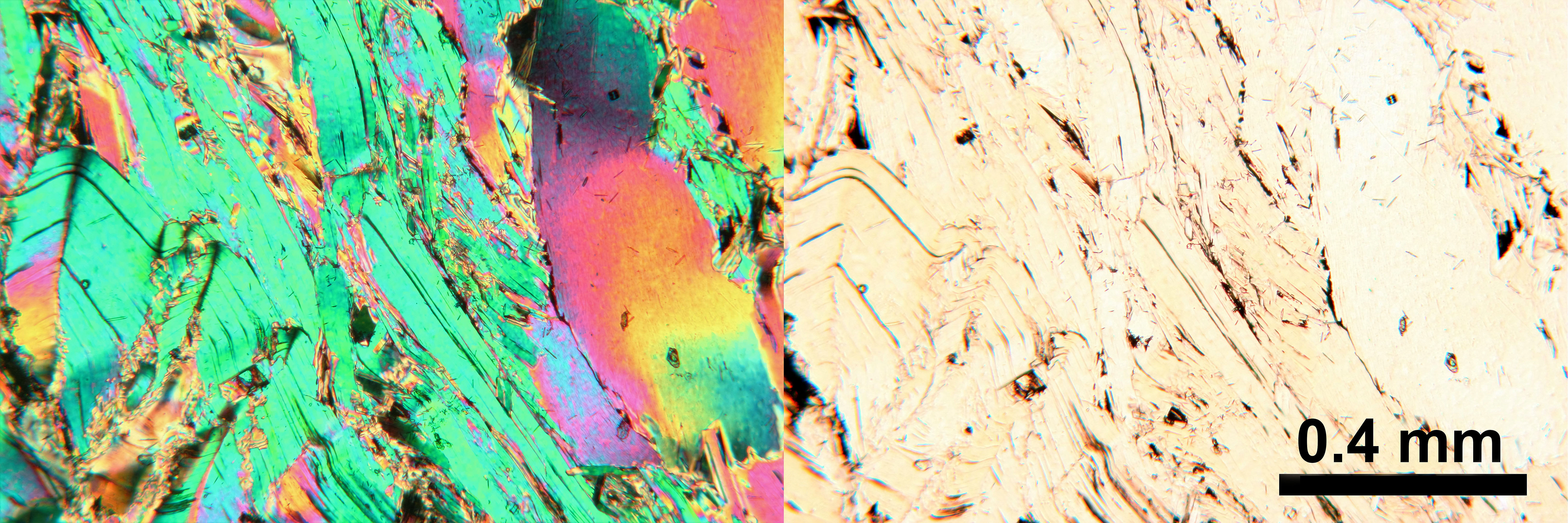
Micas ( ) are a group of silicate minerals whose outstanding physical characteristic is that individual mica crystals can easily be split into extremely thin elastic plates. This characteristic is described as perfect basal cleavage. Mica is common in igneous and metamorphic rock and is occasionally found as small flakes in sedimentary rock. It is particularly prominent in many granites, pegmatites, and schists, and "books" (large individual crystals) of mica several feet across have been found in some pegmatites. Micas are used in products such as drywalls, paints, fillers, especially in parts for automobiles, roofing and shingles, as well as in electronics. The mineral is used in cosmetics and food to add "shimmer" or "frost." Properties and structure The mica group is composed of 37 phyllosilicate minerals. All crystallize in the monoclinic system, with a tendency towards pseudohexagonal crystals, and are similar in structure but vary in chemical composition. Micas are ... [...More Info...] [...Related Items...] OR: [Wikipedia] [Google] [Baidu] |
Mica
Micas ( ) are a group of silicate minerals whose outstanding physical characteristic is that individual mica crystals can easily be split into extremely thin elastic plates. This characteristic is described as perfect basal cleavage. Mica is common in igneous and metamorphic rock and is occasionally found as small flakes in sedimentary rock. It is particularly prominent in many granites, pegmatites, and schists, and "books" (large individual crystals) of mica several feet across have been found in some pegmatites. Micas are used in products such as drywalls, paints, fillers, especially in parts for automobiles, roofing and shingles, as well as in electronics. The mineral is used in cosmetics and food to add "shimmer" or "frost." Properties and structure The mica group is composed of 37 phyllosilicate minerals. All crystallize in the monoclinic system, with a tendency towards pseudohexagonal crystals, and are similar in structure but vary in chemical composition. Micas are ... [...More Info...] [...Related Items...] OR: [Wikipedia] [Google] [Baidu] |
Drainage Basin
A drainage basin is an area of land where all flowing surface water converges to a single point, such as a river mouth, or flows into another body of water, such as a lake or ocean. A basin is separated from adjacent basins by a perimeter, the '' drainage divide'', made up of a succession of elevated features, such as ridges and hills. A basin may consist of smaller basins that merge at river confluences, forming a hierarchical pattern. Other terms for a drainage basin are catchment area, catchment basin, drainage area, river basin, water basin, and impluvium. In North America, they are commonly called a watershed, though in other English-speaking places, "watershed" is used only in its original sense, that of a drainage divide. In a closed drainage basin, or endorheic basin, the water converges to a single point inside the basin, known as a sink, which may be a permanent lake, a dry lake, or a point where surface water is lost underground. Drainage basins are similar ... [...More Info...] [...Related Items...] OR: [Wikipedia] [Google] [Baidu] |
Berrys River
The Berrys River is a river located in southeastern New Hampshire in the United States. It is a tributary of the Isinglass River, part of the Cocheco River/Piscataqua River watershed leading to the Atlantic Ocean The Atlantic Ocean is the second-largest of the world's five oceans, with an area of about . It covers approximately 20% of Earth's surface and about 29% of its water surface area. It is known to separate the " Old World" of Africa, Europe .... The river rises in Farmington, New Hampshire, and flows southeast past Blue Job Mountain. Turning south, the river passes through the eastern corner of Strafford, New Hampshire, Strafford and enters Barrington, New Hampshire, Barrington, where it is interrupted by Long Pond. One mile below the pond, the Berrys River reaches the Isinglass. See also *List of rivers of New Hampshire References Rivers of New Hampshire Rivers of Strafford County, New Hampshire {{NewHampshire-river-stub ... [...More Info...] [...Related Items...] OR: [Wikipedia] [Google] [Baidu] |
New Hampshire
New Hampshire is a U.S. state, state in the New England region of the northeastern United States. It is bordered by Massachusetts to the south, Vermont to the west, Maine and the Gulf of Maine to the east, and the Canadian province of Quebec to the north. Of the 50 U.S. states, New Hampshire is the List of U.S. states and territories by area, fifth smallest by area and the List of U.S. states and territories by population, tenth least populous, with slightly more than 1.3 million residents. Concord, New Hampshire, Concord is the state capital, while Manchester, New Hampshire, Manchester is the largest city. New Hampshire's List of U.S. state mottos, motto, "Live Free or Die", reflects its role in the American Revolutionary War; its state nickname, nickname, "The Granite State", refers to its extensive granite formations and quarries. It is well known nationwide for holding New Hampshire primary, the first primary (after the Iowa caucus) in the United States presidential election ... [...More Info...] [...Related Items...] OR: [Wikipedia] [Google] [Baidu] |
Cochecho River
The Cochecho River (incorrectly Cocheco River) is a tributary of the Piscataqua River, long, in the U.S. state of New Hampshire. It rises in northern Strafford County and runs southeastward, through the town of Farmington, New Hampshire, Farmington and the cities of Rochester, New Hampshire, Rochester and Dover, New Hampshire, Dover, where it provides hydroelectric power. Below the center of Dover, the river is tidal river, tidal and joins the Salmon Falls River at the Maine border to form the Piscataqua. Significant tributaries include the Ela River, the Mad River (Cocheco River), Mad River, and the Isinglass River. History of the name Cochecho is an Abenaki word meaning "rapid foaming water," referring to Cochecho Falls in downtown Dover. Settlers adopted the name for both the river and their principal settlement, Cochecho village. In 1642, Richard Waldron was granted water privileges at Cochecho Falls, moving there from Dover Point to build a sawmill and gristmill. During the I ... [...More Info...] [...Related Items...] OR: [Wikipedia] [Google] [Baidu] |
Bow Lake Village, New Hampshire
Bow Lake Village is a small unincorporated community in the town of Strafford, New Hampshire, located at the outlet of Bow Lake. The village is home to the Bow Lake Grange, Isinglass Country Store, 7C's Kitchen and Market (formerly the Blue Loon, Sheila's, and Uncle George's), the old Waldron Store (owned by the Strafford Historical Society) and the Independence Inn & Heartwood Restaurant (formerly the Bow Lake Inn). The village's main roads are New Hampshire Route 202A New Hampshire Route 202A (NH 202A) is a east–west State highway (US), state highway in Strafford County, New Hampshire, Strafford and Rockingham County, New Hampshire, Rockingham counties in southeastern New Hampshire, serving as a norther ..., which connects it to Northwood and Center Strafford; Province Road, which follows the north shore of the lake; and Water Street, which follows the south shore. References Unincorporated communities in New Hampshire Unincorporated communities in Strafford ... [...More Info...] [...Related Items...] OR: [Wikipedia] [Google] [Baidu] |


