|
Iowa Highway 127
Iowa Highway 127 (Iowa 127) is an east–west highway in Harrison County. It begins at Interstate 29 near Mondamin and ends in Logan at U.S. Highway 30 (US 30). The highway is nearly long. Route description Iowa Highway 127 begins at an interchange with Interstate 29 (I-29) west of Mondamin, traveling east along a two-lane highway. Just east of I-29, it meets Harrison County Road K45 (CR K45), which is a former alignment of US 75. east of Mondamin, it meets the southern end of Iowa Highway 183, which is part of the Loess Hills Scenic Byway (LHSB). The LHSB follows Iowa 127 for before Iowa 127 turns to the east and the LHSB continues south along CR L20. The route travels east for , passing through Magnolia, after which it turns to the south towards Logan Logan may refer to: Places * Mount Logan (other) Australia * Logan (Queensland electoral district), an electoral district in the Queensland Legislative Assembly * Logan, Victoria, ... [...More Info...] [...Related Items...] OR: [Wikipedia] [Google] [Baidu] |
Mondamin, Iowa
Mondamin is a city in Harrison County, Iowa, United States. The population was 339 at the time of the 2020 census. History Mondamin was platted in the winter of 1867–1868 when the railroad was extended to that point. It was named after Mondamin, a Native American corn deity. Geography Mondamin is located at (41.709831, -96.021068). According to the United States Census Bureau, the city has a total area of , all of it land. Demographics 2010 census As of the census of 2010, there were 402 people, 175 households, and 122 families living in the city. The population density was . There were 194 housing units at an average density of . The racial makeup of the city was 97.8% White, 0.2% African American, 0.5% Asian, 0.5% from other races, and 1.0% from two or more races. Hispanic or Latino of any race were 1.0% of the population. There were 175 households, of which 29.1% had children under the age of 18 living with them, 50.9% were married couples living together, 10.3% had ... [...More Info...] [...Related Items...] OR: [Wikipedia] [Google] [Baidu] |
Logan, Iowa
Logan is a city and county seat of Harrison County, Iowa, United States, along the Boyer River. The population was 1,397 at the time of the 2020 census. History Logan was platted in 1867 when Chicago and North Western Railway was extended to that point. It was named for John A. Logan, a Union Army general. Geography Logan's longitude and latitude coordinates in decimal form are 41.644614, -95.789931. According to the United States Census Bureau, the city has a total area of , all of it land. Climate Demographics 2010 census As of the census of 2010, there were 1,534 people, 595 households, and 397 families living in the city. The population density was . There were 649 housing units at an average density of . The racial makeup of the city was 98.6% White, 0.1% African American, 0.1% Native American, 0.4% Asian, and 0.8% from two or more races. Hispanic or Latino of any race were 0.8% of the population. There were 595 households, of which 35.0% had children under the age ... [...More Info...] [...Related Items...] OR: [Wikipedia] [Google] [Baidu] |
Harrison County, Iowa
Harrison County is a county located in the U.S. state of Iowa. As of the 2020 census, the population was 14,582. The county seat is Logan. The county was formed in 1851. It was named for ninth US President William Henry Harrison. Harrison County is included in the Omaha-Council Bluffs, NE-IA Metropolitan Statistical Area. Geography According to the U.S. Census Bureau, the county has a total area of , of which is land and (0.7%) is water. Major highways * Interstate 29 * U.S. Highway 30 * Iowa Highway 37 * Iowa Highway 44 * Iowa Highway 127 * Iowa Highway 183 * Iowa Highway 191 Adjacent counties * Monona County (north) *Crawford County (northeast) * Shelby County (east) * Pottawattamie County (south) * Washington County, Nebraska (southwest) * Burt County, Nebraska (northwest) National protected area * DeSoto National Wildlife Refuge (part) Demographics 2020 census The 2020 census recorded a population of 14,582 in the county, with a population density of . 96 ... [...More Info...] [...Related Items...] OR: [Wikipedia] [Google] [Baidu] |
Highway
A highway is any public or private road or other public way on land. It is used for major roads, but also includes other public roads and public tracks. In some areas of the United States, it is used as an equivalent term to controlled-access highway, or a translation for ''autobahn'', '' autoroute'', etc. According to Merriam Webster, the use of the term predates the 12th century. According to Etymonline, "high" is in the sense of "main". In North American and Australian English, major roads such as controlled-access highways or arterial roads are often state highways (Canada: provincial highways). Other roads may be designated "county highways" in the US and Ontario. These classifications refer to the level of government (state, provincial, county) that maintains the roadway. In British English, "highway" is primarily a legal term. Everyday use normally implies roads, while the legal use covers any route or path with a public right of access, including footpaths etc. Th ... [...More Info...] [...Related Items...] OR: [Wikipedia] [Google] [Baidu] |
Interstate 29 In Iowa
In the US state of Iowa, Interstate 29 (I-29) is a north–south Interstate Highway which closely parallels the Missouri River. I-29 enters Iowa from Missouri near Hamburg and heads to the north-northwest through the Omaha–Council Bluffs and the Sioux City areas. It exits the state by crossing the Big Sioux River into South Dakota. For its entire distance through the state, it runs on the flat land between the Missouri River and the Loess Hills. I-29 was built in sections over a period of 15 years. When there was a shortage of male workers, female workers stepped in to build a section near Missouri Valley. Between Council Bluffs and Sioux City, I-29 replaced U.S. Highway 75 (US 75) as the major route in western Iowa. As a result of I-29's creation, US 75 south of Sioux City was relocated into Nebraska. Route description I-29 enters Iowa south of Hamburg. The Interstate heads northwest, where it meets Iowa Highway 333 (Iowa 333) at a diamond interch ... [...More Info...] [...Related Items...] OR: [Wikipedia] [Google] [Baidu] |
Interchange (road)
In the field of road transport, an interchange (American English) or a grade-separated junction (British English) is a road junction that uses grade separations to allow for the movement of traffic between two or more roadways or highways, using a system of interconnecting roadways to permit traffic on at least one of the routes to pass through the junction without interruption from crossing traffic streams. It differs from a standard intersection, where roads cross at grade. Interchanges are almost always used when at least one road is a controlled-access highway (freeway or motorway) or a limited-access divided highway (expressway), though they are sometimes used at junctions between surface streets. Terminology ''Note:'' The descriptions of interchanges apply to countries where vehicles drive on the right side of the road. For left-side driving, the layout of junctions is mirrored. Both North American (NA) and British (UK) terminology is included. ; Freeway juncti ... [...More Info...] [...Related Items...] OR: [Wikipedia] [Google] [Baidu] |
Iowa Highway 183
Iowa Highway 183 (Iowa 183) is a state highway in western Iowa. It runs north to south for . It begins at an intersection with Iowa Highway 127 east of Mondamin and ends at an intersection with Iowa Highway 141 in Ute. The highway as currently constituted is the same as it was when it was commissioned in 1930. The first of the route are a part of the Loess Hills Scenic Byway. Previously, the highway began at U.S. Highway 30 in Missouri Valley. It was extended to U.S. Highway 6 in Council Bluffs and then truncated to the northern city limits of Council Bluffs. The previously existing segment between Missouri Valley and Council Bluffs was a portion of the Lincoln Highway and is now County Road L20 in Harrison and Pottawattamie Counties. Route description Iowa Highway 183 begins east of Mondamin, at the foot of the Loess Hills, at an intersection with Iowa Highway 127. It heads north along the Loess Hills Scenic Byway (LHSB) with the Loess Hills rising immediatel ... [...More Info...] [...Related Items...] OR: [Wikipedia] [Google] [Baidu] |
Loess Hills Scenic Byway
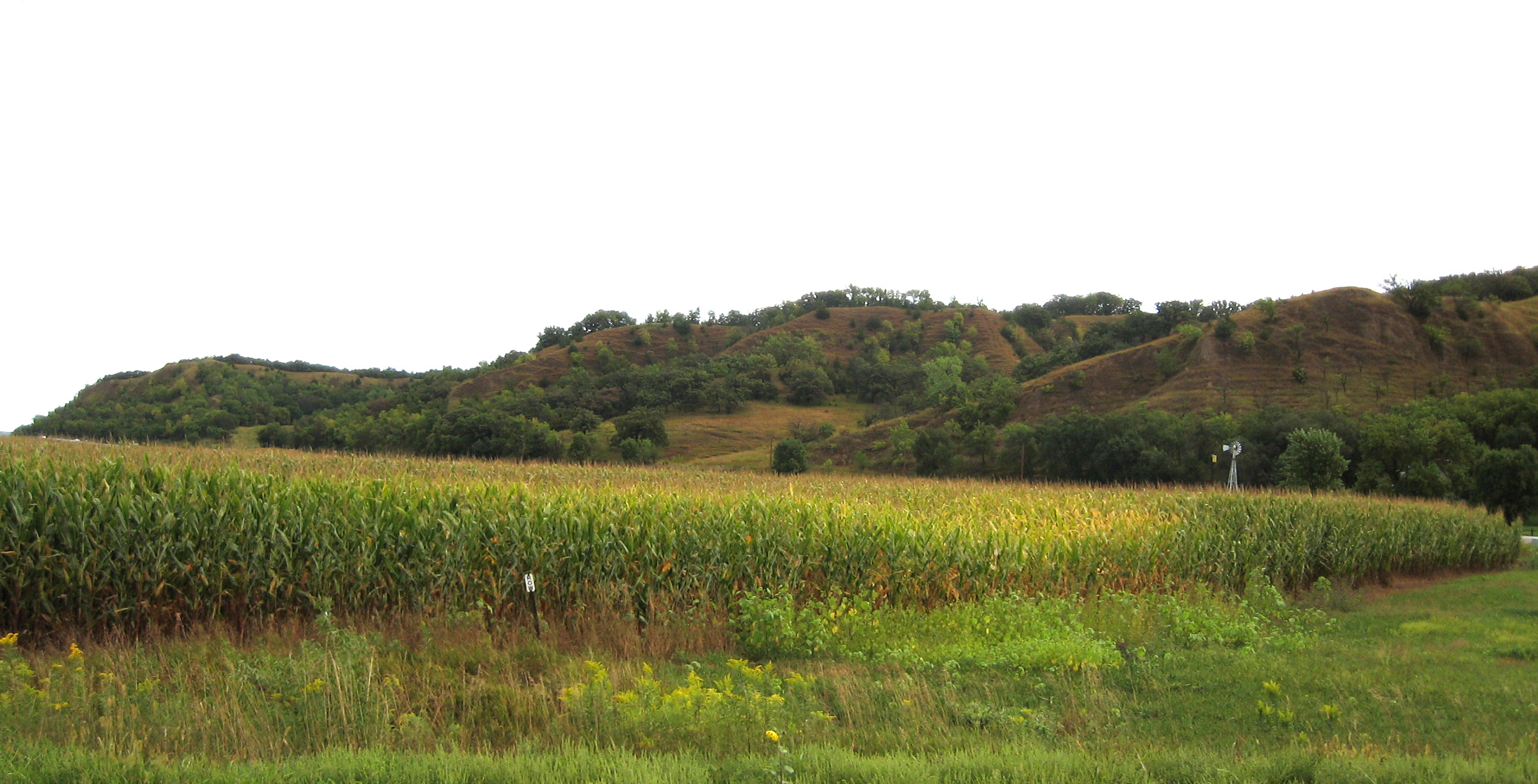
The Loess Hills are a formation of wind-deposited loess, loess soil in the westernmost parts of Iowa and Missouri, and the easternmost parts of Nebraska and Kansas, along the Missouri River. Geology The Loess (, , or ) Hills are generally located between east of the Missouri River channel. The Loess Hills rise above the flat plains forming a narrow band running north–south along the Missouri River."Geology of the Loess Hills, Iowa" USGS These hills are the first rise in land beyond the floodplain, forming something of a "front range" for Iowa, and parts of Missouri and Nebraska adjacent to the Missouri River. The Loess land formations of Iowa extend north into South Dakota and is a feature of three state Parks in South Eastern South Dakota. Union Grove State Park, Newton Hills State Park and Blood Run State Park. ... [...More Info...] [...Related Items...] OR: [Wikipedia] [Google] [Baidu] |
Iowa Department Of Transportation
The Iowa Department of Transportation (Iowa DOT) is the government organization in the U.S. state of Iowa responsible for the organization, construction, and maintenance of the primary highway system. Located in Ames, Iowa, DOT is also responsible for licensing drivers and programming and planning for aviation, rail, and public transit. The organization was created in 1904 as the Iowa State Highway Commission, an extension of Iowa State College in Ames. In 1913, the commission was spun off from the college and became a government organization. In 1974, the highway commission was folded into a larger transportation department with other modes of transportation. Organization Transportation Commission The decision-making body of the Iowa DOT is the Iowa Transportation Commission. Seven people, of whom no more than four people can represent the same political party, make up the commission. Each member of the commission is nominated by the governor and confirmed by the senate f ... [...More Info...] [...Related Items...] OR: [Wikipedia] [Google] [Baidu] |
Magnolia, Iowa
Magnolia is a city in Harrison County, Iowa, United States. The population was 190 at the time of the 2020 census. History Harrison County was established in 1851 and organized on March 7, 1853. Abram Fletcher, Charles Wolcott and A. D. Jones were appointed by the Iowa General Assembly as Commissioners to organize the county and establish a county seat. They chose the location for Magnolia and gave it its name. The third building that was erected in the town for the county courthouse in 1873 was listed on the National Register of Historic Places. The building was demolished in 2019 due to extreme disrepair and the lack of funds to maintain it. The county seat was transferred to Logan from Magnolia in 1875. Geography Magnolia is located at (41.694404, -95.873516). According to the United States Census Bureau, the city has a total area of , all of it land. Demographics 2010 census As of the census of 2010, there were 183 people, 79 households, and 50 families living in the ... [...More Info...] [...Related Items...] OR: [Wikipedia] [Google] [Baidu] |

.jpg)


