|
Interstate 894 (Wisconsin)
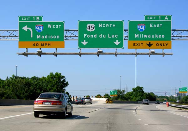
Interstate 894 (I-894) is a auxiliary Interstate Highway in Milwaukee County in the US state of Wisconsin. The route serves as a bypass of downtown Milwaukee, connecting with I-94 at the Zoo Interchange west of downtown and the Mitchell Interchange south of downtown. The route runs concurrently with three other highways for its duration, following US Highway 45 (US 45) from the Zoo Interchange to Hale Interchange as the Zoo Freeway, where it separates from US 45 to follow I-43 heading east to the Mitchell Interchange as the Airport Freeway. In local traffic reporting and casual conversation, it is known simply as "the bypass" or "894". I-894 is entirely concurrent with I-41/ US 41, and the east–west portion is also concurrent with I-43. I-894 is part of what was proposed to be an extensive freeway network around the Milwaukee area. The Zoo Freeway portion was completed from Beloit Road northward in 1963, and the Airport Freeway and remaining segmen ... [...More Info...] [...Related Items...] OR: [Wikipedia] [Google] [Baidu] |
West Allis, Wisconsin
West Allis is a city in Milwaukee County, Wisconsin, Milwaukee County, Wisconsin, United States. A suburb of Milwaukee, it is part of the Milwaukee metropolitan area. The population was 60,325 at the 2020 United States Census, 2020 census. History The name West Allis derives from Edward P. Allis, whose Edward P. Allis Company was a large Milwaukee-area manufacturing firm in the late 19th century. In 1901, the Allis company became Allis-Chalmers, and in 1902 built a large new manufacturing plant west of its existing plant. The locale in which the new plant was constructed was at the time called North Greenfield, and prior to the 1880s had been called Honey Creek. With the building of the western Allis plant, the area was incorporated as the Village of West Allis, and it became the City of West Allis in 1906. With the presence of Allis-Chalmers, the largest manufacturer in the area, West Allis became the largest suburb of Milwaukee in the early 20th century. After that, West Allis ... [...More Info...] [...Related Items...] OR: [Wikipedia] [Google] [Baidu] |
Hales Corners, Wisconsin
Hales Corners is a village in Milwaukee County, Wisconsin, United States. The population was 7,692 at the 2010 census. History The land in the area that would eventually encompass the Village was first claimed as French, then British, and eventually as the Northwest Territory of the United States in 1783. It was the land of the Potawatomi Indians until they were forced to move from their land in 1838. They were the dominant tribe in southeast Wisconsin with large villages. Like the Europeans that arrived later, they planted crops, but theirs were beans, squash, and corn. By engaging in the fur trade, the Potawatomi learned to speak French and English, and they eventually intermarried with the Europeans. During the 1830s and 1840s, more settlers arrived, starting with a number of New England families. Among them were three Hale families, whose lineage has been charted to England in the 1200s. Hales Corners traces its history as a Village to 1837, when Seneca Hale laid claim to la ... [...More Info...] [...Related Items...] OR: [Wikipedia] [Google] [Baidu] |
Freeways In The Milwaukee Area
A controlled-access highway is a type of highway that has been designed for high-speed vehicular traffic, with all traffic flow—ingress and egress—regulated. Common English terms are freeway, motorway and expressway. Other similar terms include ''throughway'' and ''parkway''. Some of these may be limited-access highways, although this term can also refer to a class of highways with somewhat less isolation from other traffic. In countries following the Vienna convention, the motorway qualification implies that walking and parking are forbidden. A fully controlled-access highway provides an unhindered flow of traffic, with no traffic signals, intersections or property access. They are free of any at-grade crossings with other roads, railways, or pedestrian paths, which are instead carried by overpasses and underpasses. Entrances and exits to the highway are provided at interchanges by slip roads (ramps), which allow for speed changes between the highway and arteria ... [...More Info...] [...Related Items...] OR: [Wikipedia] [Google] [Baidu] |


