|
Interstate 10 In Louisiana
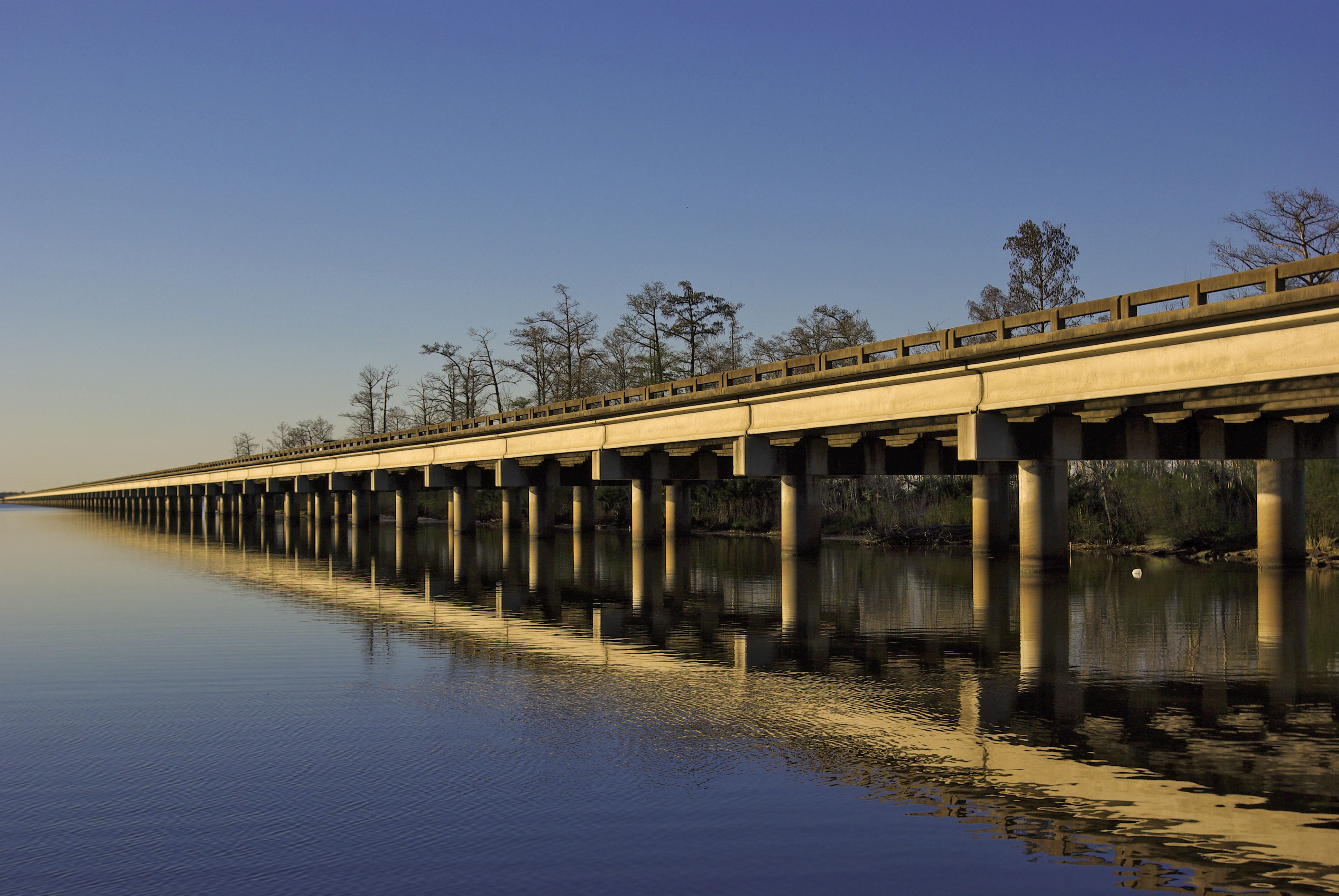
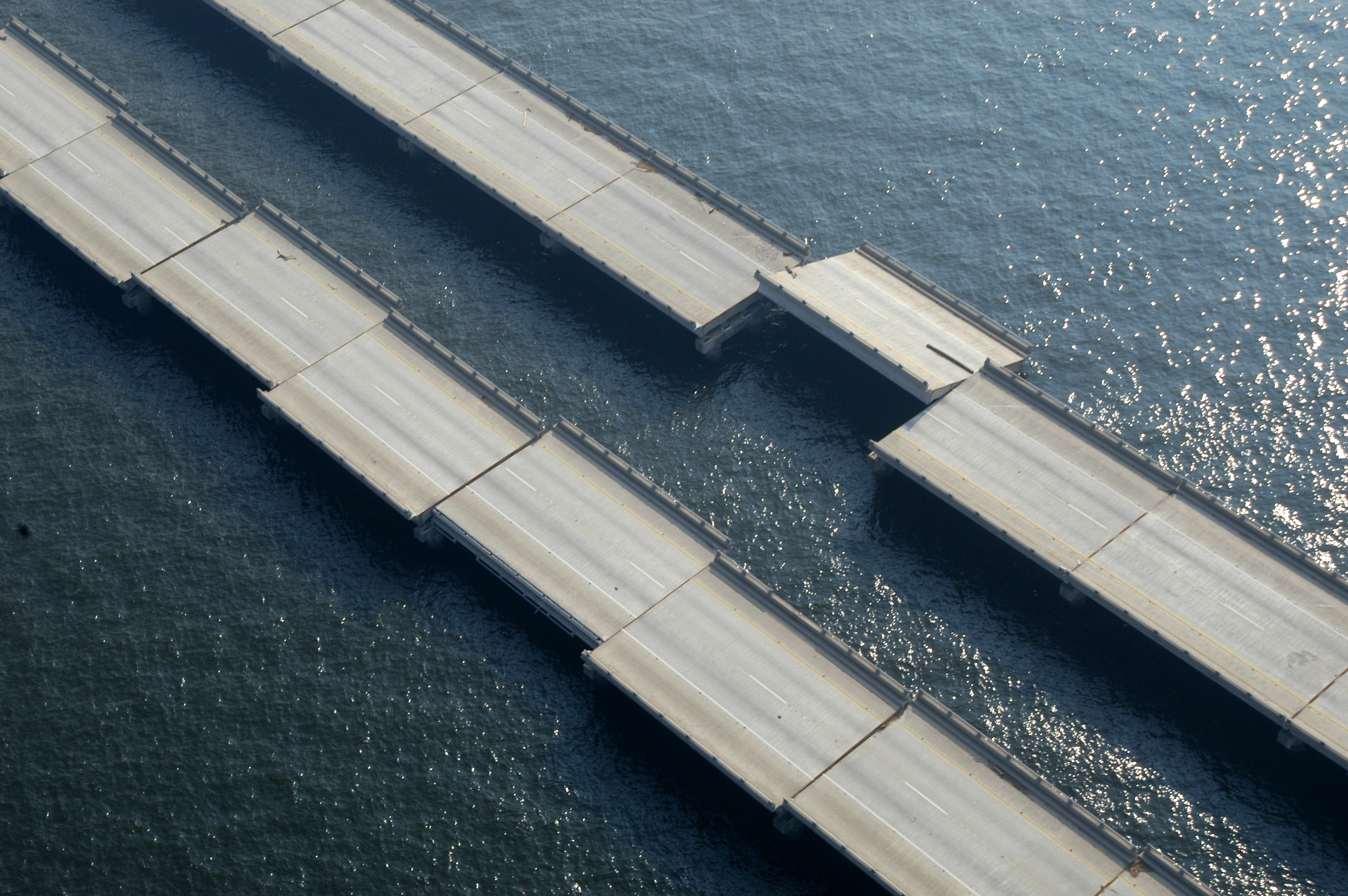
Interstate 10 (I-10), a major transcontinental Interstate Highway in the Southern United States, runs across the southern part of Louisiana for from Texas to Mississippi. It passes through Lake Charles, Lafayette, and Baton Rouge, dips south of Lake Pontchartrain to serve the New Orleans metropolitan area, then crosses Lake Pontchartrain and leaves the state. On August 29, 2005, the I-10 Twin Span Bridge was severely damaged by Hurricane Katrina, rendering it unusable. The bridge was repaired, and later replaced with two higher elevation spans in 2009 and 2010. Route description I-10 enters Louisiana at the state's southwestern corner from Orange, Texas, in a concurrency with US Route 90 (US 90), which leaves the freeway at the first exit. The two routes closely parallel each other through much of the state. The first community I-10 approaches in the state is Vinton, Louisiana. Between Sulphur and Lake Charles there is an interchange with I-210. I-10 cr ... [...More Info...] [...Related Items...] OR: [Wikipedia] [Google] [Baidu] |
Federal Highway Administration
The Federal Highway Administration (FHWA) is a division of the United States Department of Transportation that specializes in highway transportation. The agency's major activities are grouped into two programs, the Federal-aid Highway Program and the Federal Lands Highway Program. Its role had previously been performed by the Office of Road Inquiry, Office of Public Roads and the Bureau of Public Roads. History Background The organization has several predecessor organizations and complicated history. The Office of Road Inquiry (ORI) was founded in 1893. In 1905, that organization's name was changed to the Office of Public Roads (OPR) which became a division of the United States Department of Agriculture. The name was changed again to the Bureau of Public Roads in 1915 and to the Public Roads Administration (PRA) in 1939. It was then shifted to the Federal Works Agency which was abolished in 1949 when its name reverted to Bureau of Public Roads under the Department of Commerce ... [...More Info...] [...Related Items...] OR: [Wikipedia] [Google] [Baidu] |
Jefferson Parish, Louisiana
Jefferson Parish (french: Paroisse de Jefferson; es, Parroquia de Jefferson) is a parish in the U.S. state of Louisiana. As of the 2020 census, the population was 440,781. Its parish seat is Gretna, its largest community is Metairie, and its largest incorporated city is Kenner. Jefferson Parish is included in the Greater New Orleans area. History 1825 to 1940 Jefferson Parish was named in honor of U.S. President Thomas Jefferson of Virginia when the parish was established by the Louisiana Legislature on February 11, 1825, a year before Jefferson died. A bronze statue of Jefferson stands at the entrance of the General Government Complex on Derbigny Street in Gretna. The parish seat was in the city of Lafayette, until that area was annexed by New Orleans in 1852. In that year the parish government moved to Carrollton, where it remained for twenty-two years. Originally, this parish was larger than it is today, running from Felicity Street in New Orleans to the St. Charles P ... [...More Info...] [...Related Items...] OR: [Wikipedia] [Google] [Baidu] |
Welsh, Louisiana
Welsh is a town in Jefferson Davis Parish, Louisiana. The population was 3,226 at the time of the 2010 census. It is part of the Jennings Micropolitan Statistical Area. History Welsh was originally a homestead owned by former plantation overseer and Confederate States Army soldier Henry Welsh in the late 1800s. In 1881, Welsh donated right-of-way and a section house to the Southern Pacific Railroad on the condition that trains stop in the town. The town of Welsh was platted in 1880 and incorporated on March 15, 1888, when Henry Welsh was elected the first mayor. Initially part of the Old Imperial Calcasieu Parish, in 1913 Welsh became part of the newly established Jefferson Davis Parish. Geography Welsh is located at (30.237419, -92.820593). According to the United States Census Bureau, the town has a total area of 6.3 square miles (16.4 km), of which 6.2 square miles (16.1 km) is land and 0.1 square mile (0.3 km) (1.89%) is water. Demographics ... [...More Info...] [...Related Items...] OR: [Wikipedia] [Google] [Baidu] |
Iowa, Louisiana
Iowa () is a town in Calcasieu Parish, Louisiana, Calcasieu Parish, Louisiana, United States. The population was 3,436 in 2020. It is part of the Lake Charles, Louisiana, Lake Charles Lake Charles metropolitan area, metropolitan statistical area. History The history of this region is filled with stories of the early Midwestern settlers from Kansas, Illinois and Iowa, of the Acadians (Cajuns), and of Jean Lafitte's pirates. The community of Iowa was developed in the mid-19th century. The railroad that cut through this country brought settlers who were lured to the prairie land for rice farming, cattle raising and later oil fields. Much of southwest Louisiana was developed by the North American Land and Timber Co. Seaman A. Knapp, president of the Iowa State College of Agriculture, was engaged in 1885 to demonstrate the suitability of the region for rice production. Knapp attracted a number of Iowans to settle the area. The settlers were lured to this area by advertisements publishe ... [...More Info...] [...Related Items...] OR: [Wikipedia] [Google] [Baidu] |
Calcasieu River Bridge
The Calcasieu River Bridge, officially named the Louisiana Memorial World War II Bridge in June 1951 is a through truss located on Interstate 10 between Lake Charles, Louisiana and Westlake, Louisiana. It was the only major bridge in Lake Charles, until the construction of the Lake Charles Loop with the I-210 Calcasieu River High Bridge began in 1962, with an average annual daily traffic (2009) of 51,800. The bridge has a vertical clearance of 135 feet (41 m). It was built under the administration of Gov. Earl K. Long and opened in 1952. It has decorative iron work with crossed guns integrated into the railings. The I-10 Bridge was originally built as the U.S. Hwy 90 bridge and later was grandfathered into Interstate 10. The bridge has been rated structurally deficient by the Department of Transportation but was declared safe by the Louisiana Department of Transportation and Development (DOTD). There are plans to replace the bridge and improve the Westlake exit. History Construc ... [...More Info...] [...Related Items...] OR: [Wikipedia] [Google] [Baidu] |
Interstate 210 (Louisiana)
Interstate 210 (I-210) in Louisiana, also known as the Lake Charles Bypass, is a bypass route in Lake Charles, in the southwestern part of the state. As a bypass of I-10, both ends of I-210 meet with I-10. Route description The western terminus connects with I-10 east of Sulphur, heading southeast as it bypasses central Lake Charles around the southside. east of the western terminus, I-210 rises over the Israel LaFleur Bridge, one of the highest bridges in the Interstate Highway System, to pass over the Calcasieu Ship Channel. At the southeastern end of the bridge, the highway meets with exit 3, Prien Lake Road, eastbound. I-210 heads east through Lake Charles, turning 90 degrees at exit 8, LA 14/Gerstner Memorial Drive. The highway then heads north toward its eastern terminus with I-10 just east of Lake Charles. Though portions of the freeway run north–south, the entire route is signed east–west. All of I-210 is included as part of the Natio ... [...More Info...] [...Related Items...] OR: [Wikipedia] [Google] [Baidu] |
Sulphur, Louisiana
Sulphur (french: Soufre) is a city in Calcasieu Parish, Louisiana, Calcasieu Parish, Louisiana. The population was 21,809 in 2020. Sulphur is part of the Lake Charles, Louisiana, Lake Charles Lake Charles metropolitan area, metropolitan statistical area. History Sulphur is named for the sulfur mines that were operated in the area in the 1900s. In 1867, Professor Eugene W. Hilgard, an experienced geologist who was prospecting for oil and other minerals, conducted exploratory borings in Calcasieu Parish, Louisiana and discovered sulfur in the caprock of a salt dome. However, the sulfur was beneath several hundred feet of muck and quicksand containing deadly hydrogen sulfide gas, which made mining extremely hazardous. Repeated unsuccessful attempts to sink conventional mining shafts in the 1870s and 1880s resulted in the loss of many lives. In 1890, the German immigrant Herman Frasch invented and patented the Frasch Process of mining sulfur, using concentric pipes to pump superheated ... [...More Info...] [...Related Items...] OR: [Wikipedia] [Google] [Baidu] |
Vinton, Louisiana
Vinton is a town in Calcasieu Parish, Louisiana, United States. The population was 3,400 in 2020. It is part of the Lake Charles metropolitan statistical area. History The Old Spanish Trail, which was neither old nor Spanish, wandered north and south of what is now U.S. Highway 90, in large part because of the unstable roadbed. The chief means of outside travel in the parish relied on riverboats plying the Sabine and Calcasieu rivers. Much of the marsh and bayous remained impassable. River travel made Lake Charles possible, just as mining for sulfur led to the founding of Sulphur. Settlers had long been in the Vinton area. Jean Baptise Granger settled acreage between what is now Vinton and Big Woods about 1827, one of the first pioneers of the area. Even so, the area remained sparsely populated. The area had few settlers because France, New Spain, and Mexico disputed the western boundary of Louisiana for many years. When the United States made the Louisiana Purchase, the dispu ... [...More Info...] [...Related Items...] OR: [Wikipedia] [Google] [Baidu] |
Orange, Texas
Orange is a city and the county seat of Orange County, Texas, United States. As of the 2020 census, the city population was 19,324. It is the easternmost city in Texas, located on the Sabine River at the border with Louisiana, and is from Houston. Orange is part of the Beaumont− Port Arthur Metropolitan Statistical Area. Founded in 1836, it is a deep-water port to the Gulf of Mexico. History This community was originally called Greens Bluff after a man named Resin Green, a Sabine River boatman, who arrived at this location sometime before 1830. A short time later, in 1840, the town was renamed Madison in honor of President James Madison. To resolve the frequent post-office confusion with another Texas community called Madisonville, the town was renamed "Orange" in 1858. The area experienced rapid growth in the late 19th century due to 17 sawmills within the city limits, making Orange the center of the Texas lumber industry. Orange's growth led to the arrival of many immigrant ... [...More Info...] [...Related Items...] OR: [Wikipedia] [Google] [Baidu] |
I-10 Twin Span Bridge
The I-10 Twin Span Bridge, a nearly causeway officially known as the Frank Davis "Naturally N'Awlins" Memorial Bridge, consists of two parallel trestle bridges. These parallel bridges cross the eastern end of Lake Pontchartrain in southern Louisiana from New Orleans to Slidell. The current bridge spans were constructed in the second half of the 2000s after the original bridges were extensively damaged by Hurricane Katrina on August 29, 2005. The first span opened to eastbound traffic on July 9, 2009. On April 7, 2010, the second span was opened to traffic and the old twin spans were permanently closed to traffic. The approaches to the westbound lanes were completed with a ribbon-cutting ceremony on September 8, 2011, and the opening of all six lanes the next morning. The original Twin Span bridges were demolished shortly after the replacement spans opened. A short portion remains in use as a public fishing pier in Slidell. The debris from the demolition was used to line the nea ... [...More Info...] [...Related Items...] OR: [Wikipedia] [Google] [Baidu] |
Lake Pontchartrain
Lake Pontchartrain ( ) is an estuary located in southeastern Louisiana in the United States. It covers an area of with an average depth of . Some shipping channels are kept deeper through dredging. It is roughly oval in shape, about from west to east and from south to north. In descending order of area, the lake is located in parts of six Louisiana parishes: St. Tammany, Orleans, Jefferson, St. John the Baptist, St. Charles, and Tangipahoa. The water boundaries were defined in 1979 (see list of parishes in Louisiana). The lake is crossed by the Lake Pontchartrain Causeway, the longest continuous bridge over water in the world. A power line also crosses the lake. Its towers stand on caissons in Lake Pontchartrain, and its length can be used to visually demonstrate the curvature of the earth. Toponymy Lake Pontchartrain is named for , . He was the French Minister of the Marine, Chancellor, and Controller-General of Finances during the reign of France's "Sun King", L ... [...More Info...] [...Related Items...] OR: [Wikipedia] [Google] [Baidu] |
Lake Charles, Louisiana
Lake Charles (French: ''Lac Charles'') is the fifth-largest incorporated city in the U.S. state of Louisiana, and the parish seat of Calcasieu Parish, located on Lake Charles, Prien Lake, and the Calcasieu River. Founded in 1861 in Calcasieu Parish, it is a major industrial, cultural, and educational center in the southwest region of the state. As of the 2020 U.S. census, Lake Charles's population was 84,872. The city and metropolitan area of Lake Charles is considered a regionally significant center of petrochemical refining, gambling, tourism, and education, being home to McNeese State University and Sowela Technical Community College. Because of the lakes and waterways throughout the city, metropolitan Lake Charles is often called ''the Lake Area''. History On March 7, 1861, Lake Charles was incorporated as the town of Charleston, Louisiana. Lake Charles was founded by merchant and tradesman Marco Eliche (or Marco de Élitxe) as an outpost. He was a Sephardic Jew ... [...More Info...] [...Related Items...] OR: [Wikipedia] [Google] [Baidu] |


