|
Inspiration Glacier
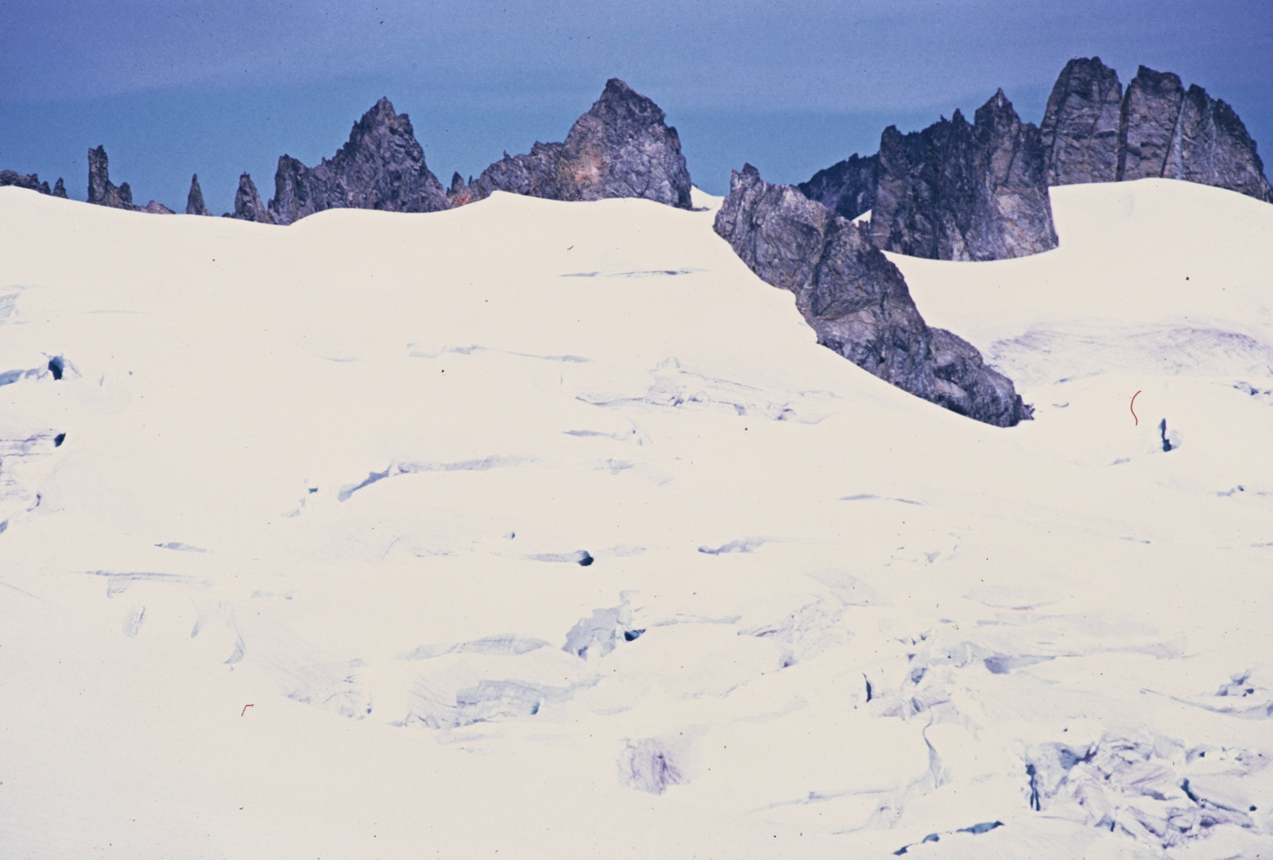
Inspiration Glacier is on the east slopes of Eldorado Peak, North Cascades National Park in the U.S. state of Washington. The glacier is approximately in length, in width at its terminus and descends from . Inspiration Glacier lies in a cirque with Eldorado Peak to the west, the arête known as Tepeh Towers to the northwest and Klawatti Peak to the northeast. Inspiration Glacier is connected to the Eldorado Glacier to the south and partially separated by the Tepeh Towers from the McAllister Glacier to the north. Meltwaters from Inspiration Glacier flow into Moraine Lake. See also *List of glaciers in the United States This is a list of glaciers existing in the United States, currently or in recent centuries. These glaciers are located in nine states, all in the Rocky Mountains or farther west. The southernmost named glacier among them is the Lilliput Glacier ... References Glaciers of the North Cascades Glaciers of Skagit County, Washington Glaciers of Washington ( ... [...More Info...] [...Related Items...] OR: [Wikipedia] [Google] [Baidu] |
North Cascades National Park
North Cascades National Park is an American national park in the state of Washington. At more than , it is the largest of the three National Park Service units that comprise the North Cascades National Park Complex. North Cascades National Park consists of a northern and southern section, bisected by the Skagit River that flows through the reservoirs of Ross Lake National Recreation Area. Lake Chelan National Recreation Area lies on the southern border of the south unit of the park. In addition to the two national recreation areas, other protected lands including several national forests and wilderness areas, as well as Canadian provincial parks in British Columbia, nearly surround the park. North Cascades National Park features the rugged mountain peaks of the North Cascades Range, the most expansive glacial system in the contiguous United States, the headwaters of numerous waterways, and vast forests with the highest degree of flora biodiversity of any American national par ... [...More Info...] [...Related Items...] OR: [Wikipedia] [Google] [Baidu] |
Eldorado Glacier
Eldorado Glacier is on the south slopes of Eldorado Peak, North Cascades National Park, in the U.S. state of Washington (state), Washington. The glacier is approximately in length, in width at its terminus and descends from . Eldorado Glacier is connected to Inspiration Glacier on its upper slopes. Glacial melt waters from Eldorado Glacier flow south over Roush Creek Falls, which at , is one of the tallest waterfalls in Washington. See also * *List of glaciers in the United States References Glaciers of the North Cascades Glaciers of Skagit County, Washington Glaciers of Washington (state) {{Washington-glacier-stub ... [...More Info...] [...Related Items...] OR: [Wikipedia] [Google] [Baidu] |
Glaciers Of The North Cascades
A glacier (; ) is a persistent body of dense ice that is constantly moving under its own weight. A glacier forms where the accumulation of snow exceeds its ablation over many years, often centuries. It acquires distinguishing features, such as crevasses and seracs, as it slowly flows and deforms under stresses induced by its weight. As it moves, it abrades rock and debris from its substrate to create landforms such as cirques, moraines, or fjords. Although a glacier may flow into a body of water, it forms only on land and is distinct from the much thinner sea ice and lake ice that form on the surface of bodies of water. On Earth, 99% of glacial ice is contained within vast ice sheets (also known as "continental glaciers") in the polar regions, but glaciers may be found in mountain ranges on every continent other than the Australian mainland, including Oceania's high-latitude oceanic island countries such as New Zealand. Between latitudes 35°N and 35°S, glaciers occur only ... [...More Info...] [...Related Items...] OR: [Wikipedia] [Google] [Baidu] |
Eldorado Peak With Inspiration Glacier
El Dorado (, ; Spanish for "the golden"), originally ''El Hombre Dorado'' ("The Golden Man") or ''El Rey Dorado'' ("The Golden King"), was the term used by the Spanish in the 16th century to describe a mythical tribal chief (''zipa'') or king of the Muisca people, an indigenous people of the Altiplano Cundiboyacense of Colombia, who as an initiation rite, covered himself with gold dust and submerged in Lake Guatavita. The legends surrounding El Dorado changed over time, as it went from being a man, to a city, to a kingdom, and then finally to an empire. A second location for El Dorado was inferred from rumors, which inspired several unsuccessful expeditions in the late 1500s in search of a city called Manoa on the shores of Lake Parime or Parima. Two of the most famous of these expeditions were led by Sir Walter Raleigh. In pursuit of the legend, Spanish conquistadors and numerous others searched what is today Colombia, Venezuela, and parts of Guyana and northern Brazil, for the ... [...More Info...] [...Related Items...] OR: [Wikipedia] [Google] [Baidu] |
List Of Glaciers In The United States
This is a list of glaciers existing in the United States, currently or in recent centuries. These glaciers are located in nine states, all in the Rocky Mountains or farther west. The southernmost named glacier among them is the Lilliput Glacier in Tulare County, east of the Central Valley of California. Glaciers of Alaska There are approximately 664 named glaciers in Alaska according to the Geographic Names Information System (GNIS). * Agassiz Glacier - Saint Elias Mountains * Aialik Glacier - Kenai Peninsula * Alsek Glacier - Glacier Bay * Aurora Glacier - Glacier Bay * Bacon Glacier *Barnard Glacier * Bear Glacier - Aialik Peninsula, Resurrection Bay *Bering Glacier * Black Rapids *Brady Glacier *Brooks Glacier - Alaska Range *Buckskin Glacier - Alaska Range * Burns Glacier (Alaska) - Kenai Mountains *Byron Glacier - Kenai Mountains * Caldwell Glacier - Alaska Range *Cantwell Glacier - Alaska Range *Carroll Glacier - Glacier Bay *Casement Glacier - Glacier Bay *Cast ... [...More Info...] [...Related Items...] OR: [Wikipedia] [Google] [Baidu] |
Moraine Lake (Skagit County, Washington)
Moraine Lake is located in North Cascades National Park, in the U. S. state of Washington. Moraine Lake is in a remote section of the park and well off any designated trails. During warmer months, melt from both the Inspiration and Forbidden Glaciers flow into Moraine Lake. Mount Torment Mount Torment is a high peak in the North Cascades of Washington in the United States. It is located approximately northeast of the city of Everett. First ascended on August 23, 1946, its name originates from the first ascent party, because o ... is less than south of the lake. References Lakes of Washington (state) North Cascades National Park Lakes of Skagit County, Washington {{SkagitCountyWA-geo-stub ... [...More Info...] [...Related Items...] OR: [Wikipedia] [Google] [Baidu] |
McAllister Glacier
McAllister Glacier is in a large cirque to the north and east of Dorado Needle, North Cascades National Park, in the U.S. state of Washington. The glacier is approximately in length, in width at its terminus and descends from , where it terminates near a proglacial lake. McAllister Glacier is nearly connected to Inspiration Glacier to the south and the two glaciers are separated by the arête known as Tepeh Towers. Klawatti Peak and an arete extending north from that peak separate McAllister Glacier from the Klawatti Glacier to the east. Like most glaciers in the North Cascades, McAllister Glacier is retreating and retreated approximately 1350 ft (410 m) between 1975 and 2009. See also *List of glaciers in the United States This is a list of glaciers existing in the United States, currently or in recent centuries. These glaciers are located in nine states, all in the Rocky Mountains or farther west. The southernmost named glacier among them is the Lilliput Glacier ... Re ... [...More Info...] [...Related Items...] OR: [Wikipedia] [Google] [Baidu] |
Klawatti Peak
Klawatti Peak () is located in North Cascades National Park in the U.S. state of Washington. Klawatti Peak is a nunatak, a peak surrounded by glaciers. These are Klawatti Glacier to the east, McAllister Glacier to the northwest and Inspiration Glacier to the south. Climate Klawatti Peak is located in the marine west coast climate zone of western North America.Beckey, Fred W. Cascade Alpine Guide, Climbing and High Routes. Seattle, WA: Mountaineers Books, 2008. Most weather fronts originate in the Pacific Ocean, and travel northeast toward the Cascade Mountains. As fronts approach the North Cascades, they are forced upward by the peaks of the Cascade Range, causing them to drop their moisture in the form of rain or snowfall onto the Cascades (Orographic lift). As a result, the west side of the North Cascades experiences high precipitation, especially during the winter months in the form of snowfall. During winter months, weather is usually cloudy, but, due to high pressure sys ... [...More Info...] [...Related Items...] OR: [Wikipedia] [Google] [Baidu] |
Skagit County, Washington
Skagit County is a county in the U.S. state of Washington. As of the 2020 census, the population was 129,523. The county seat and largest city is Mount Vernon. The county was formed in 1883 from Whatcom County and is named for the Skagit Indian tribe, which has been indigenous to the area prior to European-American settlement. Skagit County comprises the Mount Vernon- Anacortes, WA Metropolitan Statistical Area, and is included in the Seattle- Tacoma, WA Combined Statistical Area. It is located in the Puget Sound region. Geography According to the United States Census Bureau, the county has a total area of , of which is land and (9.8%) is water. It is noted for its broad, fertile valley of the Skagit River, a center for cultivation of tulips and strawberries. Geographic features * Allan Island *Burrows Island *Cascade Mountains *Cypress Island * Fir Island *Fidalgo Island *Guemes Island * Hart Island * Hope Island *Kiket Island *Pass Island *Samish Island * Sauk River ... [...More Info...] [...Related Items...] OR: [Wikipedia] [Google] [Baidu] |
Arête
An arête ( ) is a narrow ridge of rock which separates two valleys. It is typically formed when two glaciers erode parallel U-shaped valleys. Arêtes can also form when two glacial cirques erode headwards towards one another, although frequently this results in a saddle-shaped pass, called a col. The edge is then sharpened by freeze-thaw weathering, and the slope on either side of the arête steepened through mass wasting Mass wasting, also known as mass movement, is a general term for the movement of rock or soil down slopes under the force of gravity. It differs from other processes of erosion in that the debris transported by mass wasting is not entrained in ... events and the erosion of exposed, unstable rock. The word ''arête'' () is actually French for "edge" or "ridge"; similar features in the Alps are often described with the German language, German equivalent term ''Grat''. Where three or more cirques meet, a pyramidal peak is created. Cleaver A ''cleaver' ... [...More Info...] [...Related Items...] OR: [Wikipedia] [Google] [Baidu] |


.jpg)


