|
Inlets Of Western Australia
The estuaries of Western Australia (also known as the Inlets of Western Australia) are located along the coastline of Western Australia. The coastline can be considered in three main sections: south, west, and Kimberley. Some estuarine features carry through all three regions. Wetlands and estuaries of the south west region have very similar ecologies and occurrences of biota. South The estuary/inlet names do not necessarily relate to the names of the rivers that flow into them. (This list is along the coast from the east near Esperance to the west near Cape Leeuwin.) * Barker * Stokes Inlet * Torradup * Oldfield Estuary * Jerdacuttup * Culham Inlet * Hamersley * Dempster * Fitzgerald * St Marys * Gordon Inlet * Wellstead Estuary * Beaufort Inlet * Cheyne * Waychinicup * Normans * Taylor Inlet * Oyster Harbour * Torbay Inlet * Wilson Inlet * Parry * Irwin Inlet * Nornalup Inlet * Broke Inlet * Gardner * Warren * Donnelly * Hardy Inlet West * Harvey Estuary * Peel Inlet ... [...More Info...] [...Related Items...] OR: [Wikipedia] [Google] [Baidu] |
Coastline Of Western Australia
Western Australia has the longest coastline of any state or territory in Australia, at 10,194 km or 12,889 km (20,781 km including islands). It is a significant portion of the coastline of Australia, which is 35,877 km (59,736 km including islands). The earliest full charting of the coastline occurred during exploration in the late eighteenth and early nineteenth centuries. The coastline has some features or organisms that are found on the entire length, while some others are specific to particular coastal regions. Various government map posters have been created over time, which have examples of coastal form, or types of coast such as the 1984 map with photos. Integrated Marine and Coastal Regionalisation of Australia (IMCRA) The Integrated Marine and Coastal Regionalisation of Australia, IMCRA has offshore regions delineated in a systematic appraisal of ecology and geography. Coastal regions used in weather reports Standard Bureau of Meteorology re ... [...More Info...] [...Related Items...] OR: [Wikipedia] [Google] [Baidu] |
Wilson Inlet
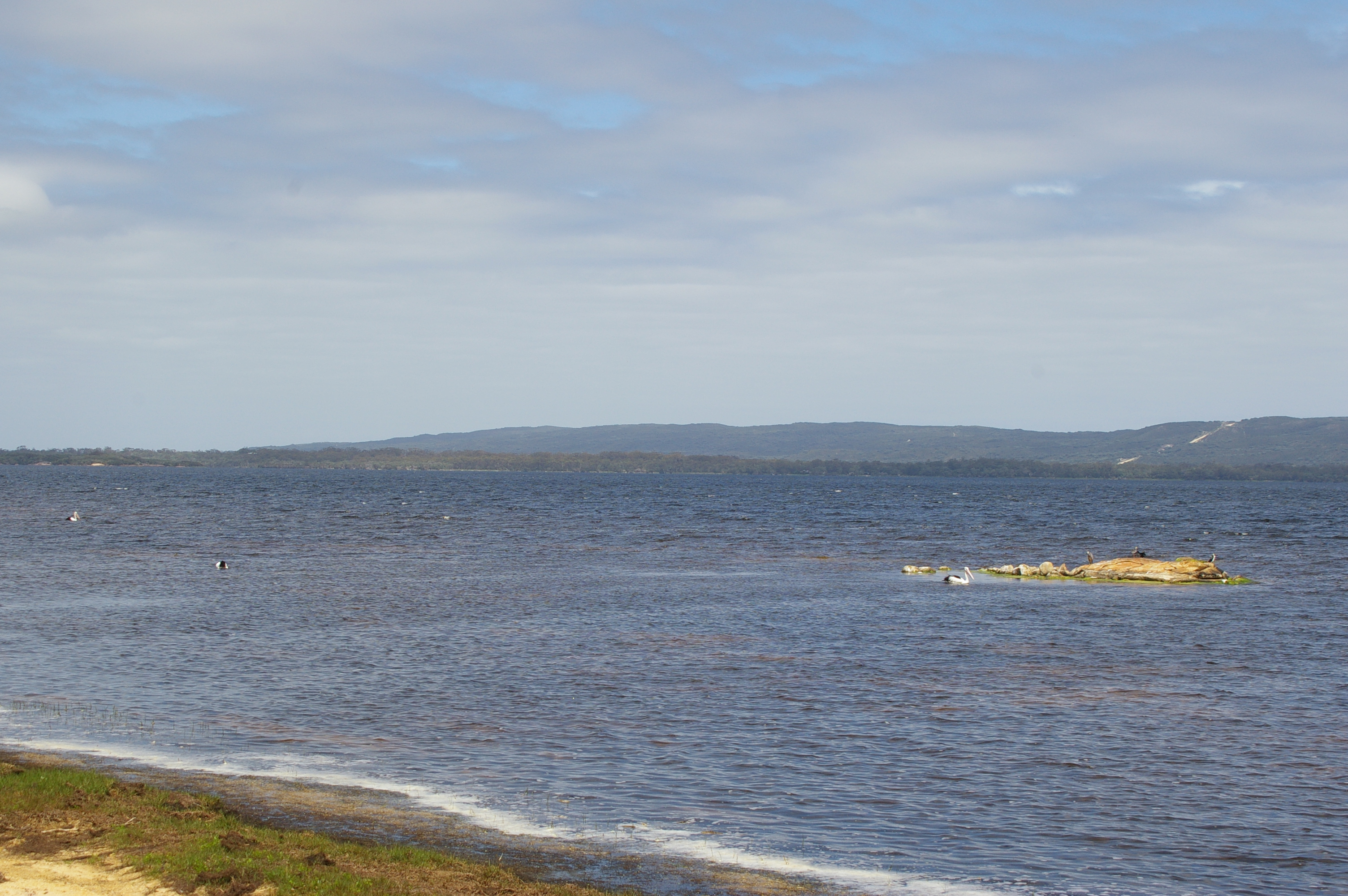
Wilson Inlet is a shallow, seasonally open estuary located on the coast of the Great Southern (Western Australia), Great Southern region of Western Australia. Description The inlet receives water from the two main rivers: the Denmark River and the Hay River (Western Australia), Hay River and some smaller rivers and streams such as the Sleeman River, Little River and Cuppup Creek. It is located south east of the town of Denmark, Western Australia, Denmark. The inlet is a wave dominated estuary with an opening mouth that has a width of with a bar blocking it from late January to August. The inlet is separated into two basins, the eastern and western basin. The estuary is situated on a narrow coastal plain between granite hills to the north and the west and the coastal dunes to the south. The area of the inlet is and it has an average depth of ; its deepest point is . The inlet is long from east to west and has a width of The inlet has a total catchment area of covering ... [...More Info...] [...Related Items...] OR: [Wikipedia] [Google] [Baidu] |
Coastline Of Western Australia
Western Australia has the longest coastline of any state or territory in Australia, at 10,194 km or 12,889 km (20,781 km including islands). It is a significant portion of the coastline of Australia, which is 35,877 km (59,736 km including islands). The earliest full charting of the coastline occurred during exploration in the late eighteenth and early nineteenth centuries. The coastline has some features or organisms that are found on the entire length, while some others are specific to particular coastal regions. Various government map posters have been created over time, which have examples of coastal form, or types of coast such as the 1984 map with photos. Integrated Marine and Coastal Regionalisation of Australia (IMCRA) The Integrated Marine and Coastal Regionalisation of Australia, IMCRA has offshore regions delineated in a systematic appraisal of ecology and geography. Coastal regions used in weather reports Standard Bureau of Meteorology re ... [...More Info...] [...Related Items...] OR: [Wikipedia] [Google] [Baidu] |
Estuaries Of Western Australia
The estuaries of Western Australia (also known as the Inlets of Western Australia) are located along the coastline of Western Australia. The coastline can be considered in three main sections: south, west, and Kimberley. Some estuarine features carry through all three regions. Wetlands and estuaries of the south west region have very similar ecologies and occurrences of biota. South The estuary/inlet names do not necessarily relate to the names of the rivers that flow into them. (This list is along the coast from the east near Esperance to the west near Cape Leeuwin.) * Barker * Stokes Inlet * Torradup * Oldfield Estuary * Jerdacuttup * Culham Inlet * Hamersley * Dempster * Fitzgerald * St Marys * Gordon Inlet * Wellstead Estuary * Beaufort Inlet * Cheyne * Waychinicup * Normans * Taylor Inlet * Oyster Harbour * Torbay Inlet * Wilson Inlet * Parry * Irwin Inlet * Nornalup Inlet * Broke Inlet * Gardner * Warren * Donnelly * Hardy Inlet West * Harvey Estuary * Peel Inle ... [...More Info...] [...Related Items...] OR: [Wikipedia] [Google] [Baidu] |
Estuaries Of Australia
Estuaries of Australia are features of the Australian coastline. They are linked to tides, river mouths and coastal features and conditions. In many cases the features of estuaries are also named ''inlets''. Types The separation of the types is related to the process based classification scheme where the energy sources define the group * Tide-dominated delta - River energy Burdekin River in Queensland and Macarthur River NT * Wave-dominated delta - River energy Manning River (NSW) and Yarra River (Vic) * Tide-dominated estuary - Tide energy a good example is Ord River (WA) and Broad Sound (Queensland) * Wave-dominated estuary - Wave energy - good example Peel Inlet Western Australia and Lake Illawarra NSW. * Tidal flat/creek - Tide energy Good enough Bay (WA) and Moonlight Creek (QLD) * Strandplain (and coastal lagoons) - Wave energy - good example coastal lagoon Irwin Inlet WA, strandplain Mooball Creek NSW. Regions The coastal regions of Australia are ... [...More Info...] [...Related Items...] OR: [Wikipedia] [Google] [Baidu] |
Ord River
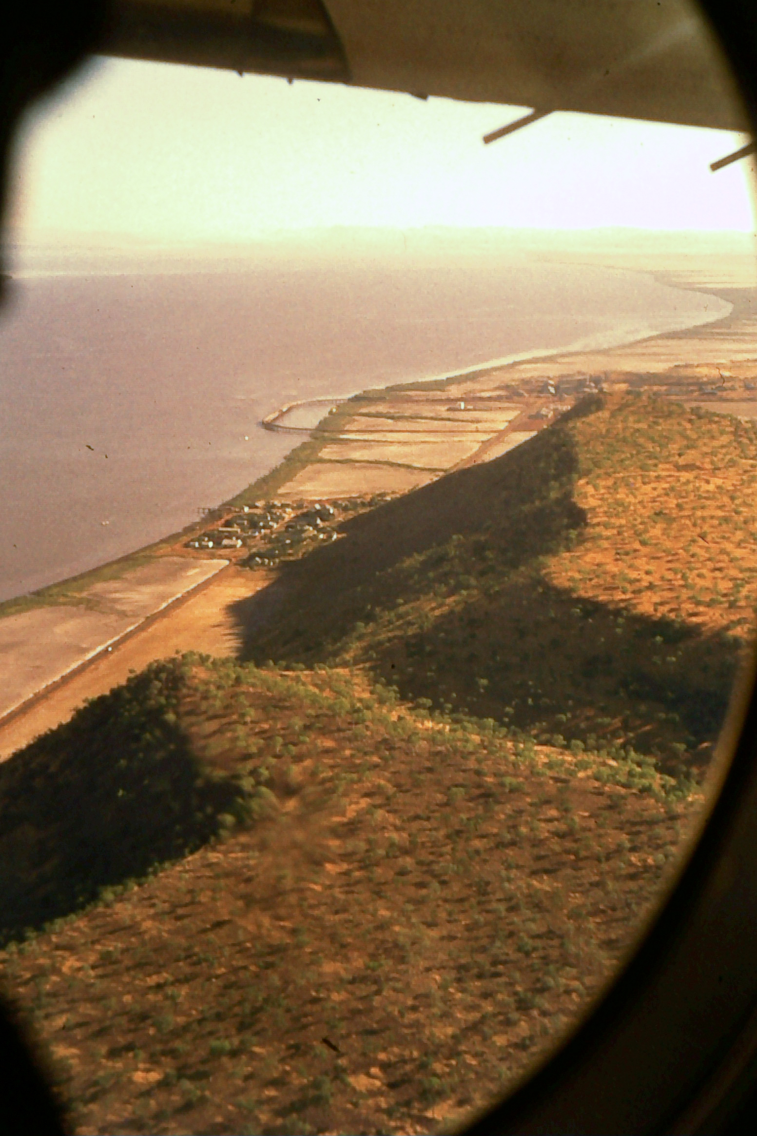
The Ord River is a river in the Kimberley region of Western Australia. The river's catchment covers . The lower Ord River and the conjunction with Cambridge Gulf create the most northern estuarine environment in Western Australia. The Ord River Irrigation Scheme was built in stages during the 20th century. Australia's largest artificial lake by volume, Lake Argyle, was completed in 1972. It has not been economically successful; $1.45 billion has been spent on the Ord Irrigation Scheme for a return of 17 cents on the dollar, and only 260 jobs created. The lower reaches of the river support an important wetland area known as the Ord River Floodplain, a protected area that contains numerous mangrove forests, lagoons, creeks, flats and extensive floodplains. The traditional owners are the Miriwoong and Gajerrong peoples who have inhabited the area for thousands of years and know the Ord River as . In a letter to the Surveyor General, dated 12 October 1959, Louise Gardine ... [...More Info...] [...Related Items...] OR: [Wikipedia] [Google] [Baidu] |
Cambridge Gulf
Cambridge Gulf is a gulf on the north coast of the Kimberley region of Western Australia. Many rivers flow into the gulf, including the Ord River, Pentecost River, Durack River, King River and the Forrest River, making the environment an estuarine one. The gulf experiences two large tidal flows each day between . The town of Wyndham, the area's principal port, lies on its eastern bank at the lower part of the gulf and is approximately by road west-north-west of Kununurra. Cambridge Gulf is a gulf within a gulf, being at the southern extremity of the Joseph Bonaparte Gulf, in the Timor Sea. The entrance of the Gulf is defined by Cape Domett on the eastern shore, Lacrosse Island in the middle, and the Cape Dussejour on the western shore, with King Shoals and Medusa Banks out in Joseph Bonaparte Gulf beyond Lacrosse Island. The conjunction between the gulf and the lower regions of the Ord River (the eastern arm), and the Durack and Pentecost Rivers (the western arm) are t ... [...More Info...] [...Related Items...] OR: [Wikipedia] [Google] [Baidu] |
Peel Inlet
The Peel-Harvey Estuarine System ( nys, Djilba) is a natural estuarine system that lies roughly parallel to the coast of Western Australia and south of the town of Mandurah. The strip of land between the Indian Ocean and the estuarine system carries the Old Coast Road and to the east is the Forrest Highway which is the main thoroughfare between Perth and the coastal towns of the south west corner of the state including Bunbury and Busselton. Description The estuarine system, which the Bindjareb Noongar people call , covers an area of approximately in total, with an average water depth of about . The Harvey River discharges into the extreme southern end of the elongated Harvey Estuary, which has an area of about . This in turn feeds into the south-western corner of the more northerly Peel Inlet which is roughly circular and occupies an area of about . The Serpentine River and Murray Rivers discharge into the eastern edges of Peel Inlet. A long channel, the Mandurah Estu ... [...More Info...] [...Related Items...] OR: [Wikipedia] [Google] [Baidu] |
Harvey Estuary
The Peel-Harvey Estuarine System ( nys, Djilba) is a natural estuarine system that lies roughly parallel to the coast of Western Australia and south of the town of Mandurah. The strip of land between the Indian Ocean and the estuarine system carries the Old Coast Road and to the east is the Forrest Highway which is the main thoroughfare between Perth and the coastal towns of the south west corner of the state including Bunbury and Busselton. Description The estuarine system, which the Bindjareb Noongar people call , covers an area of approximately in total, with an average water depth of about . The Harvey River discharges into the extreme southern end of the elongated Harvey Estuary, which has an area of about . This in turn feeds into the south-western corner of the more northerly Peel Inlet which is roughly circular and occupies an area of about . The Serpentine River and Murray Rivers discharge into the eastern edges of Peel Inlet. A long channel, the Mandurah Estu ... [...More Info...] [...Related Items...] OR: [Wikipedia] [Google] [Baidu] |
Hardy Inlet
Hardy Inlet is an inlet that is located in the South West region of Western Australia. The town of Augusta is situated on the South Western shore of the inlet, the inlet opens to the Southern Ocean via Flinders Bay. Both the Blackwood River and the Scott River discharge into the north eastern end of the inlet. The inlet is a wave dominated estuary with a high sediment trapping efficiency, it is always open to the ocean and the water is turbid. The total surface area of the inlet is . Hardy Inlet is the wide, lower basin of the Blackwood Estuary with a long narrow and shifting entrance channel. The majority of the inlet is made up of shallow banks with a depth of less than found between channels between to in depth. Algal blooms have been recorded in the inlet around Molloy Island and West Bay as a result of elevated nutrient levels, particularly Nitrogen and Phosphorus levels. Warnings have been issued so that people do not consume shellfish such as mussels and oyster ... [...More Info...] [...Related Items...] OR: [Wikipedia] [Google] [Baidu] |
Broke Inlet
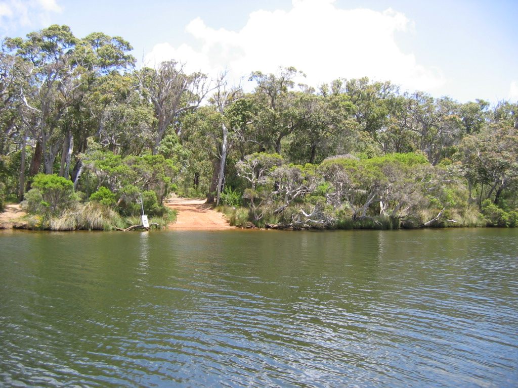
Broke Inlet, originally named Broke's Inlet, is an inlet in the South West region of Western Australia located west of Walpole. The inlet is a large shallow estuary at the eastern end of the d'Entrecasteaux National Park, linked to the Southern Ocean by a narrow seasonally open channel situated between two high sand dune systems. The inlet is the only large estuary left in the South West that has not been significantly altered by development within its catchment area or along its shores. The catchment of the inlet has an area of and the inlet itself has a surface area of with a total volume of . The inlet receives an annual inflow of , mostly from the Shannon River and discharges annually. The water in the inlet is brackish and generally has half the salinity of sea water. The salinity varies greatly depending on river discharge, the season and whether the bar is open or not. Broke Inlet is listed as a regionally significant wetland with Environment Australia Envi ... [...More Info...] [...Related Items...] OR: [Wikipedia] [Google] [Baidu] |
Nornalup Inlet
Nornalup Inlet ( /ˈnoːnələp ˈɪnlət/ Australian English) is an estuarine body of water on the south coast of the South West of Australia, approximately from Perth. It is approximately in extent, and up to deep. It is fed by the Deep and Frankland Rivers, and communicates with the Walpole Inlet via a natural channel approximately long and deep. The name is Noongar in origin, meaning "the place of the tiger snake" ('' Notechis scutatus''). The estuary is wave dominated and is mostly not modified but the catchment has been substantially cleared. The inlets have a naturally low turbidity but have a high sediment trapping efficiency. The inlets have a total area of , most of the area being found in the central basin. The inlet has a mean depth of . The Walpole - Nornalup inlet system is the only permanently open estuarine system in the South West, giving it great biological diversity. The Casuarina Isles and Goose Island lie off the coast just to the south of the ... [...More Info...] [...Related Items...] OR: [Wikipedia] [Google] [Baidu] |


