|
Inishtrahull
Inishtrahull ( ga, Inis Trá Tholl, possibly "island of the empty beach" or "island of the yonder beach") is the most northerly island of Ireland. It has an area of and lies about northeast of Malin Head, County Donegal. The most northerly landfall of Ireland, the Tor Beg rock, is another kilometre to the north. Inishtrahull is home to Ireland's northernmost lighthouse. The island had a resident community until 1929 and the lighthouse was staffed until 1987. Today it is uninhabited and has been designated a protected area due to its wildlife. Geology The island is formed of a granitic gneiss, a type of metamorphic rock, which is known as Inishtrahull Gneiss. It is dated at 1.7 billion years old, making it Paleoproterozoic in age, and is the oldest known rock on the Irish Islands. The Inishtrahull Gneiss is considered to form part of the Rhinns complex that is also exposed on the islands of Islay and Colonsay. The Rhinns complex is correlated with the Ketilidian metamorphic ... [...More Info...] [...Related Items...] OR: [Wikipedia] [Google] [Baidu] |
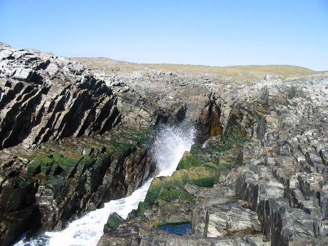
Inishtrahull Landing - Geograph
Inishtrahull ( ga, Inis Trá Tholl, possibly "island of the empty beach" or "island of the yonder beach") is the most northerly island of Ireland. It has an area of and lies about northeast of Malin Head, County Donegal. The most northerly landfall of Ireland, the Tor Beg rock, is another kilometre to the north. Inishtrahull is home to Ireland's northernmost lighthouse. The island had a resident community until 1929 and the lighthouse was staffed until 1987. Today it is uninhabited and has been designated a protected area due to its wildlife. Geology The island is formed of a granitic gneiss, a type of metamorphic rock, which is known as Inishtrahull Gneiss. It is dated at 1.7 billion years old, making it Paleoproterozoic in age, and is the oldest known rock on the Irish Islands. The Inishtrahull Gneiss is considered to form part of the Rhinns complex that is also exposed on the islands of Islay and Colonsay. The Rhinns complex is correlated with the Ketilidian metamorphic ... [...More Info...] [...Related Items...] OR: [Wikipedia] [Google] [Baidu] |
Inishtrahull Lighthouse
Inishtrahull Lighthouse is the northerly most lighthouse in Ireland located on the Inishtrahull Island off the coast of County Donegal. Coupled with the lighthouse on Tory Island they form the two main landfall lights for shipping from the Atlantic rounding the north coast of Ireland, and navigation to local shipping. Work on the first lighthouse, situated at the east end of the island began in 1812, primarily due to Royal Navy ships using Lough Foyle. Designs for the lighthouse were drawn up by a George Halpin, a Senior Inspector of Lighthouses. Acting on behalf of the Corporation for Preserving and Improving the Port of Dublin. The first Light was established on 17 March 1813. The height of the tower was approx. 12.8 metres. Later a dioptric apparatus was installed in the tower and came into operation on 29 September 1864. At the start of the 20th century, it was decided that a fog signal was required in the area of Malin Head. It was decided that it would be constructed at ... [...More Info...] [...Related Items...] OR: [Wikipedia] [Google] [Baidu] |
Rhinns Complex
The Rhinns complex is a deformed Palaeoproterozoic igneous complex that is considered to form the basement to the Colonsay Group of metasedimentary rocks. The largest outcrop of the complex is on the Rhinns of Islay, from where the complex gets its name. It has also been recognised in three other inliers extending to the southwest as far as Inishtrahull, off the north coast of Donegal. Distribution The Rhinns complex has been recognised in a series of four outcrops that form inliers within younger cover sequences of the Dalradian Supergroup and the Colonsay Group. The most easterly of these exposures is on the islands of Colonsay, where the complex consists of strongly retrogressed orthogneisses, although the correlation of this outcrop with the Rhinns complex has been questioned on the basis of new radiometric dating and Hf isotope analyses. On the Rhinns of Islay, gneisses of the Rhinns complex lie unconformably beneath the Colonsay Group, which is correlated with the ... [...More Info...] [...Related Items...] OR: [Wikipedia] [Google] [Baidu] |
Extreme Points Of Ireland
This is a list of the extreme points of Ireland – the points that are farthest north, south, east or west in Ireland. It includes the Republic of Ireland and Northern Ireland. Often the term " Malin to Mizen" is used when encompassing the entire island from north to south. The geographical centre of Ireland is 8.85 kilometres north-northwest of Athlone Town. Whole island Including islands Points: *Northernmost point: Tor Beg rock northeast of Inishtrahull, County Donegal, Republic of Ireland (ROI) *Southernmost point: Fastnet Rock southeast of Cape Clear Island, County Cork, ROI *Westernmost point: Tearaght Island, County Kerry, ROI *Easternmost point: Cannon Rock, County Down, Northern Ireland (NI) Settlements: *Northernmost settlement: Ballyhillin, Inishowen Peninsula, County Donegal *Southernmost settlement: Clear Island, County Cork *Westernmost settlement: Dunquin, Dingle Peninsula, County Kerry *Easternmost settlement: Portavogie, Ards Peninsula, County Down ... [...More Info...] [...Related Items...] OR: [Wikipedia] [Google] [Baidu] |
Islay
Islay ( ; gd, Ìle, sco, Ila) is the southernmost island of the Inner Hebrides of Scotland. Known as "The Queen of the Hebrides", it lies in Argyll just south west of Jura, Scotland, Jura and around north of the Northern Irish coast. The island's capital is Bowmore where the distinctive round Kilarrow Parish Church and a distillery are located. Port Ellen is the main port. Islay is the fifth-largest Scottish island and the eighth-largest List of islands of the British Isles, island of the British Isles, with a total area of almost . There is ample evidence of the prehistoric settlement of Islay and the first written reference may have come in the first century AD. The island had become part of the Gaelic Kingdom of Dál Riata during the Scotland in the Early Middle Ages, Early Middle Ages before being absorbed into the Norse Kingdom of the Isles. The later medieval period marked a "cultural high point" with the transfer of the Hebrides to the Kingdom of Scotland and the eme ... [...More Info...] [...Related Items...] OR: [Wikipedia] [Google] [Baidu] |
County Donegal
County Donegal ( ; ga, Contae Dhún na nGall) is a county of Ireland in the province of Ulster and in the Northern and Western Region. It is named after the town of Donegal in the south of the county. It has also been known as County Tyrconnell (), after the historic territory of the same name, on which it was based. Donegal County Council is the local council and Lifford the county town. The population was 166,321 at the 2022 census. Name County Donegal is named after the town of Donegal () in the south of the county. It has also been known by the alternative name County Tyrconnell, Tirconnell or Tirconaill (, meaning 'Land of Conall'). The latter was its official name between 1922 and 1927. This is in reference to the kingdom of Tír Chonaill and the earldom that succeeded it, which the county was based on. History County Donegal was the home of the once-mighty Clann Dálaigh, whose best-known branch was the Clann Ó Domhnaill, better known in English as the O'Don ... [...More Info...] [...Related Items...] OR: [Wikipedia] [Google] [Baidu] |
Malin Head
Malin Head ( ga, Cionn Mhálanna) is the most northerly point of mainland Ireland, located in the townland of Ardmalin on the Inishowen peninsula in County Donegal. The head's northernmost point is called Dunalderagh at latitude 55.38ºN. It is about 16 km (10 mi) north of the village of Malin. The island of Inishtrahull is further north, about 10 km (6 mi) northeast of the headland. Malin Head gives its name to the Malin sea area. There is a weather station on the head, which is one of 22 such stations whose reports are broadcast as part of the BBC Shipping Forecast. A tower built in 1805 is on Altnadarrow, also known locally as the Tower Hill. Ptolemy's ''Geography'' (2nd century AD) described a point called Βορειον (''Boreion'', "the northern") which probably referred to Malin Head. Locality To the northeast Inistrahull Island can be seen. The first lighthouse on the island was put into operation in 1813, and the light flashes every 30 seco ... [...More Info...] [...Related Items...] OR: [Wikipedia] [Google] [Baidu] |
Colonsay
Colonsay (; gd, Colbhasa; sco, Colonsay) is an island in the Inner Hebrides of Scotland, located north of Islay and south of Mull. The ancestral home of Clan Macfie and the Colonsay branch of Clan MacNeil, it is in the council area of Argyll and Bute and has an area of . Aligned on a south-west to north-east axis, it measures in length and reaches at its widest point. Geology The Colonsay Group, which takes its name from the island, is an estimated sequence of mildly metamorphosed Neoproterozoic sedimentary rocks that also outcrop on the islands of Islay and Oronsay and the surrounding seabed. The sequence has been correlated with the Grampian Group, the oldest part of the Dalradian Supergroup. It includes the meta wackes of the Oronsay Greywacke Formation, the sandstones of the Dun Gallain Grit Formation, the metasandstones and metamudstones of the Machrins Arkose, Kilchattan and Milbuie formations, the sandstones and phyllites of the Kiloran Flags Formation and the phy ... [...More Info...] [...Related Items...] OR: [Wikipedia] [Google] [Baidu] |
Bonnemaisonia Asparagoides
''Bonnemaisonia asparagoides'' is a species of red alga in the family Bonnemaisoniaceae Bonnemaisoniaceae is a family of red algae in the order Bonnemaisoniales. References External links * Red algae families Bonnemaisoniaceae, * {{Rhodophyta-stub .... References Bonnemaisoniales {{Rhodophyta-stub ... [...More Info...] [...Related Items...] OR: [Wikipedia] [Google] [Baidu] |
Callophyllis Laciniata
''Callophyllis'' is a red algae genus in the family Kallymeniaceae. Several species are exploited as edible seaweed Edible seaweed, or sea vegetables, are seaweeds that can be eaten and used for culinary purposes. They typically contain high amounts of fiber. They may belong to one of several groups of multicellular algae: the red algae, green algae, and ...s under the common name carola, most commonly '' Callophyllis variegata''. References External links Red algae genera Kallymeniaceae Taxa named by Friedrich Traugott Kützing Edible algae {{red algae-stub ... [...More Info...] [...Related Items...] OR: [Wikipedia] [Google] [Baidu] |
NASA World Wind
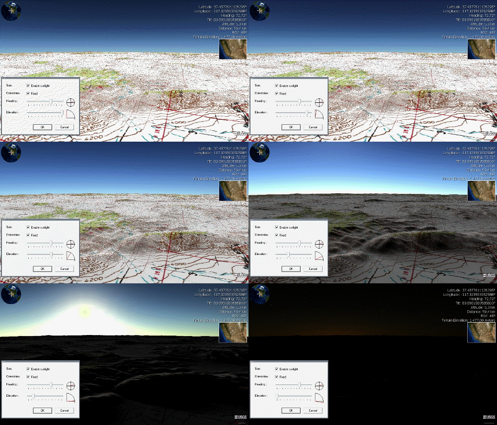
NASA WorldWind is an open-source (released under the NOSA license and the Apache 2.0 license) virtual globe. According to the website (https://worldwind.arc.nasa.gov/), "WorldWind is an open source virtual globe API. WorldWind allows developers to quickly and easily create interactive visualizations of 3D globe, map and geographical information. Organizations around the world use WorldWind to monitor weather patterns, visualize cities and terrain, track vehicle movement, analyze geospatial data and educate humanity about the Earth." It was first developed by NASA in 2003 for use on personal computers and then further developed in concert with the open source community since 2004. As of 2017, a web-based version of WorldWind is available online. An Android version is also available. The original version relied on .NET Framework, which ran only on Microsoft Windows. The more recent Java version, WorldWind Java, is cross platform, a software development kit (SDK) aime ... [...More Info...] [...Related Items...] OR: [Wikipedia] [Google] [Baidu] |


.jpg)
