|
Inis Cealtra
Inis Cealtra, also known in English as Inishcaltra or Holy Island, is an island off the western shore of Lough Derg in Ireland. Now uninhabited, it was once a monastic settlement. It has an Irish round tower, and the ruins of several small churches, as well as four high crosses and a holy well. Despite the lack of population, the cemetery on this island is still in use. Coffins and mourners are transported the short distance from County Clare in small boats. Boat trips can be taken from the harbour at Mountshannon. It is conserved by the East Clare Heritage Centre. History Around 520 AD, St. Colum (d. 548) founded a monastery on Inis Cealtra. It formerly belonged to the Cenél Donnghaile in the territory of the Ó Grádaigh. The second monastery, a famous school of learning, was founded by St. Caimin (d. 653), who was Bishop-Abbot of Inis Cealtra and possibly the first Bishop of Killaloe. Vikings visited the island in 836; led by Turgesius, they killed many of the monks. A fur ... [...More Info...] [...Related Items...] OR: [Wikipedia] [Google] [Baidu] |
Lough Derg (Shannon)
Lough Derg, historically Lough Dergart ( ga, Loch Deirgeirt), is a freshwater lake in the Shannon River Basin, Ireland. It is the third-biggest on the island of Ireland (after Lough Neagh and Lough Corrib). It is a long, narrow lake, with shores in counties Clare (south-west), Galway (north-west), and Tipperary (to the east). It is the southernmost of three large lakes on the River Shannon; the others being Lough Ree and Lough Allen. Towns and villages on Lough Derg include Portumna, Killaloe & Ballina, Dromineer, Terryglass, Mountshannon and Garrykennedy. The lake's name evolved from the Irish ''Loch Deirgdheirc''. This was one of the names of The Dagda, an Irish god, and literally means "red eye". Geography At its deepest, the lake is 36 metres deep and covers an area of 130 km2 (50.2 sq miles). Close downstream from where Lough Derg empties into the Shannon are the falls of Doonass, the largest fall on the otherwise gently sloping river. Nearby is the location of ... [...More Info...] [...Related Items...] OR: [Wikipedia] [Google] [Baidu] |
Turgesius
Turgesius (died 845) (also called Turgeis, Tuirgeis, Turges, and Thorgest) was a Viking chief active in Ireland during the 9th century. Turgesius Island, the principal island on Lough Lene, is named after him. It is not at all clear whether the names in the Irish annals represent the Old Norse ''Thurgestr'' or ''Thorgísl''.W.E.D. Allen, The Poet and the Spae-Wife: An Attempt to Reconstruct Al-Ghazal's Embassy to the Vikings' Dublin: Figgis, Viking Society for Northern Research, 1960, OCLC 557547145, p. 46. John O'Donovan (scholar), John O'Donovan and Charles Haliday independently identified him with Ragnar Loðbrók, but the identification is not generally accepted. Life The sole reliable record of Turgesius is a report of his death in the ''Annals of Ulster''. In 845 in Ireland, 845 he was captured by Máel Sechnaill mac Máele Ruanaid of Clann Cholmáin who was High King of Ireland. These reports state that Turgesius was drowned in Lough Owel. Less certainly, the ''Annals of the ... [...More Info...] [...Related Items...] OR: [Wikipedia] [Google] [Baidu] |
Bullaun
A bullaun ( ga, bullán; from a word cognate with "bowl" and French ''bol'') is the term used for the depression in a stone which is often water filled. Natural rounded boulders or pebbles may sit in the bullaun. The size of the bullaun is highly variable and these hemispherical cups hollowed out of a rock may come as singles or multiples with the same rock.Pennick, Nigel (1996). ''Celtic Sacred Landscapes''. London: Thames & Hudson. . p. 40. Local folklore often attaches religious or magical significance to bullaun stones, such as the belief that the rainwater collecting in a stone's hollow has healing properties.Anthony Weir, Early Ireland, A Field Guide, Blackstaff Press, 1980, Ritual use of some bullaun stones continued well into the Christian period and many are found in association with early churches, such as the 'Deer' Stone at Glendalough, County Wicklow. The example at St Brigit's Stone, County Cavan, still has its 'cure' or 'curse' stones. These would be used by turn ... [...More Info...] [...Related Items...] OR: [Wikipedia] [Google] [Baidu] |
Cillín
A cillín (plural cilliní) are historic burial sites in Ireland, primarily used for stillborn and unbaptized infants. These burial areas were also used for the recently deceased who were not allowed in consecrated churchyards, including the mentally disabled, suicides, beggars, executed criminals, and shipwreck victims. Definition and alternative names The Irish word ''cillín'' is defined as a small church or "cell" as in prison cell or monastic cell. In Ireland, a ''cillín'' can also be called a ''caldragh'', ''calluragh'', ''cealltrach'', ''ceallúrach'' and ''lisín'', depending upon the location of the site within Ireland. English versions of cillíns include: ''cill burial grounds'', ''kyle burial grounds'', ''killeens'' and ''children's burial grounds''. The types of locations used for these unconsecrated grounds include: abandoned graveyards and churches, castle ruins, ancient earthenworks and megalithic cairns. The name ''cillín'' is used primarily in Ulster. As ... [...More Info...] [...Related Items...] OR: [Wikipedia] [Google] [Baidu] |
Ordnance Survey Ireland
Ordnance Survey Ireland (OSI; ga, Suirbhéireacht Ordanáis Éireann) is the national mapping agency of Ireland. It was established on 4 March 2002 as a body corporate. It is the successor to the former Ordnance Survey of Ireland. It and the Ordnance Survey of Northern Ireland (OSNI) are the ultimate successors to the Irish operations of the British Ordnance Survey. OSI is part of the Irish public service. OSI has made modern and historic maps of the state free to view on its website. OSI is headquartered at Mountjoy House in the Phoenix Park in Dublin. Mountjoy House was also the headquarters, until 1922, of the Irish section of the British Ordnance Survey. Organisation Under the Ordnance Survey Ireland Act 2001, the Ordnance Survey of Ireland was dissolved and a new corporate body called Ordnance Survey Ireland was established in its place. OSI is now an autonomous corporate body, with a remit to cover its costs of operation from its sales of data and derived products, wh ... [...More Info...] [...Related Items...] OR: [Wikipedia] [Google] [Baidu] |
O'Brien Dynasty
The O'Brien dynasty ( ga, label=Classical Irish, Ua Briain; ga, label=Modern Irish, Ó Briain ; genitive ''Uí Bhriain'' ) is a nobility, noble house of Munster, founded in the 10th century by Brian Boru of the Dál gCais (Dalcassians). After becoming King of Munster, through conquest he established himself as ''Ard Rí na hÉireann'' (High King of Ireland). Brian's descendants thus carried the name Ó Briain, continuing to rule the Kingdom of Munster until the 12th century where their territory had shrunk to the Kingdom of Thomond which they would hold for just under five centuries. In total, four Ó Briains ruled in Munster, and two held the High Kingship of Ireland (with opposition). After the partition of Munster into Thomond and the MacCarthy Kingdom of Desmond by Tairrdelbach Ua Conchobair in the 12th century, the dynasty would go on to provide around thirty monarchs of Thomond until 1542. During part of this period in the late 13th century they had a rivalry with the N ... [...More Info...] [...Related Items...] OR: [Wikipedia] [Google] [Baidu] |
Arch
An arch is a vertical curved structure that spans an elevated space and may or may not support the weight above it, or in case of a horizontal arch like an arch dam, the hydrostatic pressure against it. Arches may be synonymous with vaults, but a vault may be distinguished as a continuous arch forming a roof. Arches appeared as early as the 2nd millennium BC in Mesopotamian brick architecture, and their systematic use started with the ancient Romans, who were the first to apply the technique to a wide range of structures. Basic concepts An arch is a pure compression form. It can span a large area by resolving forces into compressive stresses, and thereby eliminating tensile stresses. This is sometimes denominated "arch action". As the forces in the arch are transferred to its base, the arch pushes outward at its base, denominated "thrust". As the rise, i. e. height, of the arch decreases the outward thrust increases. In order to preserve arch action and prevent collapse ... [...More Info...] [...Related Items...] OR: [Wikipedia] [Google] [Baidu] |
Romanesque Architecture
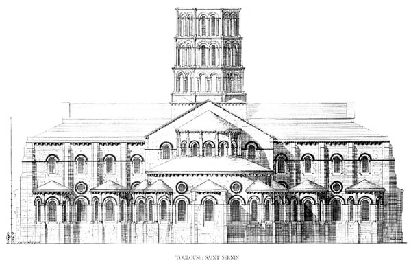
Romanesque architecture is an architectural style of medieval Europe characterized by semi-circular arches. There is no consensus for the beginning date of the Romanesque style, with proposals ranging from the 6th to the 11th century, this later date being the most commonly held. In the 12th century it developed into the Gothic style, marked by pointed arches. Examples of Romanesque architecture can be found across the continent, making it the first pan-European architectural style since Imperial Roman architecture. The Romanesque style in England and Sicily is traditionally referred to as Norman architecture. Combining features of ancient Roman and Byzantine buildings and other local traditions, Romanesque architecture is known by its massive quality, thick walls, round arches, sturdy pillars, barrel vaults, large towers and decorative arcading. Each building has clearly defined forms, frequently of very regular, symmetrical plan; the overall appearance is one of simplic ... [...More Info...] [...Related Items...] OR: [Wikipedia] [Google] [Baidu] |
Local Government (Ireland) Act 1898
The Local Government (Ireland) Act 1898 (61 & 62 Vict. c. 37) was an Act of the Parliament of the United Kingdom of Great Britain and Ireland that established a system of local government in Ireland similar to that already created for England, Wales and Scotland by legislation in 1888 and 1889. The Act effectively ended landlord control of local government in Ireland.Gailey 1984 Background From the 1880s the issue of local government reform in Ireland was a major political issue, involving both Irish politicians and the major British political parties. Questions of constitutional reform, land ownership and nationalism all combined to complicate matters, as did splits in both the Liberal Party in 1886 and the Irish Parliamentary Party in 1891. Eventually, the Conservative government of Lord Salisbury found it politically expedient to introduce the measures in 1898. The legislation was seen by the government as solving a number of problems: it softened demands for Home Rule f ... [...More Info...] [...Related Items...] OR: [Wikipedia] [Google] [Baidu] |
District Electoral Division
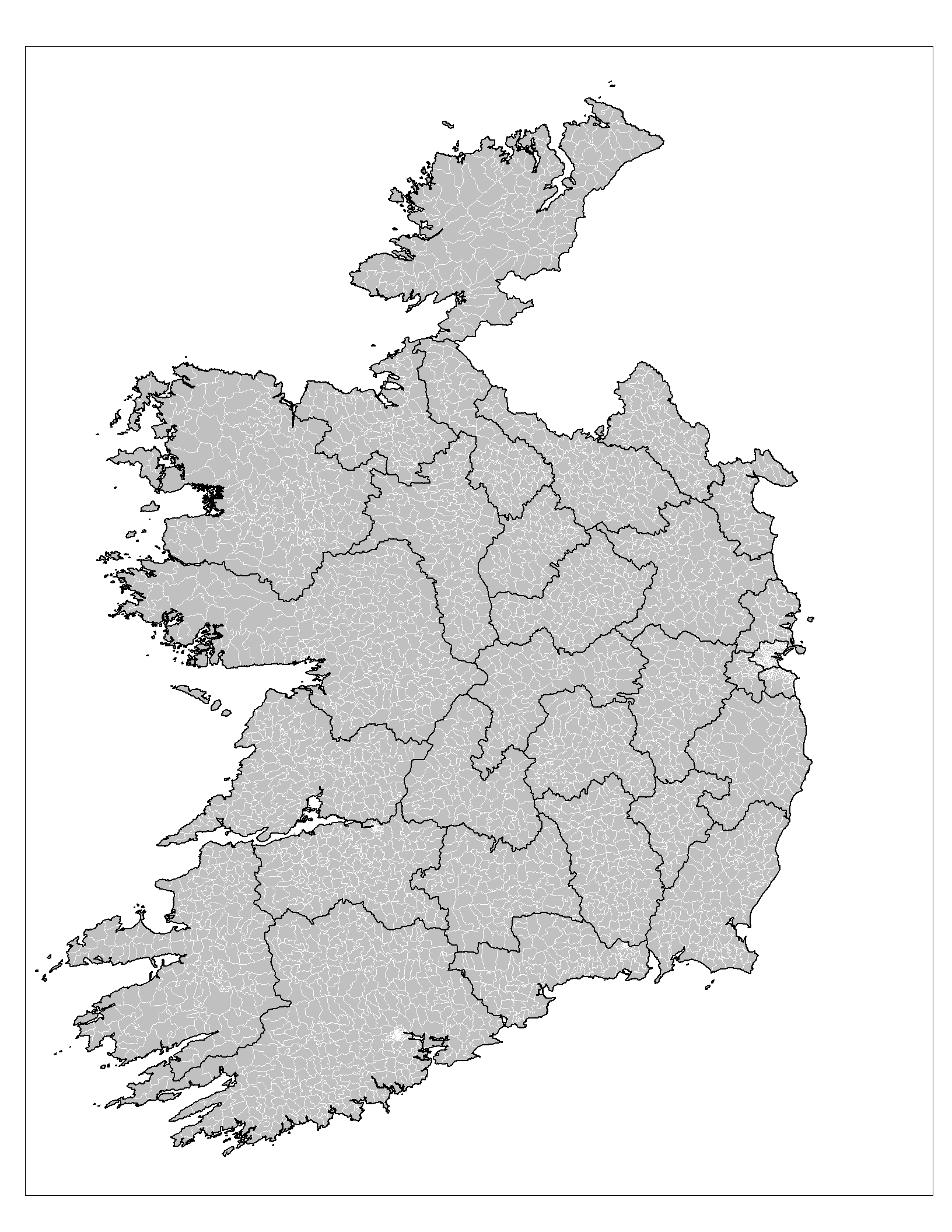
An electoral division (ED, ) is a legally defined administrative area in the Republic of Ireland, generally comprising multiple townlands, and formerly a subdivision of urban and rural districts. Until 1996, EDs were known as district electoral divisions (DEDs, ) in the 29 county council areas and wards in the five county boroughs. Until 1972, DEDs also existed in Northern Ireland. The predecessor poor law electoral divisions were introduced throughout the island of Ireland in the 1830s. The divisions were used as local-government electoral areas until 1919 in what is now the Republic and until 1972 in Northern Ireland. History until partition Electoral divisions originated under the Poor Relief (Ireland) Act 1838 as "poor law electoral divisions": electoral divisions of a poor law union (PLU) returning one or more members to the PLU's board of guardians. The boundaries of these were drawn by Poor Law Commissioners, with the intention of producing areas roughly equivalent in ... [...More Info...] [...Related Items...] OR: [Wikipedia] [Google] [Baidu] |
Griffith's Valuation
Griffith's Valuation was a boundary and land valuation survey of Ireland completed in 1868. Griffith's background Richard John Griffith started to value land in Scotland, where he spent two years in 1806-1807 valuing terrain through the examination of its soils. He used 'the Scotch system of valuation' and it was a modified version of this that he introduced into Ireland when he assumed the position of Commissioner of Valuation. Tasks in Ireland In 1825 Griffith was appointed by the British Government to carry out a boundary survey of Ireland. He was to mark the boundaries of every county, barony, civil parish and townland in preparation for the first Ordnance Survey. He completed the boundary work in 1844. He was also called upon to assist in the preparation of a Parliamentary bill to provide for the general valuation of Ireland. This Act was passed in 1826, and he was appointed Commissioner of Valuation in 1827, but did not start work until 1830 when the new 6" maps, became av ... [...More Info...] [...Related Items...] OR: [Wikipedia] [Google] [Baidu] |
Tuamgraney
Tuamgraney (; archaically spelled ''Tomgraney, Tomgrenei''; ) is a village in eastern County Clare in the west of Ireland and a civil parish by the same name. Situated a kilometre from the River Graney which flows into Lough Derg, it is an ancient settlement, noted for St Cronán's Church, said to be the oldest church in constant use in Ireland Location The parish is in the barony of Tulla Upper and contains the villages of Scarriff and Tomgraney. It is and covers . The parish is rugged, with heights ranging from above sea level. It contains the Scariff river from its headstreams through Lough O'Grady to its mouth in Scarriff bay, Lough Derg. The village of Tuamgraney lies in such close proximity to the town of Scarriff that today the two are often considered to be one single settlement. There is a holy well dedicated to St. Cronán in the Currakyle townland. The nearby castle of Tuamgraney is still in a good state of preservation. History According to legend, "Tuamgrane ... [...More Info...] [...Related Items...] OR: [Wikipedia] [Google] [Baidu] |
.png)


