|
Indiana State Road 545
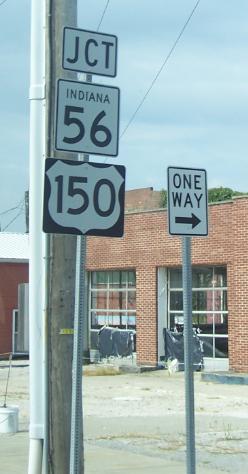
State Road 545 is a discontinuous route consisting of a northern section and a southern section. The southern section connects State Road 66 (SR 66) at the town of Troy to State Road 62 in Saint Meinrad. This section is very scenic, winding and narrow. The northern section connects State Road 164 (SR 164) with State Road 56 (SR 56) in eastern Dubois County, passing the town of Dubois. Route description Southern section From the southern terminus SR 545 heads north. Then SR 545 turns northeast towards Fulda. After Fulda, SR 545 heads northeast towards St. Meinrad. Northern section From the southern terminus of the northern section SR 545 heads northeast, then back northwest towards Dubois. From Dubois SR 545 heads due north towards SR 56. This section of the highway is named for Indiana State Representative Dennis Heeke, who lobbied for the extension of the route from the town of Dubois south to SR 164. Major ... [...More Info...] [...Related Items...] OR: [Wikipedia] [Google] [Baidu] |
Troy, Indiana
Troy is a town in Troy Township, Perry County, Indiana, along the Ohio River near the mouth of the Anderson River. It is the second oldest city in Indiana. The population was 385 at the 2010 census. History Troy was laid out in 1815. Troy was an early county seat of Perry County. A post office has been in operation at Troy since 1818. Future president Abraham Lincoln worked the ferry across the Ohio River at Troy with his father in his youth. The Nester House was listed on the National Register of Historic Places in 1990. Geography Troy is located at (37.993975, -86.799397). According to the 2010 census, Troy has a total area of , all land. Demographics 2010 census As of the census of 2010, there were 385 people, 163 households, and 103 families living in the town. The population density was . There were 190 housing units at an average density of . The racial makeup of the town was 98.4% White and 1.6% from two or more races. Hispanic or Latino of any race were 1.3 ... [...More Info...] [...Related Items...] OR: [Wikipedia] [Google] [Baidu] |
Celestine, Indiana
Celestine is an unincorporated community in Hall Township, Dubois County, in the U.S. state of Indiana. In 2008, the estimated population of Celestine was 250. The community is home to a Roman Catholic church. History Celestine was platted in 1843. It was named for Rt. Rev. Celestine Rene Lawrence De La Hailandiere, second bishop of the Roman Catholic Diocese of Vincennes, Indiana. The Celestine post office was established in 1851. On February 28, 2011, a tornado touched down and damaged two homes and a double-wide trailer, the National Weather Service stated. Schools Celestine is home to Celestine Elementary School. After students complete elementary school, They then attend the Northeast Dubois Middle School to Highschool. Geography Celestine is located at . Climate The climate in this area is characterized by hot, humid summers and generally mild to cool winters. According to the Köppen Climate Classification system, Celestine has a humid subtropical climate A humid ... [...More Info...] [...Related Items...] OR: [Wikipedia] [Google] [Baidu] |
Columbia Township, Dubois County, Indiana
Columbia Township is one of twelve townships in Dubois County, Indiana. As of the 2010 census, its population was 1,065 and it contained 467 housing units. Geography According to the 2010 census, the township has a total area of , of which (or 99.31%) is land and (or 0.69%) is water. Unincorporated towns * Crystal * Cuzco * Hillham * Norton (This list is based on USGS data and may include former settlements.) Adjacent townships * Lost River Township, Martin County (north) * French Lick Township, Orange County (northeast) * Jackson Township, Orange County (east) * Hall Township (south) * Marion Township (southwest) * Harbison Township (west) Major highways * Indiana State Road 56 State Road 56 in the U.S. state of Indiana is a route that travels the south central part of the state from west to east. Route description The western terminus of SR 56 is near Hazleton at U.S. Route 41. SR 56 heads northeast to Hazl ... Cemeteries The township contains three ... [...More Info...] [...Related Items...] OR: [Wikipedia] [Google] [Baidu] |
Indiana State Road 66
State Road 66 is an east–west highway in six counties in the southernmost portion of the U.S. state of Indiana. Route description State Road 66 begins at the eastern end of a toll bridge over the Wabash River in New Harmony and ends at U.S. Route 150 east of Hardinsburg. It is a divided limited-access highway in the metropolitan Evansville area, where it is part of the Lloyd Expressway, and also between the unincorporated communities of Yankeetown and Hatfield. For the most part, however, State Road 66 is undivided rural highway following the Ohio River, and a large portion of its route (from just east of Newburgh to State Road 62 at Sulphur) carries the designation of the Ohio River Scenic Byway. History Lloyd Expressway Within the City of Evansville, the portion of SR 66 east of US 41 is known as the Lloyd Expressway. It is named in honor of former Mayor Russell G. Lloyd, Sr., who was assassinated after leaving office in 1980. In the spring of 1983, bui ... [...More Info...] [...Related Items...] OR: [Wikipedia] [Google] [Baidu] |
Indiana State Road 62
State Road 62 (SR 62) in the U.S. state of Indiana is an east–west route that travels from the Illinois state line in the southwest corner of Indiana to the Louisville, Kentucky area, then northeast toward the Cincinnati, Ohio area. Route description SR 62 begins at the Wabash Memorial Bridge over the Wabash River between New Haven, Illinois and Posey County. It travels through Mount Vernon, Indiana and then becomes a divided highway as it approaches Evansville. Within Evansville, SR 62 forms part of the Lloyd Expressway, a divided expressway-grade highway that serves as a major east-west traffic artery through the city. The expressway contains a mix of intersections and interchanges. Nearly halfway through the city, the expressway meets US 41 and SR 62 leaves the expressway, running north concurrently with US 41 and SR 66. At Morgan Avenue, SR 62 turns east and leaves Evansville. East of Evansville, the four lane divided ro ... [...More Info...] [...Related Items...] OR: [Wikipedia] [Google] [Baidu] |
Saint Meinrad, Indiana
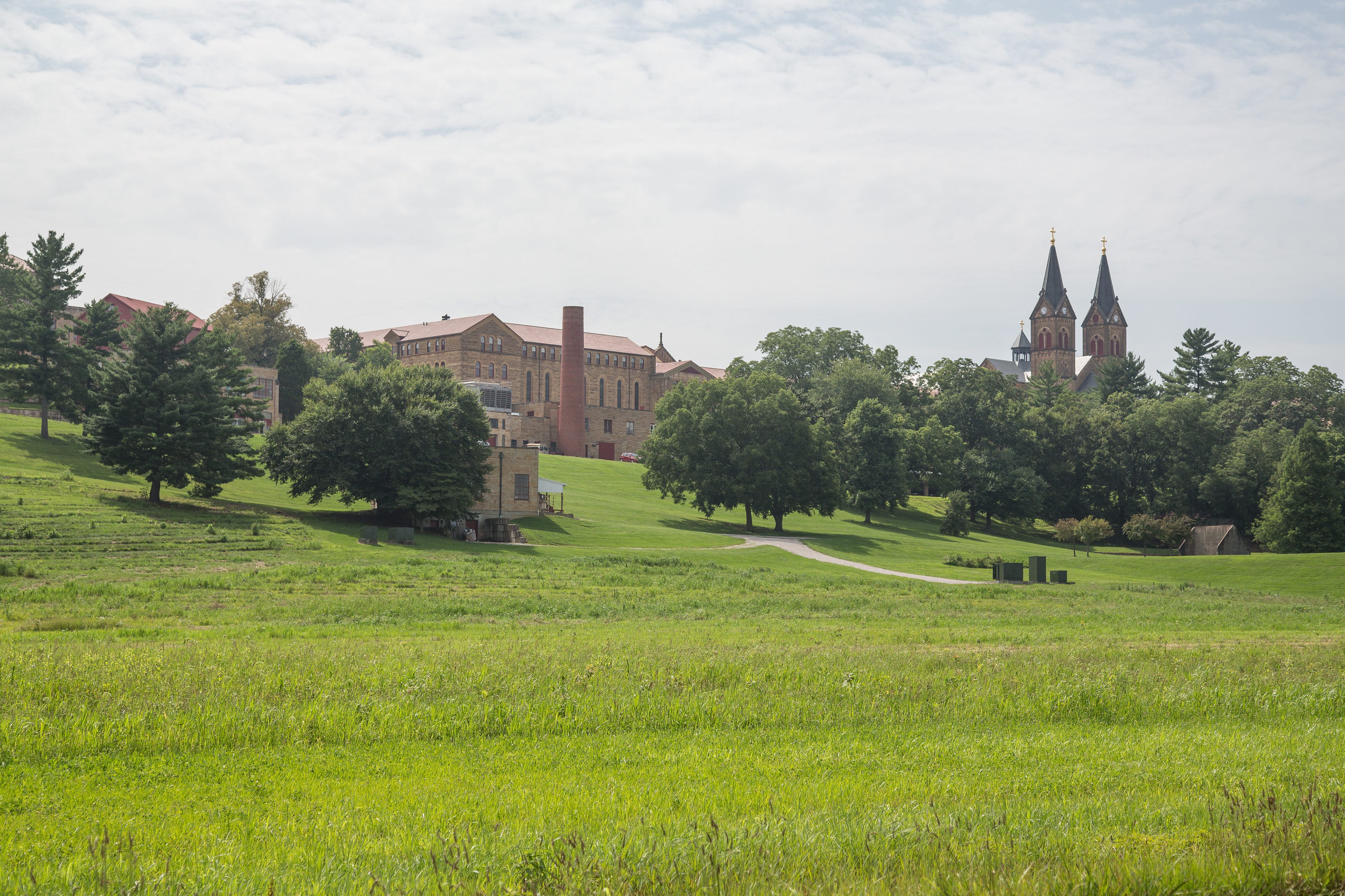
Saint Meinrad is a census-designated place (CDP) in Harrison Township, Spencer County, Indiana, United States. Located along the Anderson River, it is home to the St. Meinrad Archabbey. Interstate 64 runs near the CDP, and it is situated about 55 miles east of Evansville. Because of the archabbey, St. Meinrad, along with Harrison Township, is assigned to the Archdiocese of Indianapolis. The rest of Spencer County is within the borders of the much closer Diocese of Evansville. History Saint Meinrad was laid out in 1861, and named after the local St. Meinrad Archabbey. A post office has been in operation at Saint Meinrad since 1862. Geography St. Meinrad is located at geographical coordinates The geographic coordinate system (GCS) is a spherical or ellipsoidal coordinate system for measuring and communicating positions directly on the Earth as latitude and longitude. It is the simplest, oldest and most widely used of the vario ... 38° 10′ 19″ North, 86° 48′ ... [...More Info...] [...Related Items...] OR: [Wikipedia] [Google] [Baidu] |
Indiana State Road 164
State Road 164 in the U.S. State of Indiana is a short east–west two-lane highway in the southwest portion of the state. Route description State Road 164 begins in downtown Jasper at the U.S. Route 231 and Courthouse Square intersection. Passing east out of town, the road winds through the country, passing to the south of Jasper Lake and through the small town of Celestine. Just before leaving Dubois County for Crawford County, it crosses an arm of Patoka Lake; it then passes through the small town of Wickliffe on the edge of the Hoosier National Forest before terminating at State Road 145 on the shores of another arm of the lake. Major intersections References 164 Year 164 ( CLXIV) was a leap year starting on Saturday (link will display the full calendar) of the Julian calendar. At the time, it was known as the Year of the Consulship of Macrinus and Celsus (or, less frequently, year 917 '' Ab urbe condi ... Transportation in Crawford County, Indiana T ... [...More Info...] [...Related Items...] OR: [Wikipedia] [Google] [Baidu] |
Indiana State Road 56
State Road 56 in the U.S. state of Indiana is a route that travels the south central part of the state from west to east. Route description The western terminus of SR 56 is near Hazleton at U.S. Route 41. SR 56 heads northeast to Hazleton. After Hazleton SR 56 turns southeast then back northeast, until State Road 65 (SR 65). Where SR 56 heads east towards Petersburg, in Petersburg SR 56 is Concurrent with State Road 57 (SR 57), until the intersection with State Road 61 (SR 61). SR 56 leaves Petersburg concurrent with SR 61 heading south, until SR 56 turns east. South of Otwell SR 56 has an intersection with State Road 257. SR 56 enters Jasper on the west side and then has an intersection with U.S. Route 231, the two routes are concurrent until they leave Jasper on the north side of town. North of Jasper SR 56 turns east towards Paoli passing through French Lick. East of Paoli SR 56 heads towa ... [...More Info...] [...Related Items...] OR: [Wikipedia] [Google] [Baidu] |
Dubois County, Indiana
Dubois County ( ) is a county located in the U.S. state of Indiana. As of 2020, the population was 43,637. The county seat is Jasper. Dubois County is part of the Jasper Micropolitan Statistical Area. History Dubois County was formed on December 20, 1818, from Orange, Pike and Perry counties. It is named for Toussaint Dubois, a Frenchman who fought in the American Revolutionary War, the Battle of Tippecanoe and the War of 1812. Dubois was a merchant who lived mainly in Vincennes. He drowned in 1816 while crossing the Little Wabash River near Lawrenceville, Illinois. In 1818, as many as half of the residents of the county died of milk sickness. The plant contains the potent toxin temetrol, which is passed through the milk. The migrants from the East were unfamiliar with the Midwestern plant and its effects. Dubois County switched to the Central Time Zone on April 2, 2006, and returned to the Eastern Time Zone on November 4, 2007; both changes were controversial as Huntingburg ... [...More Info...] [...Related Items...] OR: [Wikipedia] [Google] [Baidu] |
Fulda, Indiana
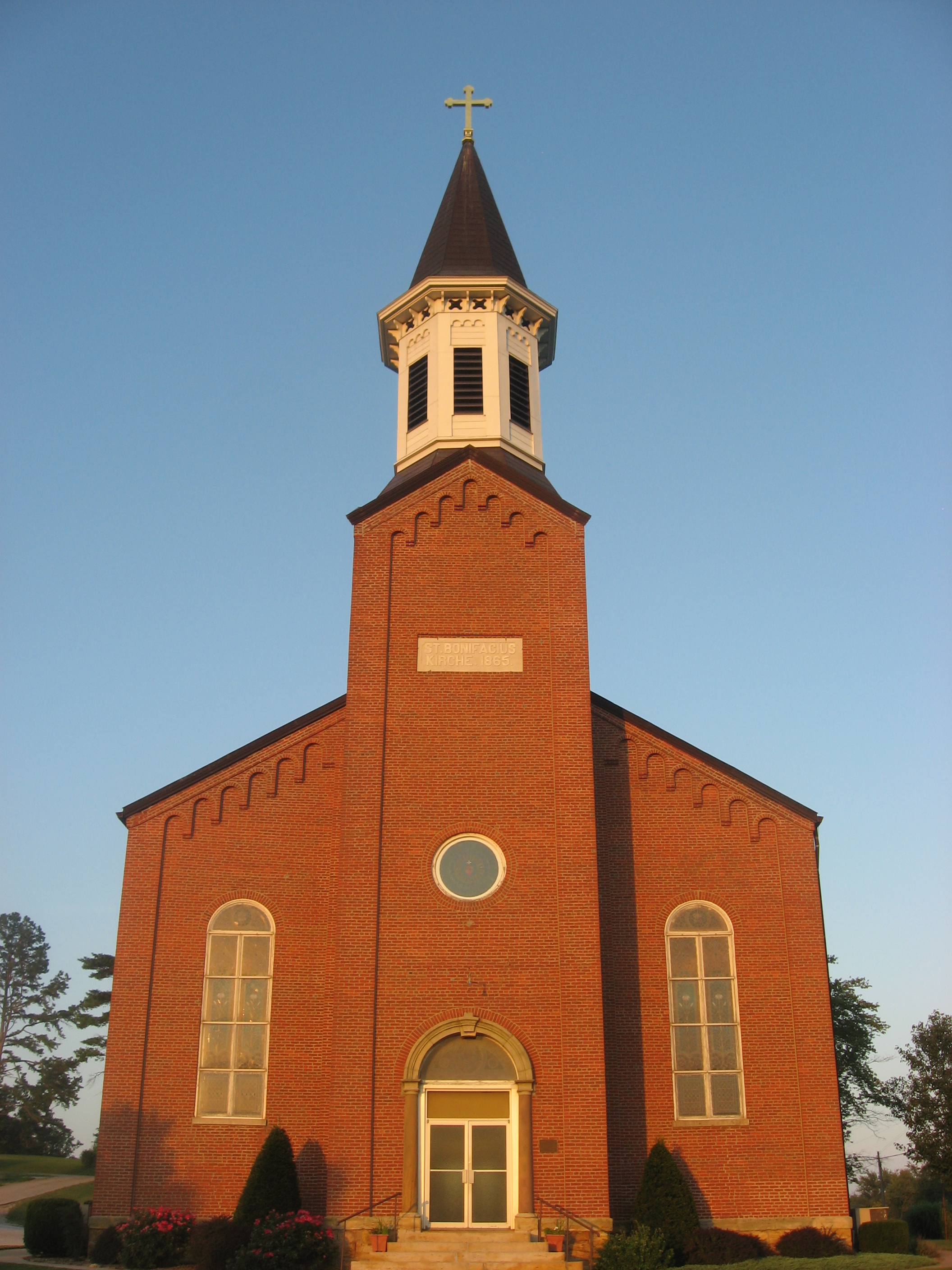
Fulda is an unincorporated community in Harrison Township, Spencer County, in the U.S. state of Indiana. The Spencer County Memorial Forest features a World War II veterans memorial. There is a shooting match the first weekend of October. History Fulda was laid out in the 1840s. The community was originally built up chiefly by Germans, who named it after Fulda, in Germany. A post office was established at Fulda in 1850, and remained in operation until it was discontinued in 1995. The elementary school closed at the end of the 1972–73 school year; the following school year, all of the students were then bused to St. Meinrad to attend school. St. Boniface Catholic Church was listed on the National Register of Historic Places The National Register of Historic Places (NRHP) is the United States federal government's official list of districts, sites, buildings, structures and objects deemed worthy of preservation for their historical significance or "great artistic v ... in ... [...More Info...] [...Related Items...] OR: [Wikipedia] [Google] [Baidu] |
Dubois, Indiana
Dubois is an unincorporated community and census-designated place (CDP) in Dubois County, Indiana, United States. Its population at the 2010 census was 488. History Dubois was platted in 1885. It took its name from Dubois County. The Dubois post office was established in 1880. An old variant name of the community was called Knoxville. Dennis H. Heeke (1927-2009), Indiana state representative and farmer, was born in Dubois. Geography Dubois is located in northeastern Dubois County at . The center of the community is split between Marion and Harbison townships, and the CDP area extends eastward into Columbia Township as well. Jasper, the Dubois County seat, is to the southwest. Indiana State Road 545 passes through Dubois, leading north to State Road 56 and southeast towards Patoka Lake. According to the U.S. Census Bureau, the Dubois CDP has a total area of , of which is land and , or 1.55%, is water. The Patoka River, a tributary of the Wabash River The Wabash River ... [...More Info...] [...Related Items...] OR: [Wikipedia] [Google] [Baidu] |
Indiana
Indiana () is a U.S. state in the Midwestern United States. It is the 38th-largest by area and the 17th-most populous of the 50 States. Its capital and largest city is Indianapolis. Indiana was admitted to the United States as the 19th state on December 11, 1816. It is bordered by Lake Michigan to the northwest, Michigan to the north, Ohio to the east, the Ohio River and Kentucky to the south and southeast, and the Wabash River and Illinois to the west. Various indigenous peoples inhabited what would become Indiana for thousands of years, some of whom the U.S. government expelled between 1800 and 1836. Indiana received its name because the state was largely possessed by native tribes even after it was granted statehood. Since then, settlement patterns in Indiana have reflected regional cultural segmentation present in the Eastern United States; the state's northernmost tier was settled primarily by people from New England and New York, Central Indiana by migrants fro ... [...More Info...] [...Related Items...] OR: [Wikipedia] [Google] [Baidu] |


