|
Imst District
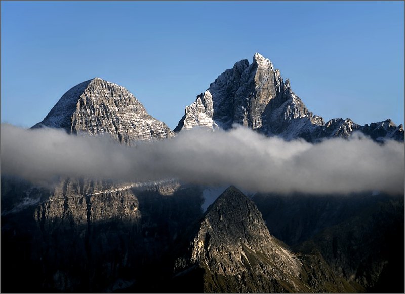
The Bezirk Imst is an administrative district (''Bezirk'') in Tyrol, Austria. It borders the district Reutte in the north, as well as sharing a small border with Bavaria (Germany). It borders the district Innsbruck-Land in the east, South Tyrol (Italy) in the south, and the district Landeck in the west. Area of the district is , which makes it by area rank 4 of the districts of Tyrol, with a population of 57,734 (as of January 1, 2012) (Number 6 in Tyrol), and a population density of 33 persons per km². The administrative center of the district is Imst. Geography The district comprises a part of the upper Inn valley, with its tributary valleys Ötztal, Pitztal, and Gurgltal, and the Mieming Plateau. The area is dominated by high alpine mountains. Mountain ranges include the Stubai Alps, Ötztal Alps, and Mieminger Mountains. The District is around 35 km from west to east and 80 km from north to south. The Highest mountain is the Wildspitze (3.768 meters), the secon ... [...More Info...] [...Related Items...] OR: [Wikipedia] [Google] [Baidu] |
Districts Of Austria
A district (german: Bezirk) is a second-level division of the executive arm of the Austrian government. District offices are the primary point of contact between resident and state for most acts of government that exceed municipal purview: marriage licenses, driver licenses, passports, assembly permits, hunting permits, or dealings with public health officers for example all involve interaction with the district administrative authority (). Austrian constitutional law distinguishes two types of district administrative authority: *district commissions (), district administrative authorities that exist as stand-alone bureaus; *statutory cities ( or ), cities that have been vested with district administration functions in addition to their municipal responsibilities, i.e. district administrative authorities that only exist as a secondary role filled by something that primarily is a city (marked in the table with an asterisk (*). As of 2017, there are 94 districts, of which 79 are d ... [...More Info...] [...Related Items...] OR: [Wikipedia] [Google] [Baidu] |
Inn River
, image = UnterinntalWest.JPG , image_caption = Lower Inn valley from Rattenberg castle , source1_location = Swiss Alps (Lägh dal Lunghin) , source1_elevation = , source1_coordinates= , mouth_location = Danube (Passau) , mouth_elevation = , mouth_coordinates = , progression = , subdivision_type1 = Countries , subdivision_name1 = , subdivision_type2 = Cities , subdivision_name2 = , length = , discharge1_location= mouth , discharge1_avg = , basin_size = The Inn ( la, Aenus; rm, En) is a river in Switzerland, Austria and Germany. The river is long. It is a right tributary of the Danube and it is the third largest tributary of the Danube by discharge. The highest point of its drainage basin is the summit of Piz Bernina at . The Engadine, the valley of the En, is the only Swiss valley whose waters end up in the Black Sea (via the Danube). Etymology The name Inn is derived from the old Celtic words ''en'' and ''enios'', ... [...More Info...] [...Related Items...] OR: [Wikipedia] [Google] [Baidu] |
Karres
Karres is a municipality and a village in the district of Imst in Austria and is located 2.5 km east of Imst near the mouth of the Pitze River The Pitze (also: ''Pitzbach'') is a river in the Imst district, Tyrol, Austria, a right tributary of the river Inn. The Pitze flows through the Pitztal valley, a southern branch of the Inntal. It has a length of about , and its basin area is . It .... The village was founded in the Middle Ages because of mining. It has 589 inhabitants. Population References External links * Cities and towns in Imst District {{Tyrol-geo-stub ... [...More Info...] [...Related Items...] OR: [Wikipedia] [Google] [Baidu] |
Jerzens
Jerzens is a municipality and a village in the district of Imst (district) and is located 8 km south of Imst at the Pitze River in the valley with the same name. Settlement of the area began around 600. The village was mentioned in a register in 1313 for the first time. Jerzens has 1008 inhabitants and its main source of income is agriculture and tourism. Population Notable people *Wolfgang Auderer - professional freestyle skier Freestyle skiing is a skiing discipline comprising aerials, moguls, cross, half-pipe, slopestyle and big air as part of the Winter Olympics. It can consist of a skier performing aerial flips and spins and can include skiers sliding rails and ... References External linksHomepage Cities and towns in Imst District {{Tyrol-geo-stub ... [...More Info...] [...Related Items...] OR: [Wikipedia] [Google] [Baidu] |
Imsterberg
Imsterberg is a municipality and a town in the district of Imst located west of Imst Imst (; Southern Bavarian: ''Imscht'') is a town in the Austrian federal state of Tyrol. It lies on the River Inn in western Tyrol, some west of Innsbruck and at an altitude of above sea level. With a current population (2013) of 9,552, Imst .... Population Economy The main source of income is agriculture. References Cities and towns in Imst District {{Tyrol-geo-stub ... [...More Info...] [...Related Items...] OR: [Wikipedia] [Google] [Baidu] |
Haiming, Austria
Haiming is a municipality and the name of its largest town, located in the district of Imst in the Austrian state of Tyrol. Geography The town of Haiming is located 11 km east of Imst Imst (; Southern Bavarian: ''Imscht'') is a town in the Austrian federal state of Tyrol. It lies on the River Inn in western Tyrol, some west of Innsbruck and at an altitude of above sea level. With a current population (2013) of 9,552, Im .... The municipality consists eight villages. Climate Population Economy Its main source of income is summer tourism. References Cities and towns in Imst District {{Tyrol-geo-stub ... [...More Info...] [...Related Items...] OR: [Wikipedia] [Google] [Baidu] |
Arzl Im Pitztal
Arzl im Pitztal is a municipality and a townHaufendorf in the district of Imst in the Austrian state of Tyrol. Geography The stream Pitze flows through the municipality. Population Personalities The professional skier Benjamin Raich Benjamin Raich (born 28 February 1978 in Arzl im Pitztal, Tyrol) is an Austrian former World Cup champion alpine ski racer and Olympic gold medalist. With 14 medals won at Winter Olympics and World Championships, 36 World Cup race victories (in ... and the band Mother's Cake come from the village. References External links * Private Webseite mit weiteren Infos zur Gemeinde Cities and towns in Imst District {{Tyrol-geo-stub ... [...More Info...] [...Related Items...] OR: [Wikipedia] [Google] [Baidu] |
Municipality (Austria)
In the Republic of Austria, the municipality ( de , Gemeinde, sometimes also ) is the administrative division encompassing a single village, town, or city. The municipality has corporate status and local self-government on the basis of parliamentary-style representative democracy: a municipal council () elected through a form of party-list system enacts municipal laws, a municipal executive board () and a mayor (, fem. ) appointed by the council are in charge of municipal administration. Austria is currently (January 1, 2020) partitioned into 2,095 municipalities, ranging in population from about fifty (the village of Gramais in Tyrol) to almost two million (the city of Vienna). There is no unincorporated territory in Austria. Basics The existence of municipalities and their role as carriers of the right to self-administration are guaranteed by the Austrian constitution ( B-VG Art. 116 (1)). The constitution means for municipalities to be autonomous () in any matter that a ... [...More Info...] [...Related Items...] OR: [Wikipedia] [Google] [Baidu] |
Mieminger Mountains
The Mieming(er) Range, Mieminger Chain (german: Mieminger Kette) or Mieminger Mountains (''Mieminger Gebirge''), is a mountain range of the Northern Limestone Alps in the Eastern Alps. It is located entirely in Austria within the state of Tyrol. This sub-group is somewhat in the shadows of its more famous neighbour, the Wetterstein to the north. Whilst the region around the Coburger Hut and the lakes of Seebensee and Drachensee in the west ( Ehrwalder Sonnenspitze and Vorderer Tajakopf with its new ''klettersteig'' over the Tajakante) and the Hohe Munde in the extreme east receive large numbers of visitors, the less developed central area remains very quiet. The Hohe Munde is also a popular and challenging ski touring destination. Public transport links: The Außerfern Railway stops at Ehrwald on the western side of the range. Busses run from Leutasch on the southern side of the mountains to Mittenwald and Seefeld in Tirol. Geology The Mieminger Mountains lie in a part ... [...More Info...] [...Related Items...] OR: [Wikipedia] [Google] [Baidu] |
Ötztal Alps
The Ötztal Alps ( it, Alpi Venoste, german: Ötztaler Alpen) are a mountain range in the Central Eastern Alps, in the State of Tyrol in western Austria and the Province of South Tyrol in northern Italy. Geography The Ötztal Alps are arrayed at the head of the Ötztal valley, a side valley of the Inn river southwest of Innsbruck, Austria. One line of summits forms part of the border between Austria and Italy. The Ötztal Alps are bordered by the Reschen Pass (1504 m) in the west and the Inn river in the northwest and north. In the east the range is separated from the Stubai Alps by the Ötztaler Ache in the Ötztal, the Timmelsjoch (2474 m) and the Passer river in the Passeier Valley. On the south and southwest, the range is limited by the deep valley of the Etsch river, here known as the Vinschgau. The Ötztal Alps are surrounded by the following ranges: * Lechtal Alps * Mieming Range * Stubai Alps * Sarntal Alps * Ortler Alps * Sesvenna Alps * Samnaun Alps On September 199 ... [...More Info...] [...Related Items...] OR: [Wikipedia] [Google] [Baidu] |
Stubai Alps
The Stubai Alps (in German ''Stubaier Alpen'') is a mountain range in the Central Eastern Alps of Europe. It derives its name from the Stubaital valley to its east and is located southwest of Innsbruck, Austria. Several peaks form the border between Austria and Italy. The range is bounded by the Inn River valley to the north; the Sill River valley (''Wipptal'') and the Brenner Pass to the east (separating it from the Zillertal Alps); the Ötztal and Timmelsjoch to the west (separating it from the Ötztal Alps), and to the south by tributaries of the Passer River and Eisack. Geography Important parts of the Stubai Alps show signs of glaciation. The northern part around the Sellrain valley and the Kühtai is now only lightly glaciated and a popular ski touring destination ( Zischgeles, Lampsenspitze, Pirchkogel, Sulzkogel). The High Stubai around the upper Stubai valley is still heavily glaciated and a classic high mountain touring region in the Eastern Alps. Here there is a glacie ... [...More Info...] [...Related Items...] OR: [Wikipedia] [Google] [Baidu] |
Mieming Plateau
{{Coord, 47, 19, N, 10, 59, E, type:mountain_region:AT-7_dim:15000_map:right_maptype: relief, display=title The Mieming Plateau (german: Mieminger Plateau) is a mountain terrace between 850 and 1000 metres high above the Upper Inn valley in the Austrian state of Tyrol at the southern foot of the Mieming Chain. It lies in the municipalities of Wildermieming, Mieming, Obsteig and Mötz. The low mountain terrace is composed of ground moraines and gravels, probably from the Würm glaciation. In the south the terrace is bounded by the so-called Achberg range (''Achbergzug''), a chain of mountains made of main dolomite, the other side of which is the Inn valley. The plateau is about 14 kilometres long and up to 4 kilometres wide. Except near Telfs and Mötz it drops steeply 200 metres down to the Inn valley and ends in the west at the Holzleiten Saddle, where the road continues to the Gurgltal and the Fern Pass section. From Telfs and Mötz there are transit rout ... [...More Info...] [...Related Items...] OR: [Wikipedia] [Google] [Baidu] |


