|
Imandra Lake
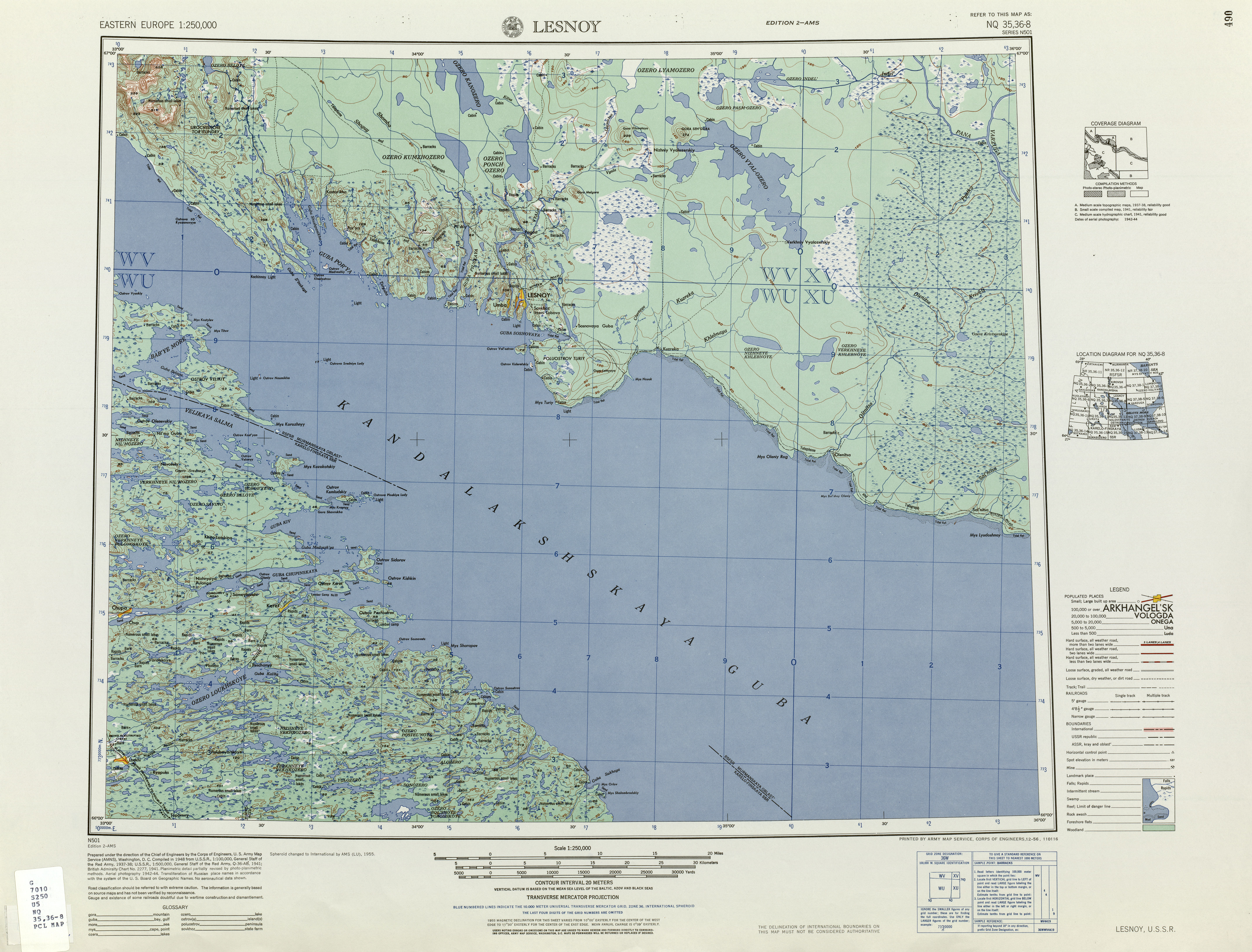
Imandra ( sms, Âʹvverjäuʹrr, Russian: Имандра, Finnish: ''Imantero'') is a lake in the south-western part of the Kola Peninsula in Murmansk Oblast, Russia, slightly beyond the Arctic circle. It is located 127 m above sea level; its area is about 876 km2, maximum depth is 67 m. The shape of the shore line is complicated. There are a number of islands and the largest one, Erm Island measures 26 km2. There are three principal parts of the lake connected by narrow straits: Greater Imandra (Большая Имандра) or Khibinskaya Imandra in the north (area 328 km2, length about 55 km, width 3–5 km), Ekostrovskaya Imandra in the centre (area 351 km2), and Babinskaya Imandra in the west (area 133 km2). The lake drains into the Kandalaksha Gulf of the White Sea by the Niva River. The lake is known for the transparency of its water and its abundance of fish. Towns on or near the lake The town of Monchegorsk, located on the M ... [...More Info...] [...Related Items...] OR: [Wikipedia] [Google] [Baidu] |
Kola Peninsula
sjd, Куэлнэгк нёа̄ррк , image_name= Kola peninsula.png , image_caption= Kola Peninsula as a part of Murmansk Oblast , image_size= 300px , image_alt= , map_image= Murmansk in Russia.svg , map_caption = Location of Murmansk Oblast within Russia , location= Northwest Russia , coordinates= , area_km2= 100000 , length_km= 370 , width_km= 244 , highest_mount= Yudychvumchorr , elevation_m= 1201 , waterbody = * Barents Sea * White Sea , country= Russia , country_admin_divisions_title= Oblast , country_admin_divisions= Murmansk Oblast , density_km2= , demonym= , population= , citizenships= The Kola Peninsula (russian: Кольский полуостров, Kolsky poluostrov; sjd, Куэлнэгк нёа̄ррк) is a peninsula in the extreme northwest of Russia, and one of the largest peninsulas of Europe. Constituting the bulk of the territory of Murmansk Oblast, it lies almost completely inside the Arctic Circle and is bordered by the Barents Sea to the n ... [...More Info...] [...Related Items...] OR: [Wikipedia] [Google] [Baidu] |
Kandalaksha Gulf
The Kandalaksha Gulf (, sms, Käddluhtt), fi, Kantalahti) is located in the Republic of Karelia, and Murmansk Oblast in northwestern Russia. Forming the north-western corner of the White Sea, it is one of four large bays and gulfs of this sea, the others being the Onega Bay (south-west), the Dvina Bay (south), and the Mezen Bay (south east). The Kola Peninsula lies north of the Kandalaksha Gulf. The city of Kandalaksha is located at the northern tip of the gulf; the new oil port Vitino, some 10 km to the south. There are hundreds of skerries in the gulf. The gulf is shallow, reaching 300 meters on its western side. In 1976, the upper reaches of the gulf were designated a Ramsar wetland of international importance, notably as a breeding ground for migratory waterfowl such as the sea duck. Kandalaksha Nature Reserve ( Кандалакшский заповедник) includes parts of the coastline and many of the islands in the gulf. It is one of Russia's oldest nature rese ... [...More Info...] [...Related Items...] OR: [Wikipedia] [Google] [Baidu] |
Kirov Railway
Railway between Murmansk on the Baltic_Sea.html"_;"title="Arctic_Ocean_and_Saint_Petersburg_on_the_Baltic_Sea">Arctic_Ocean_and_Saint_Petersburg_on_the_Baltic_Sea_ Kirov_Railway_(russian:_Кировская_железная_дорога,_''Kirovskaya_zheleznaya_doroga'',_until_1935_''Murman_Railway'')_is_a__Russian_gauge.html" ;"title="Baltic_Sea_.html" ;"title="Baltic_Sea.html" ;"title="Arctic Ocean and Saint Petersburg on the Baltic Sea">Arctic Ocean and Saint Petersburg on the Baltic Sea ">Baltic_Sea.html" ;"title="Arctic Ocean and Saint Petersburg on the Baltic Sea">Arctic Ocean and Saint Petersburg on the Baltic Sea Kirov Railway (russian: Кировская железная дорога, ''Kirovskaya zheleznaya doroga'', until 1935 ''Murman Railway'') is a Russian gauge">broad gauge Russian railway network that links the Murman Coast and Murmansk city (in the north) and Saint Petersburg (in the south). The railway is operated by the ''Arktika'' passenger train. The tota ... [...More Info...] [...Related Items...] OR: [Wikipedia] [Google] [Baidu] |
Khibiny Mountains
The Khibiny Mountains (russian: Хиби́ны ; sjd, Umptek) is one of the two main mountain ranges of the Kola Peninsula, Russia, within the Arctic Circle, located between Imandra and Umbozero lakes. The range is also known as Khibiny Massif, Khibinsky Mountains, Khibinsky Tundras, Khibins or Khibiny. The Khibiny National Park was set up in 2018. Geography The Khibiny Massif are the highest mountains of the Kola Peninsula, a large peninsula extending from northern Russia into the Barents and White seas. The total land area of the peninsula is approximately . It is rich in minerals due to the removal of a layer of soil during the last ice age. The Khibiny Massif is of oval shape of about 1,300 km2. and occupies the central part of the peninsula at a relative elevation of 900–1000 m above the surrounding plain. The mountains are not particularly high; the two highest peaks are the Yudychvumchorr, which stands , and the Chasnachorr, which stands . The average elevati ... [...More Info...] [...Related Items...] OR: [Wikipedia] [Google] [Baidu] |
Polyarnye Zori
Polyarnye Zori (russian: Поля́рные Зо́ри, lit. ) is a town in Murmansk Oblast, Russia, located on the Niva River, Lake Imandra, and Lake Pinozero, south of Murmansk. The nearest settlements to Polyarnye Zory are: Zasheek (3km), Pinozero (4 km), Nivskiy (8km) and Afrikanda-1,2 (16 and 13 km). Population : 14,196 (2020 Сensus), History Polyarnye Zori was founded in 1968 as a settlement for workers of the electric power industry due to the construction of the Kola Nuclear Power Plant. Initially a work settlement subordinated to the town of Apatity, it was elevated in status to that of a town under oblast jurisdiction by the Presidium of the Supreme Soviet of the Russian SFSR The Presidium of the Supreme Soviet of the Russian Soviet Federative Socialist Republic was the collective head of state of the Russian SFSR and the permanent body of the Supreme Soviet of the Russian SFSR that was accountable to the Supreme Sovi ... Decree of April 22, 1991.''Administ ... [...More Info...] [...Related Items...] OR: [Wikipedia] [Google] [Baidu] |
Apatity
Apatity ( rus, Апатиты, p=əpɐˈtʲitɨ, lit. apatites) is a town in Murmansk Oblast, Russia, located along the Murman Railway, west of Kirovsk and south of Murmansk, the administrative center of the oblast. The town is named after one of its most abundant natural resources in the area, apatite, the raw mineral used in the production of phosphorus mineral fertilizers. Population: Geography The town is located on the Kola Peninsula, between Lake Imandra and the Khibiny Mountains, by the left bank of the Belaya River.Google Earth History The passing loop of Bely () on the Leningrad-Murmansk Railway was built in 1926 and the settlement of Apatity was founded in 1930. It was classified as an urban locality by the All-Russian Central Executive Committee (VTsIK) Resolution of August 20, 1935, when the settlement of pri sovkhoze "Industriya" was merged into Apatity and it was granted work settlement status.''Administrative-Territorial Division of Murmansk Oblast'', ... [...More Info...] [...Related Items...] OR: [Wikipedia] [Google] [Baidu] |
Cross-country Ski
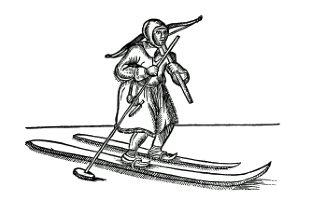
Cross-country skiing is a form of skiing where skiers rely on their own locomotion to move across snow-covered terrain, rather than using ski lifts or other forms of assistance. Cross-country skiing is widely practiced as a sport and recreational activity; however, some still use it as a means of transportation. Variants of cross-country skiing are adapted to a range of terrain which spans unimproved, sometimes mountainous terrain to groomed courses that are specifically designed for the sport. Modern cross-country skiing is similar to the original form of skiing, from which all skiing disciplines evolved, including alpine skiing, ski jumping and Telemark skiing. Skiers propel themselves either by striding forward (classic style) or side-to-side in a skating motion (skate skiing), aided by arms pushing on ski poles against the snow. It is practised in regions with snow-covered landscapes, including Europe, Canada, Russia, the United States, Australia and New Zealand. Competiti ... [...More Info...] [...Related Items...] OR: [Wikipedia] [Google] [Baidu] |
Monchegorsk
Monchegorsk (russian: Мончего́рск) is a town in Murmansk Oblast, Russia, located on the Kola Peninsula, south of Murmansk, the administrative center of the oblast. Population: 52,242 ( 2002 Census); 68,652 ( 1989 Census). Name The name of the town derives from Akkala Sámi word ''monce'' 'beautiful'. The name originally was intended for nearby Montshatuntur (Arctic Hill). History It was established in the 1930s as the inhabited locality of Moncha-Guba (), which served copper and nickel mining in the Monchetundra Massif.''Administrative-Territorial Division of Murmansk Oblast'', p. 49 It was granted work settlement status and renamed Monchegorsk by the Resolution of the Presidium of All-Russian Central Executive Committee (VTsIK) on November 25, 1935. At the same time, it was transferred from Kolsky District to Kirovsky District. By 1937, the copper-nickel mining volume increased significantly, and, consequently, the area population grew as well.''Admin ... [...More Info...] [...Related Items...] OR: [Wikipedia] [Google] [Baidu] |
Fish
Fish are aquatic, craniate, gill-bearing animals that lack limbs with digits. Included in this definition are the living hagfish, lampreys, and cartilaginous and bony fish as well as various extinct related groups. Approximately 95% of living fish species are ray-finned fish, belonging to the class Actinopterygii, with around 99% of those being teleosts. The earliest organisms that can be classified as fish were soft-bodied chordates that first appeared during the Cambrian period. Although they lacked a true spine, they possessed notochords which allowed them to be more agile than their invertebrate counterparts. Fish would continue to evolve through the Paleozoic era, diversifying into a wide variety of forms. Many fish of the Paleozoic developed external armor that protected them from predators. The first fish with jaws appeared in the Silurian period, after which many (such as sharks) became formidable marine predators rather than just the prey of arthropods. Mos ... [...More Info...] [...Related Items...] OR: [Wikipedia] [Google] [Baidu] |
White Sea
The White Sea (russian: Белое море, ''Béloye móre''; Karelian and fi, Vienanmeri, lit. Dvina Sea; yrk, Сэрако ямʼ, ''Serako yam'') is a southern inlet of the Barents Sea located on the northwest coast of Russia. It is surrounded by Karelia to the west, the Kola Peninsula to the north, and the Kanin Peninsula to the northeast. The whole of the White Sea is under Russian sovereignty and considered to be part of the internal waters of Russia.A. D. Dobrovolskyi and B. S. Zalogi"Seas of USSR. White Sea" Moscow University (1982) (in Russian) Administratively, it is divided between Arkhangelsk and Murmansk oblasts and the Republic of Karelia. The major port of Arkhangelsk is located on the White Sea. For much of Russia's history this was Russia's main centre of international maritime trade, conducted by the Pomors ("seaside settlers") from Kholmogory. In the modern era it became an important Soviet naval and submarine base. The White Sea–Baltic Canal connec ... [...More Info...] [...Related Items...] OR: [Wikipedia] [Google] [Baidu] |
Murmansk Oblast
Murmansk Oblast (russian: Му́рманская о́бласть, p=ˈmurmənskəjə ˈobləsʲtʲ, r=Murmanskaya oblast, ''Murmanskaya oblast''; Kildin Sami: Мурман е̄ммьне, ''Murman jemm'ne'') is a federal subject (an oblast) of Russia, located in the northwestern part of the country. Its administrative center is the city of Murmansk. As of the Russian Census (2010), 2010 Census, its population was 795,409. Geography Geographically, Murmansk Oblast is located mainly on the Kola Peninsula almost completely north of the Arctic Circle''2007 Atlas of Murmansk Oblast'', p. 2 and is a part of the larger Lapland (region), Sápmi (Lapland) region that spans over four countries.Ratcliffe, p. 1 The oblast borders with the Republic of Karelia in Russia in the south, Lapland, Finland, Lapland Region in Finland in the west, Troms og Finnmark, Troms and Finnmark County in Norway in the northwest, and is bounded by the Barents Sea in the north and the White Sea in ... [...More Info...] [...Related Items...] OR: [Wikipedia] [Google] [Baidu] |


