|
Igawawen
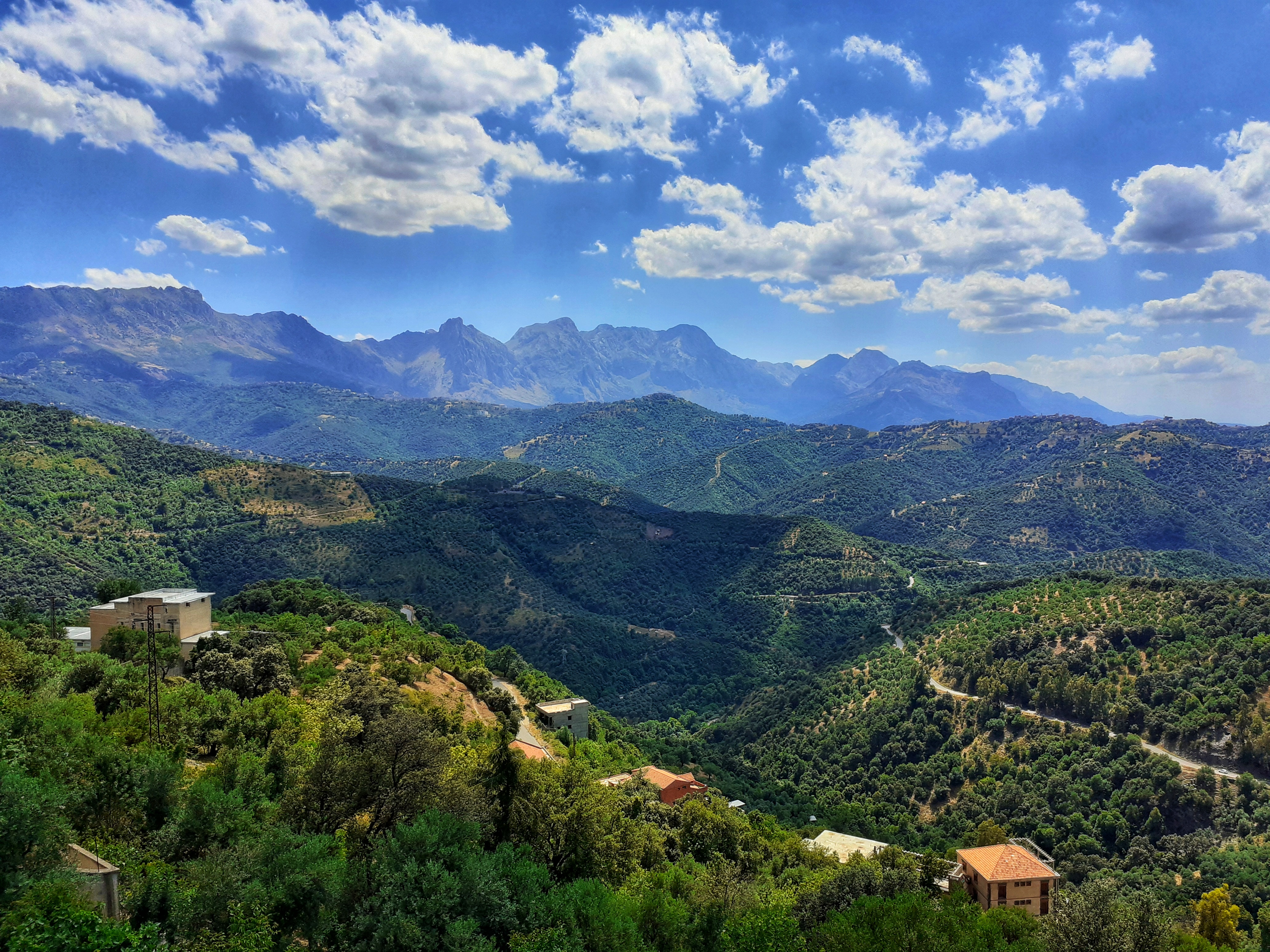
Igawawen or Gawawa, mostly known as Zwawa (in Kabyle: Igawawen, in Arabic: زواوة, and in Latin: Jubaleni''Revue archéologique, Société française d'archéologie classique'' (in French), p. 28) were a group of Kabyle tribes inhabiting the Djurdjura mountains, Greater Kabylia, in Algeria, whose most famous and strongest confederations were those of the Aït Betrun, the Aït Iraten, and the Aït Mengellat, and are divided into various tribes, and the tribes themselves are divided into many villages. The Zouaoua are a branch of the Kutama tribe of the Baranis Berbers.Ibn Khaldun, ''Histoire des Berbères et des dynasties musulmanes de l'Afrique septentrionale'' (in French), Volume 1, Paris, Imprimerie du gouvernement, 1852, 447 p.read online, p. 255 The Igawawen, in the most restricted sense, are only located in the south-eastern part of the Tizi-Ouzou province. In the least restricted sense however, they are located in the southern half of the Tizi Ouzou province, and a ... [...More Info...] [...Related Items...] OR: [Wikipedia] [Google] [Baidu] |
Kutama
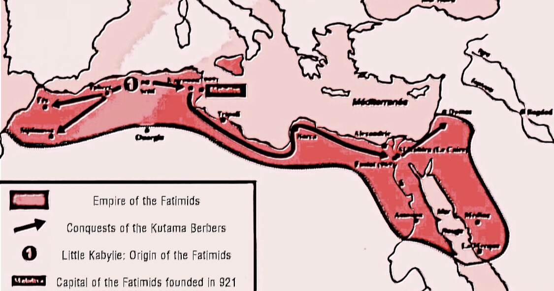
The Kutama ( Berber: ''Ikutamen''; ar, كتامة) was a Berber tribe in northern Algeria classified among the Berber confederation of the Bavares. The Kutama are attested much earlier, in the form ''Koidamousii'' by the Greek geographer Ptolemy. The Kutama played a pivotal role in establishing the Fatimid Caliphate (909–1171), forming the bulk of the Fatimid army which eventually overthrew the Aghlabids who controlled Ifriqiya, and which then went on to conquer Egypt, Sudan, Hijaz and the southern Levant in 969–975. The Kutama remained one of the mainstays of the Fatimid army until well into the 11th century. Ancient history The Kutama are attested in the form ''Koidamousii'', by the Greek geographer Ptolemy, whose African documentation seems to date from the years 100-110. They were then in the region of the Ampsaga river (oued el-Kebir) in Mauretania Caesariensis. He locates them upstream of the ''Khitouae'' tribe and downstream of the ''Todoukae'' tribe, themselves loca ... [...More Info...] [...Related Items...] OR: [Wikipedia] [Google] [Baidu] |
Kabyle People
The Kabyle people ( kab, Izwawen or ''Leqbayel'' or ''Iqbayliyen'', ) are a Berber ethnic group indigenous to Kabylia in the north of Algeria, spread across the Atlas Mountains, east of Algiers. They represent the largest Berber-speaking population of Algeria and the second largest in North Africa. Many of the Kabyles have emigrated from Algeria, influenced by factors such as the Algerian Civil War, cultural repression by the central Algerian government, and overall industrial decline. Their diaspora has resulted in Kabyle people living in numerous countries. Large populations of Kabyle people settled in France and, to a lesser extent, Canada (mainly Québec) and United States. The Kabyle people speak Kabyle, a Berber language. Since the Berber Spring of 1980, they have been at the forefront of the fight for the official recognition of Berber languages in Algeria. History Fatimid Caliphate Between 902 and 909 the Fatimid state had been founded by the Kutama Berbers from L ... [...More Info...] [...Related Items...] OR: [Wikipedia] [Google] [Baidu] |
Tizi Ouzou Province
Tizi Ouzou ( Kabyle: Tawilayt n Tizi Wezzu, ar, ولاية تيزي وزو) is a province (''wilayah'') of Algeria in the Kabylia region. Its capital is Tizi Ouzou. History In 1984, Boumerdès Province was carved out of its territory. Administrative divisions The province is divided into 21 districts (''daïras''), which are further divided into 67 ''communes'' or municipalities. Districts # Aïn El Hammam # Azazga # Azzefoun # Béni Douala # Béni Yenni # Boghni # Bouzeguène # Draâ Ben Khedda # Draâ El Mizan # Iferhounène # Larbaâ Nath Irathen # Maâtka # Makouda # Mekla # Ouadhia # Ouacifs # Ouaguenoun # Tigzirt # Tizi Gheni # Tizi # Tizi Rached Communes # Abi Youcef # Aghni-Goughrane (Agouni Gueghrane) # Aghrib # Aïn El Hammam ( Ain-El-Hammam) # Aïn Zaouia ( Ain-Zaouia) # Ait Aggouacha # Ait Bouaddou # Ait Boumehdi ( Ait Boumahdi) # Ait Chaffaa ( Ait-Chaffaa, Ait Chafâa) # Ait Khelili (Ait Khellili) # Ait Mahmoud ( Ait-Mahmoud) # Ait Ouma ... [...More Info...] [...Related Items...] OR: [Wikipedia] [Google] [Baidu] |
Kabylia
Kabylia ('' Kabyle: Tamurt n Leqbayel'' or ''Iqbayliyen'', meaning "Land of Kabyles", '','' meaning "Land of the Tribes") is a cultural, natural and historical region in northern Algeria and the homeland of the Kabyle people. It is part of the Tell Atlas mountain range and is located at the edge of the Mediterranean Sea. Kabylia covers two provinces of Algeria: Tizi Ouzou and Bejaia. Gouraya National Park and Djurdjura National Park are also located in Kabylia. History Antiquity Kabylia was a part of the Kingdom of Numidia (202 BC – 46 BC). List of Empires/Dynasties created by the Kabyle people * Zirid Dynasty * Hammadid Dynasty * Fatimid Caliphate * Taifa of Alpuente * Taifa of Granada * Kingdom of Beni Abbes * Kingdom of Kuku Middle Ages The history of Kabylie started to appear in the classical books during the fourth century AD with the revolt of the commander Firmus and his brother Guildon against the empire. The Vandals, a Germanic people, established a ... [...More Info...] [...Related Items...] OR: [Wikipedia] [Google] [Baidu] |
Béjaïa
Béjaïa (; ; ar, بجاية, Latn, ar, Bijāya, ; kab, Bgayet, Vgayet), formerly Bougie and Bugia, is a Mediterranean port city and commune on the Gulf of Béjaïa in Algeria; it is the capital of Béjaïa Province, Kabylia. Béjaïa is the largest principally Kabyle-speaking city in the region of Kabylia, Algeria. Geography The town is overlooked by the mountain ', whose profile is said to resemble a sleeping woman. Other nearby scenic spots include the ''Aiguades'' beach and the '' Pic des Singes'' (Peak of the Monkeys); the latter site is a habitat for the endangered Barbary macaque, which prehistorically had a much broader distribution than at present. All three of these geographic features are located in the Gouraya National Park. The Soummam river runs past the town. Under French rule, it was known under various European names, such as Budschaja in German, Bugia in Italian, and Bougie in French. The French and Italian versions, due to the town's wax trade, ... [...More Info...] [...Related Items...] OR: [Wikipedia] [Google] [Baidu] |
Ibn Khaldun
Ibn Khaldun (; ar, أبو زيد عبد الرحمن بن محمد بن خلدون الحضرمي, ; 27 May 1332 – 17 March 1406, 732-808 AH) was an Arab The Historical Muhammad', Irving M. Zeitlin, (Polity Press, 2007), p. 21; "It is, of course, Ibn Khaldun as an Arab here speaking, for he claims Arab descent through the male line.". The Arab World: Society, Culture, and State', Halim Barakat (University of California Press, 1993), p. 48;"The renowned Arab sociologist-historian Ibn Khaldun first interpreted Arab history in terms of badu versus hadar conflicts and struggles for power." Ibn Khaldun', M. Talbi, ''The Encyclopaedia of Islam'', Vol. III, ed. B. Lewis, V.L. Menage, C. Pellat, J. Schacht, (Brill, 1986), 825; "Ibn Khaldun was born in Tunis, on I Ramadan 732/27 May 1332, in an Arab family which came originally from the Hadramawt and had been settled at Seville since the beginning of the Muslim conquest...." Ibn Khaldun's Philosophy of History: A Study in the Philos ... [...More Info...] [...Related Items...] OR: [Wikipedia] [Google] [Baidu] |
Soummam River
The Soummam River (pronounced om'm is a river in northern Algeria, born from the confluence of the Sahel River and the Bou Sellam River near Akbou and flowing into the Mediterranean Sea at Béjaïa. Description The waters that reach the sea in this place have for their origins the Mounts of Ain Oulmane, south of Setif, Mount Dirah, south of Bouira, and the extreme west of Djurdjura. It is in fact that the physical geography of the region places the southernmost sources of the Soummam at the limits of the semi-arid zone characterized by rigors linked to the continental climate, whereas the closest sources are located in the territories Humid to temperate climate. The Soummam constitutes a dense and well-supplied hydrographic network, particularly in its part situated in the Tellian Atlas: Djurdjura, Babors and Bibans. Its watershed covers an area of 9 200 km2 spread over four wilayas: Bouira, Bordj Bou Arréridj, Sétif and Béjaïa. With the Cheliff, the Tafna and the Rhumm ... [...More Info...] [...Related Items...] OR: [Wikipedia] [Google] [Baidu] |
Béjaïa Province
The Béjaïa Province ( Kabyle: ''Tawilayt n Bgayet''; ar, ولاية بجاية, Latn, ar, Wilāyat Bijāyah; french: wilaya de Béjaïa or ) is a province of Algeria in the Kabylie region. The province's capital city is Béjaïa, the terminus of the Béni Mansour-Bejaïa line. Gouraya National Park is located in Béjaïa Province. A population of an endangered primate species, the Barbary macaque, is found within the park; this primate has a severely restricted and disjunctive range.C. Michael Hogan. 2008''Barbary Macaque: Macaca sylvanus'', Globaltwitcher.com, ed. Nicklas Stromberg History The province was created from the Sétif (département) in 1974. Administrative divisions The province is divided into 19 districts (''daïras''), which are further divided into 52 ''communes'' or municipalities. Districts Communes # Adekar # Aït-Rizine # Aït-Smail # Akbou # Akfadou # Amalou # Amizour # Aokas # Barbacha # Béjaïa # Beni Djellil # Beni Ksila # Beni Mao ... [...More Info...] [...Related Items...] OR: [Wikipedia] [Google] [Baidu] |
Bouïra Province
Bouïra ( Kabyle: Tawilayt n Tuvirett, ar, ولاية البويرة, french: Wilaya de Bouira) is a province (''wilaya'') in the Kabylie region (also known as Tazwawa) in Algeria. History The province was created from parts of Médéa (département) and Tizi-Ouzou department in 1974. Administrative divisions It is made up of 12 districts and 45 ''communes'' or municipalities. Districts # Aïn Bessem # Bechloul # Bir Ghbalou # Bordj Okhriss # Bouïra # El Hachimia # Haïzer # Kadiria # Lakhdaria # M'Chedellah # Souk El Khemis # Sour El Ghozlane Communes # Aïn Bessem # Ahnif # Aghbalou # Aïn El Hadjar # Ahl El Ksar # Ain Laloui # Ath Mansour Taourirt # Aomar # Aïn Turk (Ain el Turc) # Ait Laziz # Bouderbala # Bechloul # Bir Ghbalou # Bouiche # Boukram # Bordj Okhriss # Bouira # Dechmia # Dirrah # Djebahia # El Asnam # El Hakimia # El Hachimia # El Adjiba # El Khabouzia # El Mokrani # Guerrouma # Haizer # Hadjera Zerga # Kadiria # Lakhdaria # M'Chedal ... [...More Info...] [...Related Items...] OR: [Wikipedia] [Google] [Baidu] |
Berbers
, image = File:Berber_flag.svg , caption = The Berber ethnic flag , population = 36 million , region1 = Morocco , pop1 = 14 million to 18 million , region2 = Algeria , pop2 = 9 million to ~13 million , region3 = Mauritania , pop3 = 2.9 million , region4 = Niger , pop4 = 2.6 million, Niger: 11% of 23.6 million , region5 = France , pop5 = 2 million , region6 = Mali , pop6 = 850,000 , region7 = Libya , pop7 = 600,000 , region8 = Belgium , pop8 = 500,000 (including descendants) , region9 = Netherlands , pop9 = 467,455 (including descendants) , region10 = Burkina Faso , pop10 = 406,271, Burkina Faso: 1.9% of 21.4 million , region11 = Egypt , pop11 = 23,000 or 1,826,580 , region12 = Tunisia , pop12 ... [...More Info...] [...Related Items...] OR: [Wikipedia] [Google] [Baidu] |


.jpg)