|
Iblean Mountains
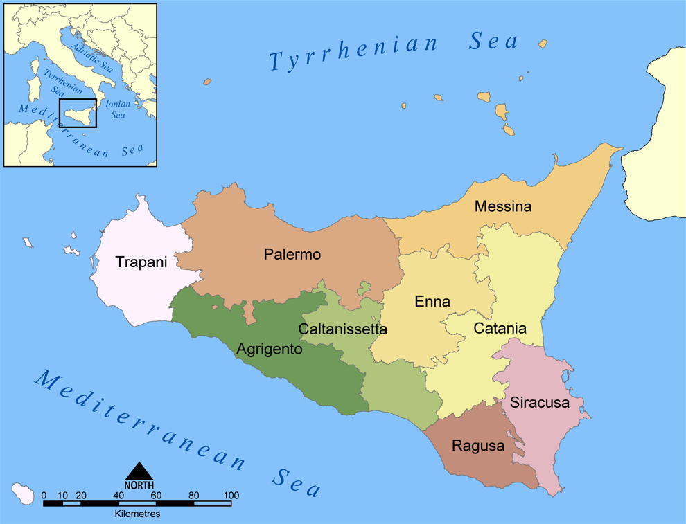
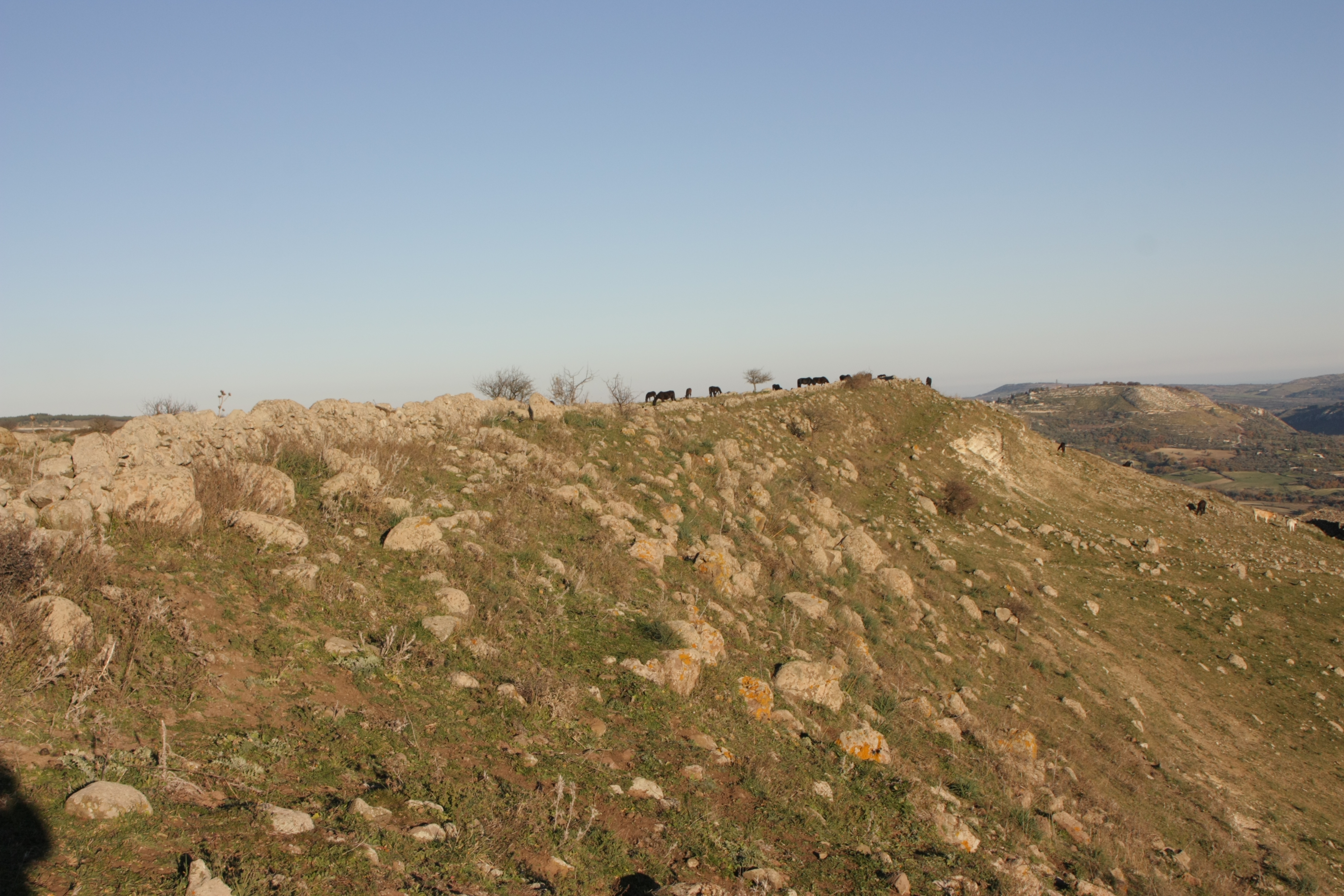
The Hyblaean Mountains ( scn, Munt'Ibblei; it, Monti Iblei; la, Hyblaei montes) is a mountain range in south-eastern Sicily, Italy. It straddles the provinces of Ragusa, Syracuse and Catania. The highest peak of the range is Monte Lauro, at 986 m. History The name derives from the Siculi king Hyblon, who gave a portion of his territory to Greek colonists to build the town of Megara Hyblaea. Geology The range is composed of white limestone rocks, characterized by Karst topography. Originally a plateau, rivers have eroded the landscape, forming numerous deep canyons. In the coastal area sandstone is also present. In some areas, such as that of Monte Lauro (once part of a submerged volcanic complex), volcanic rocks are also present. The hyblaean area is characterized by a high seismic risk. Landscape The Hyblaean Mountains are characterized by gentle slopes, interrupted by sharp valleys. In the central area are numerous woods which are intermingled with dry stone walls of ... [...More Info...] [...Related Items...] OR: [Wikipedia] [Google] [Baidu] |
Province Of Ragusa
The Province of Ragusa ( it, Provincia di Ragusa; Sicilian: ''Pruvincia 'i Rausa'') was a province in the autonomous region of Sicily in southern Italy, located in the south-east of the island. Following the abolition of the Sicilian provinces, it was replaced in 2015 by the Free municipal consortium of Ragusa. Its capital is the city of Ragusa, which is the most southerly provincial capital in Italy. Geography From Scoglitti to Pozzallo, the Ragusan coastline is approximately long. Along the Ragusan coast are many fishing villages such as Kaukana, Punta Secca, Marina di Ragusa and Marina di Modica. The Hyblaean Mountains are dominating the north of the province and its highest peaks are Monte Lauro, Monte Casale and Monte Arcibessi. The rivers of the province are the Irminio, Dirillo and Ippari and the only lake in the province is the Lago di Santa Rosalia along the course of the Irminio river. The skyline of Ragusa is punctuated by the towers, domes and cupolas of the many ch ... [...More Info...] [...Related Items...] OR: [Wikipedia] [Google] [Baidu] |
Citrus Fruit
''Citrus'' is a genus of flowering trees and shrubs in the rue family, Rutaceae. Plants in the genus produce citrus fruits, including important crops such as oranges, lemons, grapefruits, pomelos, and limes. The genus ''Citrus'' is native to South Asia, East Asia, Southeast Asia, Melanesia, and Australia. Various citrus species have been used and domesticated by indigenous cultures in these areas since ancient times. From there its cultivation spread into Micronesia and Polynesia by the Austronesian expansion (c. 3000–1500 BCE); and to the Middle East and the Mediterranean (c. 1200 BCE) via the incense trade route, and onwards to Europe and the Americas. History Citrus plants are native to subtropical and tropical regions of Asia, Island Southeast Asia, Near Oceania, and northeastern Australia. Domestication of citrus species involved much hybridization and introgression, leaving much uncertainty about when and where domestication first happened. A genomic, phylogenic, and ... [...More Info...] [...Related Items...] OR: [Wikipedia] [Google] [Baidu] |
Monte Raci
Monte Raci is a mountain reaching 610 metres located in the Sicilian province of Ragusa and is one of the Hyblaen chain. It is located in the Chiaramonte Gulfi commune A commune is an alternative term for an intentional community. Commune or comună or comune or other derivations may also refer to: Administrative-territorial entities * Commune (administrative division), a municipality or township ** Communes of .... Due to its rounded shape Monte Raci has been the subject of many photographers and advertising material. References {{Reflist Raci Province of Ragusa ... [...More Info...] [...Related Items...] OR: [Wikipedia] [Google] [Baidu] |
Serra Brugio
Serra (Latin for "saw") may refer to: People * Serra (footballer) (born 1961), Portuguese footballer * Serra (surname) * Serra (given name) Cities, towns, municipalities Brazil *Serra, Espírito Santo, a city in the Greater Vitória area *Amparo do Serra, in Minas Gerais * Araçoiaba da Serra, in São Paulo * Itapecerica da Serra, in São Paulo * Mirante da Serra, in Rondônia *Natividade da Serra, in São Paulo * Pé de Serra, in Bahia * Redenção da Serra, in São Paulo * Rio Grande da Serra, in São Paulo *Santa Maria da Serra, in São Paulo * São Lourenço da Serra, in São Paulo *Serra Azul, in São Paulo * Serra do Navio, in Amapá * Serra do Navio, in Amapá * Serra Negra, in São Paulo *Serra Talhada, in Pernambuco * Taboão da Serra, in São Paulo Italy * La Serra, San Miniato, in Tuscany * Serra (Rocca Santa Maria), in Abruzzo *Serra d'Aiello, in Calabria *Serra de' Conti, in Marche *Serra Pedace, in Calabria *Serra Riccò, in Liguria *Serra San Bruno Serra San ... [...More Info...] [...Related Items...] OR: [Wikipedia] [Google] [Baidu] |
Monte Arcibessi
Monte Arcibessi is a mountain located in the Sicilian province of Ragusa and is one of the highest peaks in the Hyblaen Mountain chain. It stretches between the Chiaramonte Gulfi and Ragusa communes. With its adjacent mountains, Monte Arcibessi is a part of the Miocene volcanic submarine complex, but they are no longer active. There are fortified settlements (''castellieri'') of the Bronze Age and Iron Age in the area of Monte Arcibessi. Prehistoric inhabitants, remnants of Archaic Greek settlements, signs from the Hellenistic and Roman Roman or Romans most often refers to: *Rome, the capital city of Italy *Ancient Rome, Roman civilization from 8th century BC to 5th century AD *Roman people, the people of ancient Rome *'' Epistle to the Romans'', shortened to ''Romans'', a lette ... periods and Byzantine and Medieval remains. As one of the highest in the area, it is the site of numerous antenna installations for radio stations and television transmitters. References {{ ... [...More Info...] [...Related Items...] OR: [Wikipedia] [Google] [Baidu] |
Monte Casale
Monte Casale is a mountainous elevation on Sicily in Italy, reaching 910m above sea level, which (with the neighbouring Monte Lauro) formed part of the oldest volcanic formation of the Hyblaean Mountains. Their peaks form the boundary between the present-day provinces of Syracuse and Ragusa and the watershed between the Irminio and Anapo rivers. It is notable for its important archaeological remains, discovered by Paolo Orsi early in the 20th century and identified by him with the ancient Greek city of Casmene Casmenae or Kasmenai ( grc, Κασμέναι, Casmene in Italian) was an ancient Greek colony located on the Hyblaean Mountains, founded in 644 BC by the Syracusans at a strategic position for the control of central Sicily. It was also inte .... {{coord, 37, 05, 47, N, 14, 49, 17, E, type:mountain_source:kolossus-itwiki, display=title Casale ... [...More Info...] [...Related Items...] OR: [Wikipedia] [Google] [Baidu] |
Ispica
Ispica (, ) is a city and ''comune'' in the south of Sicily, Italy. It is from Ragusa, from Syracuse, and away from La Valletta, on the coast of Malta. The first mention in a document of Ispica occurred in 1093, in a list of churches and ecclesiastic departments for administrative purposes, but the territory has been colonized since the Bronze Age. The city is located on a hill. The main economical activity consists of farming and organic products, especially carrot, zucchini, tomatoes, olives, vineyards. Ispica is the largest producer of organic carrot of southern Italy with about 18,000 tons of annual production. There is of coastline, most of which is sand and dunes, and an island (Porri island) at from the coast. The town also hosts examples of Sicilian Baroque architecture such as the Vincenzo Sinatra's Basilica di Santa Maria Maggiore, the Annunziata Church, the Carmine monastery, and the St. Barthelemy cathedral. Ispica was destroyed by the 1693 Sicily earthqua ... [...More Info...] [...Related Items...] OR: [Wikipedia] [Google] [Baidu] |
Necropolis Of Pantalica
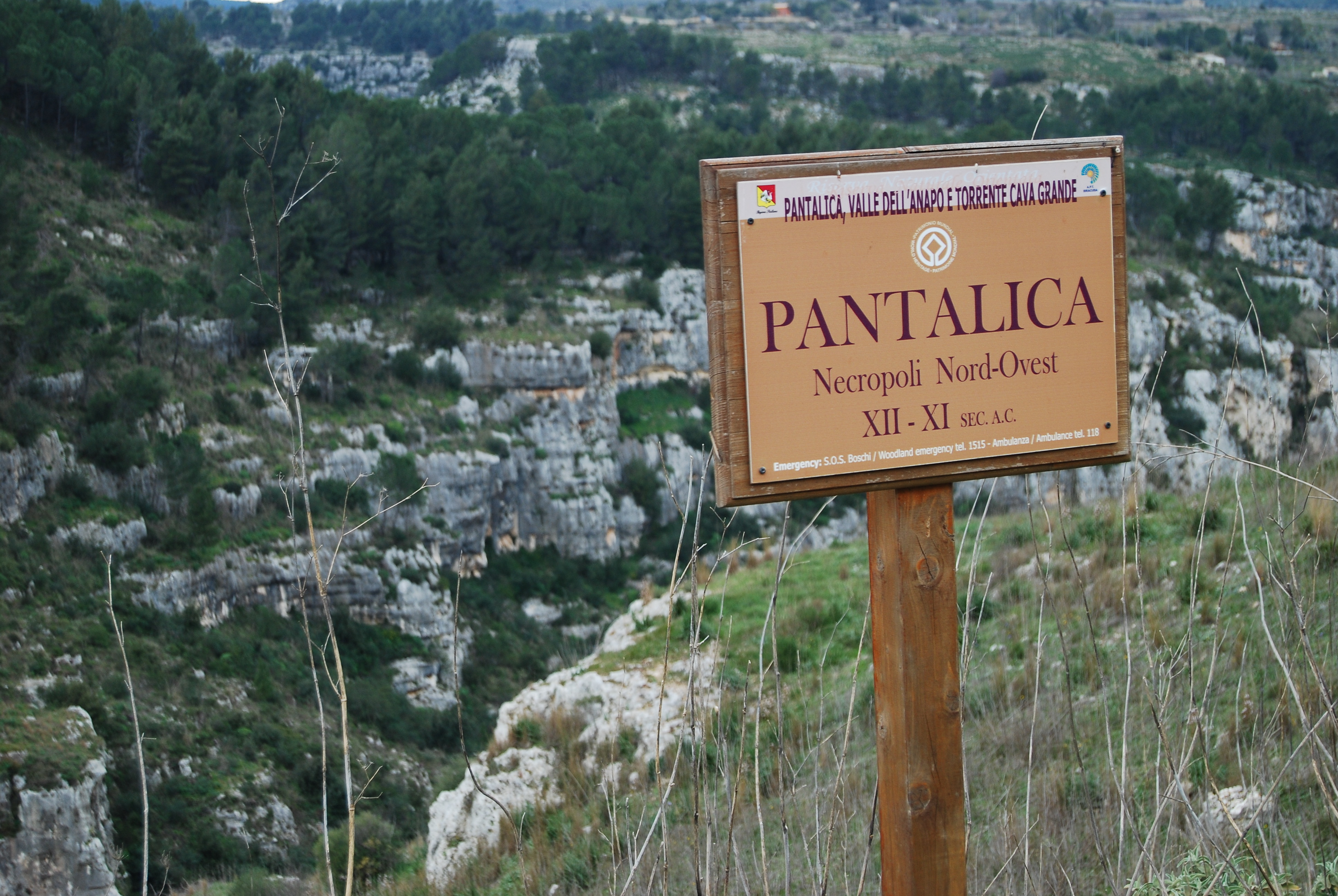
The Necropolis of Pantalica is a collection of cemeteries with rock-cut chamber tombs in southeast Sicily, Italy. Dating from the 13th to the 7th centuries BC, there was thought to be over 5,000 tombs, although the most recent estimate suggests a figure of just under 4,000. They extend around the flanks of a large promontory located at the junction of the Anapo river with its tributary, the Calcinara, about northwest of Syracuse. Together with the city of Syracuse, Pantalica was listed as a UNESCO World Heritage Site in 2005. Geography Pantalica is located on a limestone promontory surrounded by a deep gorge formed by the Anapo and Calcinara rivers between the towns of Ferla and Sortino in south-eastern Sicily. In addition to its archaeological interest it is an important nature reserve (Riserva Naturale Orientata Pantalica), with a variety of local flora and fauna and natural caves (notably the Grotta dei Pipistrelli (Bat Cave)). Various pathways facilitate visitor access, inclu ... [...More Info...] [...Related Items...] OR: [Wikipedia] [Google] [Baidu] |
Palazzolo Acreide
Palazzolo Acreide ( Sicilian: ''Palazzolu'', in the local dialect: ''Palazzuolu'') is a town and ''comune'' in the Province of Syracuse, Sicily (southern Italy). It is from the city of Syracuse in the Hyblean Mountains. History The area around Palazzolo Acreide has been inhabited since ancient times. In the 10th-11th centuries BC, the Sicels lived here in small villages. The town occupies the site of the ancient Akrai (Latin ''Acrae''), founded by Syracuse around 664 BC. The city was important as it controlled the paths of communication between the towns on the southern coast of the island. According to Thucydides, the Syracusans defeated the Athenians here in 413 BC. In the treaty between the Romans and Hiero II of Syracuse in 263 BC it was assigned to the latter. After the Roman conquest, it became a ''civitas stipendiaria'', and was still prospering in the course of the early Christian age. The old city was probably destroyed by the Arabs, in the first ... [...More Info...] [...Related Items...] OR: [Wikipedia] [Google] [Baidu] |
Modica
Modica (; scn, Muòrica) is a city and ''comune'' of 54,456 inhabitants in the Province of Ragusa, Sicily, southern Italy. The city is situated in the Hyblaean Mountains. Modica has neolithic origins and it represents the historical capital of the area which today almost corresponds to the Province of Ragusa. Until the 19th century it was the capital of a County that exercised such a wide political, economical and cultural influence to be counted among the most powerful feuds of the Mezzogiorno. Rebuilt following the devastating earthquake of 1693, its architecture has been recognised as providing outstanding testimony to the exuberant genius and final flowering of Baroque art in Europe and, along with other towns in the Val di Noto, is part of UNESCO Heritage Sites in Italy. History According to Thucydides, the city was founded in 1360 BC or 1031 BC and was inhabited by the Sicels in the 7th century BC. It was probably a dependency of Syracuse. Modica was occupied by the R ... [...More Info...] [...Related Items...] OR: [Wikipedia] [Google] [Baidu] |
Ragusa, Italy
Ragusa (; scn, Rausa ; la, Ragusia) is a city and ''comune'' in southern Italy. It is the capital of the province of Ragusa, on the island of Sicily, with 73,288 inhabitants in 2016. It is built on a wide limestone hill between two deep valleys, Cava San Leonardo and Cava Santa Domenica. Together with seven other cities in the Val di Noto, it is part of a World Heritage Site, UNESCO World Heritage Site. History The origins of Ragusa can be traced back to the 2nd millennium BC, when there were several Sicel settlements in the area. The current district of Ragusa Ibla has been identified as Hybla Heraea. The ancient city, located on a hill, came into contact with nearby Greek colonies, and grew thanks to the nearby port of Camerina. After a short period of Carthago, Carthaginian rule, it fell into the hands of the ancient Romans and the Byzantine Empire, Byzantines, who fortified the city and built a large castle. Ragusa was occupied by the Arabs in 848 Common Era, AD an ... [...More Info...] [...Related Items...] OR: [Wikipedia] [Google] [Baidu] |
Cassaro
Cassaro ( Sicilian: ''Càssaru'', in the local dialect: ''Càssuru'') is a town and ''comune'' (municipality) in the Province of Syracuse, Sicily (Italy). The name is originally from the Arabic word القصر (''al-Qasru'') meaning "the castle." Cassaro is from Ragusa and west of the city of Siracusa. Cassaro has 859 inhabitants. History According to the Capibreve of Silvestri, in the Middle Ages the town belonged to the Spadafora family. Margherita Moleti Spadafora married the Baron Pietro Siracusa, who belonged to one of the oldest families in the town of Noto and was also Baron of Monastero and Xiridia. The Siracusa dynasty (formerly known as "Zaragoza") is of Spanish origin, documented in Sicily since 1283. Members of this Family has been also the lords of ollesano counts of Villalta and duque of Casteldimirto. Records are in the State Archiv of Palermo (''Fondo Protonotaro''). Beatrice Siracusa, the only daughter of the above-mentioned Pietro and Margherita Siracusa (wh ... [...More Info...] [...Related Items...] OR: [Wikipedia] [Google] [Baidu] |


.jpg)