|
I-605
Interstate 605 (abbreviated I-605, officially known as the San Gabriel River Freeway) is a major north–south auxiliary Interstate Highway in the Greater Los Angeles urban area of Southern California. It runs from I-405 and State Route 22 (SR 22) in Seal Beach to I-210 in Duarte. The San Gabriel River Freeway closely parallels the San Gabriel River for most of its alignment, hence its name, which is one of the few Southern California freeways not named after a city along its route. Aside from changes to the interchange with I-105 (which did not open until the early 1990s), and the addition of an HOV lane between I-405 and I-10, I-605 is one of the only remaining freeways that kept its original alignment throughout its run through Los Angeles County since it first opened. Route description The California Streets and Highways Code defines Route 605 as "(a) Route 1 near Seal Beach to Route 405. (b) Route 405 to Route 210 near Duarte." However, the portion in su ... [...More Info...] [...Related Items...] OR: [Wikipedia] [Google] [Baidu] |
Interstate 405 (California)
Interstate 405 (I-405) is a major north–south auxiliary Interstate Highway in Southern California. The entire route is known as the northern segment of the San Diego Freeway. I-405 is a bypass auxiliary route of I-5, running along the southern and western parts of the Greater Los Angeles urban area from Irvine in the south to near San Fernando in the north. I-405, heavily traveled by both commuters and freight haulers along its entire length, is the busiest and most congested freeway in the United States. The freeway's annual average daily traffic between exits 21 and 22 in Seal Beach reached 374,000 in 2008, making it the highest count in the nation. It has played a crucial role in the development of dozens of cities and suburbs along its route through Los Angeles and Orange counties. It also serves Los Angeles International Airport (LAX), Long Beach Airport (LGB) and Orange County's John Wayne Airport (SNA). Route description Orange County I-405 begins at the E ... [...More Info...] [...Related Items...] OR: [Wikipedia] [Google] [Baidu] |
California State Route 22
State Route 22 (SR 22) is an east–west state highway in the U.S. state of California that serves southern Los Angeles County and northern Orange County. It runs between Pacific Coast Highway ( State Route 1) in Long Beach and the Costa Mesa Freeway ( State Route 55) in Orange by way of Garden Grove. The westernmost part of SR 22 runs along Long Beach's 7th Street. From West Garden Grove to its eastern terminus in Orange, it is known as the Garden Grove Freeway. It is one of the two principal east–west routes in Orange County (the other being SR 91 approximately to the north). Route description SR 22 begins at the intersection of 7th Street and Pacific Coast Highway ( State Route 1) in Long Beach. Then, 7th Street widens from an expressway into a freeway just before crossing the San Gabriel River (and with it, the Los Angeles/Orange County line). It then merges with the San Diego Freeway ( Interstate 405) at the Interstate 605 interchange and runs concurrently w ... [...More Info...] [...Related Items...] OR: [Wikipedia] [Google] [Baidu] |
Interstate 5 In California
Interstate 5 (I-5) is a major north–south route of the Interstate Highway System in the United States, stretching from the Mexican border at the San Ysidro crossing to the Canadian border near Blaine, Washington. The segment of I-5 in California runs across the length of the state from San Ysidro to the Oregon state line south of the Medford- Ashland metropolitan area. It is the longest interstate in California, and accounts for more than half of I-5's total length. It is the more important and most-used of the two major north–south routes on the Pacific Coast, the other being U.S. Route 101 (US 101), which is primarily coastal. I-5 links the major California cities of San Diego, Santa Ana, Los Angeles, Stockton, Sacramento, and Redding. The San Francisco Bay Area is about west of the highway. I-5 is known colloquially as "the 5" to Southern California residents and "5" to Northern California residents due to varieties in California English. I-5 als ... [...More Info...] [...Related Items...] OR: [Wikipedia] [Google] [Baidu] |
Foothill Freeway
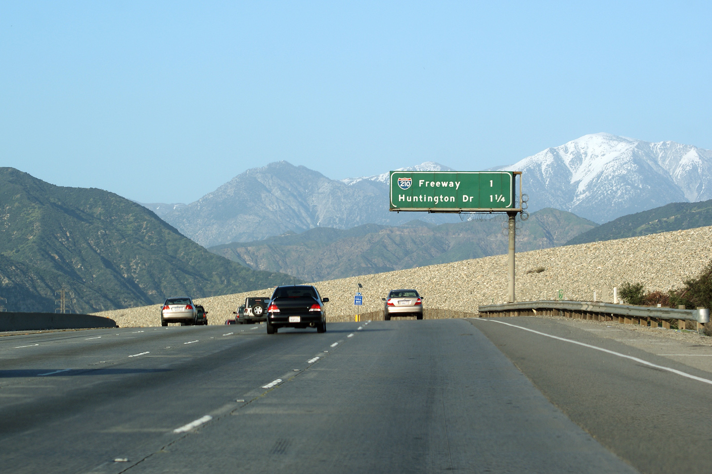
The Foothill Freeway is a freeway in the Los Angeles metropolitan area, California, running from the Sylmar district of Los Angeles east to Redlands. The western segment is signed as Interstate 210 (I-210) from its western end at I-5 to SR 57 in Glendora, while the eastern segment is signed as State Route 210 (SR 210) to its eastern terminus at I-10. Under the California Streets and Highways Code, the entire Foothill Freeway is legally referred to as Route 210. The Foothill Freeway name is a reference to Foothill Boulevard and the San Gabriel Mountains, both of which the freeway runs parallel to for most of its length. The freeway follows the foothills of these mountains, connecting the northeastern suburbs of Los Angeles with the Inland Empire. Historically, the Foothill Freeway spanned multiple numerical designations. Additionally, the I-210 designation has changed routings, previously including a portion of what is now the Orange Freeway (SR 5 ... [...More Info...] [...Related Items...] OR: [Wikipedia] [Google] [Baidu] |
Interstate 210 (California)
The Foothill Freeway is a freeway in the Los Angeles metropolitan area, California, running from the Sylmar district of Los Angeles east to Redlands. The western segment is signed as Interstate 210 (I-210) from its western end at I-5 to SR 57 in Glendora, while the eastern segment is signed as State Route 210 (SR 210) to its eastern terminus at I-10. Under the California Streets and Highways Code, the entire Foothill Freeway is legally referred to as Route 210. The Foothill Freeway name is a reference to Foothill Boulevard and the San Gabriel Mountains, both of which the freeway runs parallel to for most of its length. The freeway follows the foothills of these mountains, connecting the northeastern suburbs of Los Angeles with the Inland Empire. Historically, the Foothill Freeway spanned multiple numerical designations. Additionally, the I-210 designation has changed routings, previously including a portion of what is now the Orange Freeway (SR ... [...More Info...] [...Related Items...] OR: [Wikipedia] [Google] [Baidu] |
Orange County, California
Orange County is located in the Los Angeles metropolitan area in Southern California. As of the 2020 census, the population was 3,186,989, making it the third-most-populous county in California, the sixth-most-populous in the United States, and more populous than 19 American states and Washington, D.C. Although largely suburban, it is the second-most-densely-populated county in the state behind San Francisco County. The county's three most-populous cities are Anaheim, Santa Ana, and Irvine, each of which has a population exceeding 300,000. Santa Ana is also the county seat. Six cities in Orange County are on the Pacific coast: Seal Beach, Huntington Beach, Newport Beach, Laguna Beach, Dana Point, and San Clemente. Orange County is included in the Los Angeles-Long Beach- Anaheim Metropolitan Statistical Area. The county has 34 incorporated cities. Older cities like Old Town Tustin, Santa Ana, Anaheim, Orange, and Fullerton have traditional downtowns dating back to the 19th ... [...More Info...] [...Related Items...] OR: [Wikipedia] [Google] [Baidu] |
Southern California Freeways
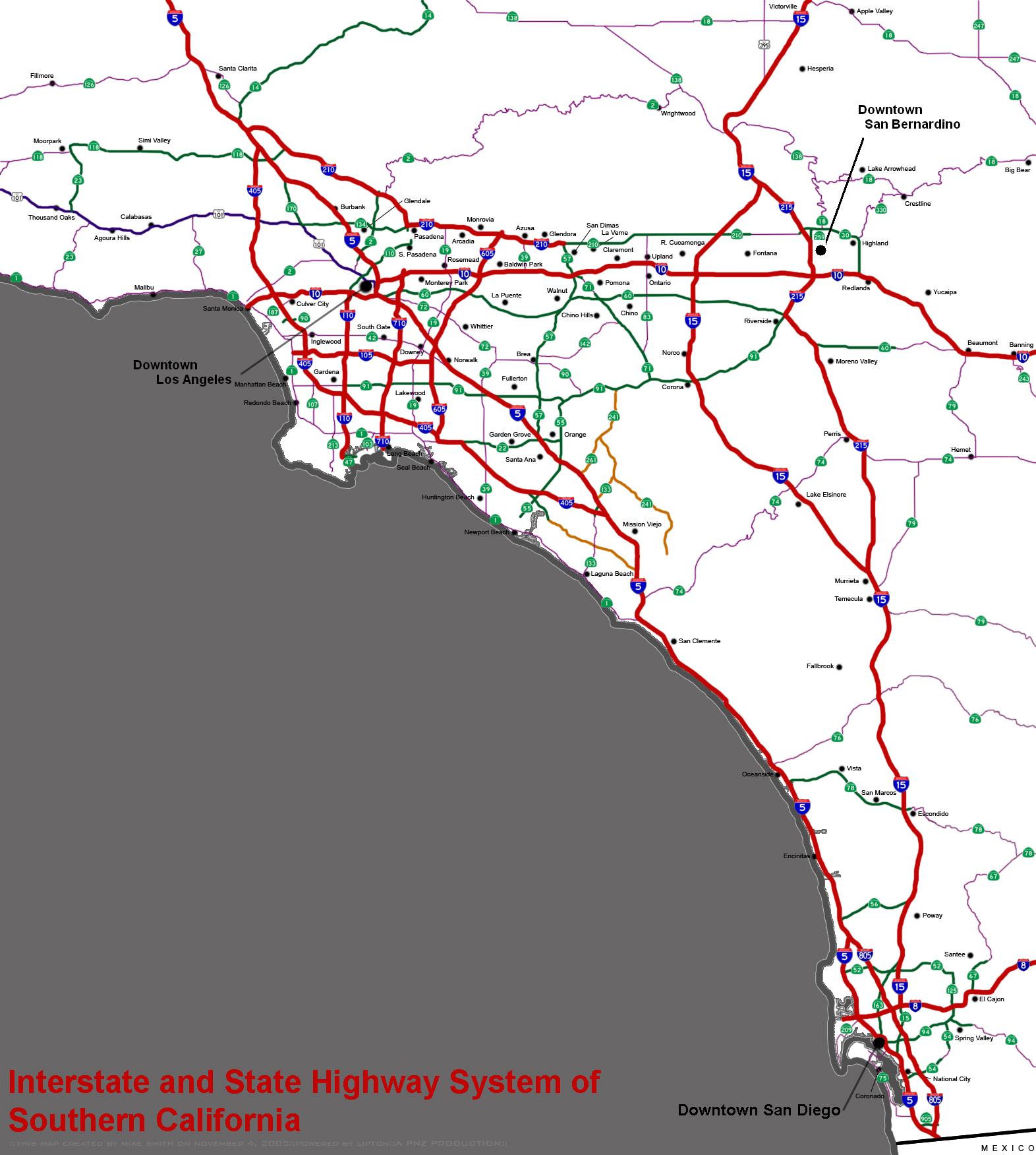
The Southern California freeways are a vast network of interconnected freeways in the megaregion of Southern California, serving a population of 23 million people. The Master Plan of Metropolitan Los Angeles Freeways was adopted by the Regional Planning Commission in 1947 and construction began in the early 1950s. The plan hit opposition and funding limitations in the 1970s, and by 2004, only some 61% of the original planned network had been completed. The region is well known for its freeways, and they are considered a cultural touchstone. History Origins Southern California's romance with the automobile owes in large part to resentment of the Southern Pacific Railroad's tight control over the region's commerce in the late 19th and early 20th centuries. During his successful campaign for governor in 1910, anti-Southern Pacific candidate Hiram Johnson traveled the state by car, which was no small feat at that time. In the minds of Southlanders, this associated the autom ... [...More Info...] [...Related Items...] OR: [Wikipedia] [Google] [Baidu] |
Norwalk, California
Norwalk is a city in Los Angeles County, California, Los Angeles County, California, United States. The population was 105,549 at the 2010 United States Census, 2010 census and an estimated 103,949 in 2019. It is the 58th most densely-populated city in California. Founded in the late 19th century, Norwalk was incorporated as a city in 1957. It is located southeast of downtown Los Angeles and is part of the Greater Los Angeles area. Norwalk is a member of the Gateway Cities Council of Governments. Norwalk's sister cities are Morelia in the Mexican state of Michoacán, and Hermosillo, in the Mexican state of Sonora. History The area known as "Norwalk" was first home to the Shoshonean Native American tribe. They survived primarily on honey, an array of berries, acorns, sage, squirrels, rabbits and birds. Their huts were part of the Sejat Indian village. In the late 1760s, settlers and missions flourished under Spanish rule with the famous El Camino Real (California), El Cam ... [...More Info...] [...Related Items...] OR: [Wikipedia] [Google] [Baidu] |
Whittier, California
Whittier () is a city in Southern California in Los Angeles County, California, Los Angeles County, part of the Gateway Cities. The city had 87,306 residents as of the 2020 United States census, an increase of 1,975 from the 2010 United States census, 2010 census figure. Whittier was incorporated in February 1898 and became a charter city in 1955. The city is named for the Quaker poet John Greenleaf Whittier and is home to Whittier College. Etymology In the founding days of Whittier, when it was a small isolated town, Jonathan Bailey and his wife, Rebecca, were among the first residents. They followed the Quaker religious faith and practice, and held religious meetings on their porch. Other early settlers, such as Aquila Pickering, espoused the Quaker faith. As the city grew, the citizens named it after John Greenleaf Whittier, a respected Quaker poet, and deeded a lot to him. Whittier wrote a dedication poem, and is honored today with statues and a small exhibit at the Whittie ... [...More Info...] [...Related Items...] OR: [Wikipedia] [Google] [Baidu] |
Avocado Heights, California
Avocado Heights () is an unincorporated census-designated place (CDP) in the San Gabriel Valley of Los Angeles County, California, United States. It is almost entirely surrounded by the City of Industry with only a small strip of unincorporated Los Angeles County separating it from South El Monte. It is in close proximity to both the Pomona (SR-60) and San Gabriel (I-605) freeways. To the west is the San Gabriel River and the California Country Club. Avocado Heights is approximately from the downtown Los Angeles Civic Center. The population was 15,411 at the 2010 census, up from 15,148 at the 2000 census. A significant portion of Avocado Heights remains equestrian and semi-rural, with many homes on lots of 0.5 acres or more. The proximity of polluting industries in what became the City of Industry, as well as the Puente Hills Landfill, suppressed property values throughout the post-World War II era—discouraging the development that transformed most of the San Gabriel Valley ... [...More Info...] [...Related Items...] OR: [Wikipedia] [Google] [Baidu] |
List Of Auxiliary Interstate Highways
Auxiliary Interstate Highways (also called three-digit Interstate Highways) are a supplemental subset of the freeways within the Interstate Highway System of the United States. Auxiliary routes are generally classified as spur routes, which connect to the parent route at one end, bypasses, which connect to the parent route at both ends, or beltways, which form a complete circle intersecting the parent route at two locations. There are 323 auxiliary Interstates in the United States. There are some routes which connect to the parent route at one end, but connect to another route at the other end; some states treat these as spurs while others treat them as bypasses. Similar to the mainline Interstate Highways, these highways also meet all Interstate Highway standards (with rare exceptions), and they receive the same percentage of federal funding (90%). The shorter auxiliary routes branch off main routes and are numbered based on the number of the parent route. All of the supple ... [...More Info...] [...Related Items...] OR: [Wikipedia] [Google] [Baidu] |
Greater Los Angeles
Greater Los Angeles is the second-largest metropolitan region in the United States with a population of 18.5 million in 2021, encompassing five counties in Southern California extending from Ventura County in the west to San Bernardino County and Riverside County in the east, with Los Angeles County in the center and Orange County to the southeast. According to the U.S. Census Bureau, the Los Angeles–Anaheim–Riverside combined statistical area covers , making it the largest metropolitan region in the United States by land area. Of this, the contiguous urban area is , the remainder mostly consisting of mountain and desert areas. In addition to being the nexus of the global entertainment industry (films, television, and recorded music), Greater Los Angeles is also an important center of international trade, education, media, business, tourism, technology, and sports. It is the 3rd largest metropolitan area by nominal GDP in the world with an economy exceeding $1 trillion ... [...More Info...] [...Related Items...] OR: [Wikipedia] [Google] [Baidu] |


