|
I-580 (NV)
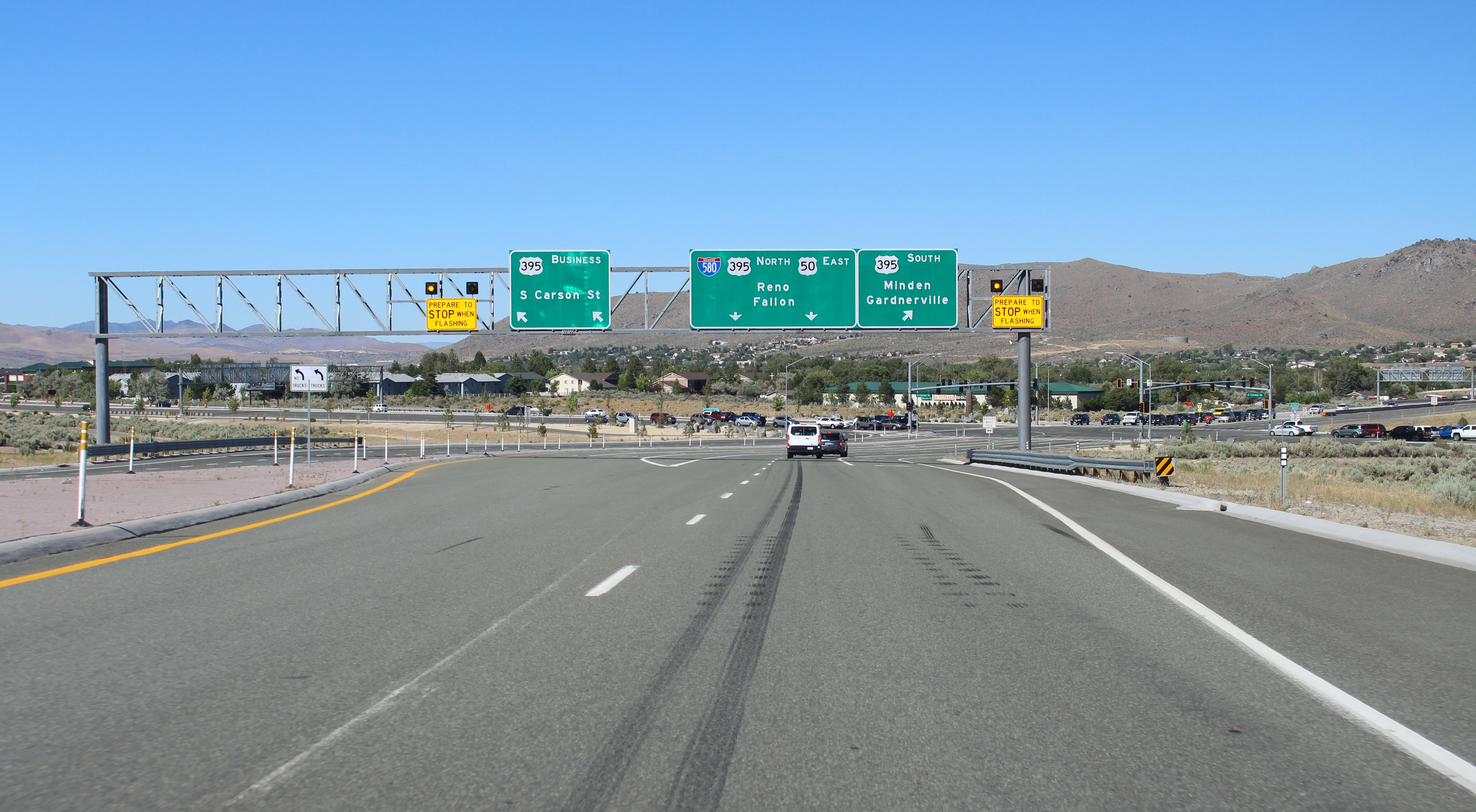
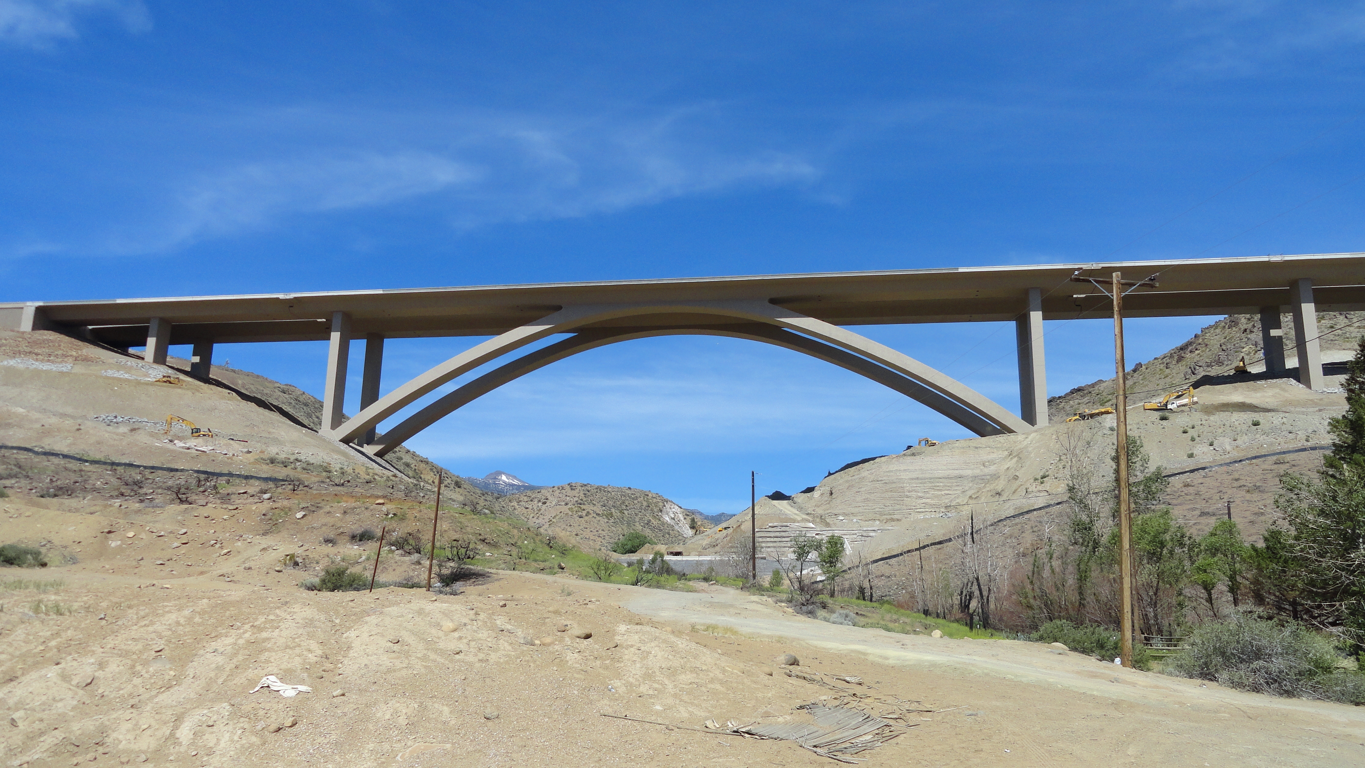
Interstate 580 (I-580) is a auxiliary Interstate Highway in Western Nevada. It runs concurrency (road), concurrently with U.S. Route 395 in Nevada, US Route 395 (US 395) from an intersection with U.S. Route 50 in Nevada, US 50 near the southern boundary of Carson City, Nevada, Carson City to the Reno Spaghetti junction, Spaghetti Bowl interchange with Interstate 80 in Nevada, I-80 in Reno, Nevada, Reno. The freeway provides a high-speed direct route between Lake Tahoe and Carson City to Reno and I-80. Construction on a freeway between Carson City and Reno was planned since 1956, but construction did not occur until 1964. The freeway opened in sections, with the final section opening on August 2, 2017. The I-580 designation was approved on October 27, 1978, but the freeway was not signed as such until the portion between Reno and Carson City was completed following the opening of the Galena Creek Bridge in late August 2012. Route description I-580 runs from ... [...More Info...] [...Related Items...] OR: [Wikipedia] [Google] [Baidu] |
Federal Highway Administration
The Federal Highway Administration (FHWA) is a division of the United States Department of Transportation that specializes in highway transportation. The agency's major activities are grouped into two programs, the Federal-aid Highway Program and the Federal Lands Highway Program. Its role had previously been performed by the Office of Road Inquiry, Office of Public Roads and the Bureau of Public Roads. History Background The organization has several predecessor organizations and complicated history. The Office of Road Inquiry (ORI) was founded in 1893. In 1905, that organization's name was changed to the Office of Public Roads (OPR) which became a division of the United States Department of Agriculture. The name was changed again to the Bureau of Public Roads in 1915 and to the Public Roads Administration (PRA) in 1939. It was then shifted to the Federal Works Agency which was abolished in 1949 when its name reverted to Bureau of Public Roads under the Department of Commerce ... [...More Info...] [...Related Items...] OR: [Wikipedia] [Google] [Baidu] |
Cathedral Arch
A cathedral arch is an arch used in bridge architecture. It consists of an arched structural system, wherein vertical load bearing occurs only at the crown, or peak of the arch. As applied to bridge design, cathedral arch bridges feature no intermediary spandrel column elements between the foundation abutments and the crown of the arch system, where the roadway superstructure is constrained to the substructure. The largest cathedral arch bridge in the world is the Galena Creek Bridge near Reno, Nevada Reno ( ) is a city in the northwest section of the U.S. state of Nevada, along the Nevada-California border, about north from Lake Tahoe, known as "The Biggest Little City in the World". Known for its casino and tourism industry, Reno is the .... References {{Reflist, refs= {{cite web, url=http://www.aspirebridge.org/pdfs/magazine/issue_13/galena_creek_win10.pdf, title=Nevada's Galena Creek Bridge, last=Durski, first=Brad F., date=Winter 2010, accessdate=2012-06-18, wor ... [...More Info...] [...Related Items...] OR: [Wikipedia] [Google] [Baidu] |
Sun Valley, Nevada
Sun Valley is a census-designated place (CDP) in Washoe County, Nevada, United States. The population was 19,299 at the 2010 census. It is north of Reno and is part of the Reno– Sparks Metropolitan Statistical Area. Geography The community is located within Sun Valley approximately three miles north of Reno on Nevada State Route 443.''Nevada Atlas & Gazetteer,'' DeLorme, 8th ed, 2012, p. 42 According to the United States Census Bureau, the CDP has a total area of , all land. Demographics As of the census of 2000, there were 19,461 people, 6,380 households, and 4,816 families living in the CDP. The population density was 1,297.2 inhabitants per square mile (500.9/km). There were 6,703 housing units at an average density of 446.8 per square mile (172.5/km). The racial makeup of the CDP was 79.78% White, 2.20% African American, 1.93% Native American, 2.21% Asian, 0.62% Pacific Islander, 9.51% from other races, and 3.74% from two or more races. Hispanic or Latino of any ra ... [...More Info...] [...Related Items...] OR: [Wikipedia] [Google] [Baidu] |
Regional Transportation Commission Of Washoe County
The Regional Transportation Commission of Washoe County (RTC) is the public body responsible for the transportation needs throughout Reno, Sparks and Washoe County, Nevada. The RTC, founded by the Nevada Legislature in 1979, is an amalgamation of the Regional Street and Highway Commission, the Regional Transit Commission and the Washoe County Area Transportation Study Policy Committee. They provide public transportation services, street and highway construction, and transportation planning. In , the system had a ridership of , or about per weekday as of . Public transportation RTC Ride RTC RIDE is the public transit bus system. From its inception as Citifare in the late 1970s, the system has since been rebranded and has grown to include a service area of approximately and an annual ridership of 8.5 million. History = Citifare era (1978–2004) = During the early part of the 20th century, streetcars provided public transportation between Reno and Sparks and served Downtow ... [...More Info...] [...Related Items...] OR: [Wikipedia] [Google] [Baidu] |
Reno–Tahoe International Airport
Reno–Tahoe International Airport is a public and military airport southeast of downtown Reno, in Washoe County, Nevada, United States. It is the state's second busiest commercial airport after Harry Reid International Airport in Las Vegas. The Nevada Air National Guard has the 152nd Airlift Wing southwest of the airport's main terminal. The airport is named after both the City of Reno, Nevada and Lake Tahoe. The airspace of Reno-Tahoe Airport is controlled by the Northern California TRACON and Oakland Air Route Traffic Control Center. History Early years The airport was built in 1929 by Boeing Transport Inc. and named Hubbard Field after Boeing Air Transport VP and air transport pioneer Eddie Hubbard. It was acquired by United Airlines in 1936 and purchased by the City of Reno in 1953. The August 1953 OAG shows 15 scheduled departures each weekday; ten years later there were 28. Jets (United 727s) arrived in June 1964; runway 16 (now 16R) was extended southward from 7800 to ... [...More Info...] [...Related Items...] OR: [Wikipedia] [Google] [Baidu] |
Meadowood Mall
Meadowood Mall is a one-level, super-regional mall in Reno, Nevada, managed by Simon Property Group, which owns 50% of it. Meadowood Mall contains 125 retailers and restaurants and it is anchored by Macy's Women, Macy's Men/Home, JCPenney, and Dick's Sporting Goods. History Meadowood Mall opened in March 1979 anchored by JCPenney, Liberty House, and Macy's. Liberty House closed in 1983 and Macy's South moved in the following year. The mall added a Copeland's Sporting Goods Superstore in 1989 as a fourth anchor. An expansion in 1995 added Sears as a fifth anchor, with additional in-line shops, and the Palms Food Court, now no longer referred to as Palms Food Court after the 2013 renovation. Following Copeland's bankruptcy filing in 2006, the company was acquired by Sports Authority. Meadowood Mall's superstore was subsequently re-branded, despite Sports Authority having a stand-alone location less than a mile away. Due to operating costs of having two stores in such a close pro ... [...More Info...] [...Related Items...] OR: [Wikipedia] [Google] [Baidu] |
The Summit (Reno, Nevada)
The Summit Reno is an upscale lifestyle center located in Reno, Nevada. The center opened in 2007 and it is owned by Birmingham, Alabama-based Bayer Properties. It offers more than 65 stores with different goods. It is located on the address of 13925 South Virginia Street - NV 89511. The venues that can be found there are both retail shops and dining restaurants. Sometimes, fountains, and live music are featured, especially during holiday shopping. The Reno Summit is also known for the Century Summit Movie theater, which often showcases the premiering movies from Hollywood. Anchor tenants * Century Theatres * Dillard's * Old Navy * Orvis See also * The Summit (Birmingham) * Paddock Shops, formerly known as The Summit of Louisville * Meadowood Mall Meadowood Mall is a one-level, super-regional mall in Reno, Nevada, managed by Simon Property Group, which owns 50% of it. Meadowood Mall contains 125 retailers and restaurants and it is anchored by Macy's Women, Macy's Men/Home, ... [...More Info...] [...Related Items...] OR: [Wikipedia] [Google] [Baidu] |
Nevada State Route 430
U.S. Route 395 Business (US 395 Bus.) is a north–south state highway in Reno, Nevada. The highway follows Virginia Street, the primary north–south arterial street of the area. US 395 is also designated as State Route 430 (SR 430) from its intersection with SR 659 (McCarran Boulevard) to its northern terminus at US 395. US 395 Bus. is the former alignment of US 395 through Reno before the construction of a new freeway alignment through the city. The route passes through the heart of Reno and is notable for passing through popular tourist landmarks. Route description As Virginia Street passes north under Interstate 580 (I-580) and US 395 freeway on the south end of Reno, the US 395 Bus. designation begins along the road (concurrent with US 395 Alternate, US 395 Alt.). The roadway turns slightly westward as it travels further north into Reno. In about , the highway again meets the I-580/US 395 freeway. The alternate r ... [...More Info...] [...Related Items...] OR: [Wikipedia] [Google] [Baidu] |
Virginia City, Nevada
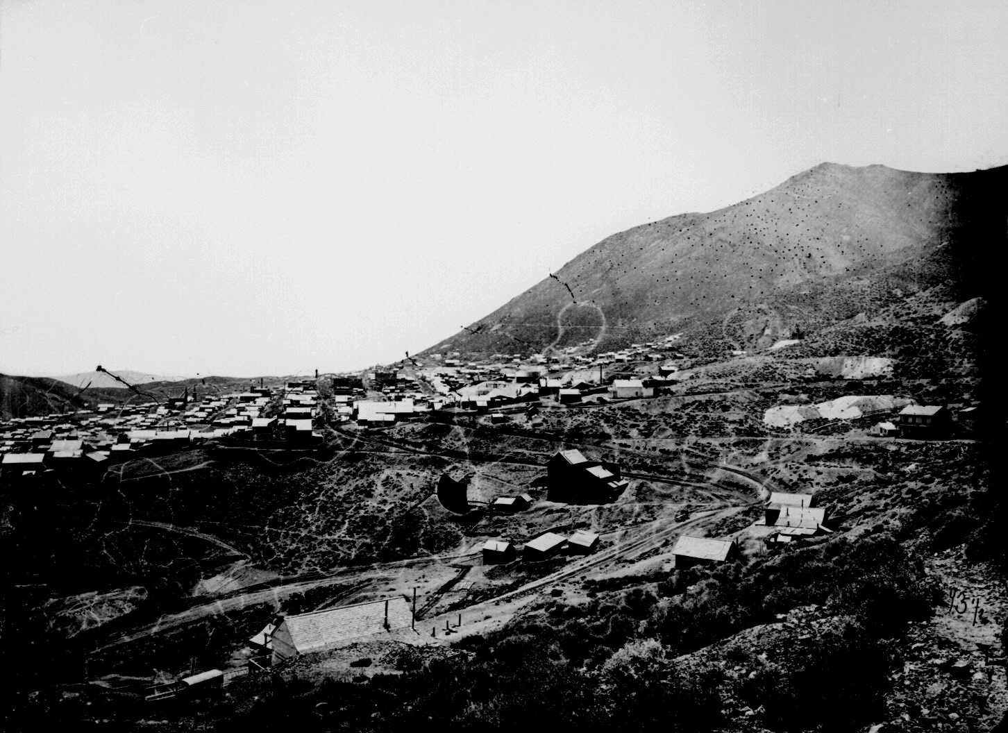
Virginia City is a census-designated place (CDP) that is the county seat of Storey County, Nevada, and the largest community in the county. The city is a part of the Reno– Sparks Metropolitan Statistical Area. Virginia City developed as a boomtown with the 1859 discovery of the Comstock Lode, the first major silver deposit discovery in the United States, with numerous mines opening. The population peaked in the mid-1870s, with an estimated 25,000 residents. The mines' output declined after 1878, and the population declined as a result. As of the 2020 Census, the population of Virginia City was 787. History Peter O'Riley and Patrick McLaughlin are credited with the discovery of the Comstock Lode. Henry T. P. Comstock's name was associated with the discovery through his own machinations. According to folklore, James Fennimore, nicknamed Old Virginny Finney, christened the town when he tripped and broke a bottle of whiskey at a saloon entrance in the northern section of Gol ... [...More Info...] [...Related Items...] OR: [Wikipedia] [Google] [Baidu] |
Nevada State Route 341
State Route 341 (SR 341) is a state highway in western Nevada connecting US 50 (US 50) near Dayton to Reno via Virginia City. Commonly known as the Virginia City Highway, or Geiger Grade north of Virginia City, the route has origins dating back to the 1860s. Route description State Route 341 begins at a point along US 50 in Lyon County between Mound House and Dayton, about to the west of the latter. From this intersection, the highway proceeds north towards its south junction with SR 342 in Silver City. From here, SR 341 veers eastward around Silver City and Gold Hill, proceeds up the Occidental Grade and bridges over the Virginia and Truckee Railroad at the site of that line's daylighted Tunnel #5 before reconnecting with SR 342 on the south side of Virginia City. The highway runs along C Street as it travels northward through Virginia City. SR 341 leaves Virginia City and travels northerly and westerly through winding sections on both sides of Geiger Summit. The highway th ... [...More Info...] [...Related Items...] OR: [Wikipedia] [Google] [Baidu] |
Nevada State Route 431
State Route 431 (SR 431), commonly known as the Mount Rose Highway, is a highway in Washoe County, Nevada, that connects Incline Village at Lake Tahoe with Reno. The highway, a Nevada Scenic Byway, takes its name from Mount Rose, which lies just off the highway. Prior to 1976, the highway existed as State Route 27. Route description The highway begins along the northeast shore of Lake Tahoe in the city of Incline Village, at an intersection with SR 28. The highway scales the Carson Range, a spur range of the Sierra Nevada, until reaching a meadow that is used as an access for the Mount Rose Wilderness. Along the western ascent is a view area with directional markers pointing to several notable peaks in the Sierra Nevada range that surround Lake Tahoe. The highway crests the Carson Range at Mount Rose Summit. The Nevada Department of Transportation has claimed in several places this is the highest summit open year-round in the Sierra Nevada mountain range, . Both the east an ... [...More Info...] [...Related Items...] OR: [Wikipedia] [Google] [Baidu] |
Interstate 580 Northern End
The Dwight D. Eisenhower National System of Interstate and Defense Highways, commonly known as the Interstate Highway System, is a network of controlled-access highways that forms part of the National Highway System in the United States. The system extends throughout the contiguous United States and has routes in Hawaii, Alaska, and Puerto Rico. The U.S. federal government first funded roadways through the Federal Aid Road Act of 1916, and began an effort to construct a national road grid with the passage of the Federal Aid Highway Act of 1921. In 1926, the United States Numbered Highway System was established, creating the first national road numbering system for cross-country travel. The roads were still state-funded and maintained, however, and there was little in the way of national standards for road design. U.S. Highways could be anything from a two-lane country road to a major multi-lane freeway. After Dwight D. Eisenhower became president in 1953, his administration ... [...More Info...] [...Related Items...] OR: [Wikipedia] [Google] [Baidu] |


