|
I-430
Interstate 430 (I-430) is a Interstate highway in Pulaski County, Arkansas, that bypasses the cities of Little Rock and North Little Rock. I-430 begins at an interchange southwest of Downtown Little Rock with I-30, U.S. Highway 67 (US 67), and US 70 and travels north to cross the Arkansas River and end at I-40 and US 65. The first plans for the freeway appeared in 1955. Route description I-430 starts its route at a trumpet interchange with I-30, US 67, and US 70. From the interchange, US 70 joins I-430 as it travels northwest and runs over Highway 338 (AR 338, Baseline Road) before having a diamond interchange with AR 5 (Stagecoach Road). At the interchange, US 70 splits off onto Stagecoach Road to the east, with AR 5 running west. I-430 goes north to pass Remington College and intersect AR 300 (Colonel Glenn Road) before curving eastward to intersect Shackleford Road and then turning back north. Immediate ... [...More Info...] [...Related Items...] OR: [Wikipedia] [Google] [Baidu] |
Big Rock Interchange
Big Rock Interchange is the I-430/ I-630/Chenal Parkway interchange in west Little Rock, Arkansas. The name is derived from a large rock formation discovered during expansion. The interchange was originally constructed in 1977, then in the mid-2000s it was decided to expand the interchange to alleviate congestion. In 2011 an outcropping of Pennsylvanian Jackfork Formation sandstone and surrounding shale was discovered in the southeast quadrant of the project. The formation was estimated to weigh about 5 million pounds. Due to the size and hardness of the sandstone it was decided to leave the unique and distinctive formation in place as a landmark, rather than use explosives or some other method to try to remove it, and it was dubbed "The Big Rock". When the original I-430 and I-630 interchange was constructed, about 14,000 vehicles a day traveled down each Interstate, and I-630 ended at Shakleford Road with a traffic signal. With expansion and growth in west Little Rock, and par ... [...More Info...] [...Related Items...] OR: [Wikipedia] [Google] [Baidu] |
Arkansas Highway 5
Highway 5 (AR 5, Ark. 5, and Hwy. 5) is a designation for three List of Arkansas state highways, state highways in Arkansas. The southern segment of runs from Arkansas Highway 7, Highway 7 in Hot Springs, Arkansas, Hot Springs north to U.S. Route 70 in Arkansas, US Highway 70 (US 70) in Little Rock, Arkansas, Little Rock. A northern segment of begins at U.S. Route 67 in Arkansas, US Highway 67/U.S. Route 167, US Highway 167 (Future Interstate 57) in Cabot, Arkansas, Cabot and runs north to Missouri Route 5, including a lengthy overlap with Arkansas Highway 25, Highway 25 between Heber Springs, Arkansas, Heber Springs and Wolf Bayou, Arkansas, Wolf Bayou. A portion of Highway 5 is designated as part of the Sylamore Scenic Byway. The Main Street Bridge in Little Rock carries a hidden Highway 5 designation. The bridge is in span. Route description Hot Springs to Little Rock In the future, Highway 5 will begin at junction US ... [...More Info...] [...Related Items...] OR: [Wikipedia] [Google] [Baidu] |
Interstate 30
Interstate 30 (I-30) is a Interstate Highway in the southern states of Texas and Arkansas in the United States. I-30 travels from I-20 west of Fort Worth, Texas, northeast via Dallas, and Texarkana, Texas, to I-40 in North Little Rock, Arkansas. The highway parallels U.S. Highway 67 (US 67) except for the portion west of downtown Dallas (which was once part of I-20). Between the termini, I-30 has interchanges with I-35W, I-35E, and I-45. I-30 is known as the Tom Landry Freeway between I-35W and I-35E, within the core of the Dallas–Fort Worth metroplex. Route description , - , Texas , , , - , Arkansas , , , - , Total , , I-30 is the shortest two-digit Interstate with a number ending in zero in the Interstate System. The Interstates ending in zero are generally the longest east–west Interstates. The largest metropolitan areas that I-30 travels through include the Dallas–Fort Worth metroplex, the Texarkana metropolitan area, and the Little Rock metropoli ... [...More Info...] [...Related Items...] OR: [Wikipedia] [Google] [Baidu] |
AR 300
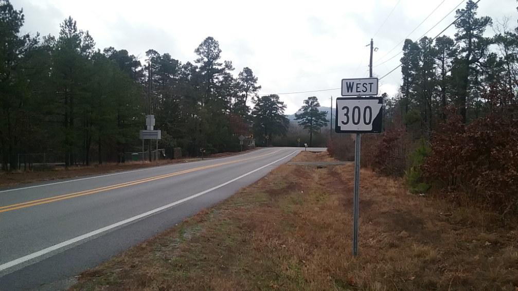
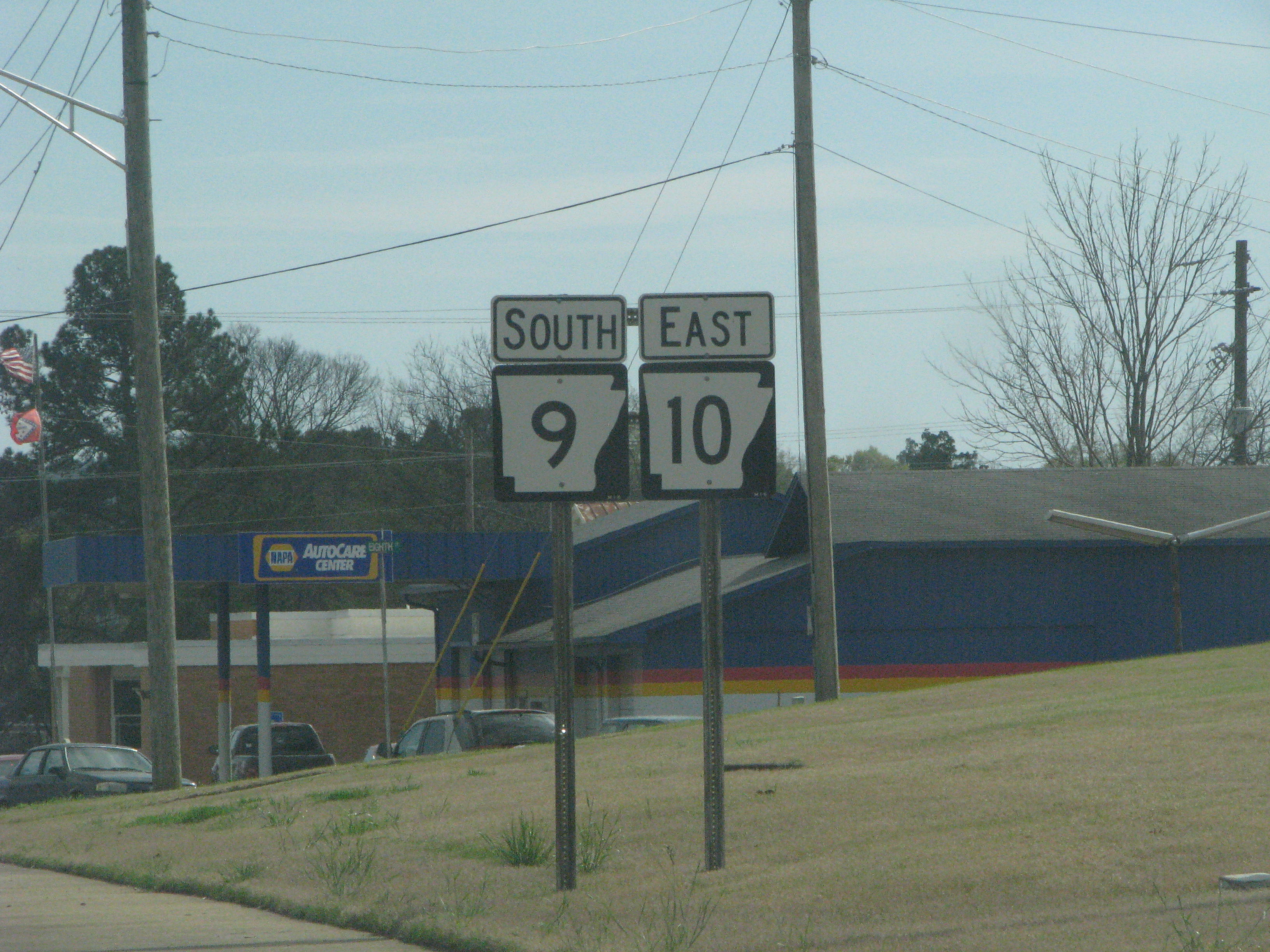
Highway 300 (AR 300, Ark. 300 and Hwy. 300) is a designation for two state highway segments in Central Arkansas. The main route of runs from Highway 9/ Highway 10 east to Cantrell Road and Chenal Parkway in Little Rock. A second segment runs east from Interstate 430 as Colonel Glenn Road. Route description Perryville to Little Rock The main route begins at Highway 9/ Highway 10 south of Perryville and runs east along the northern edge of the Harris Brake Wildlife Management Area. Highway 300 forms a quasi-concurrencyHistorically, this segment of Highway 300 ran continuously. However, modern-day Arkansas Department of Transportation guidelines has eliminated most state highway concurrencies, and sectioning has become the rule. Consequently, this main segment of Highway 300 now exists as three disjointed sections while still functioning as a continuous route. For the purposes of this article, former true concurrencies are referred to as "quasi ... [...More Info...] [...Related Items...] OR: [Wikipedia] [Google] [Baidu] |
Interstate 30 (Arkansas)
Interstate 30 (I-30) is a Interstate Highway in the southern states of Texas and Arkansas in the United States. I-30 travels from I-20 west of Fort Worth, Texas, northeast via Dallas, and Texarkana, Texas, to I-40 in North Little Rock, Arkansas. The highway parallels U.S. Highway 67 (US 67) except for the portion west of downtown Dallas (which was once part of I-20). Between the termini, I-30 has interchanges with I-35W, I-35E, and I-45. I-30 is known as the Tom Landry Freeway between I-35W and I-35E, within the core of the Dallas–Fort Worth metroplex. Route description , - , Texas , , , - , Arkansas , , , - , Total , , I-30 is the shortest two-digit Interstate with a number ending in zero in the Interstate System. The Interstates ending in zero are generally the longest east–west Interstates. The largest metropolitan areas that I-30 travels through include the Dallas–Fort Worth metroplex, the Texarkana metropolitan area, and the Little Rock metropolit ... [...More Info...] [...Related Items...] OR: [Wikipedia] [Google] [Baidu] |
Interstate 40 (Arkansas)
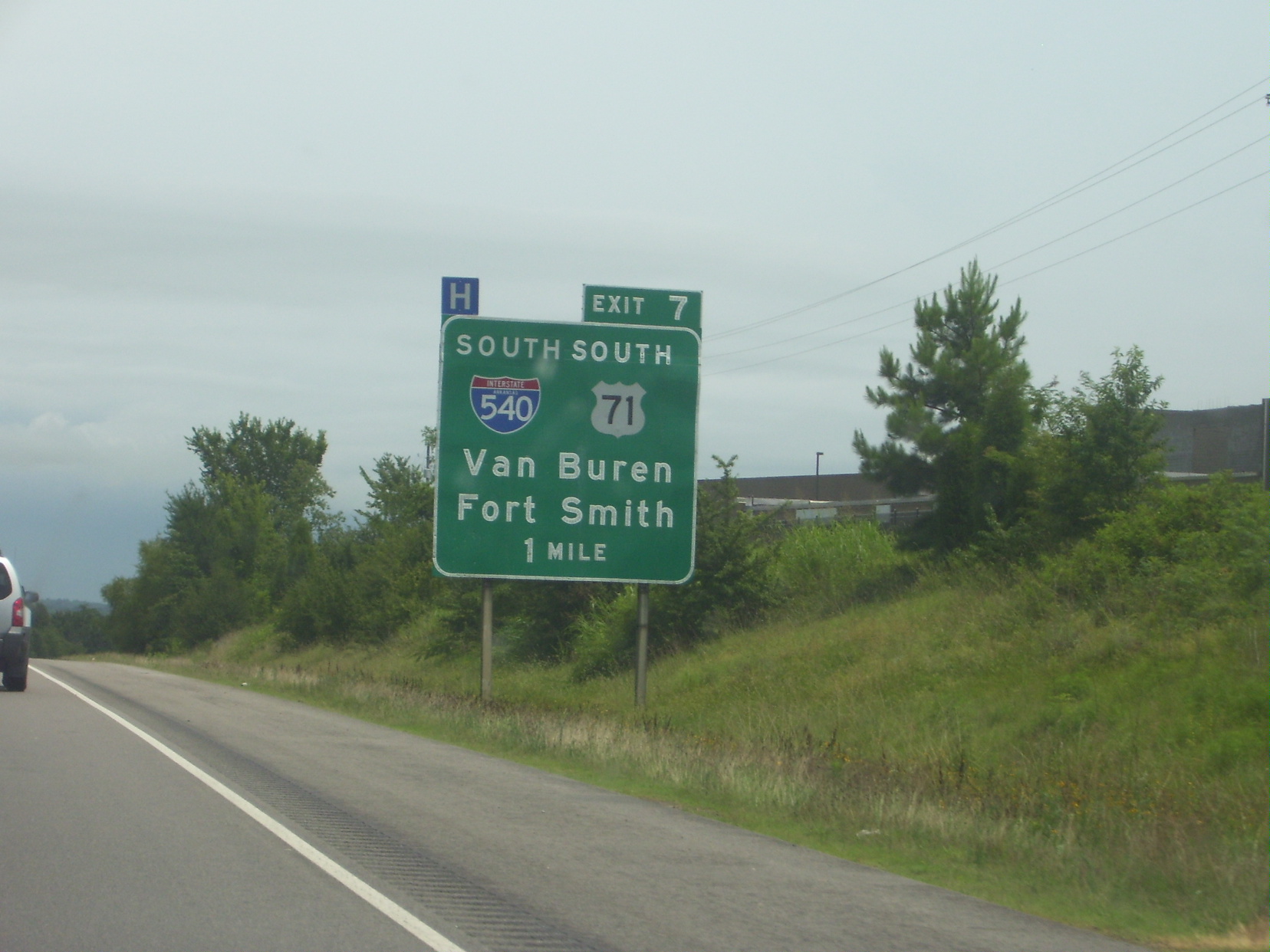
Interstate 40 (I-40) is an east–west Interstate Highway that has a section in the U.S. state of Arkansas, connecting Oklahoma to Tennessee. The route enters Arkansas from the west just north of the Arkansas River near Dora. It travels eastward across the northern portion of the state, connecting the cities of Fort Smith, Clarksville, Russellville, Morrilton, Conway, North Little Rock, Forrest City, and West Memphis. I-40 continues into Tennessee, heading through Memphis. The highway has major junctions with I-540 at Van Buren (the main highway connecting to Fort Smith), I-49 at Alma (the main highway connecting to Fayetteville and Bentonville), I-30 in North Little Rock (the Interstate linking south to Texarkana and Dallas, Texas), and I-55 to Blytheville. For the majority of its routing through Arkansas, I-40 follows the historic alignment of two separate U.S. Highways. From Oklahoma to Little Rock, I-40 generally follows U.S. Highway 64 through the Oza ... [...More Info...] [...Related Items...] OR: [Wikipedia] [Google] [Baidu] |
AR 440
Interstate 440 (I-440) and Highway 440 (AR 440), in the central part of the US state of Arkansas, form a partial loop of connecting U.S. Highway 67 (US 67), US 167, and I-40 with I-30 and I-530 near Little Rock. I-440, known as the East Belt Freeway during planning and construction, travels through much of the area's industrial core in the eastern part of the metropolitan area, near Clinton National Airport and the Port of Little Rock. The route is mostly a six-lane freeway. North of the route continues as AR 440 until it reaches US 67/ US 167 (Future I-57) in Jacksonville. This section is known as the North Belt Freeway. Route description I-440 begins at I-30 at a large interchange with I-530. After this interchange, I-440 intersects AR 365 (Springer Boulevard) and Bankhead Drive near Clinton National Airport (formerly Little Rock National Airport). The highway continues across Lindsey Road northeast to cross the Arkansas Rive ... [...More Info...] [...Related Items...] OR: [Wikipedia] [Google] [Baidu] |
Interstate 440 (Arkansas)
Interstate 440 (I-440) and Highway 440 (AR 440), in the central part of the US state of Arkansas, form a partial loop of connecting U.S. Highway 67 (US 67), US 167, and I-40 with I-30 and I-530 near Little Rock. I-440, known as the East Belt Freeway during planning and construction, travels through much of the area's industrial core in the eastern part of the metropolitan area, near Clinton National Airport and the Port of Little Rock. The route is mostly a six-lane freeway. North of the route continues as AR 440 until it reaches US 67/ US 167 (Future I-57) in Jacksonville. This section is known as the North Belt Freeway. Route description I-440 begins at I-30 at a large interchange with I-530. After this interchange, I-440 intersects AR 365 (Springer Boulevard) and Bankhead Drive near Clinton National Airport (formerly Little Rock National Airport). The highway continues across Lindsey Road northeast to cross the Arkansas Rive ... [...More Info...] [...Related Items...] OR: [Wikipedia] [Google] [Baidu] |
AR 10
Arkansas Highway 10 is an east–west state highway in West Arkansas. The route runs from Oklahoma State Highway 120 near Hackett east to Interstate 30 in Little Rock, the state's capitol. The highway serves both the Fort Smith metropolitan area and the Little Rock – North Little Rock – Conway metropolitan area. Aside from Little Rock in Pulaski County, the highway also passes through county seats in four other Arkansas counties — Greenwood, Sebastian County; Booneville, Logan County; Danville, Yell County; and Perryville, Perry County. Mount Magazine, Arkansas's highest point, lies just to the north of the highway, as does the adjoining Mount Magazine State Park. Arkansas 10 also passes through a portion of the Ozark National Forest and parallel to the Petit Jean River, Petit Jean Wildlife Management Area and Lake Maumelle — a chief source of water for residents in the Little Rock metropolitan area. Route description The route begins at Oklahoma State High ... [...More Info...] [...Related Items...] OR: [Wikipedia] [Google] [Baidu] |
Little Rock, Arkansas
(The Little Rock, The "Little Rock") , government_type = council-manager government, Council-manager , leader_title = List of mayors of Little Rock, Arkansas, Mayor , leader_name = Frank Scott Jr. , leader_party = Democratic Party (United States), D , leader_title2 = City council, Council , leader_name2 = Little Rock Board of Directors , unit_pref = Imperial , area_total_sq_mi = 123.00 , area_total_km2 = 318.58 , area_land_sq_mi = 120.05 , area_land_km2 = 310.92 , area_metro_sq_mi = 4090.34 , area_metro_km2 = 10593.94 , population_as_of = 2020 United States Census, 2020 , population_est = , pop_est_as_of = , population_demonym = Little Rocker , population_footnotes = , population_total = 202591 , population_rank = US: List of United States cities by population, 118 ... [...More Info...] [...Related Items...] OR: [Wikipedia] [Google] [Baidu] |
AR 100
Highway 100 (AR 100, Ark. 100, and Hwy. 100) is a designation for two List of Arkansas state highways, state highways in Central Arkansas. __TOC__ Description One route of begins at Arkansas Highway 365, Highway 365 and runs southeast through Maumelle, Arkansas, Maumelle to Interstate 40 in Arkansas, Interstate 40 (I-40). This route was designated in 1987 and is maintained by the Arkansas Department of Transportation (ArDOT). History The Highway 100 designation was created at the request of the mayor of North Little Rock, who planned to construct Riverside Drive between Rose City and Locust Street, and desired inclusion in the state highway system. The Arkansas State Highway Commission agreed to an alignment in 1965, but the road was not completed for over 20 years. The designation was officially assigned on December 1, 1987, following completion of Riverside Drive between I-30 and Pike Avenue.. The highway was extended east to US 70 on May 13, 1998. A ... [...More Info...] [...Related Items...] OR: [Wikipedia] [Google] [Baidu] |
Bureau Of Public Roads
The Federal Highway Administration (FHWA) is a division of the United States Department of Transportation that specializes in highway transportation. The agency's major activities are grouped into two programs, the Federal-aid Highway Program and the Federal Lands Highway Program. Its role had previously been performed by the Office of Road Inquiry, Office of Public Roads and the Bureau of Public Roads. History Background The organization has several predecessor organizations and complicated history. The Office of Road Inquiry (ORI) was founded in 1893. In 1905, that organization's name was changed to the Office of Public Roads (OPR) which became a division of the United States Department of Agriculture. The name was changed again to the Bureau of Public Roads in 1915 and to the Public Roads Administration (PRA) in 1939. It was then shifted to the Federal Works Agency which was abolished in 1949 when its name reverted to Bureau of Public Roads under the Department of Commerc ... [...More Info...] [...Related Items...] OR: [Wikipedia] [Google] [Baidu] |


